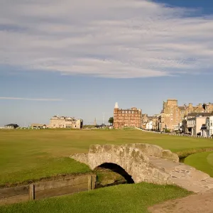
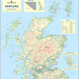
Home > Europe > United Kingdom > Scotland > Fife > St Andrews
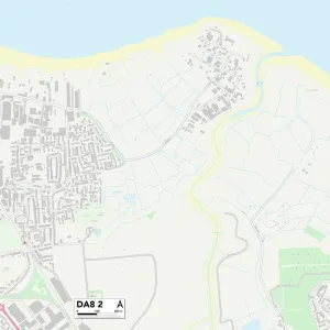
Eastleigh SO50 7 Map

![]()
Wall Art and Photo Gifts from Map Marketing
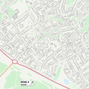
Eastleigh SO50 7 Map
Postcode Sector Map of Eastleigh SO50 7
Media ID 19982218
Aintree Close Anson Road Ascot Road Barley Fields Botley Road Bradshaw Close Bramley Gardens Brook Road Campion Close Crispin Close Davidson Drive Dean Road Dell Close Durley Road Eastleigh Eastleigh Road Eastville Road Edwards Drive Epsom Close Farley Close Fir Tree Close Fir Tree Lane Glebe Court Hawthorn Close Heath Close High Trees Highbury Close Hill Close Howard Close Kimberley Close Knowle Lane Longfield Road Main Road Malmesbury Close May Close Maytree Close Meadowsweet Way Mill Court Mitchell Drive Newmarket Close Oak Drive Orchard Road Osborne Gardens Palmers Close Pavilion Close Paynes Lane Portsmouth Road Reynolds Road Ridgeway Close Rosebay Close Saxon Court Spring Close The Beeches The Drove The Martins Trafford Road Walkers Close Westfield Close White Hart Road Willow Grove Winchester Road Yew Tree Close York Close
FEATURES IN THESE COLLECTIONS
> Animals
> Mammals
> Muridae
> Heath Mouse
> Arts
> Artists
> M
> Michael Maier
> Europe
> United Kingdom
> Scotland
> Fife
> St Andrews
> Europe
> United Kingdom
> Scotland
> Maps
> Europe
> United Kingdom
> Scotland
> Posters
> Europe
> United Kingdom
> Scotland
> Related Images
> Map Marketing
> Postcode Sector Maps
> SO - Southampton
> Maps and Charts
> Related Images
> North America
> Saint Martin
> Maps
MADE IN THE USA
Safe Shipping with 30 Day Money Back Guarantee
FREE PERSONALISATION*
We are proud to offer a range of customisation features including Personalised Captions, Color Filters and Picture Zoom Tools
SECURE PAYMENTS
We happily accept a wide range of payment options so you can pay for the things you need in the way that is most convenient for you
* Options may vary by product and licensing agreement. Zoomed Pictures can be adjusted in the Cart.