Home > Europe > United Kingdom > England > London > Boroughs > Lambeth
Shropshire SY7 9 Map

![]()
Wall Art and Photo Gifts from Map Marketing
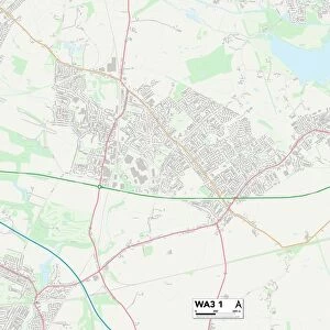
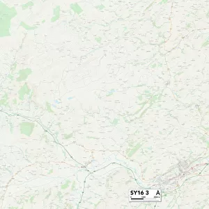
Shropshire SY7 9 Map
Postcode Sector Map of Shropshire SY7 9
Media ID 19982628
Ash Close Back Lane Broadstone Brook Road Burnside Close Chestnut Avenue Clay Lane Coppice Drive Coronation Road Dale Street Dodds Lane Fairfield Close Green Lane Greenfields Road Hawthorn Close Lambeth Close Ludlow Road Maple Close Market Street Mayfield Avenue Meadow Road Mill Lane Newton Newton Street Norton Oaks Road Park Lane Sandy Lane School Road Shrewsbury Road Shropshire St Johns Crescent Station Crescent Stokesay Close Sycamore Close The Crescent The Moors Walton Willow Grove Wootton Bache Burley Halford Heath Hungerford Stokesay Wetmore
FEATURES IN THESE COLLECTIONS
> Animals
> Mammals
> Muridae
> Heath Mouse
> Arts
> Artists
> B
> John Brooks
> Arts
> Artists
> F
> John Field
> Arts
> Artists
> F
> Newton Fielding
> Arts
> Artists
> R
> Roman Roman
> Arts
> Artists
> W
> John Wootton
> Arts
> Portraits
> Pop art gallery
> Street art portraits
> Europe
> United Kingdom
> England
> London
> Boroughs
> Lambeth
> Europe
> United Kingdom
> England
> Shropshire
> Aston
> Europe
> United Kingdom
> England
> Shropshire
> Bouldon
> Map Marketing
> Postcode Sector Maps
> SY - Shrewsbury
MADE IN THE USA
Safe Shipping with 30 Day Money Back Guarantee
FREE PERSONALISATION*
We are proud to offer a range of customisation features including Personalised Captions, Color Filters and Picture Zoom Tools
SECURE PAYMENTS
We happily accept a wide range of payment options so you can pay for the things you need in the way that is most convenient for you
* Options may vary by product and licensing agreement. Zoomed Pictures can be adjusted in the Cart.