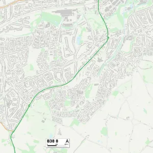
Home > Europe > United Kingdom > England > Birmingham > Area > Springfield
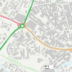
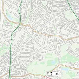
North Warwickshire B46 3 Map

![]()
Wall Art and Photo Gifts from Map Marketing
North Warwickshire B46 3 Map
Postcode Sector Map of North Warwickshire B46 3
Media ID 19965457
Birmingham Road Castle Drive Church Hill Clinton Road Coventry Road Digby Road Ferndale Road Green Lane Griffin Close High Street Hudson Avenue Keepers Close Montfort Road Oak Rise Park Avenue Park Road Parkfield Road Pound Lane Priory Close Sherborne Close Southfields Close Springfields Stonebridge Road Sumner Road The Drive The Grove Victoria Way Walkers Way Wingfield Road Coleshill Hall Walk North Warwickshire
FEATURES IN THESE COLLECTIONS
> Arts
> Portraits
> Pop art gallery
> Street art portraits
> Europe
> United Kingdom
> England
> Birmingham
> Area
> Coleshill
> Europe
> United Kingdom
> England
> Birmingham
> Area
> Hall Green
> Europe
> United Kingdom
> England
> Birmingham
> Area
> Lodge Hill
> Europe
> United Kingdom
> England
> Birmingham
> Area
> Springfield
> Europe
> United Kingdom
> England
> London
> Sights
> Victoria Park
> Europe
> United Kingdom
> England
> Warwickshire
> Coleshill
> Europe
> United Kingdom
> England
> Warwickshire
> Maxstoke
> Europe
> United Kingdom
> England
> Warwickshire
> Related Images
> Map Marketing
> Postcode Sector Maps
> B - Birmingham
> Maps and Charts
> Related Images
MADE IN THE USA
Safe Shipping with 30 Day Money Back Guarantee
FREE PERSONALISATION*
We are proud to offer a range of customisation features including Personalised Captions, Color Filters and Picture Zoom Tools
SECURE PAYMENTS
We happily accept a wide range of payment options so you can pay for the things you need in the way that is most convenient for you
* Options may vary by product and licensing agreement. Zoomed Pictures can be adjusted in the Cart.