Home > Europe > France > Maps
Photo Mug : Map / Europe / France C1000


![]()
Home Decor from Mary Evans Picture Library
Map / Europe / France C1000
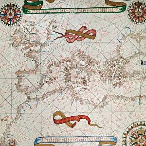
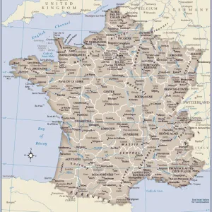
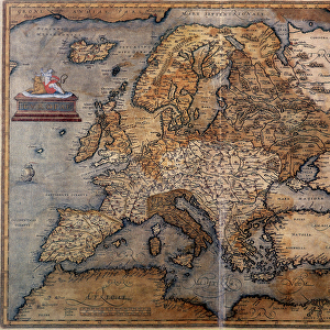
France in feudal times, with the country allotted to various nobles who bore more or less allegiance to the king, whose acquisitions are shown in map lower left
Mary Evans Picture Library makes available wonderful images created for people to enjoy over the centuries
Media ID 594579
© Mary Evans Picture Library 2015 - https://copyrighthub.org/s0/hub1/creation/maryevans/MaryEvansPictureID/10046920
1000 1500 Allegiance Allotted Bore Feudal Lower Maps Nobles Shown Times
Photo Mug (11 oz)
Introducing the Media Storehouse Photo Mug featuring an intriguing historical map of Europe and France during feudal times. This captivating image, sourced from Mary Evans Prints Online, showcases the continent's rich history with France allotted to various nobles and their allegiances to the king. Bring a piece of the past into your daily life with this high-quality mug. Perfect for sipping your favorite hot beverage while exploring the intricacies of European history. Enjoy the vivid colors and exceptional detail that bring this map to life. A thoughtful gift for history enthusiasts or a delightful addition to your own collection.
A personalized photo mug blends sentimentality with functionality, making an ideal gift for cherished loved ones, close friends, or valued colleagues. Preview may show both sides of the same mug.
Elevate your coffee or tea experience with our premium white ceramic mug. Its wide, comfortable handle makes drinking easy, and you can rely on it to be both microwave and dishwasher safe. Sold in single units, preview may show both sides of the same mug so you can see how the picture wraps around.
Mug Size is 8cm high x 9.5cm diameter (3.1" x 3.7")
These are individually made so all sizes are approximate
FEATURES IN THESE COLLECTIONS
> Maps and Charts
> Early Maps
EDITORS COMMENTS
Step back in time with this map print of Feudal France in the year 1000, as depicted in the historical map "France C1000" from Mary Evans Prints Online. This map offers a fascinating glimpse into the complex political landscape of medieval France, where the country was allotted to various nobles who bore more or less allegiance to the king. At the lower left corner of the map, the acquisitions of the king are shown, providing a clear illustration of the monarch's territorial holdings during this period. The intricate details of the map reveal the vast expanse of lands controlled by these noble families, each with their own distinct territories and domains. As you explore this historical map, you'll notice the intricate borders that mark the territories of the various feudal lords, each with their unique symbols and insignia. The map also highlights the major cities and rivers of the time, providing context to the political and geographical landscape of medieval France. This map is a testament to the rich history of France during the feudal period, a time when the country was a patchwork of territories ruled by powerful nobles, each with their own allegiances and loyalties. The intricate details of this map offer a unique perspective into this complex and fascinating era, making it an essential addition to any history or map enthusiast's collection. The "France C1000" map is not only a beautiful work of art, but also an invaluable historical resource, providing insights into the political and geographical landscape of medieval France during a time of great change and transformation. Whether you're a history buff, a map collector, or simply someone with an interest in the Middle Ages, this map is sure to captivate and inspire you.
MADE IN THE USA
Safe Shipping with 30 Day Money Back Guarantee
FREE PERSONALISATION*
We are proud to offer a range of customisation features including Personalised Captions, Color Filters and Picture Zoom Tools
SECURE PAYMENTS
We happily accept a wide range of payment options so you can pay for the things you need in the way that is most convenient for you
* Options may vary by product and licensing agreement. Zoomed Pictures can be adjusted in the Cart.