Home > Europe > Austria > Maps
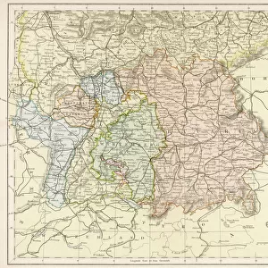
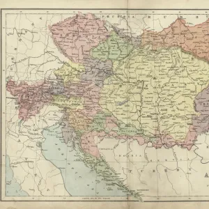
Photographic Print : Map / Europe / Austria 1857


![]()
Photo Prints from Mary Evans Picture Library
Map / Europe / Austria 1857
Map of the Austrian Empire
Mary Evans Picture Library makes available wonderful images created for people to enjoy over the centuries
Media ID 581421
© Mary Evans Picture Library 2015 - https://copyrighthub.org/s0/hub1/creation/maryevans/MaryEvansPictureID/10027192
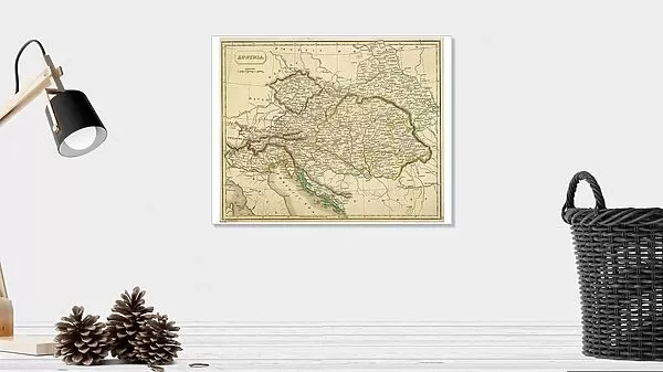
14"x11" Photo Print
Discover the historical charm of the past with our exquisite selection of photographic prints from the Media Storehouse range. This particular print, titled "Map / Europe / Austria 1857" from Mary Evans Picture Library, showcases an intricately detailed map of the Austrian Empire during that era. Travel back in time as you explore the borders and territories of this historic European power. The high-quality print, sourced from Mary Evans Prints Online, provides a stunning and authentic representation of the past, making it a perfect addition to any home or office space. Immerse yourself in history and add a touch of timeless beauty to your surroundings.
Photo prints are produced on Kodak professional photo paper resulting in timeless and breath-taking prints which are also ideal for framing. The colors produced are rich and vivid, with accurate blacks and pristine whites, resulting in prints that are truly timeless and magnificent. Whether you're looking to display your prints in your home, office, or gallery, our range of photographic prints are sure to impress. Dimensions refers to the size of the paper in inches.
Our Photo Prints are in a large range of sizes and are printed on Archival Quality Paper for excellent colour reproduction and longevity. They are ideal for framing (our Framed Prints use these) at a reasonable cost. Alternatives include cheaper Poster Prints and higher quality Fine Art Paper, the choice of which is largely dependant on your budget.
Estimated Product Size is 35.5cm x 27.9cm (14" x 11")
These are individually made so all sizes are approximate
Artwork printed orientated as per the preview above, with landscape (horizontal) orientation to match the source image.
FEATURES IN THESE COLLECTIONS
> Europe
> Austria
> Related Images
> Maps and Charts
> Early Maps
EDITORS COMMENTS
This stunning print captures a piece of history with its detailed map of the Austrian Empire from 1857. The intricate borders and boundaries of this European country are beautifully illustrated, showcasing the vast expanse of land that once made up this powerful empire.
As we gaze upon this historical map, we are transported back in time to an era where Austria held significant influence over much of Europe. The names of cities and regions long forgotten come to life on this aged parchment, reminding us of the rich cultural heritage that has shaped modern-day Austria.
The craftsmanship and attention to detail in this map are truly remarkable, highlighting the skill and precision required to create such a masterpiece in a time before modern technology. Each line and symbol tells a story of conquests, alliances, and territorial disputes that have shaped the course of European history.
Whether you have a personal connection to Austria or simply appreciate historical artifacts, this print is sure to captivate your imagination. Display it proudly in your home or office as a reminder of the enduring legacy left behind by one of Europe's most influential empires.
MADE IN THE USA
Safe Shipping with 30 Day Money Back Guarantee
FREE PERSONALISATION*
We are proud to offer a range of customisation features including Personalised Captions, Color Filters and Picture Zoom Tools
SECURE PAYMENTS
We happily accept a wide range of payment options so you can pay for the things you need in the way that is most convenient for you
* Options may vary by product and licensing agreement. Zoomed Pictures can be adjusted in the Cart.