Home > Animals > Mammals > Bovidae > Cattle
Industry / Australia
![]()

Wall Art and Photo Gifts from Mary Evans Picture Library
Industry / Australia
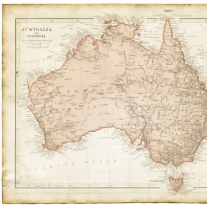
A map of south-eastern Australia showing the products of different districts Date: 1908
Mary Evans Picture Library makes available wonderful images created for people to enjoy over the centuries
Media ID 7149789
© Mary Evans Picture Library 2015 - https://copyrighthub.org/s0/hub1/creation/maryevans/MaryEvansPictureID/10149919
Cattle Districts Maps Products Wheat Wine Wool
FEATURES IN THESE COLLECTIONS
> Animals
> Farm
> Cattle
> Related Images
> Animals
> Mammals
> Bovidae
> Cattle
EDITORS COMMENTS
This map from 1908, sourced from Mary Evans Prints Online, offers a fascinating glimpse into the diverse industrial landscape of South-Eastern Australia. The intricately detailed illustration showcases the various products and industries thriving in different districts across the region. In the agricultural heartland of Victoria and New South Wales, vast expanses of wheat fields stretch across the plains, while the lush, rolling hills of the Riverina district are dotted with grapevines, signifying the region's renowned wine production. The fertile lands of Gippsland and the Murray Valley are depicted as rich cattle-rearing territories, with herds grazing peacefully amidst the verdant pastures. Moving towards the mineral-rich areas of New South Wales and Victoria, the map highlights the significant gold mining industries in Bendigo, Ballarat, and the Mount Alexander Shire. The metallurgical sector is represented by the iron and steel industries in Newcastle and Port Kembla, with their smokestacks billowing out plumes of smoke, symbolizing the industrious spirit of the region. Lastly, the southernmost tip of Victoria, known as the Wool District, is depicted as a significant producer of high-quality wool, which was a major export for Australia during this period. This map not only provides an insight into the economic and industrial landscape of South-Eastern Australia in 1908 but also offers a visual representation of the rich tapestry of industries that have shaped the region's history.
MADE IN THE USA
Safe Shipping with 30 Day Money Back Guarantee
FREE PERSONALISATION*
We are proud to offer a range of customisation features including Personalised Captions, Color Filters and Picture Zoom Tools
FREE COLORIZATION SERVICE
You can choose advanced AI Colorization for this picture at no extra charge!
SECURE PAYMENTS
We happily accept a wide range of payment options so you can pay for the things you need in the way that is most convenient for you
* Options may vary by product and licensing agreement. Zoomed Pictures can be adjusted in the Cart.


