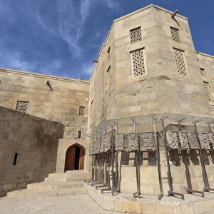
Home > Arts > Landscape paintings > Waterfall and river artworks > River artworks
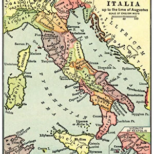
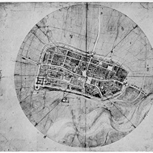
Historical city map of Imola, Italy

![]()
Wall Art and Photo Gifts from Science Photo Library
Historical city map of Imola, Italy
Science Photo Library features Science and Medical images including photos and illustrations
Media ID 6348623
© SHEILA TERRY/SCIENCE PHOTO LIBRARY
16th Century Ancient Cartography Castle City Conquest Da Vinci Earth Science Fifteenth Illustrated Italian Italy Leonardo Mapping Maps Sciences Sixteenth Survey Urban Wall Walled Walls 1502 Cesare Borgia Fortified Imola Papal State
EDITORS COMMENTS
This print showcases a historical city map of Imola, Italy, taking us on a visual journey through time. Immerse yourself in the rich tapestry of this ancient Italian city as you explore its intricate streets and landmarks. The map, dating back to the sixteenth century, offers a fascinating glimpse into the geography and urban layout of Imola during this period. The walled and fortified nature of the city is evident from the illustration, highlighting its strategic importance throughout history. As your eyes wander across the detailed artwork, you can almost feel the weight of centuries-old conquests and wars that have shaped Imola's past. Leonardo da Vinci's influence is also apparent in this masterpiece; his expertise in cartography shines through as he meticulously captures every street corner and architectural detail. The presence of Cesare Borgia adds another layer to Imola's story, reminding us of its connection to powerful political figures during that era. As you examine this remarkable piece, let your imagination transport you back to 1502 when it was created. Picture bustling markets filled with merchants trading goods along the Senterno River while gazing upon an imposing castle that once stood tall within these walls. This print by Science Photo Library allows us to appreciate not only the artistry behind historical maps but also their significance in unraveling our collective human history. Let it serve as a reminder that even within modern cities like Imola lies a treasure trove of stories waiting to be discovered.
MADE IN THE USA
Safe Shipping with 30 Day Money Back Guarantee
FREE PERSONALISATION*
We are proud to offer a range of customisation features including Personalised Captions, Color Filters and Picture Zoom Tools
SECURE PAYMENTS
We happily accept a wide range of payment options so you can pay for the things you need in the way that is most convenient for you
* Options may vary by product and licensing agreement. Zoomed Pictures can be adjusted in the Cart.