Fraud Blocker Skip to main content

Map of Lancashire, 1924-1926

Map of Lancashire, 1924-1926
In Stock
We accept all major payment options so you can pay for the things you need in the way that is most convenient for you
Framed Photos
Buy from $79.99
Photo Prints
Buy from $9.99
Jigsaw Puzzles
Buy from $39.99
Poster Prints
Buy from $24.99
Canvas Prints
Buy from $99.99
Fine Art Prints
Buy from $60.90
Metal Prints
Buy from $169.99
Home Decor
Buy from $16.99

Heritage Images Photo Prints and Wall Art

Map of Lancashire, 1924-1926

Map of Lancashire, 1924-1926. A print from Hutchinsons Britain Beautiful, edited by Walter Hutchinson, volume III, 1924-1926. Heritage Images features heritage image collections. © The Print Collector / Heritage-Images

Media ID 14924083

Cartography County Lancashire Map Making Print Collector8

SECURE PAYMENTS
We accept all major payment options so you can pay for the things you need in the way that is most convenient for you

Made in USA
Safe Shipping, Easy Returns

FREE PERSONALISATION
We are proud to offer a range of customisation including Cropping, Captions, and Filters. Zoom Cropping can be adjusted in the basket


EDITORS COMMENTS

This print showcases a Map of Lancashire, dating back to the years 1924-1926. The map is a part of Hutchinsons Britain Beautiful, an esteemed publication edited by Walter Hutchinson during that era. A testament to British cartography and geography, this colorful representation provides insight into the county's location and highlights its distinctive features. The vibrant hues used in this map bring Lancashire to life, capturing the essence of England in the 1920s. It serves as a valuable historical artifact, offering glimpses into how boundaries were defined and territories were demarcated during that time period. Created by an unknown artist or creator, this print exemplifies their skillful craftsmanship in map making. Every detail has been meticulously rendered to ensure accuracy and clarity for viewers seeking knowledge about Lancashire's landscape. As we delve into this image from The Print Collector collection, we are transported back to a significant moment in history when maps played an integral role in understanding our surroundings. This particular piece allows us to appreciate both the artistry involved in cartography and the importance of preserving such cultural treasures. Through its vivid colors and intricate details, this Map of Lancashire invites us on a journey through time while reminding us of the rich heritage embedded within these ancient landscapes.


Framed Prints of Map of Lancashire, 1924-1926

Step back in time with our vintage Map of Lancashire Framed Print, hailing from the pages of Hutchinsons Britain Beautiful, edited by Walter Hutchinson, in the 1920s. This captivating, Unknown creation, showcases intricate details of Lancashire's geography during that era. Bring a touch of history into your home or office with this beautifully framed, authentic piece from the Media Storehouse Heritage Images collection.


Photo Prints of Map of Lancashire, 1924-1926

Step back in time with our vintage Map of Lancashire print from the Media Storehouse collection. This beautiful piece, taken from Hutchinsons Britain Beautiful, edited by Walter Hutchinson, in the volumes III, 1924-1926, showcases intricate details of Lancashire's geography during that era. Add a touch of history and character to your space with this unique and captivating photographic print.


Poster Prints of Map of Lancashire, 1924-1926

Step back in time with our vintage Map of Lancashire print from the Media Storehouse collection. Originally published in Hutchinsons Britain Beautiful, edited by Walter Hutchinson, in 1924-1926, this captivating map offers a glimpse into the past. With intricate details and a charming aesthetic, this Unknown creation is the perfect addition to any home or office. Bring history to life with this beautiful and unique poster print.


Jigsaw Puzzles of Map of Lancashire, 1924-1926

Discover the charm of the past with Media Storehouse's Jigsaw Puzzle featuring a captivating Map of Lancashire from 1924-1926. This intriguing puzzle, drawn from the archives of Heritage Images, is a piece of history brought to life. Originally published in Hutchinsons Britain Beautiful, edited by Walter Hutchinson, this vintage map invites you on a journey through time as you piece together the intricate details of Lancashire's geography from over 100 years ago. Ideal for puzzle enthusiasts and history buffs alike, this jigsaw puzzle promises a satisfying and educational experience.

diamond
Made With High Grade Materials
thumb_up
Professional Quality Finish
package_2
Carefully Packed To Aid Safe Arrival

You May Also Like


Women WW1 MunitionsWomen WW1 Munitions
Add to Basket
Pierre and Marie Curie, French physicists, 1904Pierre and Marie Curie, French physicists, 1904
Add to Basket
Thomas Henry Huxley, British biologist, 1871. Artist: Carlo PellegriniThomas Henry Huxley, British biologist, 1871. Artist: Carlo Pellegrini
Add to Basket
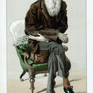
Charles Darwin, English naturalist, 1871Charles Darwin, English naturalist, 1871
Add to Basket
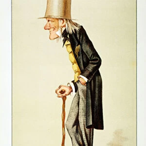
Richard Owen, British zoologist, 1873. Artist: SpyRichard Owen, British zoologist, 1873. Artist: Spy
Add to Basket
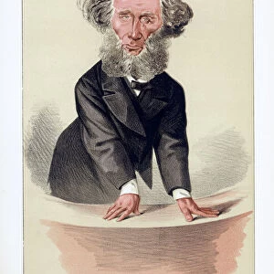
John Tyndall, Irish-born British physicist, 1872John Tyndall, Irish-born British physicist, 1872
Add to Basket
Rain of frogs recorded in 1355 (1557)Rain of frogs recorded in 1355 (1557)
Add to Basket
God creating Eve from Adams rib, 1508God creating Eve from Adams rib, 1508
Add to Basket
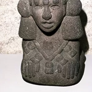
Aztec stone head of Rain God Tlaloc, 1300-1521Aztec stone head of Rain God Tlaloc, 1300-1521
Add to Basket
Cover of The Ladies World magazine, American, March 1905Cover of The Ladies World magazine, American, March 1905
Add to Basket
Henry VIII, King of England, c1520Henry VIII, King of England, c1520
Add to Basket
Women Police WW1Women Police WW1
Add to Basket

Gallery Wall Inspiration

London Map / Roman Period
WW1 - Trench map from a soldiers war diary showing the Somme Battlefield with
William Smith Geological Map
Railway Map of England
Devon County Road Map
Viking Britain Map
East Sussex County Road Map
Antique Map of Norwich, England, 1880
Antique map of Britain under the Anglo Saxons
C2, Pudsey, Tong, Drighlington & Birstall, 1849 (hand coloured engraving)
A final appeal (litho)
Scotland, Dumbarton Castle (colour litho)
Battle of Waterloo map J020089
Map of England in 1066
Map of England, 1800s
Norfolk County Road Map
Map of Britain in 597 AD
Northumberland County Road Map
Cornwall County Road Map
Map of the world with annotations by Darwin J970111
Map / Isle of Wight C1857
England in the Ninth Century
London Zoo 1929 MD93_07025
Old Map of The Isle of Wight 1836 by Thomas Moule
West Sussex County Road Map
Map of Whitby
Map / Norfolk C1857


© Copyright Media Storehouse, All Rights Reserved 2003 - 2024
Facebook     Pinterest     100% Payment Secure     Reviews IO