Fraud Blocker Skip to main content

Greetings Card > Europe > France > Paris > Maps

Maps Greetings Card Collection (#45)

Discover the enchanting beauty of Paris, France, with our Maps of Paris collection from Media Storehouse. These exquisite greeting cards showcase intricate and detailed maps of the City of Light, highlighting iconic landmarks such as the Eiffel Tower, Notre-Dame Cathedral, and the Louvre Museum. Each card is printed on high-quality paper, ensuring vibrant colors and crisp lines that will make your message stand out. Whether for a birthday, anniversary, or just to say hello, these cards are the perfect way to transport your loved ones to the romantic streets of Paris. Add a touch of European charm to your correspondence with our Maps of Paris collection.

Maps of Paris, France, Europe are invaluable resources for anyone visiting or living in the city

2,148 Greetings Cards

Background imageMaps Greetings Card Collection: Map of Africa in 1891 showing routes of explorers, 1906

Map of Africa in 1891 showing routes of explorers, 1906. From Cassells Illustrated History of England, Vol. VIII. [Cassell and Company, Limited, London, Paris, New York & Melbourne, 1906]

Background imageMaps Greetings Card Collection: Plan of Paris, c1630 (1915)

Plan of Paris, c1630 (1915). From Paris Past and Present. [London Offices of the Studio, London, 1915]

Background imageMaps Greetings Card Collection: Plan of Paris, c1630 (1915)

Plan of Paris, c1630 (1915). From Paris Past and Present. [London Offices of the Studio, London, 1915]

Background imageMaps Greetings Card Collection: Plan of the Universal Exposition, Paris, 1889

Plan of the Universal Exposition, Paris, 1889. The Exposition Universelle of 1889 was staged in commemration of the centenary of the French Revolution

Background imageMaps Greetings Card Collection: Charles Mangin, French soldier, 1918

Charles Mangin, French soldier, 1918. Mangin was a general in the French Army during the First World War. Nicknamed the Butcher by his troops

Background imageMaps Greetings Card Collection: The Political Pas de Deux, 1878 (1895)

The Political Pas de Deux, 1878 (1895). Lord Salisbury and Disraeli, both admitted to the Order of the Garter for their efforts at the Congress of Berlin

Background imageMaps Greetings Card Collection: M Tseng, Chinese minister in Paris, 1895. Artist: Armand Kohl

M Tseng, Chinese minister in Paris, 1895. Artist: Armand Kohl
M Tseng, Chinese minister in Paris, 1895. From The Universal Geography with Illustrations and Maps, division XIV, written by Elisee Reclus and published by Virtue & Co. Limited (London, 1895)

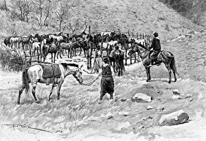
Background imageMaps Greetings Card Collection: A corral, Patagonia, Argentina, 1895. Artist: Alfred Paris

A corral, Patagonia, Argentina, 1895. Artist: Alfred Paris
A corral, Patagonia, Argentina, 1895. From The Universal Geography with Illustrations and Maps, division XXXVIII, written by Elisee Reclus and published by Virtue & Co. Limited (London, 1895)

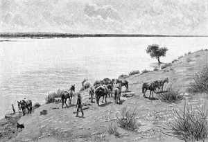
Background imageMaps Greetings Card Collection: The banks of the Rio Neuquen, Argentina, 1895. Artist: Alfred Paris

The banks of the Rio Neuquen, Argentina, 1895. Artist: Alfred Paris
The banks of the Rio Neuquen, Argentina, 1895. From The Universal Geography with Illustrations and Maps, division XXXVIII, written by Elisee Reclus and published by Virtue & Co. Limited (London, 1895)

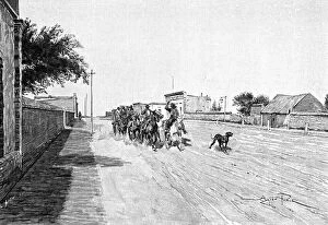
Background imageMaps Greetings Card Collection: A street in General Acha, Argentina, 1895. Artist: Alfred Paris

A street in General Acha, Argentina, 1895. Artist: Alfred Paris
A street in General Acha, Argentina, 1895. From The Universal Geography with Illustrations and Maps, division XXXVIII, written by Elisee Reclus and published by Virtue & Co. Limited (London, 1895)

Background imageMaps Greetings Card Collection: Gauchos, 1895. Artist: Alfred Paris

Gauchos, 1895. Artist: Alfred Paris
Gauchos, 1895. From The Universal Geography with Illustrations and Maps, division XXXVIII, written by Elisee Reclus and published by Virtue & Co. Limited (London, 1895)

Background imageMaps Greetings Card Collection: Mr Yang, Attache of the Chinese Legation in Paris, c1890

Mr Yang, Attache of the Chinese Legation in Paris, c1890. Illustration from The Universal Geography with Illustrations and Maps, Division XIII, (Virtue & Co Limited, London, c1890)

Background imageMaps Greetings Card Collection: Map of Rathbone Place and its neighbourhood, Westminster, London, 1746 (1878)

Map of Rathbone Place and its neighbourhood, Westminster, London, 1746 (1878). From John Rocques Maps of London. John Rocque (1709-1762) created an extensive map of Georgian London in 1746

Background imageMaps Greetings Card Collection: Map of Hyde Park, London, 1748 (1878). Artist: John Pine

Map of Hyde Park, London, 1748 (1878). Artist: John Pine
Map of Hyde Park, London, 1748 (1878). From John Rocques Map of London. John Rocque (1709-1762) created an extensive map of Georgian London in 1746

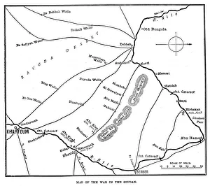
Background imageMaps Greetings Card Collection: Map of the War in the Soudan, late 19th century, (1900)

Map of the War in the Soudan, late 19th century, (1900). Map showing Sudan with the River Nile, Khartoum and Omdurman, scene of a battle in 1898 between British General Sir Horatio Kitchener

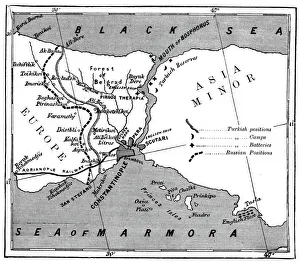
Background imageMaps Greetings Card Collection: A map showing the positions of Russian and Turkish lines outside Constantinople, 1900

A map showing the positions of Russian and Turkish lines outside Constantinople, 1900. Illustration of one of the many Russo-Turkish wars. In the centre is Constantinople, (now Istanbul, Turkey)

Background imageMaps Greetings Card Collection: Plan Of Monceau Park, Paris, 1778, (1885)

Plan Of Monceau Park, Paris, 1778, (1885). Designed by Louis Carrogis Carmontelle (1717-1806), French dramatist, painter and architect

Background imageMaps Greetings Card Collection: Paris, France, c1730

Paris, France, c1730. Fragment view of Paris as drawn under the orders of Michel Etienne Turgot. Visible landmarks are the Louvre, the Tuileries, and the Pont Royal over the River Seine

Background imageMaps Greetings Card Collection: Plan of the Porte Monumentale and Palais des Beaux-Arts, 1900

Plan of the Porte Monumentale and Palais des Beaux-Arts, 1900. Exposition Universelle of 1900 was a worlds fair held in Paris, France

Background imageMaps Greetings Card Collection: Plan for the Trocadero and Universal Exhibition of 1900, Paris, 1900. Artist: G Rochet

Plan for the Trocadero and Universal Exhibition of 1900, Paris, 1900. Artist: G Rochet
Plan for the Trocadero and Universal Exhibition of 1900, Paris, 1900. Exposition Universelle of 1900 was a worlds fair held in Paris, France

Background imageMaps Greetings Card Collection: The Champs de Mars, Universal Exhibition of 1900, Paris, 1900. Artist: G Rochet

The Champs de Mars, Universal Exhibition of 1900, Paris, 1900. Artist: G Rochet
The Champs de Mars, Universal Exhibition of 1900, Paris, 1900. Exposition Universelle of 1900 was a worlds fair held in Paris, France

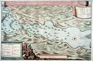
Background imageMaps Greetings Card Collection: The Bosporus or Bosphorus, 1615. Artist: Leonard Gaultier

The Bosporus or Bosphorus, 1615. Artist: Leonard Gaultier
The Bosporus or Bosphorus, 1615. A plate from Les Images Ou Tableaux De Platte Peinture Des Deux Philostrates Sophistes Grecs, by Blaise de Vigenere, Paris, 1615

Background imageMaps Greetings Card Collection: Atlas, 1615. Artist: Leonard Gaultier

Atlas, 1615. Artist: Leonard Gaultier
Atlas, 1615. In Greek mythology, Atlas was one of the primordial Titans. A plate from Les Images Ou Tableaux De Platte Peinture Des Deux Philostrates Sophistes Grecs, by Blaise de Vigenere, Paris

Background imageMaps Greetings Card Collection: Map of the Paris Universal Exposition, 1900

Map of the Paris Universal Exposition, 1900. More than 50 million people attended the exposition, designed to celebrate the achievements of the 19th century

Background imageMaps Greetings Card Collection: City of Veracruz, Mexico, 17th century

City of Veracruz, Mexico, 17th century. Detail from a map of the city which lies on the Caribbean, on the east coast of Mexico

Background imageMaps Greetings Card Collection: Battle of Vigo Bay, Spain, 12 October 1702

Battle of Vigo Bay, Spain, 12 October 1702. Dutch plan of the engagement during the War of the Spanish Succession (1701-1714)

Background imageMaps Greetings Card Collection: Voyage dans les Pouilles, 16th century

Voyage dans les Pouilles, 16th century. Manuscript in the National Library of France, Paris

Background imageMaps Greetings Card Collection: Allegory of Republican France, 1871. Artist: E Courtaux

Allegory of Republican France, 1871. Artist: E Courtaux
Allegory of Republican France, 1871. Cartoon from a series titled La Grande Crucifiee!!! depicting Marianne as Republican France

Background imageMaps Greetings Card Collection: Dorothea Klumpke Roberts, American mathematician and astronomer, 1903

Dorothea Klumpke Roberts, American mathematician and astronomer, 1903. Roberts (1861-1942) at work on the Carte du Ciel at the Paris Observatory

Background imageMaps Greetings Card Collection: Map of stellar constellations, 1775

Map of stellar constellations, 1775. Constellations of Perseus carrying the head of Medusa, Andromeda chained to a rock, and the Triangle (Triangulum)

Background imageMaps Greetings Card Collection: Copernican (heliocentric / Sun-centred) system of the Universe, 1761

Copernican (heliocentric / Sun-centred) system of the Universe, 1761
Copernican (heliocentric/Sun-centred) system of the Universe, 1761. Illustration showing the orbits of the planets around the Sun. The orbits of the moons of Earth, Jupiter and Saturn are also shown

Background imageMaps Greetings Card Collection: Constellation of Leo, 1775. Artist: Jean Fortin

Constellation of Leo, 1775. Artist: Jean Fortin
Constellation of Leo, 1775. A number of distant galaxies can be observed in Leo by astronomers, and the constellation is associated with several meteor showers, most notably the Leonids

Background imageMaps Greetings Card Collection: Astronomical map, centred on the constellation of Hercules, 1775. Artist: Jean Fortin

Astronomical map, centred on the constellation of Hercules, 1775. Artist: Jean Fortin
Astronomical map, centred on the constellation of Hercules, 1775. Part of the Milky Way is shown on the right of the image. From Atlas Coelestis de Flamsteed by JJ Fortin. (Paris, 1775)

Background imageMaps Greetings Card Collection: Illustration from De la Terre a la Lune by Jules Verne, 1865

Illustration from De la Terre a la Lune by Jules Verne, 1865. Map of Florida showing the positioin of the launch site of the spacecraft Columbiad

Background imageMaps Greetings Card Collection: Taking The Doctors Advice, 1863. Artist: John Tenniel

Taking The Doctors Advice, 1863. Artist: John Tenniel
Taking The Doctors Advice, 1863. Napoleon III had long had his French fingers in a variety of different European pies. At the beginning of November 1863

Background imageMaps Greetings Card Collection: The First Lesson!, 1859

The First Lesson!, 1859. Not so Bad for a Beginner! In this cartoon, Liberty in the role of a schoolmistress helps a childish Napoleon III to write the word Amnesty on the blackboard


All Professionally Made to Order for Quick Shipping


-

Maps Greetings Card Collection

Maps of Paris, France, Europe are invaluable resources for anyone visiting or living in the city. They provide an overview of the city's layout, including its streets and landmarks. They also show public transportation routes and stations, as well as points of interest such as parks and museums. Many it also include information about nearby cities and towns, allowing visitors to plan day trips outside the city limits. Additionally they can help visitors find their way around Paris more easily by providing detailed directions from one point to another. With a map in hand, travelers can explore all that Paris has to offer with confidence.
+

Our beautiful Wall Art and Photo Gifts include Framed Prints, Photo Prints, Poster Prints, Canvas Prints, Jigsaw Puzzles, Metal Prints and so much more

The Maps of Paris France Europe collection from Media Storehouse is a stunning assortment of wall art, framed prints, photo prints, canvas prints, jigsaw puzzles and greeting cards that capture the beauty and history of Paris. Our collection features a wide range of maps depicting different eras in the city's rich cultural heritage. From antique maps dating back to the 18th century to modern-day street maps highlighting popular landmarks such as the Eiffel Tower and Notre-Dame Cathedral, our collection offers something for everyone. Each piece in our collection is carefully crafted using high-quality materials to ensure long-lasting durability and vibrant colors that will stand out on any wall. Whether you're looking for a unique gift or want to add some French charm to your home or office decor, these beautiful pieces are sure to impress. With so many options available at affordable prices, it's easy to find exactly what you need from this impressive selection of artwork.
+

What are Maps of Paris France Europe art prints?

Maps of Paris France Europe art prints are beautiful and detailed depictions of the city of Paris, France, and its surrounding regions. These maps showcase the intricate layout of streets, landmarks, and buildings throughout the area. They are often created using a combination of traditional cartography techniques and modern design elements to produce an aesthetically pleasing representation. These art prints serve as both decorative pieces for your home or office space as well as educational tools for those interested in geography or history. They can be used to plan trips to Paris or simply admired for their artistic value. Maps of Paris France Europe art prints come in various sizes and styles, ranging from vintage designs that capture the essence of old-world charm to contemporary interpretations that reflect modern-day trends. Regardless of your personal style preferences, there is sure to be a map print that will suit your tastes perfectly.
+

What Maps of Paris France Europe art prints can I buy from Media Storehouse?

We offer a wide range of Maps of Paris, France and Europe art prints that are perfect for home decor or as gifts. These maps come in various sizes and styles to suit your preferences. You can choose from vintage-style maps that showcase the intricate details of the city's streets, landmarks, and neighborhoods, or modern designs that highlight its vibrant culture and history. Some popular options include detailed street maps of Paris with iconic landmarks such as the Eiffel Tower, Notre Dame Cathedral, and Arc de Triomphe highlighted. There are also antique-style world maps featuring Europe prominently along with other continents. Media Storehouse also offers panoramic views of Paris' skyline at different times of day including sunrise or sunset which make great wall art pieces for any room in your home. Whether you're looking for something classic or contemporary, we have a vast collection of Maps of Paris France Europe art prints to choose from.
+

How do I buy Maps of Paris France Europe art prints?

To buy Maps of Paris France Europe art prints from Media Storehouse, you can browse our extensive collection of maps and select the one that best suits your preferences. Once you have found the map you want to purchase, simply add it to your cart and proceed to checkout. You will be prompted to enter your shipping information and payment details before finalizing your order. We offer a variety of sizes for their art prints, so make sure to choose the size that fits your needs. We also offer different framing options if you prefer a framed print. If you have any questions or concerns about purchasing Maps of Paris France Europe art prints from Media Storehouse, they have a customer service team available to assist you. Simply reach out via email or phone and they will be happy to help guide you through the process.
+

How much do Maps of Paris France Europe art prints cost?

We offer a wide range of Maps of Paris France Europe art prints, which vary in price depending on the size and type of print. The cost for these prints can be affected by factors such as the quality of paper or canvas used, the printing method employed, and any additional features that may be included with the print. However, it is important to note that Media Storehouse strives to offer affordable prices for all their products while maintaining high-quality standards. You can expect reasonable pricing options for Maps of Paris France Europe art prints without compromising on quality. Whether you are looking for vintage maps or contemporary designs, we have something to suit every taste and budget. With a vast collection available online, you can easily browse through different options before making their purchase decision.
+

How will my Maps of Paris France Europe art prints be delivered to me?

We take great care in ensuring that your Maps of Paris France Europe art prints are delivered to you safely and securely. We use high-quality packaging materials to protect your print during transit, so it arrives at your doorstep in pristine condition. Your print will be carefully rolled and placed inside a protective tube before being shipped out to you. This ensures that the print is not damaged or creased during shipping. Additionally, we work with trusted courier services to ensure timely delivery of your order. Once your package has been dispatched, you will receive a tracking number via email which allows you to track the progress of your shipment online. If for any reason there are issues with the delivery of your order, our customer service team is always available to assist you. We hope that receiving your Maps of Paris France Europe art prints brings joy and inspiration into your home or office space.