Fraud Blocker Skip to main content

Town Plan Collection

"Journey through Time

Background imageTown Plan Collection: Old Map of Wolverhampton 1750 by Isaac Taylor

Old Map of Wolverhampton 1750 by Isaac Taylor
J066

Background imageTown Plan Collection: Old Map of Stoke on Trent and the Potteries 1831

Old Map of Stoke on Trent and the Potteries 1831
G148

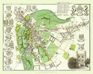
Background imageTown Plan Collection: Old Map of the City of Cambridge 1836 by Thomas Moule

Old Map of the City of Cambridge 1836 by Thomas Moule
This is a fine decorative reproduction Map of The City of Cambridge from the First Edition series of Thomas Moule Maps, originally Published in 1836

Background imageTown Plan Collection: Old Map of Cheltenham 1825 by Griffith s

Old Map of Cheltenham 1825 by Griffith s
Fine reproduction in full colour of Griffiths new historical description of Cheltenham and its vicinity originally published in 1825

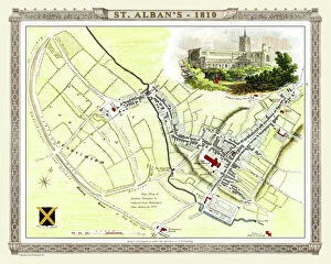
Background imageTown Plan Collection: Old Map of St Albans 1810 by Cole and Roper

Old Map of St Albans 1810 by Cole and Roper
An attractive and detailed early 19th century reproduction town plan of St Albans 1810. First published by Cole and Roper as a finely engraved series of county maps

Background imageTown Plan Collection: Old Map of Dudley 1835

Old Map of Dudley 1835
J037

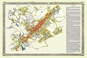
Background imageTown Plan Collection: Old Map of the Town of Bromsgrove in Worcestershire 1884

Old Map of the Town of Bromsgrove in Worcestershire 1884
PL003

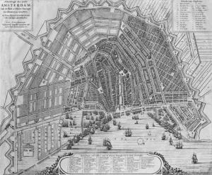
Background imageTown Plan Collection: Map of Amsterdam, 1662 (engraving) (b / w photo)

Map of Amsterdam, 1662 (engraving) (b / w photo)
XIR242868 Map of Amsterdam, 1662 (engraving) (b/w photo) by Danckerts, Cornelis I (c.1603-56); Gemeente-Archief, Amsterdam, The Netherlands; Dutch, out of copyright

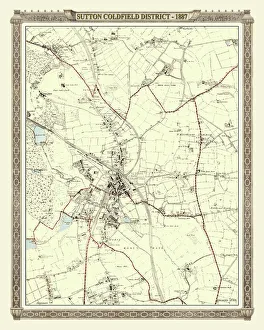
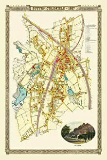
Background imageTown Plan Collection: Old Map of the District of Sutton Coldfield in the West Midlands 1887

Old Map of the District of Sutton Coldfield in the West Midlands 1887
PL016

Background imageTown Plan Collection: Old Map of Bilston 1832

Old Map of Bilston 1832
J036

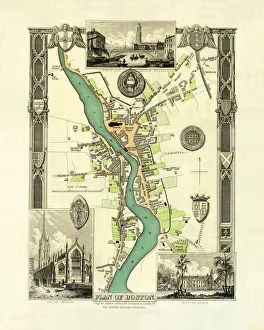
Background imageTown Plan Collection: Old Map of Boston England 1836 by Thomas Moule

Old Map of Boston England 1836 by Thomas Moule
This is a fine decorative reproduction Map of The Town of Boston from the First Edition series of Thomas Moule Maps, originally Published in 1836

Background imageTown Plan Collection: Old Map of Cambridge 1804 by Cole and Roper

Old Map of Cambridge 1804 by Cole and Roper
An attractive and detailed early 19th century reproduction town plan of Cambridge 1804. First published by Cole and Roper as a finely engraved series of county maps

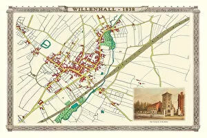
Background imageTown Plan Collection: Old Map of the Town of Willenhall in the West Midlands 1884

Old Map of the Town of Willenhall in the West Midlands 1884
PL024

Background imageTown Plan Collection: Old Map of Northampton 1807 by Cole and Roper

Old Map of Northampton 1807 by Cole and Roper
An attractive and detailed early 19th century reproduction town plan of Northampton 1807. First published by Cole and Roper as a finely engraved series of county maps

Background imageTown Plan Collection: Old Map of The Manor of Erdington in Warwickshire 1760

Old Map of The Manor of Erdington in Warwickshire 1760
PL064

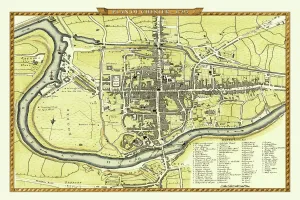
Background imageTown Plan Collection: Old Map of Chester 1795 by John Stockdale

Old Map of Chester 1795 by John Stockdale
An interesting, very detailed, reproduction 18th century street plan of the City of Chester Engraved for and published John Stockdale

Background imageTown Plan Collection: Old Map of the Village of Aldridge in Staffordshire1884

Old Map of the Village of Aldridge in Staffordshire1884
PL001

Background imageTown Plan Collection: Old Map of the Collieries of Tipton, Sedgley and Wednesbury 1848

Old Map of the Collieries of Tipton, Sedgley and Wednesbury 1848
PL005

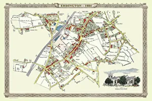
Background imageTown Plan Collection: Old Map of the Village of Erdington in the West Midlands 1884

Old Map of the Village of Erdington in the West Midlands 1884
PL007

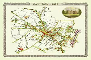
Background imageTown Plan Collection: Old Map of Cannock Town in Staffordshire 1886

Old Map of Cannock Town in Staffordshire 1886
PL004

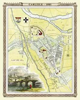
Background imageTown Plan Collection: Old Map of Carlisle 1805 by Cole and Roper

Old Map of Carlisle 1805 by Cole and Roper
An attractive and detailed early 19th century reproduction town plan of Carlisle 1805. First published by Cole and Roper as a finely engraved series of county maps

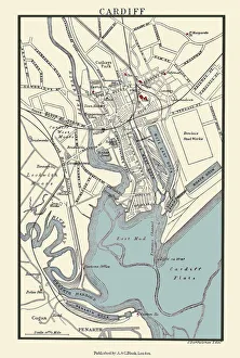
Background imageTown Plan Collection: Old Map of Cardiff 1890 by A&C Black

Old Map of Cardiff 1890 by A&C Black
J133

Background imageTown Plan Collection: Old Map of Bedford 1807 by Cole and Roper

Old Map of Bedford 1807 by Cole and Roper
An attractive and detailed early 19th century reproduction town plan of Bedford, Bedfordshire. First published by Cole and Roper as a finely engraved series of county maps

Background imageTown Plan Collection: Old Map of Canterbury 1806 by Cole and Roper

Old Map of Canterbury 1806 by Cole and Roper
An attractive and detailed early 19th century reproduction town plan of Canterbury 1806. First published by Cole and Roper as a finely engraved series of county maps

Background imageTown Plan Collection: Old Map of Colchester 1805 by Cole and Roper

Old Map of Colchester 1805 by Cole and Roper
An attractive and detailed early 19th century reproduction town plan of Colchester 1805. First published by Cole and Roper as a finely engraved series of county maps

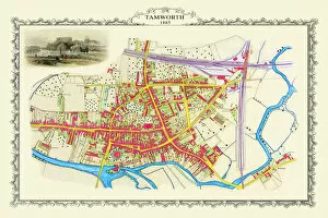
Background imageTown Plan Collection: Old Map of the Town of Tamworth in Staffordshire 1885

Old Map of the Town of Tamworth in Staffordshire 1885
PL018

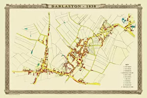
Background imageTown Plan Collection: Old Map of the Town of Darlaston in the West Midlands 1838

Old Map of the Town of Darlaston in the West Midlands 1838
PL39

Background imageTown Plan Collection: Old Map of the Royal Town of Sutton Coldfield 1884

Old Map of the Royal Town of Sutton Coldfield 1884
PL050

Background imageTown Plan Collection: Old Map of Walsall 1824 by Mason

Old Map of Walsall 1824 by Mason
J022

Background imageTown Plan Collection: Old Map of West Bromwich in the West Midlands 1837

Old Map of West Bromwich in the West Midlands 1837
PL021

Background imageTown Plan Collection: Old Map of Wednesbury Town in the Black Country 1846

Old Map of Wednesbury Town in the Black Country 1846
J023

Background imageTown Plan Collection: Old Map of the Village of Bloxwich near Walsall 1884

Old Map of the Village of Bloxwich near Walsall 1884
PL002

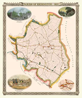
Background imageTown Plan Collection: Old Map of The Parish of Erdington 1833

Old Map of The Parish of Erdington 1833
J129

Background imageTown Plan Collection: Old Map of the City of Bath 1836 by Thomas Moule

Old Map of the City of Bath 1836 by Thomas Moule
This is a fine decorative reproduction Map of The City of Bath from the First Edition series of Thomas Moule Maps, originally Published in 1836

Background imageTown Plan Collection: Old Map of the City Oxford 1836 by Thomas Moule

Old Map of the City Oxford 1836 by Thomas Moule
This is a fine decorative reproduction Map of The City of Oxford from the First Edition series of Thomas Moule Maps, originally Published in 1836

Background imageTown Plan Collection: Old Map of Chester 1805 by Cole and Roper

Old Map of Chester 1805 by Cole and Roper
An attractive and detailed early 19th century reproduction town plan of Chester 1805. First published by Cole and Roper as a finely engraved series of county maps

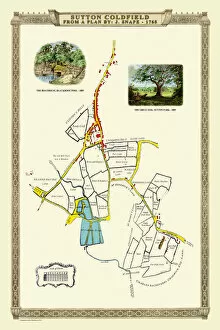
Background imageTown Plan Collection: Old Map of the Royal Town of Sutton Coldfield 1765 by John Snape

Old Map of the Royal Town of Sutton Coldfield 1765 by John Snape
PL042

Background imageTown Plan Collection: Old Map of the Town of Willenhall showing the Old Church of St Giles in 1838

Old Map of the Town of Willenhall showing the Old Church of St Giles in 1838
PL063

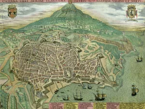
Background imageTown Plan Collection: Map of Catania, from Civitates Orbis Terrarum by Georg Braun (1541-1622

Map of Catania, from Civitates Orbis Terrarum by Georg Braun (1541-1622
STC121059 Map of Catania, from Civitates Orbis Terrarum by Georg Braun (1541-1622) and Frans Hogenberg (1535-90), c.1572 (coloured engraving) by Hoefnagel

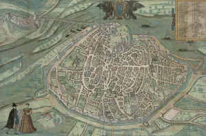
Background imageTown Plan Collection: Map of Avignon, from Civitates Orbis Terrarum by Georg Braun (1541-1622

Map of Avignon, from Civitates Orbis Terrarum by Georg Braun (1541-1622
STC121029 Map of Avignon, from Civitates Orbis Terrarum by Georg Braun (1541-1622) and Frans Hogenberg, c.1572 (colour engraving) by Hoefnagel

Background imageTown Plan Collection: Map of Nuremberg, Ulm, and Saltzburg, from Civitates Orbis Terrarum

Map of Nuremberg, Ulm, and Saltzburg, from Civitates Orbis Terrarum
STC121026 Map of Nuremberg, Ulm, and Saltzburg, from Civitates Orbis Terrarum by Georg Braun (1541-1622) and Frans Hogenberg (1535-90), c.1572 (colour engraving) by Hoefnagel

Background imageTown Plan Collection: Map of Bergen, from Civitates Orbis Terrarum by Georg Brau (1541-1622

Map of Bergen, from Civitates Orbis Terrarum by Georg Brau (1541-1622
STC138990 Map of Bergen, from Civitates Orbis Terrarum by Georg Brau (1541-1622) and Franz Hogenberg (1535-90) c.1571-1600 (coloured engraving) by Scholeus

Background imageTown Plan Collection: Map of WRATISLAVA Bresslaw, from Civitates Orbis Terrarum

Map of WRATISLAVA Bresslaw, from Civitates Orbis Terrarum
STC138988 Map of WRATISLAVA Bresslaw, from Civitates Orbis Terrarum by Georg Braun (1541-1622) and Frans Hogenberg (1535-90) c.1572-1617 (coloured engraving) by Hoefnagel

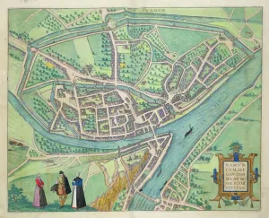
Background imageTown Plan Collection: Map of Namur, from Civitates Orbis Terrarum by Georg Braun (1541-1622

Map of Namur, from Civitates Orbis Terrarum by Georg Braun (1541-1622
STC138981 Map of Namur, from Civitates Orbis Terrarum by Georg Braun (1541-1622) and Frans Hogenberg (1535-90) c.1572-1617 (coloured engraving) by Hoefnagel

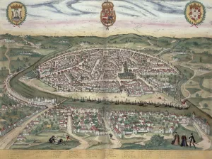
Background imageTown Plan Collection: Map of Seville, from Civitates Orbis Terrarum by Georg Braun (1541-1622

Map of Seville, from Civitates Orbis Terrarum by Georg Braun (1541-1622
STC138975 Map of Seville, from Civitates Orbis Terrarum by Georg Braun (1541-1622) and Frans Hogenberg (1535-90) c.1572-1617 (coloured engraving) by Hoefnagel

Background imageTown Plan Collection: Map of Amsterdam, from Civitates Orbis Terrarum

Map of Amsterdam, from Civitates Orbis Terrarum
STC121004 Map of Amsterdam, from Civitates Orbis Terrarum by Georg Braun (1541-1622) and Frans Hogenburg (1535-90), c.1572 (coloured engraving) by Hoefnagel

Background imageTown Plan Collection: Map of the parish of St. Paul, Covent Garden, showing the site of Bedford House

Map of the parish of St. Paul, Covent Garden, showing the site of Bedford House
GHL254051 Map of the parish of St. Paul, Covent Garden, showing the site of Bedford House and grounds, published by W.P. Metchim, 1686 (litho) by Leybourn

Background imageTown Plan Collection: Map of Montpellier, from Civitates Orbis Terrarum

Map of Montpellier, from Civitates Orbis Terrarum
CHT279763 Map of Montpellier, from Civitates Orbis Terrarum by Georg Braun (1541-1622) and Frans Hogenberg (1535-90) Brussels, 1574 (coloured engraving) (b/w photo) (see also 121038) by Hoefnagel


All Professionally Made to Order for Quick Shipping

"Journey through Time: Exploring the Fascinating Town Plans of the Past" Step back in time and immerse yourself in the rich history of various towns with these captivating old maps. From Wolverhampton to Amsterdam, each map offers a unique glimpse into the development and evolution of these vibrant communities. The "Old Map of Wolverhampton 1750 by Isaac Taylor" takes us on a visual journey through this bustling town, showcasing its layout and landmarks from centuries ago. Marvel at how much has changed since then. Travel further north to Stoke-on-Trent with the "Old Map of Stoke on Trent and the Potteries 1831. " This intricate map highlights not only the town's streets but also sheds light on its pottery industry, which played a significant role in shaping its identity. Venturing westwards, we discover Sutton Coldfield's transformation over time with an "Old Map of the District of Sutton Coldfield in West Midlands 1887. " Witness how this once rural area evolved into a thriving suburban community. Crossing borders, let your eyes wander across Amsterdam's enchanting streetscape captured in an exquisite "Map of Amsterdam, 1662 (engraving) (b/w photo). " Explore canals that have stood for centuries and imagine life during Holland's Golden Age. Heading towards Carlisle, delve into history with an "Old Map of Carlisle 1805 by Cole and Roper. " Trace ancient roads and fortifications that shaped this border city while contemplating its strategic significance throughout time. Further east lies Cambridge; discover its academic legacy through an "Old Map of City Cambridge 1836 by Thomas Moule. " Uncover hidden corners where renowned scholars once roamed as you navigate through one England's most prestigious university towns. Turning southward brings us to Cardiff – explore its growth from humble beginnings using an "Old Map Cardiff 1890 by A&C Black. " Witness how it transformed from a small market town into the vibrant capital city of Wales.