Fraud Blocker Skip to main content

Topographic Collection

"Exploring the World's Topography: From Scotland to Mars and Beyond" Discover the stunning topographic features of Scotland

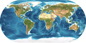
Background imageTopographic Collection: Earth, topographic and bathymetric map

Earth, topographic and bathymetric map. This whole Earth map is centred on the Greenwich meridian, at zero degrees latitude

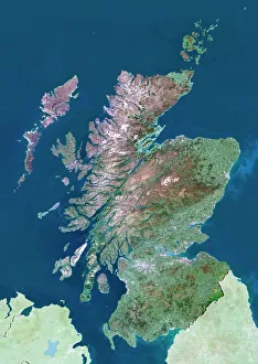
Background imageTopographic Collection: Scotland, UK, satellite image

Scotland, UK, satellite image
Scotland, UK. North is at top. Natural colour satellite image showing Scotland in the United Kingdom, with the surrounding territories shaded out

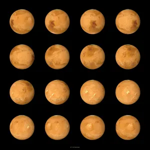
Background imageTopographic Collection: Mars, composite satellite images

Mars, composite satellite images
Mars. Composite satellite images of the surface of Mars from multiple aspects. North is at top. Mars is the fourth planet from the Sun, and is a rocky desert world

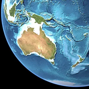
Background imageTopographic Collection: Australia, topographic map

Australia, topographic map. Highlands and lowlands of the continents are shown as ridges and flat areas. Southeast Asia (top left), New Zealand (lower right) and Antarctica (bottom right)

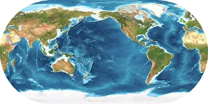
Background imageTopographic Collection: Earth, topographic and bathymetric map

Earth, topographic and bathymetric map. This map is centred on the Pacific Ocean, at longitude 140 degrees west. Highlands and lowlands of the continents are shown as ridges and flat areas

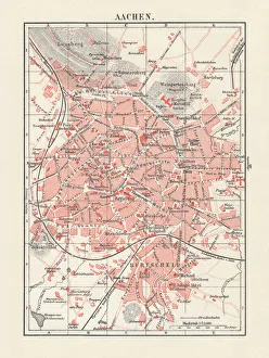
Background imageTopographic Collection: City map of Aachen, Germany, lithograph, published in 1897

City map of Aachen, Germany, lithograph, published in 1897
City map of Aachen, Germany. Lithograph, published in 1897

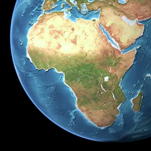
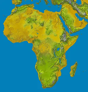
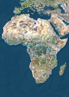
Background imageTopographic Collection: Africa, topographic map

Africa, topographic map. Highlands and lowlands of the continents are shown as ridges and flat areas. Southern Europe and the Middle East are also seen at top and upper right respectively

Background imageTopographic Collection: Birds Eye View of Bristol, 1887 (colour litho)

Birds Eye View of Bristol, 1887 (colour litho)
2829302 Birds Eye View of Bristol, 1887 (colour litho) by Lavars, Edward Colston (1842-1917); Bristol Museum and Art Gallery, UK; eBristol Museums, Galleries & Archives; English, out of copyright

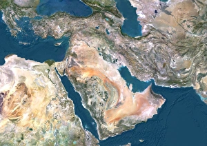
Background imageTopographic Collection: Middle East, satellite image

Middle East, satellite image
Middle East. North is at top. Satellite image of the Middle East, showing the borders (white lines) of the countries. The Middle East is a Eurocentric term used to describe a region that roughly

Background imageTopographic Collection: Pickwick, Texas, map 1927, 1:62500, United States of America by Timeless Maps, data U.S

Pickwick, Texas, map 1927, 1:62500, United States of America by Timeless Maps, data U.S. Geological Survey

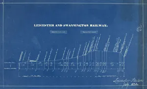
Background imageTopographic Collection: The line into Leicester Station

The line into Leicester Station
Section showing the line into Leicester Station as at 17 Jul 1832 when the L&S Railway was opened and also showing the gradient for the extension whilst still under construction

Background imageTopographic Collection: Whole Earth map

Whole Earth map based on satellite data. This is a mosaic of numerous satellite observations of the Earth. Land colours are shaded using topographic data

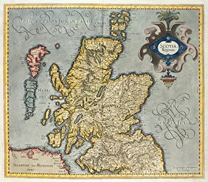
Background imageTopographic Collection: Map of the Kingdom of Scotland, 17th century

Map of the Kingdom of Scotland, 17th century
BAL42814 Map of the Kingdom of Scotland, 17th century by Unknown Artist, (17th century); O Shea Gallery, London, UK; (add.info.: Influenced by the Gerard Mercator Atlas of 1565.); out of copyright

Background imageTopographic Collection: Map of the Kingdom of Scotland, 17th century

Map of the Kingdom of Scotland, 17th century
BAL42813 Map of the Kingdom of Scotland, 17th century by Unknown Artist, (17th century); O Shea Gallery, London, UK; out of copyright

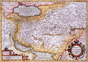
Background imageTopographic Collection: Map of Persia, 1638 (hand-coloured engraving)

Map of Persia, 1638 (hand-coloured engraving)
619430 Map of Persia, 1638 (hand-coloured engraving) by Mercator, Gerard (1512-94) (after); Private Collection; The Stapleton Collection; Flemish, out of copyright

Background imageTopographic Collection: relief image of Africa by the Shuttle Radar Topography Mission (SRTM)

relief image of Africa by the Shuttle Radar Topography Mission (SRTM)
Relief image of Africa by the Shuttle Radar Topography Mission (SRTM). This release in 2000, includes data for all of the continent, plus the island of Madagascar and the Arabian Peninsula

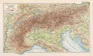
Background imageTopographic Collection: Topographic map of the European Alps, lithograph, published in 1897

Topographic map of the European Alps, lithograph, published in 1897
Topographic map of the European Alps. Lithograph, published in 1897

Background imageTopographic Collection: Drawing showing the plan of a medieval, English manor

Drawing showing the plan of a medieval, English manor
MEDIEVAL MANOR. Drawing showing the plan of a medieval, English manor

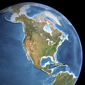
Background imageTopographic Collection: North America, topographic map

North America, topographic map. Highlands and lowlands of the continents are also shown, as ridges and flat areas. South America (bottom right) and the Arctic (top) are also seen

Background imageTopographic Collection: Eurasia, topographic map

Eurasia, topographic map. This map is centred on Russia, with Europe at centre left and East Asia at right. The North Pole (upper left), with Greenland shown in white

Background imageTopographic Collection: close up, close-up, cropped, detailed, earth, europe, globe, nobody, on black, reversed

close up, close-up, cropped, detailed, earth, europe, globe, nobody, on black, reversed, studio shot, surface, texture, topographic, topography, upside down, Hemera, 87466809

Background imageTopographic Collection: DR Congo, satellite image

DR Congo, satellite image
DR Congo. North is at top. Satellite image of the Democratic Republic of the Congo (DRC) in Central Africa, with the surrounding countries shaded out

Background imageTopographic Collection: Africa and Atlantic Ocean, with clouds C016 / 3727

Africa and Atlantic Ocean, with clouds C016 / 3727
Africa and Atlantic Ocean, with clouds. Computer graphic of an Earth globe centred on West Africa, generated using satellite and mapping data

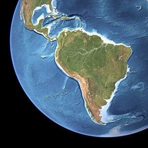
Background imageTopographic Collection: The Americas, sea floor topography C016 / 3726

The Americas, sea floor topography C016 / 3726
The Americas, sea floor topography. Computer graphic of an Earth globe centred on the Americas, generated using satellite and mapping data

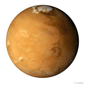
Background imageTopographic Collection: Mars, composite satellite image

Mars, composite satellite image
Mars. Composite satellite image of the surface of Mars, showing the north polar cap (white), a mixture of ice and dust that extends to the 80 degree latitude circle

Background imageTopographic Collection: South America, topographic map

South America, topographic map. Highlands and lowlands of the continents are also shown, as ridges and flat areas. North America and the Caribbean (top left) and Antarctica (bottom right)

Background imageTopographic Collection: City map of Augsburg, Bavaria, Germany, lithograph, published in 1897

City map of Augsburg, Bavaria, Germany, lithograph, published in 1897

Background imageTopographic Collection: MEXICO: TZINTZUNTZAN. Map of Tzintzuntzan, the Spanish colonial headquarters in the region

MEXICO: TZINTZUNTZAN. Map of Tzintzuntzan, the Spanish colonial headquarters in the region (center); the silver mining town of Patzcuaro (top); and other towns surrounding Lake Patzcuaro in Mexico

Background imageTopographic Collection: East Pacific Rise, topographic map

East Pacific Rise, topographic map
East Pacific Rise. Topographic map of the seabed of the Pacific Ocean around part of the East Pacific Rise (red), a mid-ocean ridge that runs northwards from near Antarctica to the Gulf of

Background imageTopographic Collection: Wales, United Kingdom, satellite image C014 / 0084

Wales, United Kingdom, satellite image C014 / 0084
Wales, satellite image. North is at top. Natural colour satellite image showing Wales in the United Kingdom, with the surrounding territories shaded out

Background imageTopographic Collection: Mariana Trench, bathymetric map C014 / 4709

Mariana Trench, bathymetric map C014 / 4709
Mariana Trench. Bathymetric map showing the varying depths of the Mariana Trench in the Pacific Ocean. Depths are reflected by shades of blue

Background imageTopographic Collection: Mariana Trench, bathymetric map C014 / 4708

Mariana Trench, bathymetric map C014 / 4708
Mariana Trench. Bathymetric map showing the varying depths of the Mariana Trench in the Pacific Ocean. Depths are reflected by shades of blue

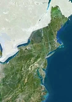
Background imageTopographic Collection: Northeastern USA, satellite image C014 / 0091

Northeastern USA, satellite image C014 / 0091
Northeastern USA, satellite image. North is at top. Natural colour satellite image showing the Northeastern USA divided into its states, and the Atlantic Ocean (blue) at right

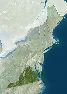
Background imageTopographic Collection: Virginia, USA, satellite image C014 / 0090

Virginia, USA, satellite image C014 / 0090
Virginia, satellite image. North is at top. Natural colour satellite image showing the state of Virginia, USA, with the surrounding states of the Northeastern USA shaded out

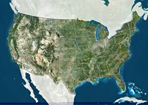
Background imageTopographic Collection: United States, satellite image C014 / 0087

United States, satellite image C014 / 0087
United States, satellite image. North is at top. Natural colour satellite image showing the United States of America (except Hawaii and Alaska), divided into its states

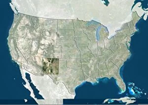
Background imageTopographic Collection: New Mexico, USA, satellite image C014 / 0086

New Mexico, USA, satellite image C014 / 0086
New Mexico, satellite image. North is at top. Natural colour satellite image showing the state of New Mexico, USA, with the other US states shaded out. The USA consists of 50 states

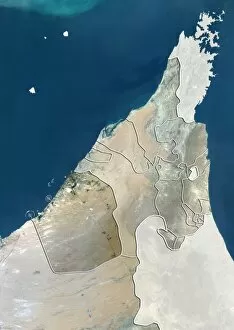
Background imageTopographic Collection: Dubai, UAE, satellite image C014 / 0082

Dubai, UAE, satellite image C014 / 0082
Dubai, satellite image. North is at top. Natural colour satellite image showing the emirate of Dubai, United Arab Emirates (UAE), with the surrounding emirates shaded out

Background imageTopographic Collection: Switzerland, satellite image C014 / 0079

Switzerland, satellite image C014 / 0079
Switzerland, satellite image. North is at top. Natural colour satellite image showing Switzerland divided into its cantons (member states)

Background imageTopographic Collection: Graubunden, Switzerland, satellite image C014 / 0078

Graubunden, Switzerland, satellite image C014 / 0078
Graubunden, satellite image. North is at top. Natural colour satellite image showing the canton of Graubunden, Switzerland, with the surrounding Swiss cantons (member states) shaded out

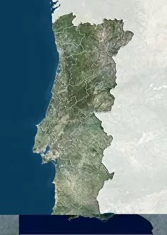
Background imageTopographic Collection: Coimbra, Portugal, satellite image

Coimbra, Portugal, satellite image
Coimbra, satellite image. North is at top. Natural colour satellite image showing the district of Coimbra, Portugal, with the surrounding Portguese districts shaded out

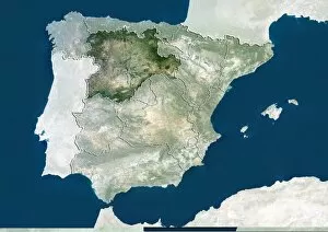
Background imageTopographic Collection: Castile and Leon, Spain, satellite image C014 / 0076

Castile and Leon, Spain, satellite image C014 / 0076
Castile and Leon, satellite image. North is at top. Natural colour satellite image showing the Castile and Leon autonomous community, Spain

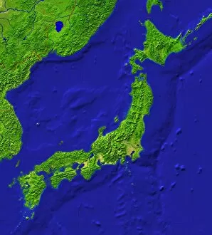
Background imageTopographic Collection: Japan topography

Japan topography
Japan / Japan

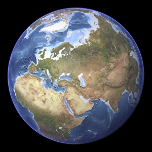
Background imageTopographic Collection: Europe and Africa, relief map

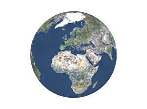
Europe and Africa, relief map. Globe centred on the continents of Europe and Africa, showing the ocean relief

Background imageTopographic Collection: Canada, satellite image

Canada, satellite image. North is at top. Natural colour satellite image showing Canada, with the surrounding regions removed. Image compiled from data acquired by LANDSAT satellites, in 2012

Background imageTopographic Collection: The Americas, relief map

The Americas, relief map. Globe centred on the continents of North and South America, showing the ocean relief

Background imageTopographic Collection: Switzerland, satellite image

Switzerland, satellite image. North is at top. Natural colour satellite image showing Switzerland, with the surrounding regions removed

Background imageTopographic Collection: Russia, satellite image

Russia, satellite image. North is at top. Natural colour satellite image showing Russia with the surrounding regions removed. Image compiled from data acquired by LANDSAT satellites, in 2012

Background imageTopographic Collection: South America, satellite image

South America, satellite image
South America. Satellite image of South America, showing the borders (white lines) of the countries, and the Caribbean Sea (top right)

Background imageTopographic Collection: India, satellite image

India, satellite image. North is at top. Natural colour satellite image showing India with the surrounding regions removed. Image compiled from data acquired by LANDSAT satellites, in 2012

Background imageTopographic Collection: Europe, satellite image

Europe, satellite image
Europe. North is at top. Satellite image of Europe, showing the borders (white lines) of the countries. Image compiled from data acquired by LANDSAT satellites, in 2012

Background imageTopographic Collection: United States, satellite image

United States, satellite image
United States. North is at top. Satellite image showing the United States of America with the surrounding territories shaded out. The USA consists of 50 states

Background imageTopographic Collection: United States, relief map

United States, relief map
United States. North is at top. Relief map showing the United States of America with the surrounding territories shaded out. The USA consists of 50 states

Background imageTopographic Collection: Turkey, satellite image

Turkey, satellite image. North is at top. Satellite image showing Turkey, with the surrounding countries shaded out. Turkey is a Eurasian country

Background imageTopographic Collection: Kazakhstan, satellite image

Kazakhstan, satellite image
Kazakhstan. North is at top. Satellite image of the Republic of Kazakhstan, with the surrounding countries shaded out. Kazakhstan is located in Central Asia

Background imageTopographic Collection: Brazil, relief map

Brazil, relief map
Brazil. North is at top. Relief map of Brazil (yellow) in South America, showing the borders (white lines) of the surrounding countries

Background imageTopographic Collection: Centre region, France, satellite image

Centre region, France, satellite image
Centre region, France. North is at top. Satellite image of a close-up on the departments that make up the Centre administrative region of France, with the surrounding areas shaded out

Background imageTopographic Collection: Provence-Alpes-Cote d Azur, France

Provence-Alpes-Cote d Azur, France. North is at top. Satellite image of a close-up on the departments that make up the Provence-Alpes-Cote d Azur administrative region of France

Background imageTopographic Collection: Tibet, China, relief map

Tibet, China, relief map
Tibet, China. North is at top. Relief map compiled from satellite data, showing the Tibet Autonomous Region (Tibet, yellow) and the surrounding Chinese provinces and regions (grey)

Background imageTopographic Collection: Bavaria, Germany, relief map

Bavaria, Germany, relief map
Bavaria, Germany. North is at top. Relief map compiled from satellite data, showing the state of Bavaria (yellow), Germany, with the surrounding German states shaded out (grey)

Background imageTopographic Collection: Texas, USA, relief map

Texas, USA, relief map
Texas, USA. North is at top. Relief map compiled from satellite data of the USA, showing the state of Texas (yellow), with the surrounding states shaded out (grey). The USA consists of 50 states

Background imageTopographic Collection: Ile-de-France, France, satellite image

Ile-de-France, France, satellite image
Ile-de-France, France. North is at top. Natural colour satellite image of a close-up on the Ile-de-France administrative region of France

Background imageTopographic Collection: Val-de-Marne, France, satellite image

Val-de-Marne, France, satellite image
Val-de-Marne, France. North is at top. Natural colour satellite image showing the French department of Val-de-Marne, with the surrounding regions shaded out. Paris can be seen at upper left

Background imageTopographic Collection: Seine-Saint-Denis, France

Seine-Saint-Denis, France. North is at top. Natural colour satellite image showing the French department of Seine-Saint-Denis, with the surrounding regions shaded out

Background imageTopographic Collection: Paris, France, satellite image

Paris, France, satellite image
Paris, France. North is at top. Natural colour satellite image showing Paris, with the surrounding regions shaded out. France is located in Western Europe

Background imageTopographic Collection: Hauts-de-Seine, France, satellite image

Hauts-de-Seine, France, satellite image
Hauts-de-Seine, France. North is at top. Natural colour satellite image showing the French department of Hauts-de-Seine, with the surrounding regions shaded out. France is located in Western Europe

Background imageTopographic Collection: Hautes-Pyrenees, France, satellite image

Hautes-Pyrenees, France, satellite image
Hautes-Pyrenees, France. North is at top. Natural colour satellite image showing the French department of Hautes-Pyrenees, with the surrounding regions shaded out

Background imageTopographic Collection: Aveyron, France, satellite image

Aveyron, France, satellite image
Aveyron, France. North is at top. Natural colour satellite image showing the French department of Aveyron, with the surrounding regions shaded out. France is located in Western Europe

Background imageTopographic Collection: Corse-du-Sud, France, satellite image

Corse-du-Sud, France, satellite image
Corse-du-Sud, France. North is at top. Natural colour satellite image showing the French department of Corse-du-Sud, with the surrounding regions shaded out. France is located in Western Europe

Background imageTopographic Collection: Wyoming, USA, satellite image

Wyoming, USA, satellite image
Wyoming, USA. North is at top. Natural colour satellite image of the USA, showing the state of Wyoming, with the surrounding states shaded out. The USA consists of 50 states

Background imageTopographic Collection: Washington, USA, satellite image

Washington, USA, satellite image
Washington, USA. North is at top. Natural colour satellite image of the USA, showing the state of Washington, with the surrounding states shaded out. The Pacific Ocean (blue) is also shown

Background imageTopographic Collection: Virginia, USA, satellite image

Virginia, USA, satellite image
Virginia, USA. North is at top. Natural colour satellite image of the USA, showing the state of Virginia, with the surrounding states shaded out. The Atlantic Ocean (blue) is also shown

Background imageTopographic Collection: Washington DC, USA, satellite image

Washington DC, USA, satellite image
Washington DC, USA. North is at top. Natural colour satellite showing Washington, D.C. in the Mid Atlantic region of the USA, with the surrounding states shaded out

Background imageTopographic Collection: Texas, USA, satellite image

Texas, USA, satellite image
Texas, USA. North is at top. Natural colour satellite image of the USA, showing the state of Texas, with the surrounding states shaded out. The USA consists of 50 states

Background imageTopographic Collection: Utah, USA, satellite image

Utah, USA, satellite image
Utah, USA. North is at top. Natural colour satellite image of the USA, showing the state of Utah, with the surrounding states shaded out. The USA consists of 50 states

Background imageTopographic Collection: New Jersey, USA, satellite image

New Jersey, USA, satellite image
New Jersey, USA. North is at top. Natural colour satellite image of the USA, showing the state of New Jersey, with the surrounding states shaded out. The Atlantic Ocean (blue) is also shown

Background imageTopographic Collection: Montana, USA, satellite image

Montana, USA, satellite image
Montana, USA. North is at top. Natural colour satellite image of the USA, showing the state of Montana, with the surrounding states shaded out. The USA consists of 50 states

Background imageTopographic Collection: Michigan, USA, satellite image

Michigan, USA, satellite image
Michigan, USA. North is at top. Natural colour satellite image of the USA, showing the state of Michigan with the surrounding states shaded out. The USA consists of 50 states

Background imageTopographic Collection: Kansas, USA, satellite image

Kansas, USA, satellite image
Kansas, USA. North is at top. Natural colour satellite image of the USA, showing the state of Kansas with the surrounding states shaded out. The USA consists of 50 states

Background imageTopographic Collection: Massachusetts, USA, satellite image

Massachusetts, USA, satellite image
Massachusetts, USA. North is at top. Natural colour satellite image of the USA, showing the state of Massachusetts with the surrounding states shaded out. The USA consists of 50 states

Background imageTopographic Collection: Iowa, USA, satellite image

Iowa, USA, satellite image
Iowa, USA. North is at top. Natural colour satellite image of the USA, showing the state of Iowa with the surrounding states shaded out. The USA consists of 50 states

Background imageTopographic Collection: Wales, UK, satellite image

Wales, UK, satellite image
Wales, UK. North is at top. Natural colour satellite image showing Wales in the United Kingdom, with the surrounding territories shaded out

Background imageTopographic Collection: Northern Ireland, UK, satellite image

Northern Ireland, UK, satellite image
Northern Ireland, UK. North is at top. Natural colour satellite image showing Northern Ireland in the United Kingdom, with the surrounding territories shaded out

Background imageTopographic Collection: England, UK, satellite image

England, UK, satellite image
England, UK. North is at top. Natural colour satellite image showing England in the United Kingdom, with the surrounding territories shaded out

Background imageTopographic Collection: Tohoku, Japan, satellite image

Tohoku, Japan, satellite image
Tohoku, Japan. North is at top. Natural colour satellite image showing the Tohoku region of Japan, with the surrounding regions shaded out. Japan is an island nation in East Asia


All Professionally Made to Order for Quick Shipping

"Exploring the World's Topography: From Scotland to Mars and Beyond" Discover the stunning topographic features of Scotland, UK through a mesmerizing satellite image that unveils its rugged landscapes and breathtaking beauty. Embark on an extraordinary journey across Earth with a detailed topographic and bathymetric map, revealing both landforms and underwater terrain in unparalleled detail. Unleash your curiosity as you delve into the mysteries of Mars, where composite satellite images showcase its intriguing topography, offering glimpses into an alien world. Dive into Australia's diverse terrain with a comprehensive topographic map that unravels its vast deserts, lush rainforests, and iconic landmarks from coast to coast. Immerse yourself in Africa's rich tapestry of geographical wonders through a captivating topographic map that showcases its majestic mountains, expansive savannas, and winding rivers. Take a step back in time with a vintage lithograph city map of Aachen, Germany published in 1897 - witness how urban landscapes have evolved over centuries while preserving their unique charm. Marvel at the intricate patterns etched across the Middle East as captured by an awe-inspiring satellite image; explore ancient cities juxtaposed against arid deserts or fertile valleys. Return to Earth once again to uncover hidden depths beneath our oceans using an all-encompassing topographic and bathymetric map - witness the secrets held within our planet's watery realms. Venture beyond our own celestial home as you navigate through Mars' enigmatic landscape via a detailed topographical map derived from cutting-edge satellite imagery - unlocking new frontiers for exploration. Travel back in time yet again with a lithograph published in 1897 depicting the magnificent European Alps - trace mountaineering routes taken by pioneers who dared conquer these towering peaks.

© Copyright Media Storehouse, All Rights Reserved 2003 - 2024
Facebook     Pinterest     100% Payment Secure     Reviews IO