Fraud Blocker Skip to main content

Surveying Collection

"Surveying: Unveiling the Past, Charting the Future" Step into a journey of discovery as we delve into the fascinating world of surveying

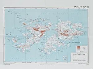
Background imageSurveying Collection: Falklands War - 1982

Falklands War - 1982
Directorate of Overseas Surveys map of the Falklands Islands, 1983 (c). One of four maps of the Falkland Islands, 1982 (c)-1984 (c)

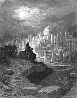
Background imageSurveying Collection: The New Zealander, 1872. Creator: Gustave Doré

The New Zealander, 1872. Creator: Gustave Doré
The New Zealander, 1872. A figure sits on the banks of the River Thames contemplating the downfall of the city. From, " LONDON. A Pilgrimage" by Gustave Dore and Blanchard Jerrold

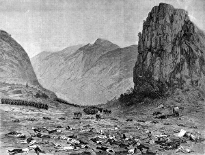
Background imageSurveying Collection: The Zulu war. Lord Chelmsfords retreat from Isandhlwana the

The Zulu war. Lord Chelmsfords retreat from Isandhlwana the
Lord Chelmsford surveying the damage after the Battle of Isandlwana. The battlefield strewn with corpses is in the foreground, Isandhlawana Hill is in the distance, as are the Zulu impi (warriors)

Background imageSurveying Collection: Larkswood Lido

Larkswood Lido
Two glamorous girls in bathing costumes and high heels surveying the scene at Larkswood open air swimming pool, Chingford, Essex

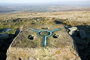
Background imageSurveying Collection: Trig point on Wild Boar Fell in the north Pennines UK

Trig point on Wild Boar Fell in the north Pennines UK
Ashley Cooper / SpecialistStock

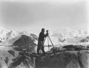
Background imageSurveying Collection: Alfred Stephenson with theodolite, Anchorage Island

Alfred Stephenson with theodolite, Anchorage Island
Photographer: Roberts, Brian Birley (1912-1978). Expedition: British Graham Land Expedition 1934-37. Leader: John Rymill. Date: 1937. Stephenson stands at a theodolite mounted on a tripod on rocks

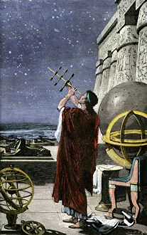
Background imageSurveying Collection: PSCI2A-00073

PSCI2A-00073
Greek astronomer Hipparchus mapping the stars over Alexandria, ancient Egypt. Hand-colored woodcut of a 19th-century illustration

Background imageSurveying Collection: Surface buildings, possibly one of the Basset Mines, Illogan, Cornwall. Around 1906

Surface buildings, possibly one of the Basset Mines, Illogan, Cornwall. Around 1906
Reginald Colwell James (1890-1974) of St Columb Major, with mine buildings in the background (thought to perhaps be one of the Basset Mines)

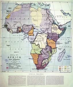
Background imageSurveying Collection: Map of Africa showing Treaty Boundaries, 1891 (colour lithograph)

Map of Africa showing Treaty Boundaries, 1891 (colour lithograph)
XCF282018 Map of Africa showing Treaty Boundaries, 1891 (colour lithograph) by English School, (19th century); British Museum, London, UK; English, out of copyright

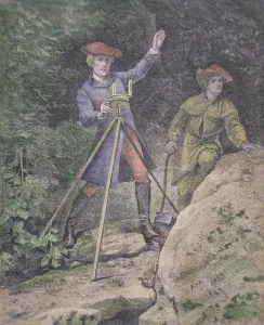
Background imageSurveying Collection: George Washington as a surveyor in Virginia, aged 21 (colour litho)

George Washington as a surveyor in Virginia, aged 21 (colour litho)
PNP257451 George Washington as a surveyor in Virginia, aged 21 (colour litho) by American School, (19th century); Private Collection; (add.info)

Background imageSurveying Collection: A Field Examination of the Surveyors Institute in Osterley Park (engraving)

A Field Examination of the Surveyors Institute in Osterley Park (engraving)
1056075 A Field Examination of the Surveyors Institute in Osterley Park (engraving) by Brewtnall, Edward Frederick (1846-1902) (after); Private Collection; (add.info)

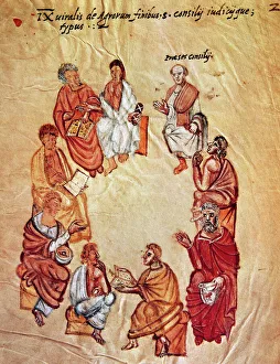
Background imageSurveying Collection: Surveyors sitting in a circle during a meeting. Miniature of

Surveyors sitting in a circle during a meeting. Miniature of the 14th century

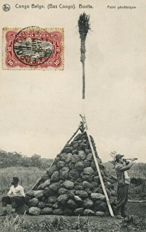
Background imageSurveying Collection: Trigonometry Point

Trigonometry Point
A Trigonometry Point at Buvita in the Belgium Congo, topped off with a broom!

Background imageSurveying Collection: Young Washington, Surveyor

Young Washington, Surveyor
LLM455716 Young Washington, Surveyor by North American, (19th century); Private Collection; (add.info.: Young Washington, Surveyor)

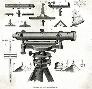
Background imageSurveying Collection: SURVEYING LEVELS

SURVEYING LEVELS
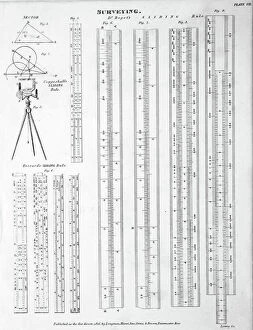
A whole selection of different surveying instruments, and diagrams relating to their specific uses. Date: 1810

Background imageSurveying Collection: James Brindley / Parsons

James Brindley / Parsons
JAMES BRINDLEY English canal engineer

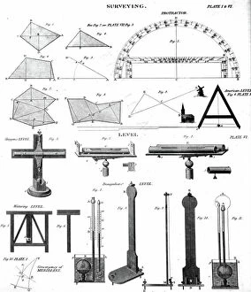
Background imageSurveying Collection: Collection of Surveying tools and methods for measurements (engraving)

Collection of Surveying tools and methods for measurements (engraving)
5616447 Collection of Surveying tools and methods for measurements (engraving); (add.info.: Collection of Surveying tools and methods for measurements)

Background imageSurveying Collection: Illustration depicting a Surveyor's Quadrant, 1765 (engraving)

Illustration depicting a Surveyor's Quadrant, 1765 (engraving)
5616450 Illustration depicting a Surveyor's Quadrant, 1765 (engraving); Universal History Archive/UIG.

Background imageSurveying Collection: Collection of Surveying tools and methods for measurements (engraving)

Collection of Surveying tools and methods for measurements (engraving)
5616445 Collection of Surveying tools and methods for measurements (engraving); (add.info.: Collection of Surveying tools and methods for measurements)

Background imageSurveying Collection: The astronauts surveying the Moon. From Jules Verne Autour de la Lune, Paris, 1865. Wood engraving

The astronauts surveying the Moon. From Jules Verne Autour de la Lune, Paris, 1865. Wood engraving
538152 The astronauts surveying the Moon. From Jules Verne Autour de la Lune, Paris, 1865. Wood engraving.; (add.info.: The astronauts surveying the Moon)

Background imageSurveying Collection: Collection of Surveying tools and methods for measurements (engraving)

Collection of Surveying tools and methods for measurements (engraving)
5616449 Collection of Surveying tools and methods for measurements (engraving); (add.info.: Collection of Surveying tools and methods for measurements)

Background imageSurveying Collection: Collection of Surveying tools and methods for measurements (engraving)

Collection of Surveying tools and methods for measurements (engraving)
5616448 Collection of Surveying tools and methods for measurements (engraving); (add.info.: Collection of Surveying tools and methods for measurements)

Background imageSurveying Collection: Illustration depicting a surveyor measuring a water level. 1887

Illustration depicting a surveyor measuring a water level. 1887
5311476 Illustration depicting a surveyor measuring a water level. 1887; (add.info.: Date: 1887); Universal History Archive/UIG.

Background imageSurveying Collection: The surveying using a water level

The surveying using a water level
5616437 The surveying using a water level; (add.info.: Illustration depicting the surveying using a water level. Dated 19th Century. 01/01/1887); Universal History Archive/UIG.

Background imageSurveying Collection: Engraving depicting a surveying party in New Zealand, 19th century

Engraving depicting a surveying party in New Zealand, 19th century
5308699 Engraving depicting a surveying party in New Zealand, 19th century; (add.info.: Engraving depicting a surveying party in New Zealand)

Background imageSurveying Collection: Collection of Surveying tools and methods for measurements (engraving)

Collection of Surveying tools and methods for measurements (engraving)
5616446 Collection of Surveying tools and methods for measurements (engraving); (add.info.: Collection of Surveying tools and methods for measurements)

Background imageSurveying Collection: A hinged staff for surveying

A hinged staff for surveying
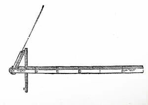
5311699 A hinged staff for surveying; (add.info.: Woodcut engraving depicting a hinged staff for surveying. Dated 17th century.); Universal History Archive/UIG.

Background imageSurveying Collection: Fuegians at Woollya, with the expedition's camp in the background, 1833

Fuegians at Woollya, with the expedition's camp in the background, 1833
539810 Fuegians at Woollya, with the expedition's camp in the background, 1833; (add.info.: From Robert Fitzroy Narrative of the Surveying Voyages of His Majesty's Ships Adventure and Beagle)

Background imageSurveying Collection: Jemmy Button, the Fuegian 'adopted' by the expedition, as he appeared in 1833

Jemmy Button, the Fuegian 'adopted' by the expedition, as he appeared in 1833
539825 Jemmy Button, the Fuegian 'adopted' by the expedition, as he appeared in 1833.; (add.info.: From Robert Fitzroy Narrative of the Surveying Voyages of His Majesty's Ships Adventure)

Background imageSurveying Collection: HMS Beagle' laid ashore: River Santa Cruz, 1839 (engraving)

HMS Beagle' laid ashore: River Santa Cruz, 1839 (engraving)
533508 HMS Beagle' laid ashore: River Santa Cruz, 1839 (engraving); (add.info.: HMS Beagle' laid ashore: River Santa Cruz)

Background imageSurveying Collection: 4th grade students of the Irkutsk Mining School with a teacher, 1914. Creator: Unknown

4th grade students of the Irkutsk Mining School with a teacher, 1914. Creator: Unknown
4th grade students of the Irkutsk Mining School with a teacher, 1914. From a collection of 136 photographs of Irkutsk from the late nineteenth and early twentieth centuries

Background imageSurveying Collection: Testimonial to Major-General Sir Andrew Scott Waugh, late Surveyor-General of India, 1862

Testimonial to Major-General Sir Andrew Scott Waugh, late Surveyor-General of India, 1862. Creator: Unknown
Testimonial to Major-General Sir Andrew Scott Waugh, late Surveyor-General and Superintendent of the Great Trigonometrical Survey of India, 1862

Background imageSurveying Collection: In the Mess-Room of the Ship 'Saint Martyr Foka', 1913. Creator: Unknown

In the Mess-Room of the Ship "Saint Martyr Foka", 1913. Creator: Unknown
In the Mess-Room of the Ship "Saint Martyr Foka", 1913. From a collection consisting of an album and individual photographs from the family archive of geologist Mikhail Alekseevich Pavlov

Background imageSurveying Collection: Lion at Rest, c1850s-1860s. Creator: Antoine-Louis Barye

Lion at Rest, c1850s-1860s. Creator: Antoine-Louis Barye
Lion at Rest, c1850s-1860s

Background imageSurveying Collection: Yasuhiro Surveying his Army being Washed Away (image 1 of 3), c1850. Creator: Utagawa Yoshitora

Yasuhiro Surveying his Army being Washed Away (image 1 of 3), c1850. Creator: Utagawa Yoshitora
Yasuhiro Surveying his Army being Washed Away (image 1 of 3), c1850. The Conquest of Oshu

Background imageSurveying Collection: The Russian Gold Medal of Merit, 1860. Creator: Unknown

The Russian Gold Medal of Merit, 1860. Creator: Unknown
The Russian Gold Medal of Merit, 1860. His Imperial Majesty the Emperor of Russia has conferred upon Mr. Charles Frodsham of the Strand, London

Background imageSurveying Collection: Standing Lion, c1850s-1860s. Creator: Antoine-Louis Barye

Standing Lion, c1850s-1860s. Creator: Antoine-Louis Barye
Standing Lion, c1850s-1860s

Background imageSurveying Collection: The late Colonel A. Strange, F.R.S. 1876. Creator: Unknown

The late Colonel A. Strange, F.R.S. 1876. Creator: Unknown
The late Colonel A. Strange, F.R.S. 1876. Engraving from a photograph by Messrs. Maull and Co. Colonel Alexander Strange...did much very good service in the work of the trigonometrical survey in

Background imageSurveying Collection: Diopter. Creator: Anon

Diopter. Creator: Anon
Diopter

Background imageSurveying Collection: Portrait of Major General Paul Mascarene, 1729. Creator: John Smibert

Portrait of Major General Paul Mascarene, 1729. Creator: John Smibert
Portrait of Major General Paul Mascarene, 1729

Background imageSurveying Collection: Ernest George Fischer, Chief of Instrument Division, Coastal Geodetic Survey, 1914

Ernest George Fischer, Chief of Instrument Division, Coastal Geodetic Survey, 1914. Creator: Harris & Ewing
Ernest George Fischer, Chief of Instrument Division, Coastal Geodetic Survey, 1914. (Chief of Instrument Division 1907-1921)

Background imageSurveying Collection: Panama Canal, 1913. Creator: Harris & Ewing. Panama Canal, 1913. Creator: Harris & Ewing

Panama Canal, 1913. Creator: Harris & Ewing. Panama Canal, 1913. Creator: Harris & Ewing
Panama Canal, 1913. The Panama Canal project was one of the largest and most difficult engineering projects ever undertaken

Background imageSurveying Collection: U.S. Coast and Geodetic Survey steamer, McArthur, between c1900 and 1927. Creator: Unknown

U.S. Coast and Geodetic Survey steamer, McArthur, between c1900 and 1927. Creator: Unknown
U.S. Coast and Geodetic Survey steamer, McArthur, between c1900 and 1927

Background imageSurveying Collection: Deadwood Central RR Engineer Corps, 1888. Creator: John C. H. Grabill

Deadwood Central RR Engineer Corps, 1888. Creator: John C. H. Grabill
Deadwood Central RR Engineer Corps, 1888. Outdoor group portrait of ten railroad engineers, wearing suits and hats, and a dog, posing in a row with surveyors transits on tripods and measuring rods

Background imageSurveying Collection: The moment of carrying out triangulation measurements under a tower on the river bank, 1909

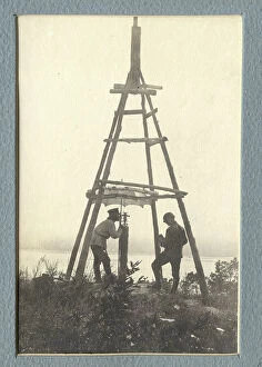
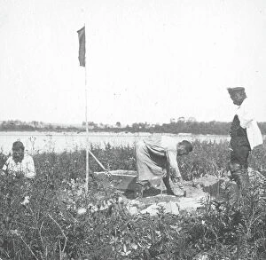
The moment of carrying out triangulation measurements under a tower on the river bank, 1909. Amur Oblast Museum of Regional History and Folklife

Background imageSurveying Collection: The moment of laying the benchmark on the river bank, 1909. Creator: Vladimir Ivanovich Fedorov

The moment of laying the benchmark on the river bank, 1909. Creator: Vladimir Ivanovich Fedorov
The moment of laying the benchmark on the river bank, 1909. Amur Oblast Museum of Regional History and Folklife

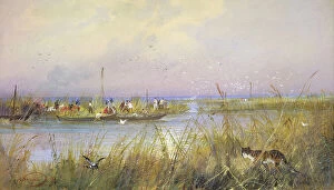
Background imageSurveying Collection: Surveying Coastal Wetlands, 19th century. Creator: Nikolay Nikolaevich Karazin

Surveying Coastal Wetlands, 19th century. Creator: Nikolay Nikolaevich Karazin
Surveying Coastal Wetlands, 19th century. One of 21 watercolors (out of an original 27) from an album relating to the history of the Siberian Cossacks held by the Rare Books Department of the Russian

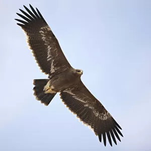
Background imageSurveying Collection: Steppe eagle (Aquila nipalensis) in flight, Oman, November

Steppe eagle (Aquila nipalensis) in flight, Oman, November


All Professionally Made to Order for Quick Shipping

"Surveying: Unveiling the Past, Charting the Future" Step into a journey of discovery as we delve into the fascinating world of surveying. From historic battles to breathtaking landscapes, this captivating practice has shaped our understanding of the world around us. In 1982, during the Falklands War, surveyors played a crucial role in mapping out strategic locations and guiding troops through treacherous terrains. Similarly, in Lord Chelmsford's retreat from Isandhlwana during The Zulu War, surveying knowledge proved vital for navigating challenging landscapes. Travel back to 1872 with Gustave Doré's masterpiece "The New Zealander, " where surveyors meticulously measured and mapped uncharted territories. Their dedication paved the way for exploration and development. Closer to home, Larkswood Lido stands as a testament to meticulous planning by skilled surveyors who ensured every inch was perfectly aligned. Meanwhile, atop Wild Boar Fell in the north Pennines UK stands a trig point—a symbol of precision measurement that aids navigation across vast expanses. Venturing underground reveals surface buildings from Basset Mines in Illogan, Cornwall circa 1906. Surveyors painstakingly documented these structures that once thrived with activity—now preserved as historical landmarks. Alfred Stephenson on Anchorage Island showcases how technology evolved over time. Armed with his trusty theodolite—an instrument used for measuring angles—he captured precise data that contributed to scientific advancements. From ancient times to modern-day practices like PSCI2A-00073, young Washington's career as a surveyor laid foundations for his future leadership role. His experiences honed skills necessary for shaping nations and making history. Beyond measurements lie moments of collaboration; miniature depictions show surveyors sitting in circles during meetings—exchanging ideas and expertise—a tradition carried forward today within this vibrant community. Maps have always been invaluable tools; one such masterpiece is the 1891 color lithograph depicting Africa's treaty boundaries.