Fraud Blocker Skip to main content

St Pauls Close Collection

Discover the charm of St. Paul's Close, a hidden gem nestled in various locations across the UK

Background imageSt Pauls Close Collection: Wolverhampton WV9 5 Map

Wolverhampton WV9 5 Map
Postcode Sector Map of Wolverhampton WV9 5

Background imageSt Pauls Close Collection: Wigan WN7 5 Map

Wigan WN7 5 Map
Postcode Sector Map of Wigan WN7 5

Background imageSt Pauls Close Collection: West Dorset DT9 4 Map

West Dorset DT9 4 Map
Postcode Sector Map of West Dorset DT9 4

Background imageSt Pauls Close Collection: Hertsmere WD6 2 Map

Hertsmere WD6 2 Map
Postcode Sector Map of Hertsmere WD6 2

Background imageSt Pauls Close Collection: Spelthorne TW15 1 Map

Spelthorne TW15 1 Map
Postcode Sector Map of Spelthorne TW15 1

Background imageSt Pauls Close Collection: Somerset TA13 5 Map

Somerset TA13 5 Map
Postcode Sector Map of Somerset TA13 5

Background imageSt Pauls Close Collection: Sutton SM5 1 Map

Sutton SM5 1 Map
Postcode Sector Map of Sutton SM5 1

Background imageSt Pauls Close Collection: Tameside SK15 3 Map

Tameside SK15 3 Map
Postcode Sector Map of Tameside SK15 3

Background imageSt Pauls Close Collection: Ealing W5 3 Map

Ealing W5 3 Map
Postcode Sector Map of Ealing W5 3

Background imageSt Pauls Close Collection: Wakefield WF9 1 Map

Wakefield WF9 1 Map
Postcode Sector Map of Wakefield WF9 1

Background imageSt Pauls Close Collection: Cannock Chase WS11 7 Map

Cannock Chase WS11 7 Map
Postcode Sector Map of Cannock Chase WS11 7

Background imageSt Pauls Close Collection: Wychavon WR11 2 Map

Wychavon WR11 2 Map
Postcode Sector Map of Wychavon WR11 2

Background imageSt Pauls Close Collection: Barnsley S75 3 Map

Barnsley S75 3 Map
Postcode Sector Map of Barnsley S75 3

Background imageSt Pauls Close Collection: Rotherham S25 3 Map

Rotherham S25 3 Map
Postcode Sector Map of Rotherham S25 3

Background imageSt Pauls Close Collection: Tonbridge and Malling TN10 4 Map

Tonbridge and Malling TN10 4 Map
Postcode Sector Map of Tonbridge and Malling TN10 4

Background imageSt Pauls Close Collection: Hounslow TW3 3 Map

Hounslow TW3 3 Map
Postcode Sector Map of Hounslow TW3 3

Background imageSt Pauls Close Collection: Hillingdon UB3 5 Map

Hillingdon UB3 5 Map
Postcode Sector Map of Hillingdon UB3 5

Background imageSt Pauls Close Collection: Telford and Wrekin TF1 3 Map

Telford and Wrekin TF1 3 Map
Postcode Sector Map of Telford and Wrekin TF1 3

Background imageSt Pauls Close Collection: Teignbridge TQ13 9 Map

Teignbridge TQ13 9 Map
Postcode Sector Map of Teignbridge TQ13 9

Background imageSt Pauls Close Collection: Mid Sussex RH16 3 Map

Mid Sussex RH16 3 Map
Postcode Sector Map of Mid Sussex RH16 3

Background imageSt Pauls Close Collection: Thurrock RM15 4 Map

Thurrock RM15 4 Map
Postcode Sector Map of Thurrock RM15 4

Background imageSt Pauls Close Collection: East Lindsey PE24 5 Map

East Lindsey PE24 5 Map
Postcode Sector Map of East Lindsey PE24 5

Background imageSt Pauls Close Collection: Fenland PE13 4 Map

Fenland PE13 4 Map
Postcode Sector Map of Fenland PE13 4

Background imageSt Pauls Close Collection: Fenland PE13 2 Map

Fenland PE13 2 Map
Postcode Sector Map of Fenland PE13 2

Background imageSt Pauls Close Collection: Plymouth PL3 6 Map

Plymouth PL3 6 Map
Postcode Sector Map of Plymouth PL3 6

Background imageSt Pauls Close Collection: Greenwich SE7 8 Map

Greenwich SE7 8 Map
Postcode Sector Map of Greenwich SE7 8

Background imageSt Pauls Close Collection: Suffolk NR34 9 Map

Suffolk NR34 9 Map
Postcode Sector Map of Suffolk NR34 9

Background imageSt Pauls Close Collection: Chorley PR6 9 Map

Chorley PR6 9 Map
Postcode Sector Map of Chorley PR6 9

Background imageSt Pauls Close Collection: South Ribble PR26 6 Map

South Ribble PR26 6 Map
Postcode Sector Map of South Ribble PR26 6

Background imageSt Pauls Close Collection: Norfolk NR10 3 Map

Norfolk NR10 3 Map
Postcode Sector Map of Norfolk NR10 3

Background imageSt Pauls Close Collection: Norfolk NR6 6 Map

Norfolk NR6 6 Map
Postcode Sector Map of Norfolk NR6 6

Background imageSt Pauls Close Collection: Bedford MK45 1 Map

Bedford MK45 1 Map
Postcode Sector Map of Bedford MK45 1

Background imageSt Pauls Close Collection: Medway ME2 2 Map

Medway ME2 2 Map
Postcode Sector Map of Medway ME2 2

Background imageSt Pauls Close Collection: Northumberland NE63 9 Map

Northumberland NE63 9 Map
Postcode Sector Map of Northumberland NE63 9

Background imageSt Pauls Close Collection: Knowsley L33 1 Map

Knowsley L33 1 Map
Postcode Sector Map of Knowsley L33 1

Background imageSt Pauls Close Collection: Leicester LE2 4 Map

Leicester LE2 4 Map
Postcode Sector Map of Leicester LE2 4

Background imageSt Pauls Close Collection: Conwy LL29 7 Map

Conwy LL29 7 Map
Postcode Sector Map of Conwy LL29 7

Background imageSt Pauls Close Collection: Runnymede KT15 1 Map

Runnymede KT15 1 Map
Postcode Sector Map of Runnymede KT15 1

Background imageSt Pauls Close Collection: Kingston upon Thames KT9 1 Map

Kingston upon Thames KT9 1 Map
Postcode Sector Map of Kingston upon Thames KT9 1

Background imageSt Pauls Close Collection: Waverley GU10 1 Map

Waverley GU10 1 Map
Postcode Sector Map of Waverley GU10 1

Background imageSt Pauls Close Collection: Suffolk Coastal IP15 5 Map

Suffolk Coastal IP15 5 Map
Postcode Sector Map of Suffolk Coastal IP15 5

Background imageSt Pauls Close Collection: Mid Suffolk IP21 4 Map

Mid Suffolk IP21 4 Map
Postcode Sector Map of Mid Suffolk IP21 4

Background imageSt Pauls Close Collection: Exeter EX2 6 Map

Exeter EX2 6 Map
Postcode Sector Map of Exeter EX2 6

Background imageSt Pauls Close Collection: North Yorkshire DL7 8 Map

North Yorkshire DL7 8 Map
Postcode Sector Map of North Yorkshire DL7 8

Background imageSt Pauls Close Collection: Cheshire East CW1 3 Map

Cheshire East CW1 3 Map
Postcode Sector Map of Cheshire East CW1 3

Background imageSt Pauls Close Collection: Dartford DA10 0 Map

Dartford DA10 0 Map
Postcode Sector Map of Dartford DA10 0

Background imageSt Pauls Close Collection: County Durham DL16 7 Map

County Durham DL16 7 Map
Postcode Sector Map of County Durham DL16 7

Background imageSt Pauls Close Collection: North Yorkshire DL10 7 Map

North Yorkshire DL10 7 Map
Postcode Sector Map of North Yorkshire DL10 7


All Professionally Made to Order for Quick Shipping

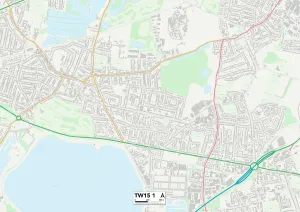
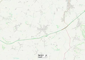
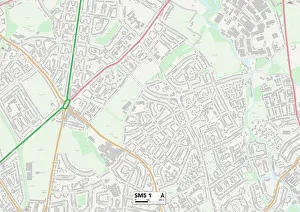
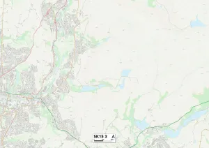
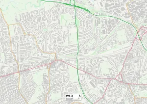
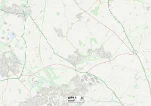
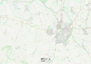
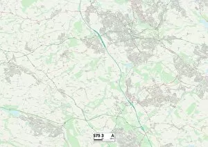
Discover the charm of St. Paul's Close, a hidden gem nestled in various locations across the UK. From Wolverhampton WV9 5 to Wychavon WR11 2, this enchanting neighborhood offers something for everyone. Immerse yourself in the rich history and vibrant culture of St. Paul's Close as you explore its diverse landscapes. Wander through the picturesque streets of Wigan WN7 5 or West Dorset DT9 4, where quaint cottages and stunning architecture transport you back in time. Indulge your senses in Hertsmere WD6 2 or Spelthorne TW15 1, where lush green spaces and tranquil parks provide a peaceful retreat from city life. Take a leisurely stroll along Somerset TA13 5 or Sutton SM5 1, soaking up the natural beauty that surrounds you. Experience the warmth and friendliness of Tameside SK15 3 or Ealing W5 3 as you connect with welcoming locals who make St. Paul's Close feel like home. Engage in community events and celebrations that bring people together. Uncover Wakefield WF9 1 or Cannock Chase WS11 7, two areas known for their thriving arts scene and bustling markets offering unique treasures waiting to be discovered. No matter which location within St. Paul's Close captures your heart, one thing is certain – each map point holds its own distinctive character and charm just waiting to be explored.