Fraud Blocker Skip to main content

Shore Collection (page 18)

"Captivating Shores: From Royal County Down Golf Course to St

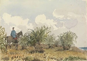
Background imageShore Collection: Tussac Grass, Falkland Islands, 1849 (watercolour)

Tussac Grass, Falkland Islands, 1849 (watercolour)
7295586 Tussac Grass, Falkland Islands, 1849 (watercolour) by Fanshawe, Admiral Sir Edward Gennys (1814-1906); 12.7x17.9 cm; National Maritime Museum, London, UK; (add.info.: No)

Background imageShore Collection: Plates of Captain Cook Voyages, Volume I Interview between Commodore Byron and the Patagonians

Plates of Captain Cook Voyages, Volume I Interview between Commodore Byron and the Patagonians
7295522 Plates of Captain Cook Voyages, Volume I Interview between Commodore Byron and the Patagonians, 18th century (engraving); National Maritime Museum, London

Background imageShore Collection: The loss of the East India Company's ship 'Halsewell' on the night of the 5-6 January 1786

The loss of the East India Company's ship 'Halsewell' on the night of the 5-6 January 1786
7342163 The loss of the East India Company's ship 'Halsewell' on the night of the 5-6 January 1786, c.1786 (aquatint, etching) by Dodd

Chart of Sindh and Kutch coasts, 1848-50 (print)
7340643 Chart of Sindh and Kutch coasts, 1848-50 (print) by British School, (19th century); 76.5x61.5 cm; National Maritime Museum, London

'Chart of part of the coasts of Cutch and Guzarat by J G Richardson
7340637 'Chart of part of the coasts of Cutch and Guzarat by J G Richardson... communicated by Capt Archibald Blair to whom this plate is inscribed by his most obliged A Dalrymple

Background imageShore Collection: England East Coast: Harwich to Kingston Upon Hull, 1857 (print)

England East Coast: Harwich to Kingston Upon Hull, 1857 (print)
7340600 England East Coast: Harwich to Kingston Upon Hull, 1857 (print) by Hobbs, J.S. (19th century); 81x65.5 cm; National Maritime Museum, London, UK; (add.info.: Creator: J.S)

Background imageShore Collection: England-East Coast. Outer Gabbard to Outer Dowsing, 1919 (engraving)

England-East Coast. Outer Gabbard to Outer Dowsing, 1919 (engraving)
7340581 England-East Coast. Outer Gabbard to Outer Dowsing, 1919 (engraving) by British School, (20th century) ; 98.5x66 cm; National Maritime Museum, London

'A new mappe of the sea coasts of England, France and Holland, wherein the English names, situation
7340046 'A new mappe of the sea coasts of England, France and Holland, wherein the English names, situation, point of the compass, and distance of the several ports, harbours, havens, creeks

Background imageShore Collection: The coast of England from the Southforeland to Orfordness, 1675 (coloured engraving)

The coast of England from the Southforeland to Orfordness, 1675 (coloured engraving)
7340045 The coast of England from the Southforeland to Orfordness, 1675 (coloured engraving) by Seller, John (1632-97); 43.5x54 cm; National Maritime Museum, London

Background imageShore Collection: A correct chart of the east coast, from Hasbrough or Haisbrough Sand to Kingston upon Hull

A correct chart of the east coast, from Hasbrough or Haisbrough Sand to Kingston upon Hull, 1797 (print)
7340042 A correct chart of the east coast, from Hasbrough or Haisbrough Sand to Kingston upon Hull, 1797 (print) by Diston, John (fl.1797); 53.5x75 cm; National Maritime Museum, London

Background imageShore Collection: A new chart of the coast from Lowestoff to Hasbrough including Yarmouth Roads and Sands

A new chart of the coast from Lowestoff to Hasbrough including Yarmouth Roads and Sands, Hasbrough Gatt
7340040 A new chart of the coast from Lowestoff to Hasbrough including Yarmouth Roads and Sands, Hasbrough Gatt, and the new lights, 1797 (technical drawing) by Diston

Background imageShore Collection: The sea coastes of England between the Isle of Wight and Dover

The sea coastes of England between the Isle of Wight and Dover, with the principal havens thereof according to their
7340013 The sea coastes of England between the Isle of Wight and Dover, with the principal havens thereof according to their situation and appearing, c.1588 (chart) by Janszoon Waghenaer

Background imageShore Collection: Plan of the Bay of St Jean D'Acre and environs sent to the Admiralty from thence on 23 March 1799

Plan of the Bay of St Jean D'Acre and environs sent to the Admiralty from thence on 23 March 1799 by Sir Sidney
7339861 Plan of the Bay of St Jean D'Acre and environs sent to the Admiralty from thence on 23 March 1799 by Sir Sidney Smith Kt

Background imageShore Collection: Battle of Copenhagen, 2 April 1801, 1801 (engraving)

Battle of Copenhagen, 2 April 1801, 1801 (engraving)
7339858 Battle of Copenhagen, 2 April 1801, 1801 (engraving) by Gibson, Francis (19th century); 40x45.5 cm; National Maritime Museum, London

Background imageShore Collection: The south west coast of Ireland from the Staggs of Castle Haven to Dursey I

The south west coast of Ireland from the Staggs of Castle Haven to Dursey I. Surveyed and navigated by M
7339857 The south west coast of Ireland from the Staggs of Castle Haven to Dursey I. Surveyed and navigated by M. Mackenzie Sen

Background imageShore Collection: A view across a bay towards the Franklin search ships under Captain Belcher's command

A view across a bay towards the Franklin search ships under Captain Belcher's command, 1852 (b/w photo)
7295742 A view across a bay towards the Franklin search ships under Captain Belcher's command, 1852 (b/w photo) by Domville, William Thomas (1822-79); 17.7x21.6 cm; National Maritime Museum

Background imageShore Collection: 'Bora bora [Society Islands], from a ruined native fort above the chief village on the East side

'Bora bora [Society Islands], from a ruined native fort above the chief village on the East side of the island
7295600 'Bora bora [Society Islands], from a ruined native fort above the chief village on the East side of the island, Septr 5th 1849', 1849 (watercolour) by Fanshawe

Background imageShore Collection: 'The Puntinha, Madeira, Jany 1st 1849. Taking a look at one's ship', 1849 (watercolour)

'The Puntinha, Madeira, Jany 1st 1849. Taking a look at one's ship', 1849 (watercolour)
7295583 'The Puntinha, Madeira, Jany 1st 1849. Taking a look at one's ship', 1849 (watercolour) by Fanshawe, Admiral Sir Edward Gennys (1814-1906); 12.7x17.7 cm; National Maritime Museum

Background imageShore Collection: Seascape with sailors sheltering from a rainstorm, mid 17th century (oil on panel)

Seascape with sailors sheltering from a rainstorm, mid 17th century (oil on panel)
7337738 Seascape with sailors sheltering from a rainstorm, mid 17th century (oil on panel) by Peeters, Bonaventura (1614-52); 33.2x45.7 cm; National Maritime Museum, London

Background imageShore Collection: A Dutch ship close-hauled, c.1610 (oil on panel)

A Dutch ship close-hauled, c.1610 (oil on panel)
7337734 A Dutch ship close-hauled, c.1610 (oil on panel) by Anthonisz, Aert (c.1579/80-1620); 25.4x38.1 cm; National Maritime Museum, London

Background imageShore Collection: Anne Bonny, female pirate, 18th century (engraving)

Anne Bonny, female pirate, 18th century (engraving)
7337522 Anne Bonny, female pirate, 18th century (engraving) by Unknown artist, (18th century); 10x16.4 cm; National Maritime Museum, London, UK; (add.info.: Creator: unknown Dressed as a man)

The Beach At Yarmouth, Norfolk, England In The Late 19Th Century. From Our Own Country Published 1898 ©UIG/Leemage
UIG5420344 The Beach At Yarmouth, Norfolk, England In The Late 19Th Century. From Our Own Country Published 1898 ©UIG/Leemage.

The 'Royal Sovereign', a royal yacht, anchored off the coast of a port
MMM5466060 The 'Royal Sovereign', a royal yacht, anchored off the coast of a port by Serres, John Thomas (1759-1825); National Maritime Museum, London, UK; (add.info.: The Royal Sovereign)

Background imageShore Collection: A royal frigate and other ships in Barn Bay off Plymouth, England, in front of Mount Edgcumbe

A royal frigate and other ships in Barn Bay off Plymouth, England, in front of Mount Edgcumbe. Oil on canvas, c
MMM5460241 A royal frigate and other ships in Barn Bay off Plymouth, England, in front of Mount Edgcumbe. Oil on canvas, c. 1830--55, by Thomas Lyde Hornbrook (1808-1855). by Hornbrook, Thomas L

View of Cape Town, Table Bay and the Tygerberg Hills (South Africa). Lithography (26.5x53.5 cm) by J.W. Burchell, 1821
MMM5483845 View of Cape Town, Table Bay and the Tygerberg Hills (South Africa). Lithography (26.5x53.5 cm) by J.W. Burchell, 1821.; National Maritime Museum, London

Background imageShore Collection: Cap Brun has the Saint Andre Gorge, Toulon (France). Lithography (30.7x43.8 cm) by Knight, 1794

Cap Brun has the Saint Andre Gorge, Toulon (France). Lithography (30.7x43.8 cm) by Knight, 1794
MMM5483735 Cap Brun has the Saint Andre Gorge, Toulon (France). Lithography (30.7x43.8 cm) by Knight, 1794.; National Maritime Museum, London, UK; (add.info.: Cap Brun has the Saint Andre Gorge)

Background imageShore Collection: 'The fortress of Bomarsund, on the Aland Islands (Finland), in August 1854

'The fortress of Bomarsund, on the Aland Islands (Finland), in August 1854
MMM5481598 'The fortress of Bomarsund, on the Aland Islands (Finland), in August 1854; National Maritime Museum, London, UK; (add.info.: The fortress of Bomarsund, on the Aland Islands (Finland)

Background imageShore Collection: Plan of Memel (present-day Klaipeda, Lithuania), during the surrender of the city

Plan of Memel (present-day Klaipeda, Lithuania), during the surrender of the city, 27 June to 5 July 1757
MMM5482024 Plan of Memel (present-day Klaipeda, Lithuania), during the surrender of the city, 27 June to 5 July 1757. Etching water in 1764 colors.; National Maritime Museum, London

Background imageShore Collection: The Spring Garden property, in St. George (Caribbean), owned by I R Grosett Esquire

The Spring Garden property, in St. George (Caribbean), owned by I R Grosett Esquire
MMM5480589 The Spring Garden property, in St. George (Caribbean), owned by I R Grosett Esquire. Colored etching, April 1, 1824, by James Hakewill (1778--1843) by Hakewill

Background imageShore Collection: Characters on the beach, probably in Amble( France), with the silhouette of Fort Vauban in

Characters on the beach, probably in Amble( France), with the silhouette of Fort Vauban in the light of dusk
MMM5480568 Characters on the beach, probably in Amble( France), with the silhouette of Fort Vauban in the light of dusk by Wyllie, William Lionel (1851-1931); 17.5x33.8 cm; National Maritime Museum

Background imageShore Collection: Lighting colom of the Midland-Sea, 1678 (print)

Lighting colom of the Midland-Sea, 1678 (print)
7342739 Lighting colom of the Midland-Sea, 1678 (print) by Colom, Arnold (1624-68); National Maritime Museum, London, UK; (add.info.: Creator: Arnold Colom [8], 104p)

Background imageShore Collection: Squadron of ships from the anchorage in Table Bay, Cape of Good Hope

Squadron of ships from the anchorage in Table Bay, Cape of Good Hope, late 18th century to early 19th century
7341741 Squadron of ships from the anchorage in Table Bay, Cape of Good Hope, late 18th century to early 19th century (watercolour) by Pocock

Background imageShore Collection: Two-decker in a gale off shore, late 18th to early 19th century (brown wash)

Two-decker in a gale off shore, late 18th to early 19th century (brown wash)
7341716 Two-decker in a gale off shore, late 18th to early 19th century (brown wash) by Pocock, Nicholas (1741-1821); 15.6x12.6 cm; National Maritime Museum, London

An animal found on the coast of New Holland, called Kanguroo', c.1773 (engraving, etching)
7341593 An animal found on the coast of New Holland, called Kanguroo', c.1773 (engraving, etching) by Stubbs, George (1724-1806) (after); 22.6x26.8 cm; National Maritime Museum, London

Background imageShore Collection: The missionary ship 'Duff' arriving at Otaheite 1797, 19th century (coloured aquatint)

The missionary ship 'Duff' arriving at Otaheite 1797, 19th century (coloured aquatint)
7341673 The missionary ship 'Duff' arriving at Otaheite 1797, 19th century (coloured aquatint) by Kronheim, Joseph Martin (1810-96); 18x25.8 cm; National Maritime Museum, London

Background imageShore Collection: 'Mando', late 19th century (glass)

'Mando', late 19th century (glass)
7341207 'Mando', late 19th century (glass) by British School, (19th century); 8.2x10.1 cm; National Maritime Museum, London

Background imageShore Collection: Manta, 1685 (bound sheet)

Manta, 1685 (bound sheet)
7339729 Manta, 1685 (bound sheet) by Hack, William (17th Century); 40x50 cm; National Maritime Museum, London, UK; (add.info.: Creator: William Hack South America, the Pacific Coast and Ecuador)

Background imageShore Collection: Bahia San Mateo, 1685 (bound sheet)

Bahia San Mateo, 1685 (bound sheet)
7339723 Bahia San Mateo, 1685 (bound sheet) by Hack, William (17th Century); 40x50 cm; National Maritime Museum, London, UK; (add.info.: Creator: William Hack South America)

Background imageShore Collection: Mount of Sapo, Punta Chame and La Chorrera, 1685 (bound sheet)

Mount of Sapo, Punta Chame and La Chorrera, 1685 (bound sheet)
7339709 Mount of Sapo, Punta Chame and La Chorrera, 1685 (bound sheet) by Hack, William (17th Century); 40x50 cm; National Maritime Museum, London

Background imageShore Collection: The Bay of Escoria, 1685 (bound sheet)

The Bay of Escoria, 1685 (bound sheet)
7339708 The Bay of Escoria, 1685 (bound sheet) by Hack, William (17th Century); 40x50 cm; National Maritime Museum, London, UK; (add.info.: Creator: William Hack North America, the Pacific Coast)

Background imageShore Collection: The Bay of Phillipina, 1685 (bound sheet)

The Bay of Phillipina, 1685 (bound sheet)
7339705 The Bay of Phillipina, 1685 (bound sheet) by Hack, William (17th Century); 40x50 cm; National Maritime Museum, London, UK; (add.info.: Creator: William Hack North America, the Pacific Coast)

Background imageShore Collection: A description of the Sweet Gulf, 1685 (bound sheet)

A description of the Sweet Gulf, 1685 (bound sheet)
7339702 A description of the Sweet Gulf, 1685 (bound sheet) by Hack, William (17th Century); 40x50 cm; National Maritime Museum, London, UK; (add.info.: Creator: William Hack North America)

The High Land of Cape Blanco, 1685 (bound sheet)
7339699 The High Land of Cape Blanco, 1685 (bound sheet) by Hack, William (17th Century); 40x50 cm; National Maritime Museum, London, UK; (add.info.: Creator: William Hack North America)

Cape Guyones, 1685 (bound sheet)
7339698 Cape Guyones, 1685 (bound sheet) by Hack, William (17th Century); 40x50 cm; National Maritime Museum, London, UK; (add.info.: Creator: William Hack North America, the Pacific Coast)

Background imageShore Collection: A description of the Old Town & the Port of Realejo, 1685 (bound sheet)

A description of the Old Town & the Port of Realejo, 1685 (bound sheet)
7339692 A description of the Old Town & the Port of Realejo, 1685 (bound sheet) by Hack, William (17th Century); 40x50 cm; National Maritime Museum, London

Background imageShore Collection: A description of the Plantations & Setlements in the Valley of Tepaca, 1685 (bound sheet)

A description of the Plantations & Setlements in the Valley of Tepaca, 1685 (bound sheet)
7339688 A description of the Plantations & Setlements in the Valley of Tepaca, 1685 (bound sheet) by Hack, William (17th Century); 40x50 cm; National Maritime Museum, London

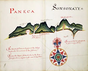
Paneca and Sonsonate, 1685 (bound sheet)
7339684 Paneca and Sonsonate, 1685 (bound sheet) by Hack, William (17th Century); 40x50 cm; National Maritime Museum, London, UK; (add.info.: Creator: William Hack North America, the Pacific Coast)

Anabacas, 1685 (bound sheet)
7339682 Anabacas, 1685 (bound sheet) by Hack, William (17th Century); 40x50 cm; National Maritime Museum, London, UK; (add.info.: Creator: William Hack North America, the Pacific Coast)


All Professionally Made to Order for Quick Shipping

"Captivating Shores: From Royal County Down Golf Course to St. Peter Port Harbour" Majestic and serene, the shores of Royal County Down Golf Course offer a picturesque backdrop for golf enthusiasts and nature lovers alike. Brigitte Bardot, the iconic actress, dons her sea boots in a captivating scene from "A Day In September, " showcasing the allure of the shore. Embark on an enchanting journey to Funchal in Madeira, Portugal, where the cityscape unfolds before your eyes as you sail along its sparkling shores. The Tyne Bridge stands tall against the Newcastle-upon-Tyne skyline, symbolizing strength and connecting communities across its magnificent river shore. As dusk settles over English Harbour in Antigua, witness a breathtaking sunset from Shirley Heights that paints the Caribbean shore with hues of gold and crimson. Aphrodite's Rock emerges gracefully from the Eastern Mediterranean Sea near Paphos, Cyprus—a legendary site entwined with tales of love and beauty by the shore. Kircubbin reveals its charm when viewed from Monaghan Bank—tranquil waters meet quaint coastal dwellings on this Irish shoreline captured beautifully in Picture No. 11981471. Explore Ibiza's Balearic Islands as you discover hidden coves along its coast near Portinatx—an idyllic retreat offering solace amidst crystal-clear waters and sandy shores. The Neck of Bruny Island beckons adventurers to Tasmania's South Eastern Coast—a rugged paradise where untamed wilderness meets dramatic cliffs overlooking pristine shores. Steeped in history and bathed in moonlight, St. Peter Port Harbor enchants visitors to Guernsey—the Channel Islands' gem boasting maritime heritage against a nocturnal shore.