Fraud Blocker Skip to main content

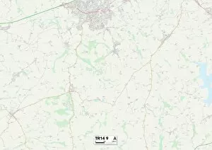
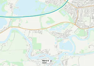
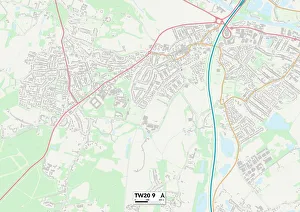
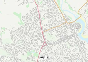
School Lane Collection (page 3)

"Exploring the Scenic School Lanes Across the UK: From Leeds to Redcar & Cleveland" Discovering hidden gems in every corner of the country

Background imageSchool Lane Collection: Shropshire SY10 8 Map

Shropshire SY10 8 Map
Postcode Sector Map of Shropshire SY10 8

Background imageSchool Lane Collection: Shropshire SY9 5 Map

Shropshire SY9 5 Map
Postcode Sector Map of Shropshire SY9 5

Background imageSchool Lane Collection: Shropshire SY8 4 Map

Shropshire SY8 4 Map
Postcode Sector Map of Shropshire SY8 4

Background imageSchool Lane Collection: Shropshire SY7 0 Map

Shropshire SY7 0 Map
Postcode Sector Map of Shropshire SY7 0

Background imageSchool Lane Collection: Shropshire SY5 9 Map

Shropshire SY5 9 Map
Postcode Sector Map of Shropshire SY5 9

Background imageSchool Lane Collection: Isles of Scilly TR25 0 Map

Isles of Scilly TR25 0 Map
Postcode Sector Map of Isles of Scilly TR25 0

Background imageSchool Lane Collection: Rother TN31 6 Map

Rother TN31 6 Map
Postcode Sector Map of Rother TN31 6

Background imageSchool Lane Collection: Cornwall TR18 3 Map

Cornwall TR18 3 Map
Postcode Sector Map of Cornwall TR18 3

Background imageSchool Lane Collection: Cornwall TR11 5 Map

Cornwall TR11 5 Map
Postcode Sector Map of Cornwall TR11 5

Background imageSchool Lane Collection: Cornwall TR27 6 Map

Cornwall TR27 6 Map
Postcode Sector Map of Cornwall TR27 6

Background imageSchool Lane Collection: Cornwall TR20 9 Map

Cornwall TR20 9 Map
Postcode Sector Map of Cornwall TR20 9

Background imageSchool Lane Collection: Cornwall TR17 0 Map

Cornwall TR17 0 Map
Postcode Sector Map of Cornwall TR17 0

Background imageSchool Lane Collection: Cornwall TR15 2 Map

Cornwall TR15 2 Map
Postcode Sector Map of Cornwall TR15 2

Background imageSchool Lane Collection: Cornwall TR14 9 Map

Cornwall TR14 9 Map
Postcode Sector Map of Cornwall TR14 9

Background imageSchool Lane Collection: Spelthorne TW17 9 Map

Spelthorne TW17 9 Map
Postcode Sector Map of Spelthorne TW17 9

Background imageSchool Lane Collection: Runnymede TW20 9 Map

Runnymede TW20 9 Map
Postcode Sector Map of Runnymede TW20 9

Background imageSchool Lane Collection: New Forest SO41 9 Map

New Forest SO41 9 Map
Postcode Sector Map of New Forest SO41 9

Background imageSchool Lane Collection: New Forest SO41 5 Map

New Forest SO41 5 Map
Postcode Sector Map of New Forest SO41 5

Background imageSchool Lane Collection: New Forest SO41 0 Map

New Forest SO41 0 Map
Postcode Sector Map of New Forest SO41 0

Background imageSchool Lane Collection: Eastleigh SO31 4 Map

Eastleigh SO31 4 Map
Postcode Sector Map of Eastleigh SO31 4

Background imageSchool Lane Collection: Staffordshire ST21 6 Map

Staffordshire ST21 6 Map
Postcode Sector Map of Staffordshire ST21 6

Background imageSchool Lane Collection: Staffordshire ST19 9 Map

Staffordshire ST19 9 Map
Postcode Sector Map of Staffordshire ST19 9

Background imageSchool Lane Collection: Staffordshire ST18 9 Map

Staffordshire ST18 9 Map
Postcode Sector Map of Staffordshire ST18 9

Background imageSchool Lane Collection: Staffordshire ST18 0 Map

Staffordshire ST18 0 Map
Postcode Sector Map of Staffordshire ST18 0

Background imageSchool Lane Collection: Staffordshire ST17 4 Map

Staffordshire ST17 4 Map
Postcode Sector Map of Staffordshire ST17 4

Background imageSchool Lane Collection: Staffordshire ST17 0 Map

Staffordshire ST17 0 Map
Postcode Sector Map of Staffordshire ST17 0

Background imageSchool Lane Collection: Staffordshire ST13 7 Map

Staffordshire ST13 7 Map
Postcode Sector Map of Staffordshire ST13 7

Background imageSchool Lane Collection: Staffordshire ST11 9 Map

Staffordshire ST11 9 Map
Postcode Sector Map of Staffordshire ST11 9

Background imageSchool Lane Collection: Shropshire SY5 6 Map

Shropshire SY5 6 Map
Postcode Sector Map of Shropshire SY5 6

Background imageSchool Lane Collection: Shropshire SY4 5 Map

Shropshire SY4 5 Map
Postcode Sector Map of Shropshire SY4 5

Background imageSchool Lane Collection: Shropshire SY4 4 Map

Shropshire SY4 4 Map
Postcode Sector Map of Shropshire SY4 4

Background imageSchool Lane Collection: Somerset TA20 2 Map

Somerset TA20 2 Map
Postcode Sector Map of Somerset TA20 2

Background imageSchool Lane Collection: Somerset TA13 5 Map

Somerset TA13 5 Map
Postcode Sector Map of Somerset TA13 5

Background imageSchool Lane Collection: South Somerset TA11 7 Map

South Somerset TA11 7 Map
Postcode Sector Map of South Somerset TA11 7

Background imageSchool Lane Collection: Winchester SO24 0 Map

Winchester SO24 0 Map
Postcode Sector Map of Winchester SO24 0

Background imageSchool Lane Collection: Winchester SO23 7 Map

Winchester SO23 7 Map
Postcode Sector Map of Winchester SO23 7

Background imageSchool Lane Collection: Test Valley SO20 8 Map

Test Valley SO20 8 Map
Postcode Sector Map of Test Valley SO20 8

Background imageSchool Lane Collection: Swindon SN4 9 Map

Swindon SN4 9 Map
Postcode Sector Map of Swindon SN4 9

Background imageSchool Lane Collection: Neath Port Talbot SA8 4 Map

Neath Port Talbot SA8 4 Map
Postcode Sector Map of Neath Port Talbot SA8 4

Background imageSchool Lane Collection: North Hertfordshire SG5 3 Map

North Hertfordshire SG5 3 Map
Postcode Sector Map of North Hertfordshire SG5 3

Background imageSchool Lane Collection: North Hertfordshire SG4 8 Map

North Hertfordshire SG4 8 Map
Postcode Sector Map of North Hertfordshire SG4 8

Background imageSchool Lane Collection: Stevenage SG2 7 Map

Stevenage SG2 7 Map
Postcode Sector Map of Stevenage SG2 7

Background imageSchool Lane Collection: North Hertfordshire SG4 7 Map

North Hertfordshire SG4 7 Map
Postcode Sector Map of North Hertfordshire SG4 7

Background imageSchool Lane Collection: Tameside SK15 3 Map

Tameside SK15 3 Map
Postcode Sector Map of Tameside SK15 3

Background imageSchool Lane Collection: Tameside SK14 5 Map

Tameside SK14 5 Map
Postcode Sector Map of Tameside SK14 5

Background imageSchool Lane Collection: Cheshire East SK11 9 Map

Cheshire East SK11 9 Map
Postcode Sector Map of Cheshire East SK11 9

Background imageSchool Lane Collection: Cheshire East SK12 1 Map

Cheshire East SK12 1 Map
Postcode Sector Map of Cheshire East SK12 1

Background imageSchool Lane Collection: Central Bedfordshire SG18 9 Map

Central Bedfordshire SG18 9 Map
Postcode Sector Map of Central Bedfordshire SG18 9


All Professionally Made to Order for Quick Shipping

"Exploring the Scenic School Lanes Across the UK: From Leeds to Redcar & Cleveland" Discovering hidden gems in every corner of the country, School Lanes offer a glimpse into the rich history and picturesque landscapes that surround them. In Leeds LS7 3 Map, this charming lane takes you on a journey through time, lined with quaint cottages and lush greenery. Heading south to Sussex PO18 8 Map, School Lane invites you to immerse yourself in its idyllic countryside setting. With rolling hills as your backdrop, take a leisurely stroll along this peaceful path and let nature's beauty captivate your senses. Venturing further west to Berkshire RG4 8 Map, School Lane welcomes you with open arms. Its enchanting atmosphere transports you back in time as you wander past historic buildings and soak up the timeless charm of this quintessential English village. In Aylesbury Vale MK18 4 Map lies another gem waiting to be discovered - School Lane offers an escape from bustling city life. As you meander through this tranquil haven, feel your worries melt away amidst stunning rural vistas. Traveling northwards towards Cheshire East SK10 4 Map reveals yet another enchanting school lane. Surrounded by breathtaking scenery and dotted with traditional stone houses, it's impossible not to be enchanted by the rustic beauty that unfolds before your eyes. As we make our way to Wolverhampton WV10 7 Map, WV10 8 Map, and WV9 5 Map respectively; these three neighboring lanes each possess their own unique character. Whether it's exploring historical landmarks or simply enjoying a leisurely walk under canopies of trees – there is something for everyone here. Wakefield WF2 6 Map beckons us next with its delightful School Lane offering glimpses into local life while Wakefield WF2 OMap boasts a vibrant community spirit reflected in its charming surroundings.