Fraud Blocker Skip to main content

Satellite Image Collection (page 6)

"Exploring the vastness of our universe, satellite images capture breathtaking views that redefine our perspective

Background imageSatellite Image Collection: Wales, United Kingdom, satellite image C014 / 0084

Wales, United Kingdom, satellite image C014 / 0084
Wales, satellite image. North is at top. Natural colour satellite image showing Wales in the United Kingdom, with the surrounding territories shaded out
Background imageSatellite Image Collection: Giant solar flare, satellite image

Giant solar flare, satellite image
Giant solar flare. Satellite image showing the development of a giant solar flare (bright) erupting from the surface of the Sun (centre)

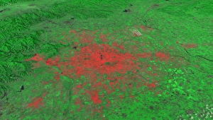
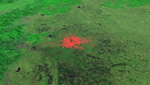
Background imageSatellite Image Collection: Beijing, China, 2010, satellite image

Beijing, China, 2010, satellite image
Beijing 2010. Satellite image showing the extent of the city of Beijing, China, in 2010. Beijing is one of the oldest cities in the world

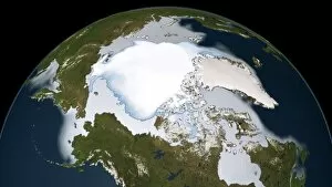
Background imageSatellite Image Collection: Artic sea ice coverage, 1980 C014 / 4710

Artic sea ice coverage, 1980 C014 / 4710
Artic sea ice coverage, 1980. Map showing the changes in Arctic sea ice coverage from 1st November 1979 to 31st January 1980

Background imageSatellite Image Collection: Greenland ice melt, 2012, satellite image

Greenland ice melt, 2012, satellite image
Greenland ice melt, 2012. Composite image based on data from three NASA satellites, showing the extent of surface melt over Greenlands ice sheet on 12th July 2012. North is at top

Background imageSatellite Image Collection: Hurricane Sandy, 28th October 2012 C014 / 5781

Hurricane Sandy, 28th October 2012 C014 / 5781
Hurricane Sandy. Satellite image of hurricane Sandy off the east coast of the USA (top centre) on 28th October 2012 at 17.45 UTC

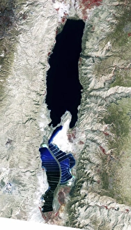
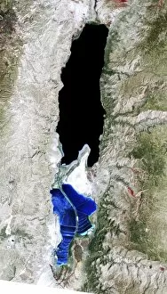
Background imageSatellite Image Collection: Dead Sea, 2011 satellite image C014 / 4705

Dead Sea, 2011 satellite image C014 / 4705
Dead Sea. False-colour satellite image of the Dead Sea. North is at top. Deep waters are blue or dark blue, while brighter blues indicate shallow waters or salt ponds (in the south)

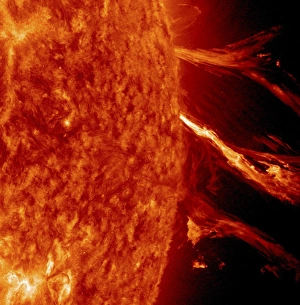
Background imageSatellite Image Collection: Solar flare, SDO ultraviolet image

Solar flare, SDO ultraviolet image
Solar activity. Extreme ultraviolet (UV) satellite image showing a solar flare and coronal mass ejection (CME) erupting from the surface of the Sun on 2nd January 2012

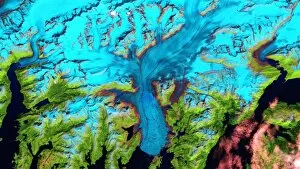
Background imageSatellite Image Collection: Columbia Glacier, Alaska, 1986

Columbia Glacier, Alaska, 1986
Columbia Glacier, Alaska. False-colour satellite image of the Columbia Glacier, Alaska, USA, taken in 1986. Columbia Glacier descends from an ice field (top) 3, 050 metres above sea level

Background imageSatellite Image Collection: Giant solar flare, UV telescope image

Giant solar flare, UV telescope image
Giant solar flare. Ultraviolet (UV) image at 195nm wavelength, of a giant solar flare (bright, lower right) erupting from the surface of the Sun

Background imageSatellite Image Collection: Icebergs off Greenland, satellite image

Icebergs off Greenland, satellite image
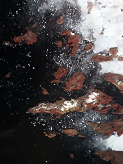
Icebergs off Greenland. Satellite image centred over the west coast of Greenland, showing an ice sheet (white, upper right) on the mainland

Background imageSatellite Image Collection: Dead Sea, 1972 satellite image C014 / 4706

Dead Sea, 1972 satellite image C014 / 4706
Dead Sea. False-colour satellite image of the Dead Sea. North is at top. Deep waters are blue or dark blue, while brighter blues indicate shallow waters or salt ponds (in the south)

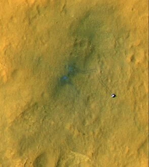
Background imageSatellite Image Collection: Curiosity rover on Mars, satellite image C014 / 4940

Curiosity rover on Mars, satellite image C014 / 4940
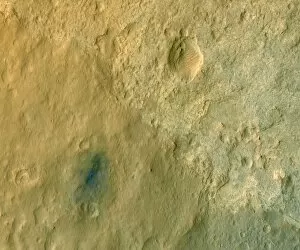
Curiosity rover on Mars. Colour-enhanced satellite image of NASAs Curiosity rover on the surface of Mars. This rover, part of the Mars Science Laboratory (MSL) mission

Background imageSatellite Image Collection: Curiosity rover in Gale Crater, Mars C014 / 4944

Curiosity rover in Gale Crater, Mars C014 / 4944
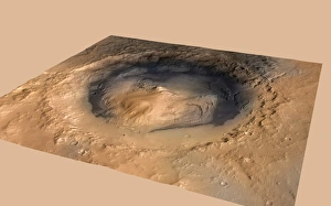
Curiosity rover in Gale Crater, Mars. The ellipse (blue) shows the target landing area, and the green dot shows where NASAs Curiosity rover landed on 6 August 2012

Background imageSatellite Image Collection: Hurricane Sandy, 29th October 2012 C014 / 5782

Hurricane Sandy, 29th October 2012 C014 / 5782
Hurricane Sandy, 29th October 2012

Background imageSatellite Image Collection: Columbia Glacier, Alaska, 2000

Columbia Glacier, Alaska, 2000
Columbia Glacier, Alaska. False-colour satellite image of the Columbia Glacier, Alaska, USA, taken in 2000. Columbia Glacier descends from an ice field (top) 3, 050 metres above sea level

Background imageSatellite Image Collection: Beijing, China, 1978, satellite image

Beijing, China, 1978, satellite image
Beijing 1978. Satellite image showing the extent of the city of Beijing, China, in 1978. Beijing is one of the oldest cities in the world

Background imageSatellite Image Collection: Columbia Glacier, Alaska, 2011

Columbia Glacier, Alaska, 2011
Columbia Glacier, Alaska. False-colour satellite image of the Columbia Glacier, Alaska, USA, taken in 2011. Columbia Glacier descends from an ice field (top) 3, 050 metres above sea level

Background imageSatellite Image Collection: Curiosity rover on Mars, satellite image C014 / 4942

Curiosity rover on Mars, satellite image C014 / 4942
Curiosity rover on Mars. Colour-enhanced satellite image of NASAs Curiosity rover on the surface of Mars. This rover, part of the Mars Science Laboratory (MSL) mission

Background imageSatellite Image Collection: Columbia Glacier, Alaska, 2003

Columbia Glacier, Alaska, 2003
Columbia Glacier, Alaska. False-colour satellite image of the Columbia Glacier, Alaska, USA, taken in 2003. Columbia Glacier descends from an ice field (top) 3, 050 metres above sea level

Background imageSatellite Image Collection: Dead Sea, 1989 satellite image C014 / 4707

Dead Sea, 1989 satellite image C014 / 4707
Dead Sea. False-colour satellite image of the Dead Sea. North is at top. Deep waters are blue or dark blue, while brighter blues indicate shallow waters or salt ponds (in the south)

Background imageSatellite Image Collection: SDO view of the Sun eclipsed by Earth

SDO view of the Sun eclipsed by Earth. The Solar Dynamics Observatory (SDO) is an Earth-orbiting spacecraft launched in 2010 by NASA and used to observe the Sun

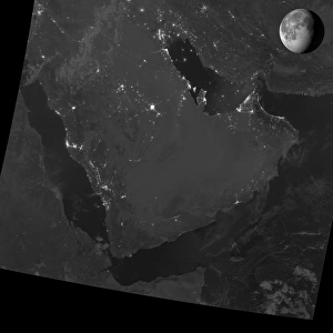
Background imageSatellite Image Collection: Persian Gulf at night, satellite image

Persian Gulf at night, satellite image
Persian Gulf at night. Black marble satellite image of the Persian Gulf at night during a waning Gibbous moon. More densely populated areas are brighter

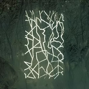
Background imageSatellite Image Collection: Gobi Desert, China, satellite image C014 / 1768

Gobi Desert, China, satellite image C014 / 1768
Gobi Desert. Satellite image showing uniform white lines in the Gobi desert, northwestern China. These lines measure about 1.6 km long and 0.9 km across

Background imageSatellite Image Collection: Vatican City, Italy, satellite image C014 / 1767

Vatican City, Italy, satellite image C014 / 1767
Vatican City. Satellite image of Rome, Italy, showing crowds of people celebrating Easter Mass in the Vatican Citys St Peters Square (circle, centre left)

Background imageSatellite Image Collection: Auroras at night, satellite image

Auroras at night, satellite image
Auroras at night. Black marble satellite image of the Aurora Borealis (Northern lights) over Ontario, Canada, at night. Aurora are atmospheric phenomena that occur when solar wind particles are

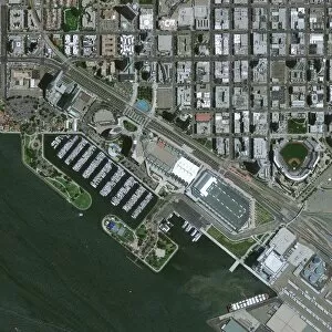
Background imageSatellite Image Collection: San Diego, USA, satellite image C014 / 1764

San Diego, USA, satellite image C014 / 1764
San Diego. Satellite image of the Embarcadero Marina Park, San Diego Bay, California, USA. The San Diego Convention Center, San Diego Marriott Marquis Marina

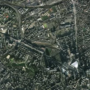
Background imageSatellite Image Collection: Paris, France, satellite image C014 / 1761

Paris, France, satellite image C014 / 1761
Paris. Satellite image of Paris, France, centred over the La Defense district in the borough of Nanterre. Imaged by the GeoEye-1 satellite on 17th January 2012

Background imageSatellite Image Collection: Naples, Italy, satellite image

Naples, Italy, satellite image
Naples. Satellite image of an area near Naples, Italy, showing the Pausilypon archaeological site and the Seiano Grotto. Imaged by the GeoEye-1 satellite on 9th April 2012

Background imageSatellite Image Collection: Pearl Harbor, USA, satellite image C014 / 1763

Pearl Harbor, USA, satellite image C014 / 1763
Pearl Harbor. Satellite image of Pearl Harbor, Oahu island, Hawaii, USA, showing crowds of people standing by the USS Missouri docked at Battleship Row (centre)

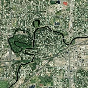
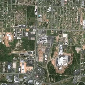
Background imageSatellite Image Collection: Minot, North Dakota, USA, satellite image C014 / 1759

Minot, North Dakota, USA, satellite image C014 / 1759
Minot. Satellite image showing the Souris River (black) flowing through Minot, North Dakota, USA. Imaged by the GeoEye-1 satellite, on 30th May 2009

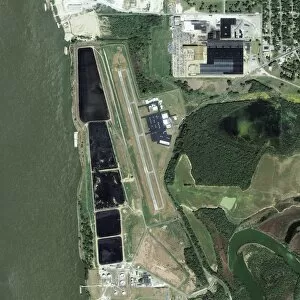
Background imageSatellite Image Collection: General DeWitt Spain Airport, USA C014 / 1757

General DeWitt Spain Airport, USA C014 / 1757
General DeWitt Spain Airport. Satellite image showing the Mississippi River (left) and the General DeWitt Spain Airport, located 8 km northwest of the central business district of Memphis, Tennessee

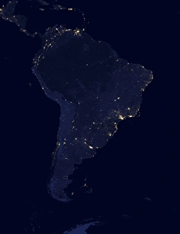
Background imageSatellite Image Collection: South America at night, satellite image

South America at night, satellite image
South America at night. Black marble satellite image of South America at night. More densely populated areas are brighter

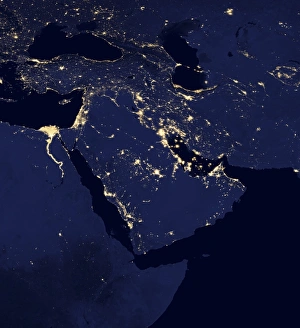
Background imageSatellite Image Collection: Middle East at night, satellite image

Middle East at night, satellite image
Middle East at night. Black marble satellite image of the Arabian peninsula at night. More densely populated areas are brighter. Gas flares from oil and gas fields are also seen

Background imageSatellite Image Collection: Joplin, USA, satellite image C014 / 1754

Joplin, USA, satellite image C014 / 1754
Joplin. Satellite image of Joplin, Missouri, USA, taken on 16th May 2011, six das before a Level 5 tornado touched down and destroyed most of the town. Imaged by the GeoEye-1 satellite

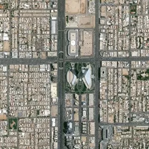
Background imageSatellite Image Collection: Riyadh, Saudi Arabia, satellite image C014 / 1756

Riyadh, Saudi Arabia, satellite image C014 / 1756
Riyadh. Satellite image of Riyadh, the capital city of Saudi Arabia, showing the Kingdom Tower (Kingdom Centre) at centre

Background imageSatellite Image Collection: Gujarat Solar Park India, satellite image C014 / 1751

Gujarat Solar Park India, satellite image C014 / 1751
Gujarat Solar Park. Satellite image showing the large array of solar panels (dark) at the Gujarat Solar Park, Charana, India. This is the worlds largest multi-developer solar park (as of 2012)

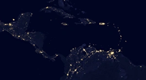
Background imageSatellite Image Collection: Central America at night, satellite image

Central America at night, satellite image
Central America at night. Black marble satellite image of Central America at night. More densely populated areas are brighter

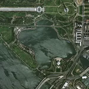
Background imageSatellite Image Collection: National Cherry Blossom Festival, USA C014 / 1749

National Cherry Blossom Festival, USA C014 / 1749
National Cherry Blossom Festival. Satellite image of Washington DC, USA, showing crowds of people gathered at the Washington Monument

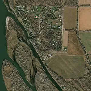
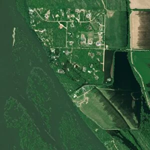
Background imageSatellite Image Collection: Bismarck, USA, satellite image C014 / 1748

Bismarck, USA, satellite image C014 / 1748
Bismarck. Satellite image taken on 12th November 2010 of the Missouri River and adjacent neighbourhood just north of Bismarck, North Dakota, USA

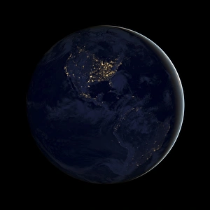
Background imageSatellite Image Collection: Americas at night, satellite image

Americas at night, satellite image
Americas at night. Black marble satellite image of North and South America at night. More densely populated areas are brighter

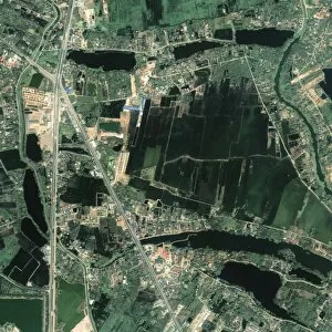
Background imageSatellite Image Collection: Bangkok, Thailand, satellite image C014 / 1745

Bangkok, Thailand, satellite image C014 / 1745
Bangkok. Satellite image taken on 4th December 2010 showing an area north of Bangkok, Thailand, before the extensive flooding of October 2011

Background imageSatellite Image Collection: Bismarck flooding, USA, satellite image C014 / 1747

Bismarck flooding, USA, satellite image C014 / 1747
Bismarck flooding. Satellite image taken on 3rd June 2011 of the flooded Missouri River and adjacent neighbourhood just north of Bismarck, North Dakota, USA. According to news reports the U.S

Background imageSatellite Image Collection: Open Northwest Passage, 2012 C014 / 0113

Open Northwest Passage, 2012 C014 / 0113
Open Northwest Passage. Satellite image of the Canadian Arctic Archipelago taken on the 3rd August 2012. Sea ice has receded enough to open up the route

Background imageSatellite Image Collection: Open Northwest Passage, 2012 C014 / 0112

Open Northwest Passage, 2012 C014 / 0112
Open Northwest Passage. Satellite image of the Canadian Arctic Archipelago taken on the 3rd August 2012. Sea ice has receded enough to open up the route

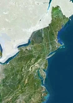
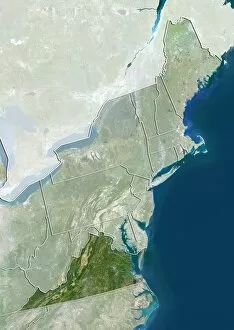
Background imageSatellite Image Collection: Northeastern USA, satellite image C014 / 0091

Northeastern USA, satellite image C014 / 0091
Northeastern USA, satellite image. North is at top. Natural colour satellite image showing the Northeastern USA divided into its states, and the Atlantic Ocean (blue) at right

Background imageSatellite Image Collection: Virginia, USA, satellite image C014 / 0090

Virginia, USA, satellite image C014 / 0090
Virginia, satellite image. North is at top. Natural colour satellite image showing the state of Virginia, USA, with the surrounding states of the Northeastern USA shaded out

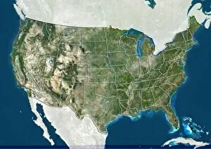
Background imageSatellite Image Collection: United States, satellite image C014 / 0087

United States, satellite image C014 / 0087
United States, satellite image. North is at top. Natural colour satellite image showing the United States of America (except Hawaii and Alaska), divided into its states


All Professionally Made to Order for Quick Shipping

"Exploring the vastness of our universe, satellite images capture breathtaking views that redefine our perspective. Inspired by Voyager 1's iconic 'Pale Blue Dot' image, we witness the beauty and fragility of Earth from space. From the British Isles to Europe at night, these satellite images reveal a tapestry of lights illuminating cities and towns across continents. Marvel at the mesmerizing glow as darkness blankets Europe or gaze in awe at the captivating sight of our entire planet aglow during nighttime. Delve into Tenerife's intricate landscapes, where satellite imagery unveils its hidden wonders with stunning clarity. Venturing beyond our home planet, New Horizons grants us an extraordinary glimpse into Jupiter and its moon Io – a celestial dance frozen in time. Witnessing Earth from afar reminds us of its remarkable diversity; behold Scotland's rugged terrain captured through a lens high above. Satellite imagery also unravels nature's grandeur: observe awe-inspiring solar prominences erupting from the sun’s surface like fiery tendrils reaching towards infinity. In January 2010, witness Mother Nature transforming the United Kingdom into a winter wonderland as snow blankets every corner. Finally, explore North America at night through satellite lenses – an ethereal spectacle showcasing bustling metropolises intertwined with serene natural landscapes under starlit skies. " Note.