
Rondonia Collection
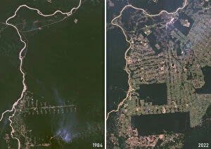
Rondonia, a state in western Brazil, was a vast expanse of lush Amazon rainforest in 1990, as seen in this relief map and true color satellite image


All Professionally Made to Order for Quick Shipping
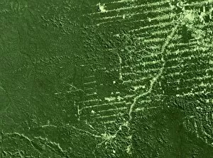
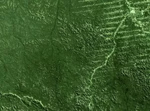
Rondonia, a state in western Brazil, was a vast expanse of lush Amazon rainforest in 1990, as seen in this relief map and true color satellite image. However, by 1975, deforestation had already begun, with the Steamer Francisco Salles navigating through once-unbroken forests to reach Porto-Velho. By 1986, deforestation had intensified, as shown in this satellite image. The Amazon rainforest continued to disappear at an alarming rate, with an estimated 11,000 square kilometers lost between 1992 and 2000. The once-verdant landscape of Rondonia, a critical part of the Amazon ecosystem, was transformed beyond recognition.