Fraud Blocker Skip to main content

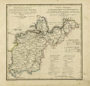
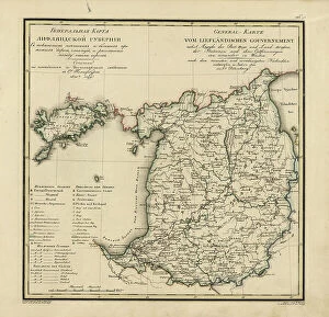
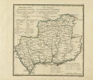
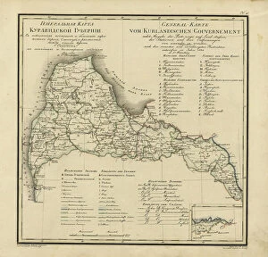
Roads Collection (page 8)

"Journey through Time: Exploring the Stories Carved on Roads" Unveiling hidden tales: The Falkland Islands Royal Engineer briefing map, 1982

Background imageRoads Collection: General Map of Saint Petersburg Province: Showing Postal and Major Roads, Stations and the... 1820

General Map of Saint Petersburg Province: Showing Postal and Major Roads, Stations and the... 1820
General Map of Saint Petersburg Province: Showing Postal and Major Roads, Stations and the Distance in Versts between Them, 1820

Background imageRoads Collection: General Map of Livland Province: Showing Postal and Major Roads, Stations and the... 1820

General Map of Livland Province: Showing Postal and Major Roads, Stations and the... 1820
General Map of Livland Province: Showing Postal and Major Roads, Stations and the Distance in Versts between Them, 1820. This 1820 map of Livland Provinceis from a larger work

Background imageRoads Collection: General Map of Kherson Province: Showing Postal and Major Roads, Stations and... 1821

General Map of Kherson Province: Showing Postal and Major Roads, Stations and... 1821
General Map of Kherson Province: Showing Postal and Major Roads, Stations and the Distance in Versts between Them, 1821. This 1821 map of Kherson Provinceis from a larger work

Background imageRoads Collection: General Map of Courland Province: Showing Postal and Major Roads, Stations and the... 1820

General Map of Courland Province: Showing Postal and Major Roads, Stations and the... 1820
General Map of Courland Province: Showing Postal and Major Roads, Stations and the Distance in Versts between Them, 1820. This 1820 map of Courland Province is from a larger work

Background imageRoads Collection: General Map of Kiev Province: Showing Postal and Major Roads, Stations and.. 1821

General Map of Kiev Province: Showing Postal and Major Roads, Stations and.. 1821
General Map of Kiev Province: Showing Postal and Major Roads, Stations and the Distance in Versts between Them, 1821. This 1821 map of Kiev Province is from a larger work

Background imageRoads Collection: General Map of Vilnius Province: Showing Postal and Major Roads, Stations and the... 1820

General Map of Vilnius Province: Showing Postal and Major Roads, Stations and the... 1820
General Map of Vilnius Province: Showing Postal and Major Roads, Stations and the Distance in Versts between Them, 1820. This 1820 map of Vilnius Provinceis from a larger work

Background imageRoads Collection: General Map of Grodno Province and the Belostok Region: Showing Postal and Major Roads... 1820

General Map of Grodno Province and the Belostok Region: Showing Postal and Major Roads... 1820
General Map of Grodno Province and the Belostok Region: Showing Postal and Major Roads, Stations and the Distance in Versts between Them, 1820

Background imageRoads Collection: General Map of Podolsk Province: Showing Postal and Major Roads, Stations and the... 1820

General Map of Podolsk Province: Showing Postal and Major Roads, Stations and the... 1820
General Map of Podolsk Province: Showing Postal and Major Roads, Stations and the Distance in Versts between Them, 1820. This 1820 map of Podolsk Provinceis from a larger work

Background imageRoads Collection: General Map of Yaroslavl Province: Showing Postal and Major Roads, Stations and the... 1822

General Map of Yaroslavl Province: Showing Postal and Major Roads, Stations and the... 1822
General Map of Yaroslavl Province: Showing Postal and Major Roads, Stations and the Distance in Versts between Them, 1822

Background imageRoads Collection: General Map of Mogilev Province: Showing Postal and Major Roads, Stations and... 1821

General Map of Mogilev Province: Showing Postal and Major Roads, Stations and... 1821
General Map of Mogilev Province: Showing Postal and Major Roads, Stations and the Distance in Versts between Them, 1821. This 1821 map of Mogilev Provinceis from a larger work

Background imageRoads Collection: General Map of Voronezh Province: Showing Postal and Major Roads, Stations and the... 1822

General Map of Voronezh Province: Showing Postal and Major Roads, Stations and the... 1822
General Map of Voronezh Province: Showing Postal and Major Roads, Stations and the Distance in Versts between Them, 1822. This 1822 map of Voronezh Provinceis from a larger work

Background imageRoads Collection: General Map of Tambov Province: Showing Postal and Major Roads, Stations and the... 1822

General Map of Tambov Province: Showing Postal and Major Roads, Stations and the... 1822
General Map of Tambov Province: Showing Postal and Major Roads, Stations and the Distance in Versts between Them, 1822. This 1822 map of Tambov Provinceis from a larger work

Background imageRoads Collection: General Map of the Polish Empire: Showing Postal and Major Roads, Stations and the... 1820

General Map of the Polish Empire: Showing Postal and Major Roads, Stations and the... 1820
General Map of the Polish Empire: Showing Postal and Major Roads, Stations and the Distance in Miles Between Them, 1820. This 1820 map of the Polish Empire, then part of the Russian Empire

Background imageRoads Collection: General Map of Kostroma Province: Showing Postal and Major Roads, Stations and... 1822

General Map of Kostroma Province: Showing Postal and Major Roads, Stations and... 1822
General Map of Kostroma Province: Showing Postal and Major Roads, Stations and the Distance in Versts between Them, 1822. This 1822 map of Kostroma Provinceis from a larger work

Background imageRoads Collection: General Map of Orel Province: Showing Postal and Major Roads, Stations and... 1822

General Map of Orel Province: Showing Postal and Major Roads, Stations and... 1822
General Map of Orel Province: Showing Postal and Major Roads, Stations and the Distance in Versts between Them, 1822. This 1822 map of Orel Province is from a larger work

Background imageRoads Collection: General Map of Taurida Province: Showing Postal and Major Roads, Stations and.. 1822

General Map of Taurida Province: Showing Postal and Major Roads, Stations and.. 1822
General Map of Taurida Province: Showing Postal and Major Roads, Stations and the Distance in Versts between Them, 1822. This 1822 map ofTaurida Provinceis from a larger work

Background imageRoads Collection: General Map of Ryazan Province: Showing Postal and Major Roads, Stations and... 1822

General Map of Ryazan Province: Showing Postal and Major Roads, Stations and... 1822
General Map of Ryazan Province: Showing Postal and Major Roads, Stations and the Distance in Versts between Them, 1822. This 1822 map of Ryazan Provinceis from a larger work

Background imageRoads Collection: General Map of Tula Province: Showing Postal and Major Roads, Stations and... 1822

General Map of Tula Province: Showing Postal and Major Roads, Stations and... 1822
General Map of Tula Province: Showing Postal and Major Roads, Stations and the Distance in Versts between Them, 1822. This 1822 map of Tula Provinceis from a larger work

Background imageRoads Collection: General Map of Estland Province: Showing Postal and Major Roads, Stations and... 1820

General Map of Estland Province: Showing Postal and Major Roads, Stations and... 1820
General Map of Estland Province: Showing Postal and Major Roads, Stations and the Distance in Versts between Them, 1820. This 1820 map of Estland Province is from a larger work

Background imageRoads Collection: A church stood alone

A church stood alone
Bing Li

Background imageRoads Collection: Naked couple wearing cowboy boots and hat crossing road in Monument Valley, Arizona

Naked couple wearing cowboy boots and hat crossing road in Monument Valley, Arizona Date: 27-03-2021

Background imageRoads Collection: Map of the Butte Montmartre, Paris, France

Map of the Butte Montmartre, Paris, France
Map of the Butte Montmartre, 18th arrondissement, Paris, France. Date: circa 1900s

Background imageRoads Collection: Traffic flow at Switch Island Junction illustrated in the Liverpool Echo drawing Circa

Traffic flow at Switch Island Junction illustrated in the Liverpool Echo drawing Circa 1980, showing A5036, A59, M58 & M57 motorways

Background imageRoads Collection: The Newly opened Gabalfa Fly-over in Cardiff. 10th March 1971

The Newly opened Gabalfa Fly-over in Cardiff. 10th March 1971

Background imageRoads Collection: General scenes of traffic scenes in Newcastle - cars going along Stephenson Road to

General scenes of traffic scenes in Newcastle - cars going along Stephenson Road to Benton Bank 20 June 1979

Background imageRoads Collection: Richmond Hill, Truro, Cornwall. Early 1900s

Richmond Hill, Truro, Cornwall. Early 1900s
A view looking down the north side of Richmond Hill. Children and adults are standing on the pavement while a woman stands in the doorway of Number 42

Background imageRoads Collection: Henver Road, Newquay, Cornwall. 1977

Henver Road, Newquay, Cornwall. 1977
View of Henver Road from Bosuen Road, showing Barclays Bank on the corner of Chester Road. Signage erected by building contractors K.H.J

Background imageRoads Collection: Shibuya pedestrian crossing in Shibuya with lights at night, Tokyo, Japan

Shibuya pedestrian crossing in Shibuya with lights at night, Tokyo, Japan

Background imageRoads Collection: General view of bridge, Kennall Vale, Stithians, Cornwall. 1966

General view of bridge, Kennall Vale, Stithians, Cornwall. 1966
Grade II listed road bridge over the River Kennall, immediately south of Kennall Vale Mill. A four span bridge of post and lintel construction

Background imageRoads Collection: Path towards the coastguard cottages and the Seven Sisters Chalk Cliffs

Path towards the coastguard cottages and the Seven Sisters Chalk Cliffs. Seaford Head Nature Reserve, East Sussex, UK, May 2009

Background imageRoads Collection: Great Ocean Road Memorial and Arch, Victoria, Australia

Great Ocean Road Memorial and Arch, Victoria, Australia

Background imageRoads Collection: Cobblestone street in Trujillo, Extremadura, Caceres, Spain

Cobblestone street in Trujillo, Extremadura, Caceres, Spain

Background imageRoads Collection: Country road draped in autumn leaves Goulais River, Ontario, Canada

Country road draped in autumn leaves Goulais River, Ontario, Canada

Background imageRoads Collection: Country road with hardwood forest in autumn colors Goulais River, Ontario, Canada

Country road with hardwood forest in autumn colors Goulais River, Ontario, Canada

Background imageRoads Collection: winding road of the Pordoi Pass during a summer day. Fassa Valley, Dolomiti, Canazei

winding road of the Pordoi Pass during a summer day. Fassa Valley, Dolomiti, Canazei, Trento province, Trentino Alto Adige district, Italy

Background imageRoads Collection: UK, Scotland, Highland, Isle of Skye, Skye Bridge and Kyle Lighthouse on Eilean Ban

UK, Scotland, Highland, Isle of Skye, Skye Bridge and Kyle Lighthouse on Eilean Ban

Background imageRoads Collection: Gardesana Occidentale scenic road named 'Strada della Forra'on Garda Lake

Gardesana Occidentale scenic road named "Strada della Forra"on Garda Lake
Gardesana Occidentale scenic road named " Strada della Forra" on Garda Lake, Lombardy, Italy

Background imageRoads Collection: Cars driving on a straight road between red rocks during sunny day

Cars driving on a straight road between red rocks during sunny day, Valley of Fire State Park, Nevada, Western United States, USA

Background imageRoads Collection: Caineville Badlands next to Utah State Route 24, Caineville, Utah, Western United States

Caineville Badlands next to Utah State Route 24, Caineville, Utah, Western United States, USA

Background imageRoads Collection: Campervan and cars driving on a straight road between red rocks during sunny day

Campervan and cars driving on a straight road between red rocks during sunny day, Valley of Fire State Park, Nevada, Western United States, USA

Background imageRoads Collection: Aerial view of ruins of buildings at Fort James, St. Johns, Antigua and Barbuda

Aerial view of ruins of buildings at Fort James, St. Johns, Antigua and Barbuda
Aerial view of ruins of buildings at Fort James, St. John s, Antigua and Barbuda, Leeward Islands, West Indies

Background imageRoads Collection: Elevated view of Fredvang bridges, Lofoten Islands, Nordland, Norway

Elevated view of Fredvang bridges, Lofoten Islands, Nordland, Norway

Background imageRoads Collection: A view towards volcanic crater Stutur and Landmannalaugar mountains, Highlands, Iceland

A view towards volcanic crater Stutur and Landmannalaugar mountains, Highlands, Iceland

Background imageRoads Collection: US 190 road, Death Valley National Park, California, USA

US 190 road, Death Valley National Park, California, USA

Background imageRoads Collection: Aerial view of the Tremola San Gottardo road, the longest road monument in Switzerland listed in

Aerial view of the Tremola San Gottardo road, the longest road monument in Switzerland listed in the inventory of the historic Swiss roads

Background imageRoads Collection: Aerial view on Furka pass road and Rhone glacier, Valais, Switzerland

Aerial view on Furka pass road and Rhone glacier, Valais, Switzerland

Background imageRoads Collection: View of Arrow Junction Lookout Point, Arrow Junction Quarry, Arrow Junction

View of Arrow Junction Lookout Point, Arrow Junction Quarry, Arrow Junction, Queenstown Lakes District, Otago Region, South Island, New Zealand

Background imageRoads Collection: USA, Arizona, Kingman, Route 66, Route 66 Motel

USA, Arizona, Kingman, Route 66, Route 66 Motel


All Professionally Made to Order for Quick Shipping

"Journey through Time: Exploring the Stories Carved on Roads" Unveiling hidden tales: The Falkland Islands Royal Engineer briefing map, 1982, reveals the strategic importance in military operations. Fisher Street, Doolin: A picturesque road winding through County Clare, Ireland, Europe, offering breathtaking views of rugged landscapes and ancient traditions. High Row in Darlington: Tracing the footsteps of history along this charming County Durham road that has witnessed centuries of change and progress. Spaghetti Junction: An architectural marvel or a tangled web? Delve into the fascinating engineering behind this iconic interchange connecting Birmingham's roads. Clash of Titans: Relive the legendary naval battle between USS Monitor and CSS Virginia as ironclad warships clashed on treacherous waters. Westhampton beach's scenic coastal road on Long Island beckons with its tranquil beauty and promises unforgettable seaside adventures. Map of the City of Dublin, 1797: Step back in time to explore Dublin's labyrinthine streets during an era when horse-drawn carriages ruled these historic roads. Teignmouth-Shaldon Toll Bridge stands as a testament to human ingenuity bridging gaps both physical and metaphorical for generations past and present. London Map / Roman Period: Discover remnants from ancient Rome embedded within modern-day London's bustling streetscape – where two worlds collide across time. Industrial Revolution Iconography: Witnessing progress unfold at the new Rolls Royce factory in East Kilbride, Scotland June 1954 – where innovation meets asphalt dreams. Picture No. 10899522 captures a fleeting moment frozen in time—a snapshot that encapsulates life unfolding along busy city roads worldwide. Colourful Shop Fronts on Quay Hill add vibrancy to Lymington within England’s enchanting New Forest region—where roads lead to charming surprises at every turn.