mail_outline sales@mediastorehouse.com
Framed Print
Premium Framed Print
Canvas Print
Metal Print
Photographic Print
Poster Print
Fine Art Print
Jigsaw Puzzle
Photo Mug
Pillow
Mouse Mat
BERING STRAIT MAP, 1593. Cornelis de Jodes 1593 map of Western North America showing the fabled province of Quivira in California and the Bering Strait (El Streto de Anian)
Red-tailed hawk doing a fly by Date: 01-01-2021
Short eared owl resting on fence post Date: 26-12-2020
Large cottonwood tree at Quivira National Game Refuge Date: 26-12-2020
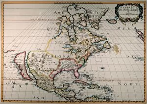
MAP OF NORTH AMERICA, 1650. By Nicolas Sanson; the first printed map to show all five of the Great Lakes and vaguely locating the legendary lands of Cibola and Quivira in the southwest
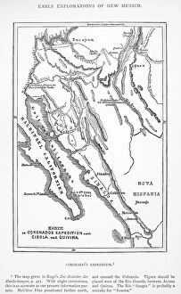
FRANCISCO de CORONADO (c1510-1554). Francisco Vasquez de Coronado. Spanish explorer. Map of Coronados expeditions to Cibola and Quivira in 1540. German, 19th century