Fraud Blocker Skip to main content

Plan Collection (page 100)

"Unveiling the Blueprint of Success: The Power of a Well-Crafted Plan" In every era, plans have shaped destinies and transformed history

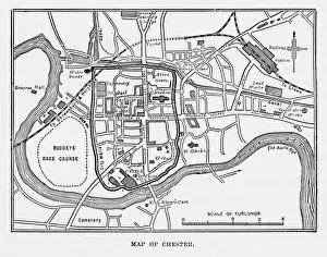
Background imagePlan Collection: Map of the City of Chester, England Victorian Engraving, 1840

Map of the City of Chester, England Victorian Engraving, 1840
Very Rare, Beautifully Illustrated Antique Engraving of Map of the City of Chester, England Victorian Engraving, 1840. Source: Original edition from my own archives

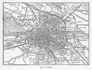
Background imagePlan Collection: Map of the City of Dublin, Ireland Victorian Engraving, 1840

Map of the City of Dublin, Ireland Victorian Engraving, 1840
Very Rare, Beautifully Illustrated Antique Engraving of Map of the City of Map of the City of Dublin, Ireland Victorian Engraving, 1840. Source: Original edition from my own archives

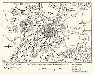
Background imagePlan Collection: Franco Prussian War - Plan of Metz and French camp

Franco Prussian War - Plan of Metz and French camp
Vintage engraving of a scene fro the Franco Prussian War. Plan of Metz and French entrenched camp

Background imagePlan Collection: Second Boer War - Battle of Belmont

Second Boer War - Battle of Belmont
Vintage engraving of a plan of the Battle of Belmont an engagement of the Second Boer War on 23 November 1899, where the British under Lord Methuen assaulted a Boer position on Belmont kopje

Background imagePlan Collection: Map of Derwentwater, Keswick, England Victorian Engraving, 1840

Map of Derwentwater, Keswick, England Victorian Engraving, 1840
Very Rare, Beautifully Illustrated Antique Engraving of Map of Derwentwater, Keswick, England Victorian Engraving, 1840 from Our Own Country, Great Britain, Descriptive, Historical, Pictorial

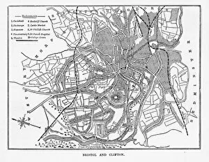
Background imagePlan Collection: Map of Bristol and Clifton, Yorkshire, England Victorian Engraving, 1840

Map of Bristol and Clifton, Yorkshire, England Victorian Engraving, 1840
Very Rare, Beautifully Illustrated Antique Engraving of Map of Bristol and Clifton in Yorkshire, England Victorian Engraving, Circa 1840 from Our Own Country, Great Britain, Descriptive, Historical

Background imagePlan Collection: Map of Bristol in Yorkshire, England Victorian Engraving, Circa 1247

Map of Bristol in Yorkshire, England Victorian Engraving, Circa 1247
Very Rare, Beautifully Illustrated Antique Engraving of Map of Bristol in Yorkshire, England Victorian Engraving, Circa 1247 from Our Own Country, Great Britain, Descriptive, Historical, Pictorial

Background imagePlan Collection: Map of Woburn and Neighborhoods, England Victorian Engraving, Circa 1840

Map of Woburn and Neighborhoods, England Victorian Engraving, Circa 1840
Very Rare, Beautifully Illustrated Antique Engraving of Map of Woburn and Neighborhoods, England Victorian Engraving, Circa 1840 from Our Own Country, Great Britain, Descriptive, Historical

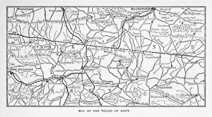
Background imagePlan Collection: Map of Kent and Neighborhoods, England Victorian Engraving, 1840

Map of Kent and Neighborhoods, England Victorian Engraving, 1840
Very Rare, Beautifully Illustrated Antique Engraving of Map of Kent and Neighborhoods, England Victorian Engraving, 1840 from Our Own Country, Great Britain, Descriptive, Historical, Pictorial

Background imagePlan Collection: Map of Burghley and Neighborhoods, England Victorian Engraving, 1840

Map of Burghley and Neighborhoods, England Victorian Engraving, 1840
Very Rare, Beautifully Illustrated Antique Engraving of Map of Burghley and Neighborhoods, England Victorian Engraving, 1840 from Our Own Country, Great Britain, Descriptive, Historical, Pictorial

Background imagePlan Collection: Map of the Course of the River Clyde, England Victorian Engraving, 1840

Map of the Course of the River Clyde, England Victorian Engraving, 1840
Very Rare, Beautifully Illustrated Antique Engraving of Map of the Course of the River Clyde, England Victorian Engraving, 1840 from Our Own Country, Great Britain, Descriptive, Historical

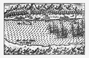
Background imagePlan Collection: Porto Deseado Historical Map by Van Noort, Circa 1598

Porto Deseado Historical Map by Van Noort, Circa 1598
Very Rare, Beautifully Illustrated Antique Engraved Victorian Illustration of Historical Map of Van Noort at Porto Deseado, 1598. Copyright has expired on this artwork. Digitally restored

Background imagePlan Collection: Map of Ludlow, England Victorian Engraving, Circa 1840

Map of Ludlow, England Victorian Engraving, Circa 1840
Very Rare, Beautifully Illustrated Antique Engraving of Map of Ludlow, England Victorian Engraving, Circa 1840 from Our Own Country, Great Britain, Descriptive, Historical, Pictorial

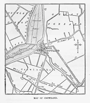
Background imagePlan Collection: Map of Crowland, England Victorian Engraving, Circa 1840

Map of Crowland, England Victorian Engraving, Circa 1840
Very Rare, Beautifully Illustrated Antique Engraving of Crowland, The Cut at Peakirk Victorian Engraving from Our Own Country, Great Britain, Descriptive, Historical, Pictorial. Published in 1880

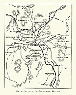
Background imagePlan Collection: Second Boer War - Plan Ladysmith and surrounding heights

Second Boer War - Plan Ladysmith and surrounding heights
Vintage engraving of a Plan Ladysmith and surrounding heights. 1899

Background imagePlan Collection: Victorian Map of Australia

Victorian Map of Australia
Engraved illustrations of the Map of Australia from Iconographic Encyclopedia of Science, Literature and Art, Published in 1851. Copyright has expired on this artwork. Digitally restored

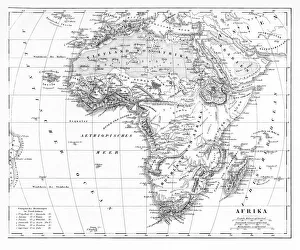
Background imagePlan Collection: Victorian Map of Africa

Victorian Map of Africa
Engraved illustrations of a Map of Africa from Iconographic Encyclopedia of Science, Literature and Art, Published in 1851. Copyright has expired on this artwork. Digitally restored

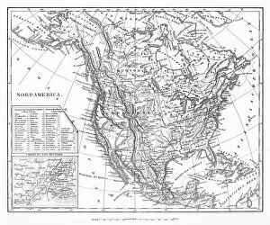
Background imagePlan Collection: Map of North America

Map of North America
Engraved illustrations of a Map of North America from Iconographic Encyclopedia of Science, Literature and Art, Published in 1851. Copyright has expired on this artwork. Digitally restored

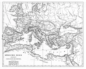
Background imagePlan Collection: Victorian Map of The Roman Empire

Victorian Map of The Roman Empire
Engraved illustrations of the Roman Empire Under Constantine the Great from Iconographic Encyclopedia of Science, Literature and Art, Published in 1851. Copyright has expired on this artwork

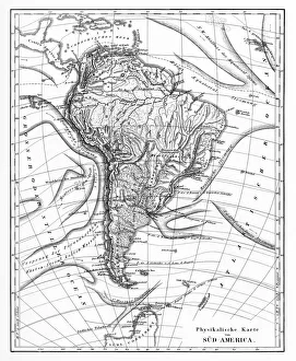
Background imagePlan Collection: Victorian Map of North America

Victorian Map of North America
Engraved illustrations of the Physical Map of South America from Iconographic Encyclopedia of Science, Literature and Art, Published in 1851. Copyright has expired on this artwork. Digitally restored

Background imagePlan Collection: Fortifications of Paris Map Engraving

Fortifications of Paris Map Engraving
Engraved illustrations of the Fortifications of Paris from Iconographic Encyclopedia of Science, Literature and Art, Published in 1851. Copyright has expired on this artwork. Digitally restored

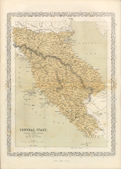
Background imagePlan Collection: Victorian Map of Central Italy, Circa 1865

Victorian Map of Central Italy, Circa 1865
Extremely Rare, Beautifully Illustrated Antique Victorian Engraved Illustration of the map of Central Italy including Tuscany, Parma and Modena from Liberators of Italy

Background imagePlan Collection: Acropolis of Pergamon, published in 1881

Acropolis of Pergamon, published in 1881
Map of the Acropolis of Pergamon (Unesco World Heritage Site). Wood engraving, published in 1881

Background imagePlan Collection: Excavations of Olympia, lithograph, published in 1880

Excavations of Olympia, lithograph, published in 1880
Old map of the plan of the excavations of Olympia. Lithograph, published in 1880

Background imagePlan Collection: Volcanic and Hurricane Charts; Craters; and Antarctica Engraving

Volcanic and Hurricane Charts; Craters; and Antarctica Engraving
Engraved Illustrations of Volcanic and Hurricane Charts; Craters; and Antarctica from Iconographic Encyclopedia of Science, Literature and Art, Published in 1851

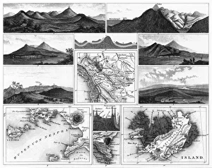
Background imagePlan Collection: Volcanoes and Volcanic Formations and Stratification Engraving

Volcanoes and Volcanic Formations and Stratification Engraving
Engraved Illustrations of Volcanoes and Volcanic Formations and Stratification from Iconographic Encyclopedia of Science, Literature and Art, Published in 1851. Copyright has expired on this artwork

Background imagePlan Collection: Map of Bay of Naples and Naples Engraving

Map of Bay of Naples and Naples Engraving
Engraved Illustrations of Volcanoes and Volcanic Formations and Stratification and the Map of Bay of Naples and Naples, Italy from Iconographic Encyclopedia of Science, Literature and Art

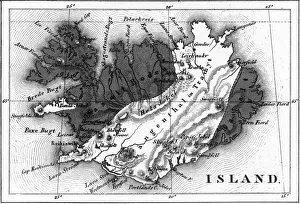
Background imagePlan Collection: Map of Volcanic Chart of Iceland Engraving

Map of Volcanic Chart of Iceland Engraving
Engraved Illustrations of Volcanoes and Volcanic Formations and Stratification and the Map of Volcanic Chart of Iceland from Iconographic Encyclopedia of Science, Literature and Art

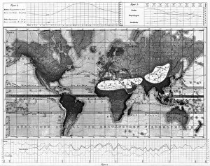
Background imagePlan Collection: Historical Rainfall and Temperature Charts Engraving

Historical Rainfall and Temperature Charts Engraving
Engraved Illustrations of Historical Rainfall and Temperature Map; Temperature Charts of the World from Iconographic Encyclopedia of Science, Literature and Art, Published in 1851

Background imagePlan Collection: Climate and Weather Charts Engraving

Climate and Weather Charts Engraving
Engraved Illustrations of Climate and Weather Charts of the World from Iconographic Encyclopedia of Science, Literature and Art, Published in 1851. Copyright has expired on this artwork

Background imagePlan Collection: Travels of Our Savior Map Engraving

Travels of Our Savior Map Engraving
Engraved illustration of the Travels of Our Savior Map Engraving from The Popular Pictorial Bible, Containing the Old and New Testaments, Published in 1862. Copyright has expired on this artwork

Background imagePlan Collection: North America 1850 Engraving

North America 1850 Engraving
Engraved illustrations of the Physical Map of North America from Iconographic Encyclopedia of Science, Literature and Art, Published in 1851. Copyright has expired on this artwork. Digitally restored

Background imagePlan Collection: Missouri Campaigns

Missouri Campaigns
Vintage engraving from 1863 of a map of the Missouri Campaigns from the time of the American Civil War

Background imagePlan Collection: Antique France Map

Antique France Map
France Map, - Antique style. Includes mountains and water bodies. High detail - vector illustration

Background imagePlan Collection: MANOR, 17TH CENTURY. The Map of Mockbeggar Hall, with his Situation in the Spacious

MANOR, 17TH CENTURY. The Map of Mockbeggar Hall, with his Situation in the Spacious Country Called Anywhere. English woodcut illustrating one of the Roxburghe broadside ballads, early 17th century

Background imagePlan Collection: Map of Paris 1895

Map of Paris 1895
map/plan of the city of Paris, France 1895

Background imagePlan Collection: Map of Chicago 1895

Map of Chicago 1895
Map of the city of Chicago, USA

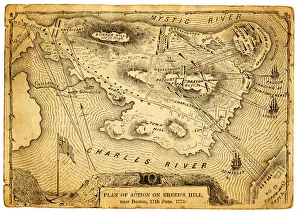
Background imagePlan Collection: Plan of action at the Battle on Breeds Hill

Plan of action at the Battle on Breeds Hill
Vintage engraving of the Plan of action at the Battle of Breeds Hill (also known as the Battle of Bunker Hill), Near Boston on 17th June 1775. Part of the American War of IndependenceView more:

Background imagePlan Collection: Antique map of Tongataboo in the South Pacific

Antique map of Tongataboo in the South Pacific

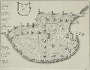
Background imagePlan Collection: Antique map of fortified city of Ptolemaida

Antique map of fortified city of Ptolemaida

Background imagePlan Collection: Antique plan of Jerusalem, Israel

Antique plan of Jerusalem, Israel

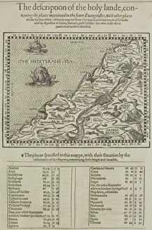
Background imagePlan Collection: Antique map of the holy land with table of data

Antique map of the holy land with table of data

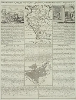
Background imagePlan Collection: Antique map of Peru and Ecuador with plans for Lima

Antique map of Peru and Ecuador with plans for Lima

Background imagePlan Collection: Old Plan of Exeter in Devon, England Victorian Engraving, 1840

Old Plan of Exeter in Devon, England Victorian Engraving, 1840
Very Rare, Beautifully Illustrated Antique Engraving of Old Plan of Exeter in Devon, England Victorian Engraving, 1840. Source: Original edition from my own archives

Background imagePlan Collection: Plan of Leeds (Victorian engraving)

Plan of Leeds (Victorian engraving)
A 19th century plan of Leeds in Yorkshire, England. From Our Own Country: Descriptive, Historical, Pictoriala published by Cassell & Co Ltd, 1885

Background imagePlan Collection: Map of Coventry in Warwickshire, England Victorian Engraving, 1840

Map of Coventry in Warwickshire, England Victorian Engraving, 1840
Very Rare, Beautifully Illustrated Antique Engraving of Map of Coventry in Warwickshire, England Victorian Engraving, 1840. Source: Original edition from my own archives

Background imagePlan Collection: Franco Prussian War - Plan of Second Battle of Orleans

Franco Prussian War - Plan of Second Battle of Orleans
Vintage engraving of a scene from the Franco Prussian War. Plan of the Second Battle of Orleans, 1870

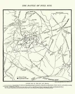
Background imagePlan Collection: Map of the Battle of Bull Run

Map of the Battle of Bull Run
Vintage engraving of a Map of the Battle of Bull Run, The Century Magazine, 1884


All Professionally Made to Order for Quick Shipping

"Unveiling the Blueprint of Success: The Power of a Well-Crafted Plan" In every era, plans have shaped destinies and transformed history. From the meticulously detailed Swindon Works Map in the 1940s to the strategic D-Day Map of 1944, maps have guided armies towards victory and nations towards liberation. The grandeur of empires is etched on maps like the British Empire's expansive territories, reminding us that meticulous planning can forge vast dominions. Even legendary figures like Admiral Nelson relied on precise battle plans to secure triumph at Trafalgar in 1805. Beyond military conquests, plans have given rise to architectural marvels. Filippo Brunelleschi's ingenious design for Santa Maria del Fiore Cathedral in Florence showcased his visionary plan through Lodovico Cardi da Cigoli's contemporary drawing. This cross-section blueprint exemplifies how careful planning can manifest breathtaking beauty. Yet not all plans come to fruition unscathed. The Titanic blueprint serves as a haunting reminder that even with meticulous preparations, unforeseen circumstances may arise. Nevertheless, it underscores the importance of thorough planning and risk assessment. From historic battles such as Waterloo or Chancellorsville during the US Civil War where General Lee and General Jackson strategized their moves before engaging in combat, we witness how well-executed they can turn tides amidst chaos and uncertainty. Even ancient times bear testament to strategic brilliance; Hannibal's Battle of Cannae plan from 216 BC showcases his tactical genius by encircling enemy forces—an enduring lesson in outmaneuvering adversaries. Plans extend beyond warfare; they shape our world at large. Whether it be mapping zoological wonders like London Zoo in 1929 or charting geographical landscapes like an old map detailing the majestic Alps—plans enable exploration and understanding of our surroundings while fostering conservation efforts for future generations. In essence, these diverse examples remind us that behind every triumph, there lies a well-crafted plan.