Fraud Blocker Skip to main content

Physical Geography Collection (page 9)

"Exploring the Diverse Landscapes

Background imagePhysical Geography Collection: Panoramic sunset at Balos Beach, Crete Island, Greece

Panoramic sunset at Balos Beach, Crete Island, Greece

Background imagePhysical Geography Collection: Panoramic view at Balos Beach, Crete Island, Greece

Panoramic view at Balos Beach, Crete Island, Greece

Background imagePhysical Geography Collection: Sunset at Vai Beach, Crete Island, Greece

Sunset at Vai Beach, Crete Island, Greece

Background imagePhysical Geography Collection: Vai Beach at sunrise, Crete Island, Greece

Vai Beach at sunrise, Crete Island, Greece

Background imagePhysical Geography Collection: Sunrise at Vai Beach, Crete Island, Greece

Sunrise at Vai Beach, Crete Island, Greece

Background imagePhysical Geography Collection: Sunrise at Crete Island - Vai Beach, Greece

Sunrise at Crete Island - Vai Beach, Greece

Background imagePhysical Geography Collection: Hot air balloons at sunrise, Goreme, Cappadocia, Turkey

Hot air balloons at sunrise, Goreme, Cappadocia, Turkey

Background imagePhysical Geography Collection: Hot air balloons, Goreme, Cappadocia, Turkey

Hot air balloons, Goreme, Cappadocia, Turkey

Background imagePhysical Geography Collection: Spring mountain landscape, Gran Canaria, Spain

Spring mountain landscape, Gran Canaria, Spain

Background imagePhysical Geography Collection: Spring mountain landscape, Gran Canaria, Canary Islands, Spain

Spring mountain landscape, Gran Canaria, Canary Islands, Spain

Background imagePhysical Geography Collection: Beach of the cathedrals, Praia As Catedrais, Ribadeo, Spain

Beach of the cathedrals, Praia As Catedrais, Ribadeo, Spain

Background imagePhysical Geography Collection: Gunung Agung Volcano and rice terrace landscape, Bali, Indonesia

Gunung Agung Volcano and rice terrace landscape, Bali, Indonesia

Background imagePhysical Geography Collection: Tenerife - panoramic view of Mount Teide and Los Roques de Garcia, Teide National Park

Tenerife - panoramic view of Mount Teide and Los Roques de Garcia, Teide National Park, Canary Islands, Spain

Background imagePhysical Geography Collection: Algarve coast at sunrise near Lagos, Algarve, Portugal

Algarve coast at sunrise near Lagos, Algarve, Portugal

Background imagePhysical Geography Collection: Greece - Zakynthos Island, Ionian Sea, Keri Cape

Greece - Zakynthos Island, Ionian Sea, Keri Cape

Background imagePhysical Geography Collection: Blue Caves, Skinari Cape, Zakynthos Island, Greece

Blue Caves, Skinari Cape, Zakynthos Island, Greece

Background imagePhysical Geography Collection: Sunrise at Algarve rocky beach near Lagos, Algarve, Portugal

Sunrise at Algarve rocky beach near Lagos, Algarve, Portugal

Background imagePhysical Geography Collection: Sunrise at Algarve beach near Lagos, Ponta da Piedade, Algarve, Portugal

Sunrise at Algarve beach near Lagos, Ponta da Piedade, Algarve, Portugal

Background imagePhysical Geography Collection: Algarve coast before sunrise, Ponta da Piedade, Algarve, Lagos, Portugal

Algarve coast before sunrise, Ponta da Piedade, Algarve, Lagos, Portugal

Background imagePhysical Geography Collection: Sunrise landscape at Algarve coast near Lagos, Portugal

Sunrise landscape at Algarve coast near Lagos, Portugal

Background imagePhysical Geography Collection: Sunrise at Algarve coast near Lagos, Portugal

Sunrise at Algarve coast near Lagos, Portugal

Background imagePhysical Geography Collection: Hallstatt mountain village at evening, Salzkammergut, Austrian Alps, Austria, UNESCO

Hallstatt mountain village at evening, Salzkammergut, Austrian Alps, Austria, UNESCO

Background imagePhysical Geography Collection: Austria - Hallstatt mountain village, Salzkammergut, Austrian Alps, UNESCO

Austria - Hallstatt mountain village, Salzkammergut, Austrian Alps, UNESCO

Background imagePhysical Geography Collection: Les Calanches, volcanic red rocks formations mountains, Piana, Corsica Island, France, UNESCO

Les Calanches, volcanic red rocks formations mountains, Piana, Corsica Island, France, UNESCO

Background imagePhysical Geography Collection: Mountains road through the Calanches de Piana, Golfe de Porto, Corsica Island, France, UNESCO

Mountains road through the Calanches de Piana, Golfe de Porto, Corsica Island, France, UNESCO

Background imagePhysical Geography Collection: Tenerife - view of Teide Volcano Mount, Canary Islands, Spain

Tenerife - view of Teide Volcano Mount, Canary Islands, Spain

Background imagePhysical Geography Collection: Lomnicks Peak, 26345m, one of the highest mountain peaks in the High Tatras mountains of Slovakia

Lomnicks Peak, 26345m, one of the highest mountain peaks in the High Tatras mountains of Slovakia June 2012

Background imagePhysical Geography Collection: A lightning strike hits the surface of the water in the distance

A lightning strike hits the surface of the water in the distance
Brisbane, Queensland, Australia

Background imagePhysical Geography Collection: world map 1883

world map 1883
map of the world - 1883

Background imagePhysical Geography Collection: River and mountains map of North America

River and mountains map of North America
Illustration of a River and mountains map of North America

Background imagePhysical Geography Collection: Map of Australasia (1898 engraving)

Map of Australasia (1898 engraving)
Old map of Australasia from 1898

Background imagePhysical Geography Collection: Antique map of Algeria and Tunisia

Antique map of Algeria and Tunisia

Background imagePhysical Geography Collection: Rugged rock formation

Rugged rock formation
Arches National Park in Western USA Desert. Large rock formations in Arid climate landscape with desert brush in background. Blue sky above

Background imagePhysical Geography Collection: Reflections in glacial fjord, Kongsfjorden, Svalbard, Norway

Reflections in glacial fjord, Kongsfjorden, Svalbard, Norway

Background imagePhysical Geography Collection: North America map

North America map
Vector illustration of a detailed map of North America. Reference map was created by the US Central Intelligence Agency and is available as a public domain map at the University of Texas Libraries

Background imagePhysical Geography Collection: A Commercial Jet Flies Over The Mountains Of The American West; Colorado, United States Of America

A Commercial Jet Flies Over The Mountains Of The American West; Colorado, United States Of America

Background imagePhysical Geography Collection: Field Of Arctic Lupine Near The Turnagain Arm South Of Girdwood, Alaska

Field Of Arctic Lupine Near The Turnagain Arm South Of Girdwood, Alaska

Background imagePhysical Geography Collection: Map of Australasia (1882 engraving)

Map of Australasia (1882 engraving)
Old map of Australasia from Royal Geographical Readers no. 5 of Asia, Africa, America and Oceania, publ. T Nelson & Sons, London in 1883

Background imagePhysical Geography Collection: Remarkable Rocks at night, Flinders Chase National Park, Kangaroo Island, South Australia State

Remarkable Rocks at night, Flinders Chase National Park, Kangaroo Island, South Australia State, Australia, September 2011

Background imagePhysical Geography Collection: Views from the Slea Head drive on the Dingle peninsula, Wild Atlantic Way

Views from the Slea Head drive on the Dingle peninsula, Wild Atlantic Way
County Kerry, Ireland

Background imagePhysical Geography Collection: Antique map of Denmark, Norway, Sweden and Finland

Antique map of Denmark, Norway, Sweden and Finland
Wonderful hand coloured antique map, circa 1780 - 1800

Background imagePhysical Geography Collection: Antique map of Persia and Arabia 1730

Antique map of Persia and Arabia 1730
Original antique copper engraved map by H. Moll, titled Persia Sive Shahistana, published in 1747 for the Universal History (London, T. Osborne & J. Shipton, 8 vols. 1747)

Background imagePhysical Geography Collection: Mineral rich landscape and copper lake from the Bogo La pass at17000 ft, Tibet

Mineral rich landscape and copper lake from the Bogo La pass at17000 ft, Tibet, June 2010

Background imagePhysical Geography Collection: Dramatic evening sky over Anse Source d Argent, La Digue. Seychelles. February 2007

Dramatic evening sky over Anse Source d Argent, La Digue. Seychelles. February 2007

Background imagePhysical Geography Collection: Aerial view of Everglades National Park, Florida, USA, February 2012

Aerial view of Everglades National Park, Florida, USA, February 2012

Background imagePhysical Geography Collection: Sand dunes in the Libyan desert, Sahara, Libya, North Africa, December 2007

Sand dunes in the Libyan desert, Sahara, Libya, North Africa, December 2007

Background imagePhysical Geography Collection: Sandstone cliffs, Rackwick Bay, Hoy, Orkney, Scotland, July 2004

Sandstone cliffs, Rackwick Bay, Hoy, Orkney, Scotland, July 2004

Background imagePhysical Geography Collection: Icebergs off the Antarctic Peninsula, Antarctica, February 2009, Taken on location

Icebergs off the Antarctic Peninsula, Antarctica, February 2009, Taken on location for BBC Frozen Planet series


All Professionally Made to Order for Quick Shipping

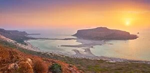
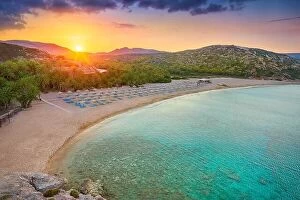
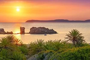
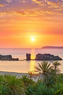
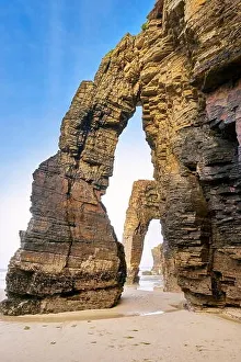
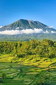
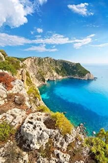
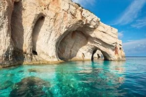
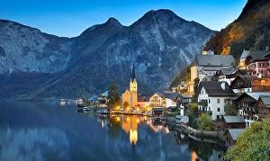
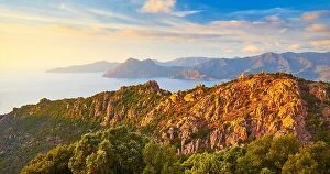
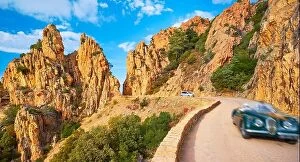
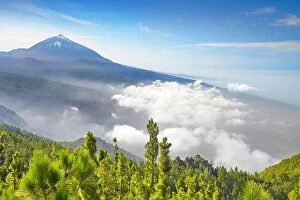
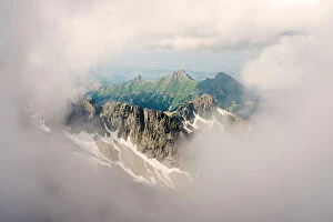
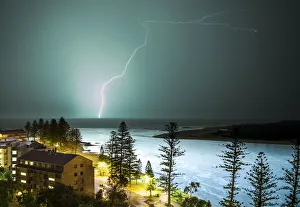
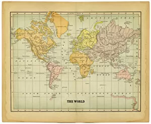
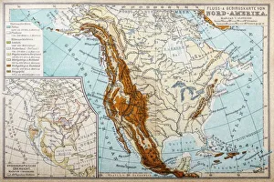
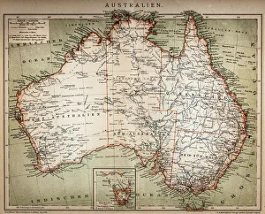
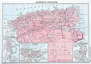
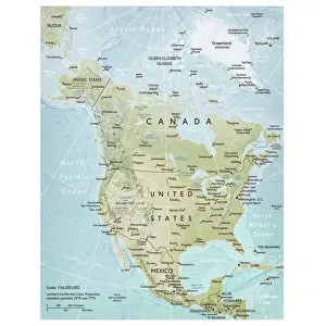
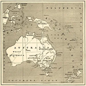
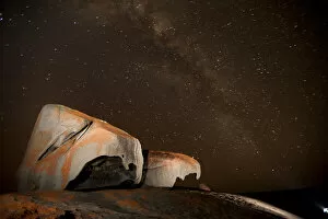
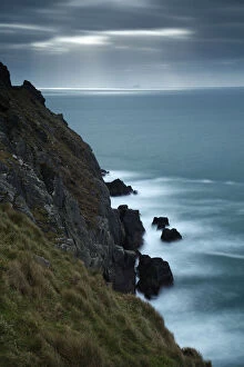
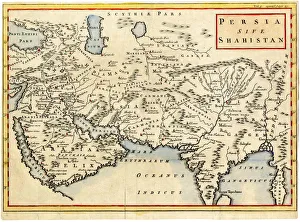
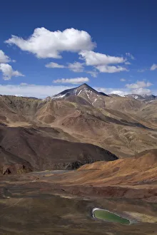
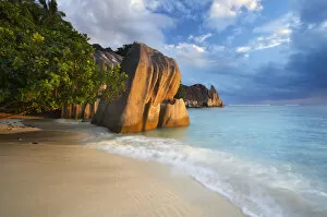
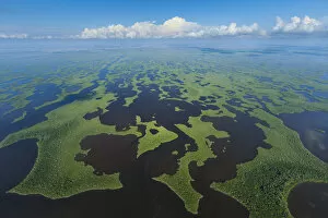
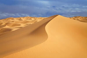
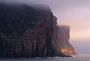
"Exploring the Diverse Landscapes: A Journey through Physical Geography" Embark on a captivating journey through physical geography as we delve into the intricate details of our world's diverse landscapes. From the political map of Africa, showcasing its nations and boundaries, to Mappa Mundi - an exquisite ink and color creation from 1265 London that offers a glimpse into medieval cartography. Travel back in time with the antique maps such as Map of Ireland (1897), Great Britain and Ireland (1867), Sicily (1895), Palestine (1875), and even Tasmania. These historical artifacts not only provide geographical information but also offer insights into how our understanding of land has evolved over centuries. Discover the wonders hidden within Antarctica as you explore a unique map overlaid with illustrations of sea gulls, penguins, elephant seals, shrimp, and buildings. Witness China unfold before your eyes through its intricately detailed map or marvel at Earth's tectonic plates marked by lines on a global scale. Experience rare moments captured by nature itself like never before – witness a snow-covered United Kingdom during January 2010 or immerse yourself in Earth's topographic and bathymetric features depicted meticulously on one single map. Physical geography is more than just studying landforms; it is about unraveling stories etched onto every inch of our planet's surface. Join us on this fascinating expedition where maps become windows to exploration, knowledge, and appreciation for the remarkable diversity that exists right beneath our feet.