
Orteliuss Collection
Ortelius's Maps: A Glimpse into the World of the 16th Century Step back in time and explore the intricate world of cartography with Abraham Ortelius


All Professionally Made to Order for Quick Shipping
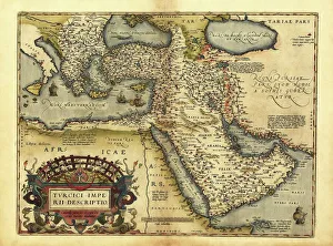
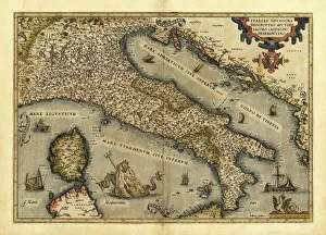
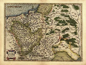
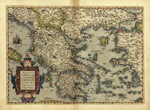
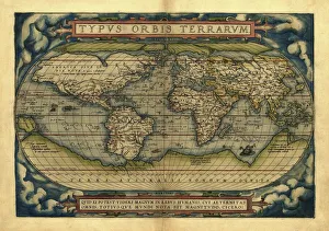
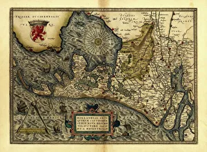
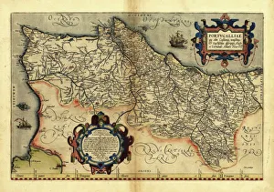
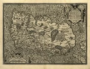
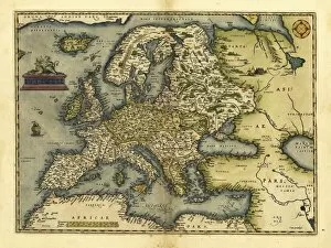
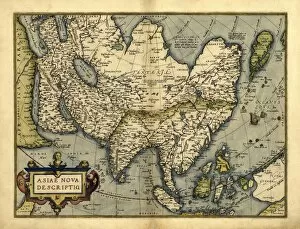
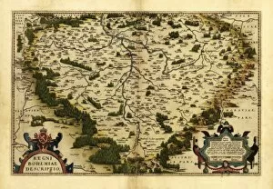
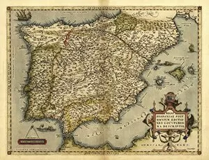
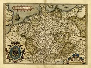
Ortelius's Maps: A Glimpse into the World of the 16th Century Step back in time and explore the intricate world of cartography with Abraham Ortelius, a renowned Flemish mapmaker whose works have left an indelible mark on history. In 1570, Ortelius unveiled his magnum opus, "Theatrum Orbis Terrarum, " considered to be one of the first modern atlases ever created. One captivating piece within this collection is Orteliuss's map of the Ottoman Empire. This meticulously detailed representation showcases the vast territories under Ottoman rule during that era. From Istanbul to Cairo, it provides a glimpse into an empire at its zenith. Another gem from Orteliuss's repertoire is his map of Italy. With its delicate strokes and vibrant colors, it captures Italy's diverse regions and cities as they were in 1570 - a testament to both artistic skill and geographical accuracy. Traveling northwards on our journey through time, we encounter Orteliuss's map of Poland. It reveals a nation rich in history and culture, highlighting major cities such as Warsaw and Krakow while showcasing Poland's intricate borders with neighboring countries. Venturing further south brings us to Greece - land steeped in mythology and ancient wonders. Through Ortelius’s lens, we witness Athens' grandeur alongside lesser-known towns like Corinth or Delphi; each dot on this masterpiece tells stories untold for centuries. Orteliuss’s world map takes us beyond individual nations' boundaries into uncharted territories where imagination meets exploration. Here continents blend seamlessly together; oceans stretch endlessly across paper horizons – an awe-inspiring reminder that there was still much unknown about our planet back then. Returning closer to home, Orteliuss’s maps also delve into specific European regions such as Holland or Portugal. These intricately designed pieces provide invaluable insights into political divisions, trade routes, and the interconnectedness of nations during this era.