Fraud Blocker Skip to main content

Navigational Equipment Collection (page 9)

"Unveiling the Past: Navigational Equipment Guides Us Through History" Exploring ancient civilizations

Background imageNavigational Equipment Collection: Map of Asia, 1740 (hand-coloured engraving)

Map of Asia, 1740 (hand-coloured engraving)
986320 Map of Asia, 1740 (hand-coloured engraving) by Fer, Nicolas de (1646-1720); 104x156 cm; Private Collection; (add.info.: Map of Asia; L Asie.... Nicolas de Fer (1646-1720)

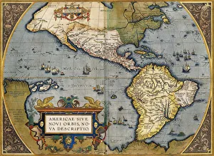
Background imageNavigational Equipment Collection: A Map of America, 1612 (hand-coloured engraving)

A Map of America, 1612 (hand-coloured engraving)
985976 A Map of America, 1612 (hand-coloured engraving) by Ortelius, Abraham (1527-98) (after); Private Collection; (add.info.: A Map of America. From Theatro d el Orbe de la Tierra)

Background imageNavigational Equipment Collection: A Map of Japan, 1769 (colour engraving)

A Map of Japan, 1769 (colour engraving)
985940 A Map of Japan, 1769 (colour engraving) by German School, (18th century); 42.5x29 cm; Private Collection; (add.info.: A Map of Japan)

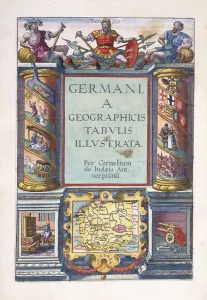
Background imageNavigational Equipment Collection: Title page to part 2, Germania geographicus tabulis illustrata

Title page to part 2, Germania geographicus tabulis illustrata
985891 Title page to part 2, Germania geographicus tabulis illustrata, 1593 (hand-coloured engraving) by Jode, Gerard de (1509-91); 41.7x30 cm; Private Collection; (add.info.: Title page to part 2)

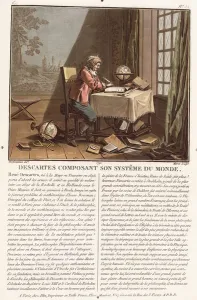
Background imageNavigational Equipment Collection: Descartes Composing His World System, c. 1786-1792 (colour aquatint)

Descartes Composing His World System, c. 1786-1792 (colour aquatint)
985865 Descartes Composing His World System, c.1786-1792 (colour aquatint) by Desfontaines, (fl.1800) (after); 32x22.5 cm; Private Collection; (add.info.: Descartes Composing His World System)

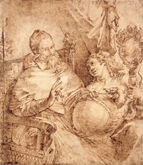
Background imageNavigational Equipment Collection: Portrait of Pope Gregory XIII, three-quarter length, Seated in an Armchair

Portrait of Pope Gregory XIII, three-quarter length, Seated in an Armchair
990018 Portrait of Pope Gregory XIII, three-quarter length, Seated in an Armchair, (pen and brown ink) by Passarotti, Bartolomeo (1529-92); 45.9x39.6 cm; Private Collection; (add.info)

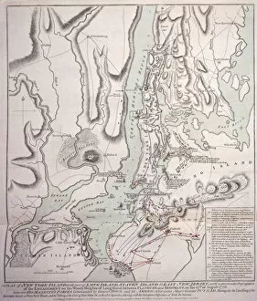
Background imageNavigational Equipment Collection: Plan of New York Island with Part of Long Island, Staten Island and East New Jersey

Plan of New York Island with Part of Long Island, Staten Island and East New Jersey
985783 Plan of New York Island with Part of Long Island, Staten Island and East New Jersey and the Engagement on the Woody Heights of Long Island between the British Forces

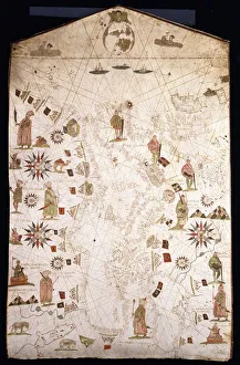
Background imageNavigational Equipment Collection: Portolan chart of the Mediterranean and Northern Europe, c

Portolan chart of the Mediterranean and Northern Europe, c
991250 Portolan chart of the Mediterranean and Northern Europe, c.1575-1600 (Illuminated manuscript on vellum) by Italian School

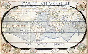
Background imageNavigational Equipment Collection: Carte Universelle (World Map), 1624 (ink and watercolour on vellum)

Carte Universelle (World Map), 1624 (ink and watercolour on vellum)
991249 Carte Universelle (World Map), 1624 (ink and watercolour on vellum) by French School, (17th century); 46.7x90.45 (approx.) cm; Private Collection; (add.info.: Carte Universelle (World Map)

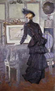
Background imageNavigational Equipment Collection: Daisy, Princess of Pless in the Artists Studio, 1907 (oil on canvas)

Daisy, Princess of Pless in the Artists Studio, 1907 (oil on canvas)
658891 Daisy, Princess of Pless in the Artists Studio, 1907 (oil on canvas) by Helleu, Paul Cesar (1859-1927); 118x73 cm; Private Collection; (add.info.: Daisy)

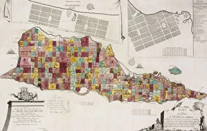
Background imageNavigational Equipment Collection: Tilforladelig Kort over Eglandet St. Croix udi America, Copenhagen, 1754

Tilforladelig Kort over Eglandet St. Croix udi America, Copenhagen, 1754
828371 Tilforladelig Kort over Eglandet St. Croix udi America, Copenhagen, 1754, 1754 (hand coloured engraving) by Unknown artist

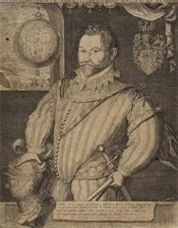
Background imageNavigational Equipment Collection: Portrait of Sir Francis Drake, (copper-engraving)

Portrait of Sir Francis Drake, (copper-engraving)
828370 Portrait of Sir Francis Drake, (copper-engraving) by Hondius, Jodocus (1567-1611); 38.7x30.5 cm; Private Collection; (add.info.: Portrait of Sir Francis Drake. Jodocus Hondius (1567-1611)

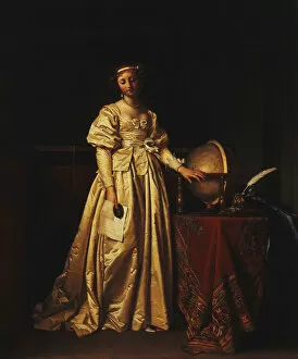
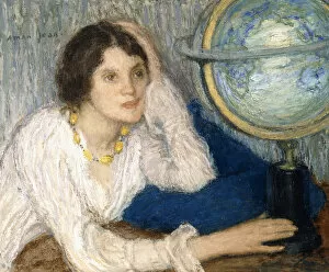
Background imageNavigational Equipment Collection: A Lady in an Interior, in a Yellow Satin Dress, with a Globe on a Table Beside her

A Lady in an Interior, in a Yellow Satin Dress, with a Globe on a Table Beside her
827642 A Lady in an Interior, in a Yellow Satin Dress, with a Globe on a Table Beside her, Mourning the Absence of her Husband, (oil on panel, unframed) by Gorp

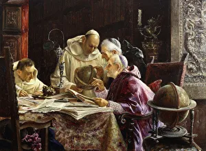
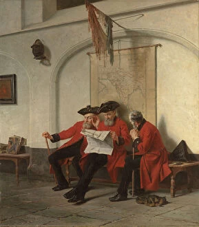
Background imageNavigational Equipment Collection: The Geographers, 1902 (oil on panel)

The Geographers, 1902 (oil on panel)
827221 The Geographers, 1902 (oil on panel) by Gallegos Arnosa, Jose (1859-1917); 22.9x30.5 cm; Private Collection; (add.info.: The Geographers. Jose Gallegos Y Arnosa (1859-1917). Oil on panel
Background imageNavigational Equipment Collection: Vignettes of the World from Grosser Atlas, 1725 (hand-coloured engraving)

Vignettes of the World from Grosser Atlas, 1725 (hand-coloured engraving)
986454 Vignettes of the World from Grosser Atlas, 1725 (hand-coloured engraving) by Homann, Johann Baptista (1663-1724); 43x34 cm; Private Collection; (add.info)

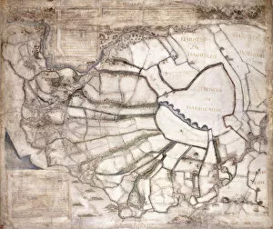
Background imageNavigational Equipment Collection: Map of the Seven Marshland Townships, after 1581 (manuscript on vellum, ink)

Map of the Seven Marshland Townships, after 1581 (manuscript on vellum, ink)
986262 Map of the Seven Marshland Townships, after 1581 (manuscript on vellum, ink) by English School, (16th century); 6.9x8.3 cm; Private Collection; (add.info)

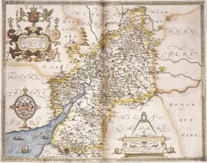
Background imageNavigational Equipment Collection: Gloucester(shire), 1579 (hand-coloured engraving)

Gloucester(shire), 1579 (hand-coloured engraving)
985997 Gloucester(shire), 1579 (hand-coloured engraving) by Saxton, Christopher (c.1542-c.1610); 41.5x55 cm; Private Collection; (add.info.: Gloucester(shire); Glocestriae

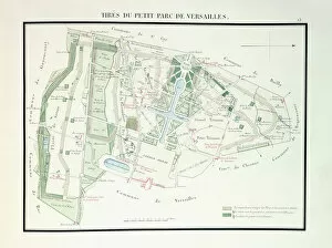
Background imageNavigational Equipment Collection: Map of the Small Park of Versailles, 1818-1819 (colour engraving)

Map of the Small Park of Versailles, 1818-1819 (colour engraving)
985937 Map of the Small Park of Versailles, 1818-1819 (colour engraving) by French School, (19th century); 17.3x11.5. cm; Private Collection; (add.info.: Map of the Small Park of Versailles)

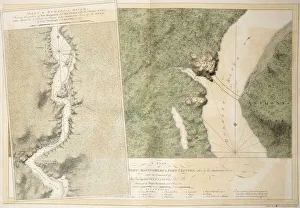
Background imageNavigational Equipment Collection: A plan of Fort Montgomery & Fort Clinton, 1774-1779 (hand coloured etching in various

A plan of Fort Montgomery & Fort Clinton, 1774-1779 (hand coloured etching in various
985889 A plan of Fort Montgomery & Fort Clinton, 1774-1779 (hand coloured etching in various watercolour tints) by English School

Background imageNavigational Equipment Collection: A chart of New York harbour, 1774-1779 (hand coloured etching tinted in sepia

A chart of New York harbour, 1774-1779 (hand coloured etching tinted in sepia
985888 A chart of New York harbour, 1774-1779 (hand coloured etching tinted in sepia, orange and red watercolou) by English School

Background imageNavigational Equipment Collection: Map of the world, 1744 (engraving)

Map of the world, 1744 (engraving)
985756 Map of the world, 1744 (engraving) by Seutter, Georg MatthAaus (1678-1757); Private Collection; (add.info.: Map of the world. From Atlas novus.... Georg Matthaus Seutter (1678-1757)

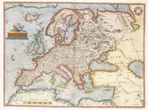
Background imageNavigational Equipment Collection: Map of Europe, 1587 (hand-coloured engraving)

Map of Europe, 1587 (hand-coloured engraving)
985729 Map of Europe, 1587 (hand-coloured engraving) by Ortelius, Abraham (1527-98) (after); 40.8x28.5 cm; Private Collection; (add.info.: Map of Europe)

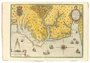
Background imageNavigational Equipment Collection: Map of Virginia showing the arrival of Sir Walter Raleighs expedition in 1585

Map of Virginia showing the arrival of Sir Walter Raleighs expedition in 1585
1195464 Map of Virginia showing the arrival of Sir Walter Raleighs expedition in 1585, 1590 (hand-coloured engraving) by White

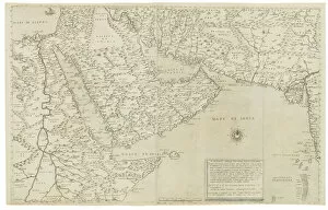
Background imageNavigational Equipment Collection: Map of India and Southeastern Asia; Il Disegno Della Terza Parte Dell Asia

Map of India and Southeastern Asia; Il Disegno Della Terza Parte Dell Asia
1195417 Map of India and Southeastern Asia; Il Disegno Della Terza Parte Dell Asia, 1561 (engraving) by Gastaldi, Giacomo (c.1500-66) (after); 48x73, 2 cm; Private Collection; (add.info.: Gastaldi)

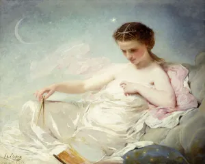
Background imageNavigational Equipment Collection: Personification of the Sciences, (oil on canvas)

Personification of the Sciences, (oil on canvas)
827423 Personification of the Sciences, (oil on canvas) by Chaplin, Charles Joshua (1825-91); 101.6x126 cm; Private Collection; (add.info.: Personification of the Sciences)

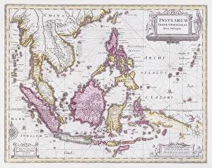
Background imageNavigational Equipment Collection: Map of China and Indonesia, c. 1710 (hand-coloured engraving)

Map of China and Indonesia, c. 1710 (hand-coloured engraving)
1195484 Map of China and Indonesia, c.1710 (hand-coloured engraving) by Schenk, Pieter (1660-1719) and Valk, Gerard (1651-1726); 53.7x63 cm; Private Collection; Photo eChristies Images; Dutch

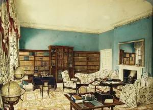
Background imageNavigational Equipment Collection: The Library, Binfield, Berkshire, (pencil, pen and grey ink

The Library, Binfield, Berkshire, (pencil, pen and grey ink
659240 The Library, Binfield, Berkshire, (pencil, pen and grey ink and watercolour heightened with white) by Hassell, Edward (fl.1827-52); 34x46.5 cm; Private Collection; (add.info.: The Library)

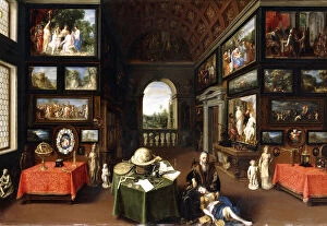
Background imageNavigational Equipment Collection: The Interior of a Picture Gallery with Personifications of Painting and Drawing, c

The Interior of a Picture Gallery with Personifications of Painting and Drawing, c
990290 The Interior of a Picture Gallery with Personifications of Painting and Drawing, c.1630 (oil on copper) by Flemish School

Background imageNavigational Equipment Collection: Portrait of the Artists Son with his Teacher, said to be the Artist Jean Baptiste de

Portrait of the Artists Son with his Teacher, said to be the Artist Jean Baptiste de
990311 Portrait of the Artists Son with his Teacher, said to be the Artist Jean Baptiste de Courtonne the Younger, in a Library, (oil on canvas) by Lajoue

Background imageNavigational Equipment Collection: 986455

986455

Background imageNavigational Equipment Collection: Globe, 1579 (gilt metal)

Globe, 1579 (gilt metal)
986450 Globe, 1579 (gilt metal) by Gerhard Mercator of Duisburg (15th century) (workshop of) (attr.to); 29.6x40 cm; Private Collection; (add.info.: Globe)

Background imageNavigational Equipment Collection: General Map of the whole of Europe, divided into its main countries

General Map of the whole of Europe, divided into its main countries
986324 General Map of the whole of Europe, divided into its main countries, 1782 (hand-coloured engraving.) by German School

Background imageNavigational Equipment Collection: Map of Africa, Arabia and India (double-page), 1695-1702 (hand-coloured engraving)

Map of Africa, Arabia and India (double-page), 1695-1702 (hand-coloured engraving)
986321 Map of Africa, Arabia and India (double-page), 1695-1702 (hand-coloured engraving) by Jaillot, Alexis-Hubert (1632-1712); 63x102

Background imageNavigational Equipment Collection: Map of Asia, 1786 (hand-coloured engraving)

Map of Asia, 1786 (hand-coloured engraving)
986319 Map of Asia, 1786 (hand-coloured engraving) by Desnos, Louis-Charles (c.1725-c.1800); 100x119 cm; Private Collection; (add.info.: Map of Asia; L Asie.... Louis-Charles Desnos (c.1725-c.1800)

Background imageNavigational Equipment Collection: Coloured map of Venice and its region, c. 1610 (watercolour on paper)

Coloured map of Venice and its region, c. 1610 (watercolour on paper)
986186 Coloured map of Venice and its region, c.1610 (watercolour on paper) by Sabbadino, Cristoforo (c.1487-1560); 41.5x57 cm; Private Collection; (add.info.: Coloured map of Venice and its region)

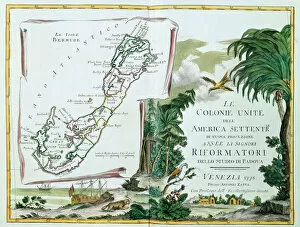
Background imageNavigational Equipment Collection: A Map of Bermuda, 1775-85 (hand coloured engraving)

A Map of Bermuda, 1775-85 (hand coloured engraving)
986112 A Map of Bermuda, 1775-85 (hand coloured engraving) by Italian School, (18th century); 17x13in cm; Private Collection; (add.info.: A Map of Bermuda; La Isole Bermude)

Background imageNavigational Equipment Collection: News from the Front, 1880 (oil on canvas)

News from the Front, 1880 (oil on canvas)
1772166 News from the Front, 1880 (oil on canvas) by Webb, Charles Meer (1830-1895); 91.5x80 cm; Private Collection; (add.info.: News from the Front. Charles Meer Webb (1830-1895). Oil on canvas

Background imageNavigational Equipment Collection: Miss Annie Harmsworth in an Interior, 1907 (oil on canvas)

Miss Annie Harmsworth in an Interior, 1907 (oil on canvas)
656927 Miss Annie Harmsworth in an Interior, 1907 (oil on canvas) by Orpen, William (1878-1931); Private Collection; (add.info.: Miss Annie Harmsworth in an Interior. Sir William Orpen (1878-1931)

Background imageNavigational Equipment Collection: A Map of Austria and Czechoslovakia, 1718 (hand-coloured engraving)

A Map of Austria and Czechoslovakia, 1718 (hand-coloured engraving)
1195489 A Map of Austria and Czechoslovakia, 1718 (hand-coloured engraving) by Pfantz, Gottfried (fl.1718); Private Collection; (add.info.: Pfantz)

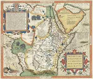
Background imageNavigational Equipment Collection: Map of Africa and the Arabian Peninsula, (hand-coloured engraving)

Map of Africa and the Arabian Peninsula, (hand-coloured engraving)
1195418 Map of Africa and the Arabian Peninsula, (hand-coloured engraving) by Ortelius, Abraham (1527-98) (after); 37x43, 5 cm; Private Collection; Photo eChristies Images; Flemish, out of copyright

Background imageNavigational Equipment Collection: View of the Madrid Escorial, c. 1662-5 (colour engraving)

View of the Madrid Escorial, c. 1662-5 (colour engraving)
1195401 View of the Madrid Escorial, c.1662-5 (colour engraving) by Dutch School, (17th century); 56x35.8 cm; Private Collection; Photo eChristies Images; Dutch, out of copyright

Background imageNavigational Equipment Collection: Le Beau Voyage, (oil on canvas)

Le Beau Voyage, (oil on canvas)
1196612 Le Beau Voyage, (oil on canvas) by Aman-Jean, Edmond-Francois (1858-1936); 72.5x59 cm; Private Collection; Photo eChristies Images; French, out of copyright

Background imageNavigational Equipment Collection: A View-Plan of Zurich, 1576 (woodcut)

A View-Plan of Zurich, 1576 (woodcut)
1195496 A View-Plan of Zurich, 1576 (woodcut) by Murer, Jos (1530-80) & Froschauer, Christoffel (c.1490-1564); 89x123 cm; Private Collection; (add.info.: Murer, Jos (1530-1580) & Froschower

Background imageNavigational Equipment Collection: Personification of Sculpture, (oil on canvas)

Personification of Sculpture, (oil on canvas)
990308 Personification of Sculpture, (oil on canvas) by Fragonard, Jean-Honore (1732-1806) (attr. to); 82x105 cm; Private Collection; (add.info.: Personification of Sculpture)

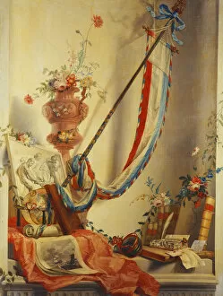
Background imageNavigational Equipment Collection: A Banner, Flowers in an Urn, a Relief, a Globe, a Print, a Compass, a Writing Set

A Banner, Flowers in an Urn, a Relief, a Globe, a Print, a Compass, a Writing Set
827864 A Banner, Flowers in an Urn, a Relief, a Globe, a Print, a Compass, a Writing Set, Letters and Blaeus Atlas in a Niche (oil on canvas) by Jager


All Professionally Made to Order for Quick Shipping

"Unveiling the Past: Navigational Equipment Guides Us Through History" Exploring ancient civilizations: An antique map of the Roman Empire reveals their vast territories and navigational prowess. Tracing Anglo-Saxon roots: Delve into history with an antique map showcasing Britain under the Anglo Saxons, a captivating glimpse into early English heritage. Byzantine marvels in ink: Step back in time as a 9th-century map of the Byzantine Empire unfolds its intricate details, guiding us through this remarkable era. Unraveling Liverpool's maritime legacy: A fascinating 19th-century antique map takes us on a journey through Liverpool and Birkenhead, England, offering insights into their rich nautical history. Ireland's enchanting landscapes mapped: Discover Ireland's allure through an exquisite antique map that showcases its diverse geography and invites exploration. Scottish Isles beckon adventurers: Embark on a virtual voyage to Jura, Mull, Argyll, Islay with a stunning 19th-century antique map that captures Scotland's rugged beauty. Charting New Zealand's discovery: Travel back to 1873 with an extraordinary antique map of New Zealand; witness how explorers navigated these uncharted lands centuries ago. The allure of vintage cartography continues: Immerse yourself in nostalgia with an enchanting vintage map of Magna Graecia - relish its timeless charm and historical significance. Island paradise revealed - Cyprus unveiled. Explore this Mediterranean gem as you trace your fingers across an alluringly detailed vintage map capturing Cyprus' unique essence. Saint Lucia whispers tales from yesteryears: Transport yourself to the Caribbean island paradise as you explore a mesmerizing 19th-century antique map depicting Saint Lucia’s vibrant past. The road less traveled across America awaits.