
Navigational Collection
"Discovering the Path: Navigational Wonders Across Time and Space" Embark on a journey through time and explore the fascinating world of navigation


All Professionally Made to Order for Quick Shipping
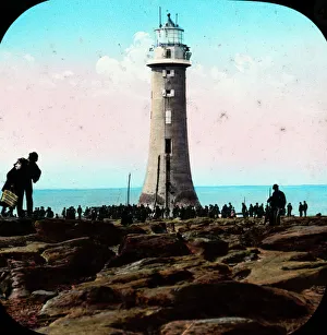
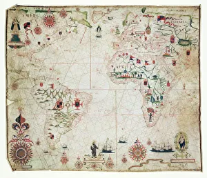
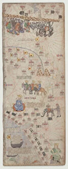
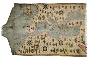
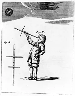
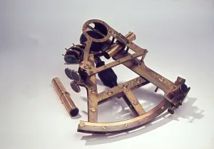
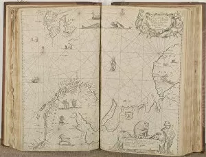
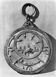
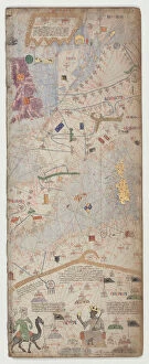
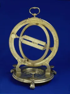
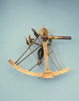
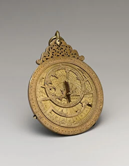
"Discovering the Path: Navigational Wonders Across Time and Space" Embark on a journey through time and explore the fascinating world of navigation. From Perch Rock Lighthouse to New Brighton Lighthouse, these beacons have guided countless sailors home. Travel back to the 17th century as you unravel the mysteries of nautical maps depicting the vast Atlantic. Marvel at their intricate details, showcasing early attempts to navigate treacherous waters. In Canada's Newfoundland, St. John's Inukshuk stands tall, mimicking human form and serving as a navigational aid for generations of travelers braving harsh terrains. Witness its silent guidance amidst rugged landscapes. Trace back to Ancient China where the compass was born—a revolutionary invention that transformed seafaring forever. Imagine sailors relying on this magnetic marvel to chart their course across uncharted waters. As dusk settles over Sunderland, England, witness a breathtaking sight—the row of houses illuminated by sunset with Roker Pier Lighthouse standing proudly in the distance. A picturesque scene blending natural beauty with navigational prowess. Step into aviation history with Boeing T-43A aircraft—an icon in aerial navigation training. These mighty machines honed pilots' skills and ensured safe journeys through skies filled with uncertainty. Delve into Captain John Treasure Jones Archive and discover his trusty sextant—a tool that enabled accurate celestial navigation during perilous voyages across vast oceans. An invaluable artifact preserving maritime heritage. Uncover stories behind Boeing CT-43A aircraft like 72-0288 or 71-1404—guardians of modern air travel equipped with advanced navigational systems ensuring seamless flights worldwide. Join us on this captivating voyage where lighthouses guide lost souls home, ancient tools shape our understanding of exploration, and cutting-edge technology propels us towards new horizons—navigating through time itself.