Fraud Blocker Skip to main content

Mediterranean Sea Collection (page 9)

The Mediterranean Sea, a timeless expanse of beauty and history, has witnessed the rise and fall of empires throughout the ages

Background imageMediterranean Sea Collection: France, Provence-Alpes-Cote d'Azur, Alpes-Maritimes (06), Nice: La Promenade des Anglais, 1885

France, Provence-Alpes-Cote d'Azur, Alpes-Maritimes (06), Nice: La Promenade des Anglais, 1885
LUX4706818 France, Provence-Alpes-Cote d'Azur, Alpes-Maritimes (06), Nice: La Promenade des Anglais, 1885; (add.info.: France, Provence-Alpes-Cote d'Azur, Alpes-Maritimes (06)

Background imageMediterranean Sea Collection: Chart of Mediterranean Sea, with part of the Black Sea, 1626 (vellum)

Chart of Mediterranean Sea, with part of the Black Sea, 1626 (vellum)
7340473 Chart of Mediterranean Sea, with part of the Black Sea, 1626 (vellum) by Oliva, Placido Caloiro e (c.1621-65); 68x43 cm; National Maritime Museum, London

Background imageMediterranean Sea Collection: Roman naval victory over Carthage at Mylae (Milazzo) during the First Punic War, 260 BC

Roman naval victory over Carthage at Mylae (Milazzo) during the First Punic War, 260 BC
NWI4859228 Roman naval victory over Carthage at Mylae (Milazzo) during the First Punic War, 260 BC. Colouring engraving of the 19th century.; (add.info)

Background imageMediterranean Sea Collection: Map of the Roman Empire in the 3rd century. The territory occupies North Africa

Map of the Roman Empire in the 3rd century. The territory occupies North Africa, the coasts of the Mediterranean Sea
NWI4857392 Map of the Roman Empire in the 3rd century. The territory occupies North Africa, the coasts of the Mediterranean Sea, Samarte country, Asia Minor, Near East, Gaul, Germany

Background imageMediterranean Sea Collection: Map of the Middle East (Middle East) in antiquity, birth of civilization

Map of the Middle East (Middle East) in antiquity, birth of civilization. We see the territories of: Egypt, Nubia
NWI4860542 Map of the Middle East (Middle East) in antiquity, birth of civilization. We see the territories of: Egypt, Nubia, Ethiopia, the Red Sea, Babylon, Phenicia, Tyre, Mesopotamia, Armenia

Background imageMediterranean Sea Collection: Geographic atlas: view of the Mediterranean Sea and the coasts of Barbaria (Algeria, Tunisia)

Geographic atlas: view of the Mediterranean Sea and the coasts of Barbaria (Algeria, Tunisia, Tripolitan)
JEB4874639 Geographic atlas: view of the Mediterranean Sea and the coasts of Barbaria (Algeria, Tunisia, Tripolitan). Atlas de Nicolas et Guillaume Sanson, 1670

Background imageMediterranean Sea Collection: View of the Port of La Ciotat in 1850 Painting by Emile Loubon (1809-1863)

View of the Port of La Ciotat in 1850 Painting by Emile Loubon (1809-1863) 1850 Dim 32x51 cm Musee Ciotaden, La ciotat
JEB4864872 View of the Port of La Ciotat in 1850 Painting by Emile Loubon (1809-1863) 1850 Dim 32x51 cm Musee Ciotaden, La ciotat; Musee Ciotaden, La Ciotat

Background imageMediterranean Sea Collection: Geographic map of the Middle East at the time of the Crusades. Lithography, 19th century

Geographic map of the Middle East at the time of the Crusades. Lithography, 19th century
NWI4876898 Geographic map of the Middle East at the time of the Crusades. Lithography, 19th century.; (add.info.: Geographic map of the Middle East at the time of the Crusades)

Background imageMediterranean Sea Collection: Geographic atlas: portulan or nautical map of the Mediterranean Sea and its coasts (Africa)

Geographic atlas: portulan or nautical map of the Mediterranean Sea and its coasts (Africa, Barbaria, Europe)
JEB4874843 Geographic atlas: portulan or nautical map of the Mediterranean Sea and its coasts (Africa, Barbaria, Europe, Middle East). Nautical chart, 1665

Background imageMediterranean Sea Collection: Port mediterraneen Painting a la gouache de Gamoisse. 18th century Sun. 23x34 cm Mandatory mention

Port mediterraneen Painting a la gouache de Gamoisse. 18th century Sun. 23x34 cm Mandatory mention
JEB4846923 Port mediterraneen Painting a la gouache de Gamoisse. 18th century Sun. 23x34 cm Mandatory mention: Collection foundation regards de Provence

Background imageMediterranean Sea Collection: View of the port of Marseille with Fort Saint Jean Painting by Theodore Gudin (1802-1880) 1828 Dim

View of the port of Marseille with Fort Saint Jean Painting by Theodore Gudin (1802-1880) 1828 Dim
JEB4912206 View of the port of Marseille with Fort Saint Jean Painting by Theodore Gudin (1802-1880) 1828 Dim. 36,7x49,4 cm Mandatory mention: Collection fondation regards de Provence

Background imageMediterranean Sea Collection: Les pecheurs de la Calanque Painting by Emmanuel Coulange-Lautrec (1824-1898)

Les pecheurs de la Calanque Painting by Emmanuel Coulange-Lautrec (1824-1898) 19th century Mandatory mention
JEB4902246 Les pecheurs de la Calanque Painting by Emmanuel Coulange-Lautrec (1824-1898) 19th century Mandatory mention: Collection foundation regards of Provence

Background imageMediterranean Sea Collection: Marseille, view of the Madrague Watercolour by Berthe Girard (19th century) 1860 Mandatory mention

Marseille, view of the Madrague Watercolour by Berthe Girard (19th century) 1860 Mandatory mention
JEB4910872 Marseille, view of the Madrague Watercolour by Berthe Girard (19th century) 1860 Mandatory mention: Collection fondation regards de Provence, Marseille; Musee Regards de Provence

Background imageMediterranean Sea Collection: Allegory of the British Empire as the Colossus of Rhodes, 19th century

Allegory of the British Empire as the Colossus of Rhodes, 19th century
CUL4940269 Allegory of the British Empire as the Colossus of Rhodes, 19th century; (add.info.: Il Colosso di Rodi. Allegory of the British Empire as the 'Colossus of Rhodes" monitoring)

Background imageMediterranean Sea Collection: Reis of Barbary, Ottoman naval captain. Illustration From Francois Pouqueville (1770-1838)

Reis of Barbary, Ottoman naval captain. Illustration From Francois Pouqueville (1770-1838), Travels through More
FLO4721813 Reis of Barbary, Ottoman naval captain. Illustration From Francois Pouqueville (1770-1838), Travels through More, Albania and several other parts of the Ottoman Empire, 1805

Background imageMediterranean Sea Collection: France, Provence-Alpes-Cote d'Azur, Alpes-Maritimes (06), Villefranche sur Mer

France, Provence-Alpes-Cote d'Azur, Alpes-Maritimes (06), Villefranche sur Mer (Villefranche-sur-Mer)
LUX4720483 France, Provence-Alpes-Cote d'Azur, Alpes-Maritimes (06), Villefranche sur Mer (Villefranche-sur-Mer): the squadron harbour, 1885; (add.info.: France, Provence-Alpes-Cote d'Azur)

Background imageMediterranean Sea Collection: Algeria, Cap Tenes: animated view. The beach with customs office, cabins and fishing boats, 1900

Algeria, Cap Tenes: animated view. The beach with customs office, cabins and fishing boats, 1900
LUX4766764 Algeria, Cap Tenes: animated view. The beach with customs office, cabins and fishing boats, 1900; (add.info.: Algeria, Cap Tenes: animated view)

Background imageMediterranean Sea Collection: First World War: France, Patriotic Map showing the capture of the dardanelles by the French army

First World War: France, Patriotic Map showing the capture of the dardanelles by the French army, 1915
LUX4742817 First World War: France, Patriotic Map showing the capture of the dardanelles by the French army, 1915; (add.info.: First World War - War 14-18 (1914-1918) - World War I (WWI or WW1)

Background imageMediterranean Sea Collection: Map of Corsica, c.1900 (engraving)

Map of Corsica, c.1900 (engraving)
533290 Map of Corsica, c.1900 (engraving); (add.info.: Map of Corsica, France, circa 1902, from the 10th edition of Encyclopaedia Britannica.); Encyclopaedia Britannica/UIG.

Background imageMediterranean Sea Collection: Map of the Nile Delta and Suez Canal, c.1900 (engraving)

Map of the Nile Delta and Suez Canal, c.1900 (engraving)
533396 Map of the Nile Delta and Suez Canal, c.1900 (engraving); (add.info.: Map of Nile Delta and Suez Canal, Egypt, circa 1902)

Background imageMediterranean Sea Collection: Map of France, c.1900 (engraving)

Map of France, c.1900 (engraving)
532946 Map of France, c.1900 (engraving); (add.info.: Map of France with inset map of Vicinity of Marseille and the Mediterranean Coast of France, and Corsica, circa 1902)

Background imageMediterranean Sea Collection: Map of Turkey in 1914 (litho)

Map of Turkey in 1914 (litho)
8661161 Map of Turkey in 1914 (litho) by English School, (20th century); Private Collection; (add.info.: Map of Turkey in 1914)

Background imageMediterranean Sea Collection: View of the city and the bay of Smyrna (present-day Izmir, Turkey)

View of the city and the bay of Smyrna (present-day Izmir, Turkey). Lithography (30.5x48 cm), de Havil, 1818
MMM5483784 View of the city and the bay of Smyrna (present-day Izmir, Turkey). Lithography (30.5x48 cm), de Havil, 1818.; National Maritime Museum, London

Background imageMediterranean Sea Collection: View of the western part of Porto Ferrajo Bay (Portoferraio, Elba Island, Italy)

View of the western part of Porto Ferrajo Bay (Portoferraio, Elba Island, Italy)
MMM5483776 View of the western part of Porto Ferrajo Bay (Portoferraio, Elba Island, Italy). Lithography (34.1x52.5 cm) by James Weir, 1814.; National Maritime Museum, London

Background imageMediterranean Sea Collection: Map of Asia Minor, showing the expedition of Cyrus the Younger and retreat of the Ten Thousand

Map of Asia Minor, showing the expedition of Cyrus the Younger and retreat of the Ten Thousand
6867235 Map of Asia Minor, showing the expedition of Cyrus the Younger and retreat of the Ten Thousand. From Cassell's Universal History

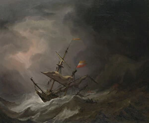
Background imageMediterranean Sea Collection: A Mediterranean Brigantine Drifting Onto a Rocky Coast in a Storm, c.1700 (oil on canvas)

A Mediterranean Brigantine Drifting Onto a Rocky Coast in a Storm, c.1700 (oil on canvas)
7342589 A Mediterranean Brigantine Drifting Onto a Rocky Coast in a Storm, c.1700 (oil on canvas) by Velde, Willem van de, the Younger (1633-1707); 63.5x76.2 cm; National Maritime Museum, London

Background imageMediterranean Sea Collection: Chart of the Mediterrean, Black and Caspian Seas, c.1600 (manuscript)

Chart of the Mediterrean, Black and Caspian Seas, c.1600 (manuscript)
7339791 Chart of the Mediterrean, Black and Caspian Seas, c.1600 (manuscript) by Unknown Artist, (17th century); 47x35 cm; National Maritime Museum, London

Background imageMediterranean Sea Collection: Chart of Mediterranean, Black and Caspian Seas, 16th century, 1569 (coloured engraving)

Chart of Mediterranean, Black and Caspian Seas, 16th century, 1569 (coloured engraving)
7339549 Chart of Mediterranean, Black and Caspian Seas, 16th century, 1569 (coloured engraving) by Forlani, Paolo (fl.1560-74); 48x81 cm; National Maritime Museum, London

Background imageMediterranean Sea Collection: General chart of the Mediterranean Sea including the Gulf of Venice, Archipelago

General chart of the Mediterranean Sea including the Gulf of Venice, Archipelago
7339360 General chart of the Mediterranean Sea including the Gulf of Venice, Archipelago and part of the Black Sea with the steampacket routes, 1846 (coloured engraving) by Wyld

Background imageMediterranean Sea Collection: Vavassore chart of the Mediterranean Sea, believed to be the earliest surviving printed chart

Vavassore chart of the Mediterranean Sea, believed to be the earliest surviving printed chart, 1541 (woodcut)
7339448 Vavassore chart of the Mediterranean Sea, believed to be the earliest surviving printed chart, 1541 (woodcut) by Vavassore, Giovanni Andrea (fl.1518-72); 27x76 cm; National Maritime Museum

Background imageMediterranean Sea Collection: Spanish engagement with Barbary pirates, early to mid 17th century (oil painting)

Spanish engagement with Barbary pirates, early to mid 17th century (oil painting)
7337736 Spanish engagement with Barbary pirates, early to mid 17th century (oil painting) by Eertvelt, Andries van (1590-1652); 53.3x71.1 cm; National Maritime Museum, London

Background imageMediterranean Sea Collection: Cartography, 17th century. map of the Mediterranean Sea Nautical Atlas by Francesco Oliva

Cartography, 17th century. map of the Mediterranean Sea Nautical Atlas by Francesco Oliva, 1658 (map)
AIS5350421 Cartography, 17th century. map of the Mediterranean Sea Nautical Atlas by Francesco Oliva, 1658 (map); Museu Maritim Atarazanas, Barcelona, Catalunya, Spain; © Iberfoto.

Background imageMediterranean Sea Collection: Cartography, 16th century. Map of the Mediterranean Sea, from a portolan chart by Pietro Russo

Cartography, 16th century. Map of the Mediterranean Sea, from a portolan chart by Pietro Russo, Messina, 1508 (map)
AIS5350346 Cartography, 16th century. Map of the Mediterranean Sea, from a portolan chart by Pietro Russo, Messina, 1508 (map); Museu Maritim Atarazanas, Barcelona, Catalunya, Spain; © Iberfoto.

Background imageMediterranean Sea Collection: View of the promenade by the sea. Photograph by Adolphe Terris. 19th century

View of the promenade by the sea. Photograph by Adolphe Terris. 19th century. Departmental Archives, Marseille
JEB4858387 View of the promenade by the sea. Photograph by Adolphe Terris. 19th century. Departmental Archives, Marseille; (add.info.: View of the promenade by the sea. Photograph by Adolphe Terris)

Background imageMediterranean Sea Collection: Empire of Arab Caliphs, mid-8th century. 19th century lithography

Empire of Arab Caliphs, mid-8th century. 19th century lithography
NWI4877446 Empire of Arab Caliphs, mid-8th century. 19th century lithography.; (add.info.: Empire of Arab Caliphs, mid-8th century. 19th century lithography.); Photo © North Wind Pictures.

Background imageMediterranean Sea Collection: Geographic atlas: detail of Augustin Roussin's portulan representing the coasts of Tunisia, 1630

Geographic atlas: detail of Augustin Roussin's portulan representing the coasts of Tunisia, 1630
JEB4874870 Geographic atlas: detail of Augustin Roussin's portulan representing the coasts of Tunisia, 1630. Municipal library of Marseille.; (add.info.: Geographic atlas)

Background imageMediterranean Sea Collection: Rock of Gibraltar occupied by the troops of the British army at the beginning of the 18th century

Rock of Gibraltar occupied by the troops of the British army at the beginning of the 18th century
NWI4869347 Rock of Gibraltar occupied by the troops of the British army at the beginning of the 18th century. Colour engraving of the 19th century; (add.info)

Background imageMediterranean Sea Collection: Geographic map showing the expansion of the Roman Empire. Colouring engraving from the 19th century

Geographic map showing the expansion of the Roman Empire. Colouring engraving from the 19th century
NWI4863016 Geographic map showing the expansion of the Roman Empire. Colouring engraving from the 19th century.; (add.info.: Geographic map showing the expansion of the Roman Empire)

Background imageMediterranean Sea Collection: Fishing for sea turtles in mediterranean sea. Late 19th century (chromolithograph)

Fishing for sea turtles in mediterranean sea. Late 19th century (chromolithograph)
ELD4848669 Fishing for sea turtles in mediterranean sea. Late 19th century (chromolithograph).; Private Collection; Photo © The Holbarn Archive.

Background imageMediterranean Sea Collection: France, Rhone-Alpes, Rhone (69), Villefranche: warships at anchorage in the harbor, 1880

France, Rhone-Alpes, Rhone (69), Villefranche: warships at anchorage in the harbor, 1880
LUX4716009 France, Rhone-Alpes, Rhone (69), Villefranche: warships at anchorage in the harbor, 1880; (add.info.: France, Rhone-Alpes, Rhone (69), Villefranche: warships at anchorage in the harbor

Background imageMediterranean Sea Collection: View of the salettes in Carqueiranne, Var - postcard 1910

View of the salettes in Carqueiranne, Var - postcard 1910
ELD4952048 View of the salettes in Carqueiranne, Var - postcard 1910; Private Collection; (add.info.: View of the salettes in Carqueiranne, Var - postcard 1910); Photo © The Holbarn Archive.

Background imageMediterranean Sea Collection: Algerie, Algiers: the dock with the docks, animated view with tram Hussein Bey

Algerie, Algiers: the dock with the docks, animated view with tram Hussein Bey
LUX4766594 Algerie, Algiers: the dock with the docks, animated view with tram Hussein Bey, travelling merchant Felayo and on the quay of the wine barrels, 1900 - tram Hussein Bey

Background imageMediterranean Sea Collection: Algeria, Algiers: The port, military boat, Latin sailing boats and the Kasbah

Algeria, Algiers: The port, military boat, Latin sailing boats and the Kasbah, 1900 - Lithography Jourdan, Store 4
LUX4766544 Algeria, Algiers: The port, military boat, Latin sailing boats and the Kasbah, 1900 - Lithography Jourdan, Store 4, Place du gouvernement. Typography Jourdan, Peninsular Havraise, Biere E

Background imageMediterranean Sea Collection: Greece, Crete, Candie: English sector, general view of the harbour with sailboats

Greece, Crete, Candie: English sector, general view of the harbour with sailboats and boats - On the wharf, a shipyard
LUX4762850 Greece, Crete, Candie: English sector, general view of the harbour with sailboats and boats - On the wharf, a shipyard, 1908 - trade: eastern telegraph; (add.info.: Greece, Crete)

Background imageMediterranean Sea Collection: France, Provence-Alpes-Cote d'Azur, Alpes-Maritimes (06), Nice: the port, general view with warship

France, Provence-Alpes-Cote d'Azur, Alpes-Maritimes (06), Nice: the port, general view with warship
LUX4763244 France, Provence-Alpes-Cote d'Azur, Alpes-Maritimes (06), Nice: the port, general view with warship, cargo and fishing boat, 1900; (add.info.: France, Provence-Alpes-Cote d'Azur)

Background imageMediterranean Sea Collection: Algerie, Maghreb, Algiers: general view of the harbour with a quay

Algerie, Maghreb, Algiers: general view of the harbour with a quay, a steam room with two chiminees and fishing boats
LUX4763788 Algerie, Maghreb, Algiers: general view of the harbour with a quay, a steam room with two chiminees and fishing boats, 1900 - fishing boats: AL 1639, AL 151, Antoine; (add.info.: Algerie)

Background imageMediterranean Sea Collection: France, Provence-Alpes-Cote d'Azur, Alpes-Maritimes (06), Nice: casino de la jetee, 1900

France, Provence-Alpes-Cote d'Azur, Alpes-Maritimes (06), Nice: casino de la jetee, 1900
LUX4787304 France, Provence-Alpes-Cote d'Azur, Alpes-Maritimes (06), Nice: casino de la jetee, 1900; (add.info.: France, Provence-Alpes-Cote d'Azur, Alpes-Maritimes (06)

Background imageMediterranean Sea Collection: French soldiers pose next to a cannon waiting for debarkage, 1918

French soldiers pose next to a cannon waiting for debarkage, 1918
LUX4816163 French soldiers pose next to a cannon waiting for debarkage, 1918; (add.info.: French soldiers pose next to a cannon waiting for debarkage, 1918); Photo © Lux-in-Fine.


All Professionally Made to Order for Quick Shipping

The Mediterranean Sea, a timeless expanse of beauty and history, has witnessed the rise and fall of empires throughout the ages. As we explore its rich tapestry through various maps and lithographs, we are transported to different eras that have shaped our world. Let's begin our journey with a Map of Cyprus from 1880, revealing the island's strategic location in the heart of this ancient sea. It serves as a gateway to Apostle Paul's Missionary Journeys depicted in an 1886 lithograph. These journeys spread Christianity across lands touched by the Mediterranean's gentle waves. Moving forward in time, we encounter a Map of the Byzantine Empire in the 9th Century. This empire once dominated these shores with its grandeur and influence. Further west lies Portugal on another map, reminding us of their maritime prowess during Europe's Age of Exploration. As we delve deeper into history, Medieval Europe at the start of the Crusades comes alive before us. The clash between East and West reverberates across these waters as kingdoms vie for control amidst religious fervor. Sicily unveils itself through a map from 1895 – an island steeped in diverse cultures due to its strategic position within this sea. Ancient Palestine emerges next with maps showcasing kingdoms like Judah and Israel; lands where stories from biblical times unfolded against this breathtaking backdrop. Greece takes center stage as we witness it at the beginning of one of history's most famous conflicts -the Peloponnesian War (431-404 BC). City-states battle for supremacy while leaving an indelible mark on Western civilization. A View of Old Town City Dubrovnik captures our attention next; its medieval walls standing strong against time’s relentless march. This Croatian gem reminds us how coastal cities flourished along these shores since antiquity.