Fraud Blocker Skip to main content

Meadow Walk Collection

"Discover the Serenity of Meadow Walk

Background imageMeadow Walk Collection: Sutton SM6 7 Map

Sutton SM6 7 Map
Postcode Sector Map of Sutton SM6 7

Background imageMeadow Walk Collection: East Hertfordshire SG11 1 Map

East Hertfordshire SG11 1 Map
Postcode Sector Map of East Hertfordshire SG11 1

Background imageMeadow Walk Collection: Central Bedfordshire SG16 6 Map

Central Bedfordshire SG16 6 Map
Postcode Sector Map of Central Bedfordshire SG16 6

Background imageMeadow Walk Collection: Malvern Hills WR13 6 Map

Malvern Hills WR13 6 Map
Postcode Sector Map of Malvern Hills WR13 6

Background imageMeadow Walk Collection: Wakefield WF9 2 Map

Wakefield WF9 2 Map
Postcode Sector Map of Wakefield WF9 2

Background imageMeadow Walk Collection: Wakefield WF9 1 Map

Wakefield WF9 1 Map
Postcode Sector Map of Wakefield WF9 1

Background imageMeadow Walk Collection: Rotherham S66 8 Map

Rotherham S66 8 Map
Postcode Sector Map of Rotherham S66 8

Background imageMeadow Walk Collection: Stockton-on-Tees TS21 1 Map

Stockton-on-Tees TS21 1 Map
Postcode Sector Map of Stockton-on-Tees TS21 1

Background imageMeadow Walk Collection: Pembrokeshire SA61 2 Map

Pembrokeshire SA61 2 Map
Postcode Sector Map of Pembrokeshire SA61 2

Background imageMeadow Walk Collection: Barking and Dagenham RM9 5 Map

Barking and Dagenham RM9 5 Map
Postcode Sector Map of Barking and Dagenham RM9 5

Background imageMeadow Walk Collection: Wokingham RG41 2 Map

Wokingham RG41 2 Map
Postcode Sector Map of Wokingham RG41 2

Background imageMeadow Walk Collection: South Buckinghamshire SL8 5 Map

South Buckinghamshire SL8 5 Map
Postcode Sector Map of South Buckinghamshire SL8 5

Background imageMeadow Walk Collection: South Holland PE12 6 Map

South Holland PE12 6 Map
Postcode Sector Map of South Holland PE12 6

Background imageMeadow Walk Collection: West Oxfordshire OX20 1 Map

West Oxfordshire OX20 1 Map
Postcode Sector Map of West Oxfordshire OX20 1

Background imageMeadow Walk Collection: Sussex PO22 6 Map

Sussex PO22 6 Map
Postcode Sector Map of Sussex PO22 6

Background imageMeadow Walk Collection: Hampshire PO13 0 Map

Hampshire PO13 0 Map
Postcode Sector Map of Hampshire PO13 0

Background imageMeadow Walk Collection: Monmouthshire NP16 5 Map

Monmouthshire NP16 5 Map
Postcode Sector Map of Monmouthshire NP16 5

Background imageMeadow Walk Collection: East Northamptonshire NN10 8 Map

East Northamptonshire NN10 8 Map
Postcode Sector Map of East Northamptonshire NN10 8

Background imageMeadow Walk Collection: Maidstone ME15 7 Map

Maidstone ME15 7 Map
Postcode Sector Map of Maidstone ME15 7

Background imageMeadow Walk Collection: Tonbridge and Malling ME6 5 Map

Tonbridge and Malling ME6 5 Map
Postcode Sector Map of Tonbridge and Malling ME6 5

Background imageMeadow Walk Collection: North Lanarkshire ML5 3 Map

North Lanarkshire ML5 3 Map
Postcode Sector Map of North Lanarkshire ML5 3

Background imageMeadow Walk Collection: Leeds LS7 4 Map

Leeds LS7 4 Map
Postcode Sector Map of Leeds LS7 4

Background imageMeadow Walk Collection: West Lindsey LN1 2 Map

West Lindsey LN1 2 Map
Postcode Sector Map of West Lindsey LN1 2

Background imageMeadow Walk Collection: Suffolk Coastal IP12 4 Map

Suffolk Coastal IP12 4 Map
Postcode Sector Map of Suffolk Coastal IP12 4

Background imageMeadow Walk Collection: Epsom and Ewell KT19 0 Map

Epsom and Ewell KT19 0 Map
Postcode Sector Map of Epsom and Ewell KT19 0

Background imageMeadow Walk Collection: Reigate and Banstead KT20 7 Map

Reigate and Banstead KT20 7 Map
Postcode Sector Map of Reigate and Banstead KT20 7

Background imageMeadow Walk Collection: Wycombe HP10 8 Map

Wycombe HP10 8 Map
Postcode Sector Map of Wycombe HP10 8

Background imageMeadow Walk Collection: Suffolk Coastal IP17 1 Map

Suffolk Coastal IP17 1 Map
Postcode Sector Map of Suffolk Coastal IP17 1

Background imageMeadow Walk Collection: East Hampshire GU33 7 Map

East Hampshire GU33 7 Map
Postcode Sector Map of East Hampshire GU33 7

Background imageMeadow Walk Collection: East Riding of Yorkshire HU14 3 Map

East Riding of Yorkshire HU14 3 Map
Postcode Sector Map of East Riding of Yorkshire HU14 3

Background imageMeadow Walk Collection: Gloucester GL16 8 Map

Gloucester GL16 8 Map
Postcode Sector Map of Gloucester GL16 8

Background imageMeadow Walk Collection: Redbridge E18 2 Map

Redbridge E18 2 Map
Postcode Sector Map of Redbridge E18 2

Background imageMeadow Walk Collection: Dartford DA2 7 Map

Dartford DA2 7 Map
Postcode Sector Map of Dartford DA2 7

Background imageMeadow Walk Collection: Doncaster DN3 2 Map

Doncaster DN3 2 Map
Postcode Sector Map of Doncaster DN3 2

Background imageMeadow Walk Collection: Kent CT5 4 Map

Kent CT5 4 Map
Postcode Sector Map of Kent CT5 4

Background imageMeadow Walk Collection: Wirral CH61 6 Map

Wirral CH61 6 Map
Postcode Sector Map of Wirral CH61 6

Background imageMeadow Walk Collection: Rhondda Cynon Taf CF41 7 Map

Rhondda Cynon Taf CF41 7 Map
Postcode Sector Map of Rhondda Cynon Taf CF41 7

Background imageMeadow Walk Collection: Bridgend CF31 2 Map

Bridgend CF31 2 Map
Postcode Sector Map of Bridgend CF31 2

Background imageMeadow Walk Collection: Cambridge CB21 6 Map

Cambridge CB21 6 Map
Postcode Sector Map of Cambridge CB21 6

Background imageMeadow Walk Collection: Bolton BL4 9 Map

Bolton BL4 9 Map
Postcode Sector Map of Bolton BL4 9

Background imageMeadow Walk Collection: Bradford BD2 1 Map

Bradford BD2 1 Map
Postcode Sector Map of Bradford BD2 1

Background imageMeadow Walk Collection: Sandwell B64 7 Map

Sandwell B64 7 Map
Postcode Sector Map of Sandwell B64 7

Background imageMeadow Walk Collection: UK Maps, AB Aberdeen, AB42 4

UK Maps, AB Aberdeen, AB42 4
AB42 4

Background imageMeadow Walk Collection: St Albans AL5 5 Map

St Albans AL5 5 Map
Postcode Sector Map of St Albans AL5 5


All Professionally Made to Order for Quick Shipping

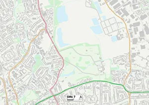
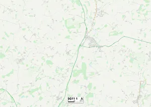
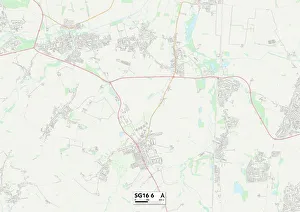
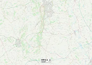
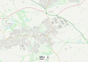
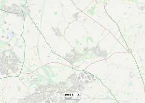
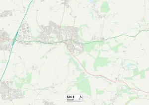
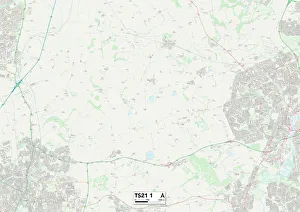
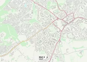
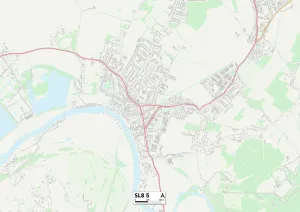
"Discover the Serenity of Meadow Walk: Exploring Nature's Beauty Across Multiple Locations" Embark on a picturesque journey through lush meadows and enchanting landscapes with Meadow Walk. With locations spanning across Sutton SM6 7, East Hertfordshire SG11 1, Central Bedfordshire SG16 6, Malvern Hills WR13 6, Wakefield WF9 2 and WF9 1, Rotherham S66 8, Stockton-on-Tees TS21 1, Pembrokeshire SA61 2, Barking and Dagenham RM9 5, Wokingham RG41 2 and South Buckinghamshire SL8 5; this captivating experience awaits nature enthusiasts. In Sutton SM6 7 Map lies an idyllic meadow walk that will transport you to a world of tranquility. Immerse yourself in the beauty of East Hertfordshire SG11 Map as you stroll along its scenic paths adorned with vibrant wildflowers. Central Bedfordshire SG16 Map offers breathtaking views that are sure to leave you in awe. Venture into the mesmerizing landscapes of Malvern Hills WR13 Map where rolling hills meet sprawling meadows - a sight to behold. Wakefield WF9 Maps beckon explorers with their hidden gems waiting to be discovered amidst nature's embrace. Rotherham S66 Map invites visitors for an unforgettable journey through its charming countryside trails while Stockton-on-Tees TS21 Map promises an escape from the hustle and bustle into serene surroundings. Pembrokeshire SA61 Map boasts stunning coastal walks that offer both peace and adventure. Barking and Dagenham RM9 Map is home to delightful green spaces perfect for leisurely strolls or picnics amidst nature's bounty. Wokingham RG41 Maps invite residents and tourists alike to unwind in their tranquil settings while South Buckinghamshire SL8 Maps showcase natural wonders at every turn.