Fraud Blocker Skip to main content

Mapped Collection (page 5)

"Exploring the Depths and Heights: Mapped Wonders of Earth, Mars, and Beyond" Earth's vastness unfolds in intricate detail through topographic and bathymetric maps

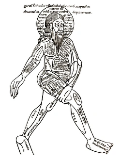
Background imageMapped Collection: Map of diseases, 15th century diagram

Map of diseases, 15th century diagram
Map of diseases. 15th century diagram with Latin text illustrating which diseases commonly afflict specific parts of the body

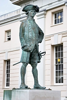
Background imageMapped Collection: Captain James Cook, British explorer

Captain James Cook, British explorer
Captain James Cook (1728-1779), British explorer, navigator and cartographer. Captain James Cook first served in the British merchant navy as a teenager and joined the Royal Navy in 1755

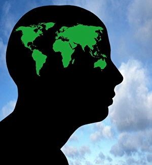
Background imageMapped Collection: Global thought, conceptual image

Global thought, conceptual image
Global consciousness, conceptual image. Map of the Earths continents inside the silhouette of a human head. This could represent humans thinking about global issues such as global warming

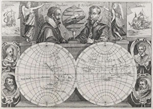
Background imageMapped Collection: Circumnavigators, 16th to 17th century

Circumnavigators, 16th to 17th century
34536a

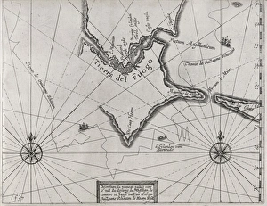
Background imageMapped Collection: Schouten rounding Cape Horn, 1616

Schouten rounding Cape Horn, 1616

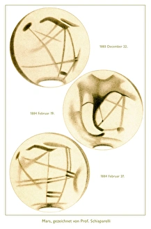
Background imageMapped Collection: Martian canals, historical artwork

Martian canals, historical artwork
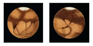
Giovanni Schiaparellis sketches of planet Mars in 1883 and 1884. The dark triangle was called Syrtis Mayor, white appears the polar cap of the south

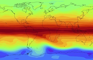
Background imageMapped Collection: Global methane concentration, 2004

Global methane concentration, 2004
Global methane concentration. Map showing the concentration of methane (CH4) gas in the stratosphere (about 10-50 kilometres in altitude) on 25th July 2004

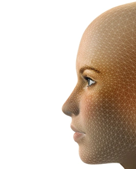
Background imageMapped Collection: Facemapping, artwork

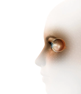
Facemapping, artwork
Facemapping. Computer artwork of a grid system layered over a human face in order to create a digitised version of it

Background imageMapped Collection: Biometric recognition, conceptual artwork

Biometric recognition, conceptual artwork
Biometric recognition, conceptual computer artwork

Background imageMapped Collection: Sredinnyy Khrebet volcanoes, radar image

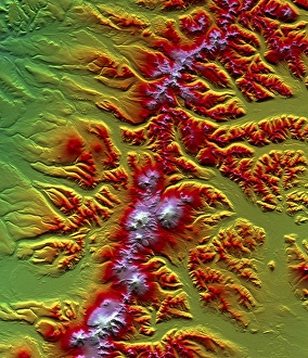
Sredinnyy Khrebet volcanoes, radar image
Sredinnyy Khrebet volcanoes. Coloured three- dimensional computer map of the Sredinnyy Khrebet volcanoes in Kamchatka Peninsula, Russia. North is at top

Background imageMapped Collection: Schiaparellis map of Mars, 1877-1888

Schiaparellis map of Mars, 1877-1888
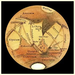
Schiaparellis map of Mars. This drawing of the two hemispheres of Mars was made by the Italian astronomer Giovanni Schiaparelli (1835-1910) between the years 1877 and 1888

Background imageMapped Collection: Schiaparellis map of Mars, 1882-1888

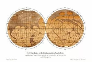
Schiaparellis map of Mars, 1882-1888
Schiaparellis map of Mars. This drawing of the two hemispheres of Mars was made by the Italian astronomer Giovanni Schiaparelli (1835-1910) between the years 1882 and 1888

Background imageMapped Collection: Schiaparellis map of Mars, 1879

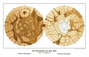
Schiaparellis map of Mars, 1879
Schiaparellis map of Mars. This drawing of the southern (left) and northern (right) hemipsheres of Mars was made in 1879 by the Italian astronomer Giovanni Schiaparelli (1835-1910)

Background imageMapped Collection: Earth, topographic and bathymetric map

Earth, topographic and bathymetric map. Computer generated image showing the varying heights and depths of the Worlds landmasses, oceans and seas

Background imageMapped Collection: Schiaparellis observations of Mercury

Schiaparellis observations of Mercury. This drawing was made by the Italian astronomer Giovanni Schiaparelli (1835-1910). In the 1880s he mapped the planet more accurately

Background imageMapped Collection: Schiaparellis observations of Mars

Schiaparellis observations of Mars. This drawing was made by the Italian astronomer Giovanni Schiaparelli (1835-1910). His most detailed observations were made between 1877 and 1888

Background imageMapped Collection: Lowells observations of Mars

Lowells observations of Mars. Percival Lowell (1855-1916) was a US astronomer who was one of the proponents of the theory that the straight lines some observers saw on Mars were canals

Background imageMapped Collection: Beyers observations of Mars

Beyers observations of Mars. Six dated and labelled observations of Mars made during the opposition of 1924 by M. Beyer of the Hamburg Bergedorf Observatory, Germany

Background imageMapped Collection: Geothermal mapping, USA

Geothermal mapping, USA. Map of the USA, showing the temperature at a depth of six kilometres below the surface. This shows areas with a high potential for boreholes to be drilled to those depths

Background imageMapped Collection: Geothermal mapping, Iceland

Geothermal mapping, Iceland. Map of iceland, showing the temperature at a depth of two kilometres below the surface. This shows areas with a high potential for boreholes to be drilled to those

Background imageMapped Collection: Geothermal mapping, Europe

Geothermal mapping, Europe. Map of Europe, showing the temperature at a depth of five kilometres below the surface. This shows areas with a high potential for boreholes to be drilled to those depths

Background imageMapped Collection: JOHN RAE 1813 - 1893

JOHN RAE 1813 - 1893
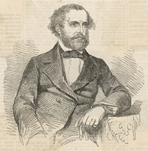
JOHN RAE Scottish explorer. Went on several Polar exploring expeditions, and mapped 1400 miles of the Canadian coast

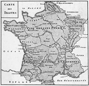
Background imageMapped Collection: Fermes of France

Fermes of France
The fermes or taxation districts of France, as mapped in Neckers Compte rendu au Roi prepared for Louis XVI

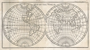
Background imageMapped Collection: Maps / World, Late C18

Maps / World, Late C18
Earths globe still far from completely mapped - note how North America and Australia fade away

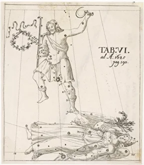
Background imageMapped Collection: COMET 1685

COMET 1685
Comets seen at Rome by Francesco Blanchino between June and July 1685 and mapped out in this Latin language German scientific journal


All Professionally Made to Order for Quick Shipping

"Exploring the Depths and Heights: Mapped Wonders of Earth, Mars, and Beyond" Earth's vastness unfolds in intricate detail through topographic and bathymetric maps, revealing the hidden contours of both land and sea. Journey to Mars with composite satellite images that piece together a captivating mosaic of the Red Planet's enigmatic landscapes. Australia comes alive on a topographic map, showcasing its diverse terrain from rugged mountains to sprawling deserts. Delight in an illustration featuring graceful hummingbirds - members of the Trochilidae family - as they flit amidst vibrant flowers. Dive into Earth's mysteries once again with a mesmerizing blend of topographic and bathymetric maps, unraveling the secrets held within our oceans' depths. Marvel at an exquisite illustration capturing the delicate beauty of liverworts, known scientifically as Hepaticae – nature's botanical masterpiece. Embark on an adventure across Africa through a detailed topographic map that unveils its majestic peaks, expansive savannas, and winding rivers. Immerse yourself in another stunning fusion of topography and bathymetry as you traverse Earth's varied landscapes yet again. Discover Mars anew with a comprehensive topographical map accompanied by vivid satellite imagery – witness its alien terrains like never before. Encounter stinkhorn mushrooms in all their peculiar glory through an enchanting illustration depicting these fascinating members of Basidiomycetes family. Uncover history's footprints with Rodrigo de Bastidas; this Spanish conquistador left his mark during exploration journeys between 1460-1526 AD. Simon Panser’s artistic prowess shines bright as he brings life to these captivating illustrations that transport us into worlds unseen before our eyes.