mail_outline sales@mediastorehouse.com
Framed Print
Premium Framed Print
Canvas Print
Metal Print
Photographic Print
Poster Print
Fine Art Print
Jigsaw Puzzle
Photo Mug
Pillow
Mouse Mat
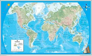
Physical World MapA Physical map of the World designed for school children. Based on the Van Der Grinten projection, the map displays the continents of the world labelling significant rivers
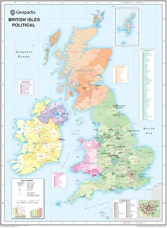
Childrens Political British Isles MapThe British Isles Political map designed for school children was created using Universal Transverse Mercator projection. This political student map clearly marks the counties
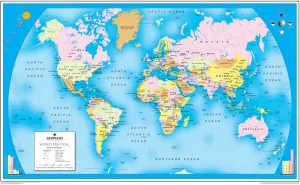
Childrens Political World MapA Political map of the World designed for school children. Based on the Van Der Grinten projection, the World map displays international political boundaries, including ones which are disputed
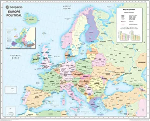
Childrens Political Europe MapA Political map of Europe designed for school children. Based on the Lambert Conformal Conic projection, the Europe map covers the whole of the continent from northern Africa to Norwayaes North Cape
Childrens Physical British Isles MapThe British Isles Physical map designed for school children was created using Universal Transverse Mercator projection. This physical student map displays relief
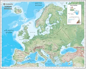
Childrens Physical Europe MapA Physical map of Europe designed for school children. Based on the Lambert Conformal Conic projection, the Europe map covers the whole of the continent from northern Africa to Norwayaes North Cape