Fraud Blocker Skip to main content

Island Collection (page 21)

"Exploring the Enchanting World of Islands

Background imageIsland Collection: St. Jago or green monkey, Chlorocebus sabaeus. Illustration copied from George Edwards

St. Jago or green monkey, Chlorocebus sabaeus. Illustration copied from George Edwards
FLO4640568 St. Jago or green monkey, Chlorocebus sabaeus. Illustration copied from George Edwards. Handcoloured copperplate engraving from " The Naturalist's Pocket Magazine," Harrison

Background imageIsland Collection: Geographical map of Italy. Miniature from the 15th century, based on the manuscript 'Geographia'

Geographical map of Italy. Miniature from the 15th century, based on the manuscript 'Geographia' (Geography)
BEN5469694 Geographical map of Italy. Miniature from the 15th century, based on the manuscript 'Geographia' (Geography) by Claudius Ptolemaeus (Claudius Ptolemaeus, 90-168)

Background imageIsland Collection: The interior of a Dutch house

The interior of a Dutch house
5616068 The interior of a Dutch house; (add.info.: Illustration depicting the interior of a house on the Dutch island of Maaken, showing a cupboard bed behind the two figures. Dated 19th Century)

Background imageIsland Collection: The Footprint on the Sand, from Daniel Defoe's novel Robinson Crusoe, c.1900 (print)

The Footprint on the Sand, from Daniel Defoe's novel Robinson Crusoe, c.1900 (print)
5614332 The Footprint on the Sand, from Daniel Defoe's novel Robinson Crusoe, c.1900 (print); (add.info.: The Footprint on the Sand, from Daniel Defoe's novel Robinson Crusoe)

Background imageIsland Collection: Engraving depicting a Carolina anole, an arboreal lizard found primarily in the south-eastern

Engraving depicting a Carolina anole, an arboreal lizard found primarily in the south-eastern United States
5308950 Engraving depicting a Carolina anole, an arboreal lizard found primarily in the south-eastern United States and some Caribbean islands

Background imageIsland Collection: Engraving depicting Skerryvore Lighthouse

Engraving depicting Skerryvore Lighthouse
5308677 Engraving depicting Skerryvore Lighthouse; (add.info.: Engraving depicting Skerryvore Lighthouse. Skerryvore is a remote reef that lies off the west coast of Scotland)

Background imageIsland Collection: Sarawak from West Indies, North American and Borneo scrapbook, 1845 (Watercolour)

Sarawak from West Indies, North American and Borneo scrapbook, 1845 (Watercolour)
7295674 Sarawak from West Indies, North American and Borneo scrapbook, 1845 (Watercolour) by Fanshawe, Admiral Sir Edward Gennys (1814-1906); 16.3x24.7 cm; National Maritime Museum, London

Background imageIsland Collection: Falkland's Islands, c.1805 (coloured manuscript)

Falkland's Islands, c.1805 (coloured manuscript)
7295386 Falkland's Islands, c.1805 (coloured manuscript) by Unknown Artist, (19th century); 30x34.5 cm; National Maritime Museum, London, UK; (add.info.: Creator: Anonymous Single sheet)

Background imageIsland Collection: View from Point Venus, Island of Otaheite (Tahiti), 1772-75 (oil on panel)

View from Point Venus, Island of Otaheite (Tahiti), 1772-75 (oil on panel)
7295311 View from Point Venus, Island of Otaheite (Tahiti), 1772-75 (oil on panel) by Hodges, William (1744-97); 24x47 cm; National Maritime Museum, London

Background imageIsland Collection: The landing at Tanna (Tana), one of the New Hebrides, 1775-76 (oil on panel)

The landing at Tanna (Tana), one of the New Hebrides, 1775-76 (oil on panel)
7295304 The landing at Tanna (Tana), one of the New Hebrides, 1775-76 (oil on panel) by Hodges, William (1744-97); 24x47 cm; National Maritime Museum, London

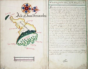
Background imageIsland Collection: Isle of Juan Fernandes, 1685 (bound sheet)

Isle of Juan Fernandes, 1685 (bound sheet)
7295405 Isle of Juan Fernandes, 1685 (bound sheet) by Hack, William (17th Century); 40.5x50 cm; National Maritime Museum, London

Background imageIsland Collection: 'Feejee hair-dressing; from one Tanoa's younger sons, Octr 7th 1849 [Fiji]', 1849 (watercolour)

'Feejee hair-dressing; from one Tanoa's younger sons, Octr 7th 1849 [Fiji]', 1849 (watercolour, graphite)
7295607 'Feejee hair-dressing; from one Tanoa's younger sons, Octr 7th 1849 [Fiji]', 1849 (watercolour, graphite) by Fanshawe

Background imageIsland Collection: Teriitaria or Ariapaia [Teri'i tari'a II Ari'i' paea], Queen of Huahine

Teriitaria or Ariapaia [Teri'i tari'a II Ari'i' paea], Queen of Huahine
7295597 Teriitaria or Ariapaia [Teri'i tari'a II Ari'i' paea], Queen of Huahine, Augt 30th 1849' [Society Islands], 1849 (graphite, watercolour) by Fanshawe

Background imageIsland Collection: 'In Eimeo [Moorea, Society Islands], Augt 27th 1849', 1849 (watercolour)

'In Eimeo [Moorea, Society Islands], Augt 27th 1849', 1849 (watercolour)
7295596 'In Eimeo [Moorea, Society Islands], Augt 27th 1849', 1849 (watercolour) by Fanshawe, Admiral Sir Edward Gennys (1814-1906); 17.5x25.8 cm; National Maritime Museum, London

Background imageIsland Collection: 'Fautaua, Tahiti, Augt 25th 1849 [Society Islands]', 1849 (watercolour)

'Fautaua, Tahiti, Augt 25th 1849 [Society Islands]', 1849 (watercolour)
7295593 'Fautaua, Tahiti, Augt 25th 1849 [Society Islands]', 1849 (watercolour) by Fanshawe, Admiral Sir Edward Gennys (1814-1906); 22.7x32.5 cm; National Maritime Museum, London

Background imageIsland Collection: 'Eimeo [Moorea] from near Papeiti [Tahiti, Society Islands], Augt 25th 1849', 1849 (watercolour)

'Eimeo [Moorea] from near Papeiti [Tahiti, Society Islands], Augt 25th 1849', 1849 (watercolour)
7295592 'Eimeo [Moorea] from near Papeiti [Tahiti, Society Islands], Augt 25th 1849', 1849 (watercolour) by Fanshawe

Background imageIsland Collection: Settlement at Port Stanley, Falkland Islands, May 1849 (watercolour)

Settlement at Port Stanley, Falkland Islands, May 1849 (watercolour)
7295587 Settlement at Port Stanley, Falkland Islands, May 1849 (watercolour) by Fanshawe, Admiral Sir Edward Gennys (1814-1906); 17.4x25.6 cm; National Maritime Museum, London, UK; (add.info.: No)

Background imageIsland Collection: Discoveries in the Arctic Sea between Baffin Bay and Melville Island, 1851 (engraving)

Discoveries in the Arctic Sea between Baffin Bay and Melville Island, 1851 (engraving)
7295397 Discoveries in the Arctic Sea between Baffin Bay and Melville Island, 1851 (engraving) by Arrowsmith, John (1790-1873); 44x64 cm; National Maritime Museum, London

Background imageIsland Collection: Albany in New York, 1833 (engraving)

Albany in New York, 1833 (engraving)
7273634 Albany in New York, 1833 (engraving); 19.7x29.0 cm; JMK Archiv, Bremen, Germany; (add.info.: Captions 'Albany in New York, United States' and 'From Art Institute d. Bibliogr)

Background imageIsland Collection: Tourists visiting the colums of basalt in Staffa island, Scotland

Tourists visiting the colums of basalt in Staffa island, Scotland, Stereoscopic circa 1890 - Private collection
ELD4839404 Tourists visiting the colums of basalt in Staffa island, Scotland, Stereoscopic circa 1890 - Private collection; (add.info.: Tourists visiting the colums of basalt in Staffa island)

Background imageIsland Collection: View of the island of Capri from Massa Lubrense (Italy) - Photography, 1880-1900

View of the island of Capri from Massa Lubrense (Italy) - Photography, 1880-1900, original print (20x25 cm) by contact
JEB4937758 View of the island of Capri from Massa Lubrense (Italy) - Photography, 1880-1900, original print (20x25 cm) by contact, extract from an ancient work on Naples

Background imageIsland Collection: Normandy Anglo Island, Jersey, Saint-Brelade: Sommerville Hotel, 1875

Normandy Anglo Island, Jersey, Saint-Brelade: Sommerville Hotel, 1875
LUX4706982 Normandy Anglo Island, Jersey, Saint-Brelade: Sommerville Hotel, 1875; (add.info.: Normandy Anglo Island, Jersey, Saint-Brelade: Sommerville Hotel, 1875); Photo © Lux-in-Fine.

Background imageIsland Collection: The expedition to Port Edgmont, Falkland Islands - MALASPINA, Alejandro (1754-1809)

The expedition to Port Edgmont, Falkland Islands - MALASPINA, Alejandro (1754-1809)
CUL4873759 The expedition to Port Edgmont, Falkland Islands - MALASPINA, Alejandro (1754-1809). Italian-Spanish navigator and explorer.; RAVENET, Juan (1766). Malaspina Expedition (1789-1794)

Background imageIsland Collection: Geography map: representation of the island of Cuba, Jamaica, Bahamas, South Florida

Geography map: representation of the island of Cuba, Jamaica, Bahamas, South Florida
VEN5030476 Geography map: representation of the island of Cuba, Jamaica, Bahamas, South Florida and Yucatan in the Gulf of Mexico from an Atlas made by the Italian cartographer Antonio Francesco

Background imageIsland Collection: Geography map: double page of an Atlas showing maps and descriptive texts of the islands of Jamaica

Geography map: double page of an Atlas showing maps and descriptive texts of the islands of Jamaica
VEN5030435 Geography map: double page of an Atlas showing maps and descriptive texts of the islands of Jamaica and Cuba in the Caribbean. Engraving of the 17th century

Background imageIsland Collection: Geography map: representation of the southern island of Cuba and the island of Hispaniola

Geography map: representation of the southern island of Cuba and the island of Hispaniola and the small Caribbean
VEN5030180 Geography map: representation of the southern island of Cuba and the island of Hispaniola and the small Caribbean, made by the Dutch cartographer Gerard van Keulen (1678-1726) 1709-1713

Background imageIsland Collection: Geography Atlas: representation of the island of Hispaniola (which includes Santo Domingo and Haiti)

Geography Atlas: representation of the island of Hispaniola (which includes Santo Domingo and Haiti)
VEN5031366 Geography Atlas: representation of the island of Hispaniola (which includes Santo Domingo and Haiti) in the Caribbean archipelago. Map by the Knight Lapie, 1819

Background imageIsland Collection: Geography Atlas: representation of the island of Santo Domingo

Geography Atlas: representation of the island of Santo Domingo, the Bahamas of Puerto Rico to the West Indies
VEN5031345 Geography Atlas: representation of the island of Santo Domingo, the Bahamas of Puerto Rico to the West Indies. Map from an atlas of 1867

Background imageIsland Collection: Geography: map showing the Gulf of Mexico and the Caribbean Sea islands (Caribbean)

Geography: map showing the Gulf of Mexico and the Caribbean Sea islands (Caribbean)
VEN5031257 Geography: map showing the Gulf of Mexico and the Caribbean Sea islands (Caribbean). Plate taken from an Atlas by Philippe Buache (1700-1773) 1780

Background imageIsland Collection: Geography Atlas: description of the Caribbean Sea, Caribbean Sea (Cuba, Jamaica, Hispaniola)

Geography Atlas: description of the Caribbean Sea, Caribbean Sea (Cuba, Jamaica, Hispaniola, Jamaica)
VEN5031247 Geography Atlas: description of the Caribbean Sea, Caribbean Sea (Cuba, Jamaica, Hispaniola, Jamaica), the Bahamas Islands and the Lesser Antilles with map

Background imageIsland Collection: Geography: map showing Central America (Mexico, Honduras, Yucatan)

Geography: map showing Central America (Mexico, Honduras, Yucatan) and the Caribbean Sea Islands (Antilles)
VEN5031211 Geography: map showing Central America (Mexico, Honduras, Yucatan) and the Caribbean Sea Islands (Antilles). Plate from a British Atlas of 1737

Background imageIsland Collection: Geography: map of the islands of Central America (Antilles), the Detroit of Panama

Geography: map of the islands of Central America (Antilles), the Detroit of Panama and representation of Mexico City
VEN5031188 Geography: map of the islands of Central America (Antilles), the Detroit of Panama and representation of Mexico City

Background imageIsland Collection: New Map of the English Empire in the Ocean of America or West Indies: Jamaica, Antigua, Tobago, St

New Map of the English Empire in the Ocean of America or West Indies: Jamaica, Antigua, Tobago, St
VEN5031184 New Map of the English Empire in the Ocean of America or West Indies: Jamaica, Antigua, Tobago, St. Kitts Island, Barbados. Plate taken from an Atlas by John Senex (1678-1740), ca. 1720

Background imageIsland Collection: Geography: representation of the island of Hispaniola with the east coast of the island of Cuba in

Geography: representation of the island of Hispaniola with the east coast of the island of Cuba in the Caribbean Sea
VEN5031183 Geography: representation of the island of Hispaniola with the east coast of the island of Cuba in the Caribbean Sea

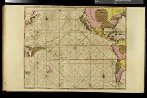
Background imageIsland Collection: Geography map: representation of the Pacific Ocean (or South Sea)

Geography map: representation of the Pacific Ocean (or South Sea) with the Americas (South and United States)
VEN5031134 Geography map: representation of the Pacific Ocean (or South Sea) with the Americas (South and United States), as well as New Zealand, Indonesia and Japan

Background imageIsland Collection: Geography Atlas: representation of the region of the Caribbean Sea, the Greater Antilles (Cuba)

Geography Atlas: representation of the region of the Caribbean Sea, the Greater Antilles (Cuba, Jamaica)
VEN5030081 Geography Atlas: representation of the region of the Caribbean Sea, the Greater Antilles (Cuba, Jamaica, Hispaniola) and the small Antilles with colours indicating membership to France

Background imageIsland Collection: Geography Atlas: representation of the Caribbean Sea region, the Caribbean (Cuba, Jamaica)

Geography Atlas: representation of the Caribbean Sea region, the Caribbean (Cuba, Jamaica)
VEN5030071 Geography Atlas: representation of the Caribbean Sea region, the Caribbean (Cuba, Jamaica, Hispaniola) and the Lesser Antilles. Map from an Atlas of 1637

Background imageIsland Collection: Geography Atlas: representation of North America and the Caribbean Sea region, Caribbean (Cuba)

Geography Atlas: representation of North America and the Caribbean Sea region, Caribbean (Cuba, Jamaica, Hispaniola)
VEN5030064 Geography Atlas: representation of North America and the Caribbean Sea region, Caribbean (Cuba, Jamaica, Hispaniola, Jamaica). Map from an Atlas by Adrien Hubert Brue (1786-1832), 1821

Background imageIsland Collection: Geography Atlas: representation of the Caribbean archipelago (Cuba, Hispaniola, Puerto Rico)

Geography Atlas: representation of the Caribbean archipelago (Cuba, Hispaniola, Puerto Rico), the Bahamas Islands
VEN5030034 Geography Atlas: representation of the Caribbean archipelago (Cuba, Hispaniola, Puerto Rico), the Bahamas Islands. Map from a Spanish Atlas of 1825

Background imageIsland Collection: Geography Atlas: representation of the island of Hispaniola (which includes Santo Domingo and Haiti)

Geography Atlas: representation of the island of Hispaniola (which includes Santo Domingo and Haiti)
VEN5030030 Geography Atlas: representation of the island of Hispaniola (which includes Santo Domingo and Haiti) in the Caribbean archipelago

Background imageIsland Collection: Geography Atlas: representation of the island of Saint Lucia (Antilles)

Geography Atlas: representation of the island of Saint Lucia (Antilles). Map taken from "The west indian atlas or
VEN5030018 Geography Atlas: representation of the island of Saint Lucia (Antilles). Map taken from "The west indian atlas or general description of west indies" by Thomas Jefferys

Background imageIsland Collection: Geography Atlas: representation of the island of Jamaica (Antilles)

Geography Atlas: representation of the island of Jamaica (Antilles). Map taken from "The west indian atlas or
VEN5030010 Geography Atlas: representation of the island of Jamaica (Antilles). Map taken from "The west indian atlas or general description of west indies" by Thomas Jefferys

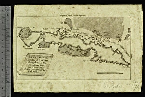
Background imageIsland Collection: Geography Atlas: representation of the Detroit of Bahamas and the island of Cuba

Geography Atlas: representation of the Detroit of Bahamas and the island of Cuba
VEN5029617 Geography Atlas: representation of the Detroit of Bahamas and the island of Cuba. Map printed in "London Magazine", 1763

Background imageIsland Collection: Norse mythology: the Fingal's Cave on the Staffa island Engraving from 'Nordisch-Germanische

Norse mythology: the Fingal's Cave on the Staffa island Engraving from "Nordisch-Germanische Gotter und
ELD4958681 Norse mythology: the Fingal's Cave on the Staffa island Engraving from "Nordisch-Germanische Gotter und Helden" by Wilhelm wagner 1901; Private Collection; (add.info)

Background imageIsland Collection: Desolation of the Oceanides at the foot of the rock or Promethee is chain Painting by Henri

Desolation of the Oceanides at the foot of the rock or Promethee is chain Painting by Henri Lehmann (Karl Ernest (Ernst)
JEB4960169 Desolation of the Oceanides at the foot of the rock or Promethee is chain Painting by Henri Lehmann (Karl Ernest (Ernst) Rudolf Heinrich Salem dit) (1814-1882)

Background imageIsland Collection: Woman of Manila, on the island of Luzon, the Philippines. Handcoloured copperplate engraving

Woman of Manila, on the island of Luzon, the Philippines. Handcoloured copperplate engraving from Frederic
FLO4695511 Woman of Manila, on the island of Luzon, the Philippines. Handcoloured copperplate engraving from Frederic Shoberl's The World in Miniature: The Asiatic Islands and New Holland, R

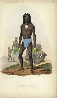
Background imageIsland Collection: Natives of Tikopia island, Solomon Islands, Pacific ocean, 19th century

Natives of Tikopia island, Solomon Islands, Pacific ocean, 19th century. He wears a large pendant on a choker
FLO4688454 Natives of Tikopia island, Solomon Islands, Pacific ocean, 19th century. He wears a large pendant on a choker, blue loincloth and holds handfulls of leaves

Background imageIsland Collection: A sailor and a cabin boy, 1850

A sailor and a cabin boy, 1850
3478523 A sailor and a cabin boy, 1850; (add.info.: Illustration depicting a sailor and a cabin boy have become marooned on a deserted island after being shipwrecked)


All Professionally Made to Order for Quick Shipping

"Exploring the Enchanting World of Islands: From Ancient Maps to Exotic Destinations" Delve into the mysterious allure of islands with "The Wicker Man (1973) UK One Sheet poster, " a cinematic masterpiece that transports you to an isolated land filled with secrets and suspense. Uncover the chilling tale of HMS Erebus and HMS Terror, 1845, as these ill-fated ships embarked on a treacherous Arctic expedition, forever etching their names in history. Journey back in time with a Map of Cyprus published in 1880, tracing the island's rich heritage and cultural tapestry that has captivated explorers for centuries. Marvel at the vastness and diversity of Africa through a Political Map of Africa, showcasing its vibrant nations and breathtaking landscapes that make it one of Earth's most captivating continents. Escape to Barry Island through an enticing poster, promising sun-soaked beaches and endless fun amidst this beloved British seaside destination cherished by generations. Immerse yourself in Iceland's fascinating past with an Iceland map from the 1800s, where rugged terrains meet ethereal beauty, inviting adventurers to explore its otherworldly wonders. Discover the charm of Isle of Wight through a meticulously detailed map capturing its idyllic villages, rolling hillsides, and picturesque coastlines that have made it a favorite among travelers worldwide. Embark on an aviation adventure across Portsmouth, Southsea & Isle of Wight with an enchanting vintage poster depicting soaring planes against azure skies—a testament to humanity's desire for exploration even beyond islands' shores. Traverse Vancouver Island through a mesmerizing map from the 1870s—unravel hidden treasures within dense forests or embark on thrilling coastal escapades along Canada's western gemstone. Lose yourself in Portugal’s rich history as you navigate its diverse regions using a captivating map, unveiling the country's enchanting landscapes and architectural wonders.