Fraud Blocker Skip to main content

Island Collection (page 18)

"Exploring the Enchanting World of Islands

Background imageIsland Collection: A chart of Lord Howe Island, 1788, 1789 (engraving)

A chart of Lord Howe Island, 1788, 1789 (engraving)
7339400 A chart of Lord Howe Island, 1788, 1789 (engraving) by Stockdale, J. (18th century); 24x33 cm; National Maritime Museum, London, UK; (add.info.: Creator: J)

Background imageIsland Collection: Plan of Eagle Island and Bird Island, late 18th to early 19th century (paper)

Plan of Eagle Island and Bird Island, late 18th to early 19th century (paper)
7340731 Plan of Eagle Island and Bird Island, late 18th to early 19th century (paper) by Dalrymple, Alexander (18th-19th century); National Maritime Museum, London

Background imageIsland Collection: Plate from Edward Barlow's journal of his life at sea in king's ships

Plate from Edward Barlow's journal of his life at sea in king's ships
7340651 Plate from Edward Barlow's journal of his life at sea in king's ships, East & West Indiamen & other merchantmen from 1659 to 1703., 1814 (print) by Heather, W

Background imageIsland Collection: Piazzetta and San Georgio by moonlight, Venice, Italy, c.1890-1900 (photochrom)

Piazzetta and San Georgio by moonlight, Venice, Italy, c.1890-1900 (photochrom)
8735747 Piazzetta and San Georgio by moonlight, Venice, Italy, c.1890-1900 (photochrom) by Detroit Publishing Co. (1880-1920); Private Collection; (add.info)

Background imageIsland Collection: SALOMON ISLANDS (19th century). Music of the natives. Illustration of 1881 (Engraving)

SALOMON ISLANDS (19th century). Music of the natives. Illustration of 1881 (Engraving)
AIS5393933 SALOMON ISLANDS (19th century). Music of the natives. Illustration of 1881 (Engraving); Private Collection; © Lorio / Iberfoto.

Background imageIsland Collection: A complete map of the West Indies containing the coasts of Florida, Louisiana

A complete map of the West Indies containing the coasts of Florida, Louisiana
7339476 A complete map of the West Indies containing the coasts of Florida, Louisiana, New Spain and Terra Firma with all the islands, 1794 (print) by Dunn

Background imageIsland Collection: Greece, the Peiraeus or Port Drako surveyed by Commander Thomas Graves, H.M.S

Greece, the Peiraeus or Port Drako surveyed by Commander Thomas Graves, H.M.S. Beacon 1840, [Detail], 1843 (print)
7342579 Greece, the Peiraeus or Port Drako surveyed by Commander Thomas Graves, H.M.S. Beacon 1840, [Detail], 1843 (print) by Walker, J. & C

Background imageIsland Collection: Greece, the Peiraeus or Port Drako surveyed by Commander Thomas Graves, H.M.S

Greece, the Peiraeus or Port Drako surveyed by Commander Thomas Graves, H.M.S. Beacon 1840, 1843 (print)
7342578 Greece, the Peiraeus or Port Drako surveyed by Commander Thomas Graves, H.M.S. Beacon 1840, 1843 (print) by Walker, J. & C

Background imageIsland Collection: Archipeligo, Rhodes Island, town and ports of Rhodes surveyed by Commander Thomas Graves

Archipeligo, Rhodes Island, town and ports of Rhodes surveyed by Commander Thomas Graves, HMS 'Beacon' 1838
7342500 Archipeligo, Rhodes Island, town and ports of Rhodes surveyed by Commander Thomas Graves, HMS 'Beacon' 1838, 1844 (print) by Walker, J. & C

Background imageIsland Collection: Plan of the Island of Dominica laid down by actual survey under the direction of the Honorable

Plan of the Island of Dominica laid down by actual survey under the direction of the Honorable the Commissioners for
7340451 Plan of the Island of Dominica laid down by actual survey under the direction of the Honorable the Commissioners for the Sale of Lands in the Ceded Islands by John Byres Chief Surveyor 1776

Background imageIsland Collection: Plan of the Island of Bequia laid down by actual survey under the direction of the Honorable

Plan of the Island of Bequia laid down by actual survey under the direction of the Honorable the Commissioners for
7340450 Plan of the Island of Bequia laid down by actual survey under the direction of the Honorable the Commissioners for the Sale of Lands in the Ceded Islands by John Byres Chief Surveyor 1776

Background imageIsland Collection: The Magdalen Isles in the gulph of St. Lawrence, 1778 (engraving)

The Magdalen Isles in the gulph of St. Lawrence, 1778 (engraving)
7340417 The Magdalen Isles in the gulph of St. Lawrence, 1778 (engraving) by DesBarres, Joseph Frederick Wallet (1721-1824); 73x55 cm; National Maritime Museum, London

Background imageIsland Collection: A chart of the entrance into the Channel containing the west coast of Cornwall

A chart of the entrance into the Channel containing the west coast of Cornwall
7340130 A chart of the entrance into the Channel containing the west coast of Cornwall and Scilly Islands with all the soundings, 1779 (copperplate engraving) by British School

Background imageIsland Collection: Heradura [and] Conception, 1685 (manuscript)

Heradura [and] Conception, 1685 (manuscript)
7339771 Heradura [and] Conception, 1685 (manuscript) by Hack, William (17th Century); 40.5x5 cm; National Maritime Museum, London

Background imageIsland Collection: 'Bora bora, SE side, within the reef, Septr 5th 1849 [Society Islands]', 1849 (watercolour)

'Bora bora, SE side, within the reef, Septr 5th 1849 [Society Islands]', 1849 (watercolour)
7295601 'Bora bora, SE side, within the reef, Septr 5th 1849 [Society Islands]', 1849 (watercolour) by Fanshawe, Admiral Sir Edward Gennys (1814-1906); 12.9x17.6 cm; National Maritime Museum

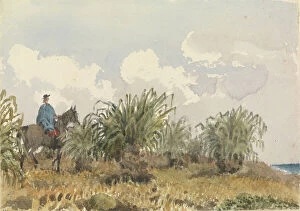
Background imageIsland Collection: Tussac Grass, Falkland Islands, 1849 (watercolour)

Tussac Grass, Falkland Islands, 1849 (watercolour)
7295586 Tussac Grass, Falkland Islands, 1849 (watercolour) by Fanshawe, Admiral Sir Edward Gennys (1814-1906); 12.7x17.9 cm; National Maritime Museum, London, UK; (add.info.: No)

Background imageIsland Collection: Mediterranean archipelago Rhodes Island surveyed...under the direction of Com'r T Graves RN HMS

Mediterranean archipelago Rhodes Island surveyed...under the direction of Com'r T Graves RN HMS 'Beacon'
7342521 Mediterranean archipelago Rhodes Island surveyed...under the direction of Com'r T Graves RN HMS 'Beacon' (1841), 1862-1906 (engraving) by Walker, J. & C

Background imageIsland Collection: A chart of the easternmost part of the East Indies with all the adjacent islands from Cape Comorin

A chart of the easternmost part of the East Indies with all the adjacent islands from Cape Comorin to Japan
7340780 A chart of the easternmost part of the East Indies with all the adjacent islands from Cape Comorin to Japan, 1675 (Hand coloured engraving) by Seller

Background imageIsland Collection: A new and exact map of the island of Antigua in America, according to a survey made in the years

A new and exact map of the island of Antigua in America, according to a survey made in the years 1746-1748
7340454 A new and exact map of the island of Antigua in America, according to a survey made in the years 1746-1748, c.1749 (coloured engraving) by Baker

Background imageIsland Collection: Chart of Negroponte, c.1485 (Vellum)

Chart of Negroponte, c.1485 (Vellum)
7340068 Chart of Negroponte, c.1485 (Vellum) by Sonetti, Bartolomeo da li (fl.1485); 27.5x19 cm; National Maritime Museum, London

Background imageIsland Collection: A chart of the trading part of the East Indies and China, with the adjacent islands

A chart of the trading part of the East Indies and China, with the adjacent islands, from Surrat to Japan, 1677 (print)
7340055 A chart of the trading part of the East Indies and China, with the adjacent islands, from Surrat to Japan, 1677 (print) by Seller, John (1632-97); 44.5x56 cm; National Maritime Museum

Background imageIsland Collection: French illustration depicting people in traditional costumes in Majorca in Spain. 19th century

French illustration depicting people in traditional costumes in Majorca in Spain. 19th century
5304655 French illustration depicting people in traditional costumes in Majorca in Spain. 19th century; (add.info.: French illustration depicting people in traditional costumes in Majorca in Spain)

Background imageIsland Collection: 18th century map, Central America and Gulf of Mexico

18th century map, Central America and Gulf of Mexico
5322624 18th century map, Central America and Gulf of Mexico.; (add.info.: 18th century map of Central America and the Gulf of Mexico engraved by Balthasar Ruyter.).

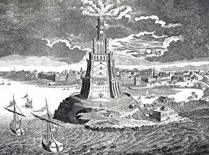
Background imageIsland Collection: The great lighthouse of Alexandria

The great lighthouse of Alexandria
5307255 The great lighthouse of Alexandria.; (add.info.: 18th century representation of the great lighthouse of Alexandria which was built in 280 BC on the Island of Pharos)

Background imageIsland Collection: Double canoe off Moalu, Feejee Islands, Septr 26th 1849 [Fiji], 1849 (pen, ink)

Double canoe off Moalu, Feejee Islands, Septr 26th 1849 [Fiji], 1849 (pen, ink)
7295606 Double canoe off Moalu, Feejee Islands, Septr 26th 1849 [Fiji], 1849 (pen, ink) by Fanshawe, Admiral Sir Edward Gennys (1814-1906); 15.7x25.8 cm; National Maritime Museum, London

Background imageIsland Collection: Sunday bonnets at the Navigators Islands (Samoa), Apia Bay, September 14 1849 (watercolour)

Sunday bonnets at the Navigators Islands (Samoa), Apia Bay, September 14 1849 (watercolour)
7295602 Sunday bonnets at the Navigators Islands (Samoa), Apia Bay, September 14 1849 (watercolour) by Fanshawe, Admiral Sir Edward Gennys (1814-1906); 19.4x32.7 cm; National Maritime Museum, London

Background imageIsland Collection: 'Bora bora [Society Islands], from a ruined native fort above the chief village on the East side

'Bora bora [Society Islands], from a ruined native fort above the chief village on the East side of the island
7295600 'Bora bora [Society Islands], from a ruined native fort above the chief village on the East side of the island, Septr 5th 1849', 1849 (watercolour) by Fanshawe

Background imageIsland Collection: Lighting colom of the Midland-Sea, 1678 (print)

Lighting colom of the Midland-Sea, 1678 (print)
7342739 Lighting colom of the Midland-Sea, 1678 (print) by Colom, Arnold (1624-68); National Maritime Museum, London, UK; (add.info.: Creator: Arnold Colom [8], 104p)

Background imageIsland Collection: Chart of Chius (Chios, Greece), 1554 (vellum)

Chart of Chius (Chios, Greece), 1554 (vellum)
7339646 Chart of Chius (Chios, Greece), 1554 (vellum) by Agnese, Battista (c.1500-64); 26x40 cm; National Maritime Museum, London, UK; (add.info.: Creator: Battista Agnese Scale circa 1:650000)

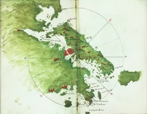
Background imageIsland Collection: Khios and adjacent mainland, c.1485 (vellum)

Khios and adjacent mainland, c.1485 (vellum)
7339635 Khios and adjacent mainland, c.1485 (vellum) by Sonetti, Bartolomeo da li (fl.1485); 27.5x19 cm; National Maritime Museum, London

Background imageIsland Collection: Astipalaia, c.1485 (vellum)

Astipalaia, c.1485 (vellum)
7339633 Astipalaia, c.1485 (vellum) by Sonetti, Bartolomeo da li (fl.1485); 27.5x19 cm; National Maritime Museum, London, UK; (add.info.: Creator: Bartolommeo dalli Sonetti Bound sheet. Col. ms)

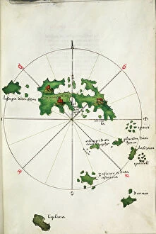
Background imageIsland Collection: Kithira and Antikithira, 1485 (vellum)

Kithira and Antikithira, 1485 (vellum)
7339631 Kithira and Antikithira, 1485 (vellum) by Sonetti, Bartolomeo da li (fl.1485); 27x19 cm; National Maritime Museum, London

Background imageIsland Collection: A chart of Khios and adjacent mainland, c.1420 (Vellum)

A chart of Khios and adjacent mainland, c.1420 (Vellum)
7339628 A chart of Khios and adjacent mainland, c.1420 (Vellum) by Buondelmonti, Cristoforo (1385-1430); 25x18 cm; National Maritime Museum, London

Background imageIsland Collection: 'A chart of the islands in the China Sea near the Straits of Malacca with the positions of

'A chart of the islands in the China Sea near the Straits of Malacca with the positions of the English fleet
7339495 'A chart of the islands in the China Sea near the Straits of Malacca with the positions of the English fleet and the squadron of Admiral Linois on the 14 & 15th February 1804'

Background imageIsland Collection: Chart of the Promontory of Boodroom with the Karabaghla Islands

Chart of the Promontory of Boodroom with the Karabaghla Islands and the North Point of the Island of Kos
7339475 Chart of the Promontory of Boodroom with the Karabaghla Islands and the North Point of the Island of Kos ... by Francis Beaufort F.R.S

Background imageIsland Collection: Padang - the chief settlement of the Dutch Company on the west coast of Sumatra, 1782 (engraving)

Padang - the chief settlement of the Dutch Company on the west coast of Sumatra, 1782 (engraving)
7339395 Padang - the chief settlement of the Dutch Company on the west coast of Sumatra, 1782 (engraving) by Dalrymple, Alexander (18th-19th century); 30.5x31 cm; National Maritime Museum, London

Background imageIsland Collection: Buried Treasure, early 20th century (book illustration)

Buried Treasure, early 20th century (book illustration)
7339186 Buried Treasure, early 20th century (book illustration) by Pyle, Howard (1853-1911); 57x51.7 cm; National Maritime Museum, London

Background imageIsland Collection: Eugen Zintgraff, born January 16, 1858 in Duesseldorf, died December 4, 1897 on Tenerife

Eugen Zintgraff, born January 16, 1858 in Duesseldorf, died December 4, 1897 on Tenerife, was a German explorer
UIG5413304 Eugen Zintgraff, born January 16, 1858 in Duesseldorf, died December 4, 1897 on Tenerife, was a German explorer, Woodcut from 1892 ©Bildagentur-online/UIG/Leemage.

Background imageIsland Collection: illustration. circa 1884.depicting a tropical island with dolphin

illustration. circa 1884.depicting a tropical island with dolphin
5306712 illustration. circa 1884.depicting a tropical island with dolphin; Universal History Archive/UIG.

Background imageIsland Collection: Abel Janszoon Tasman,1603- 1659

Abel Janszoon Tasman,1603- 1659
5614421 Abel Janszoon Tasman,1603- 1659; (add.info.: Abel Janszoon Tasman,1603- 1659. Dutch seafarer, explorer, and merchant)

Background imageIsland Collection: The harbour, Rhodes, Greece, 1887

The harbour, Rhodes, Greece, 1887
7125136 The harbour, Rhodes, Greece, 1887; (add.info.: The harbour, Rhodes, Greece. From A Popular History of Greece, published 1887. Rhodes); Photo © Ken Welsh. All rights reserved 2024.

Background imageIsland Collection: East coast at high water, Le Mont St. Michel, France

East coast at high water, Le Mont St. Michel, France
1128941 East coast at high water, Le Mont St. Michel, France; Private Collection; (add.info.: Photochrom Collection, photomechanical print).

Background imageIsland Collection: A view of Levuka, Island of Ovalau, Fiji Islands at the time of the annexation in 1875

A view of Levuka, Island of Ovalau, Fiji Islands at the time of the annexation in 1875
3062094 A view of Levuka, Island of Ovalau, Fiji Islands at the time of the annexation in 1875.; Private Collection; (add.info.: From The Century Edition of Cassell's History of England)

Background imageIsland Collection: Cotton: the culture and preparation, c.1800 (engraving)

Cotton: the culture and preparation, c.1800 (engraving)
XND75983 Cotton: the culture and preparation, c.1800 (engraving); Private Collection.

Background imageIsland Collection: Natural Arch, Capri, 1856 (oil on paper mounted on canvas)

Natural Arch, Capri, 1856 (oil on paper mounted on canvas)
XOS5874854 Natural Arch, Capri, 1856 (oil on paper mounted on canvas) by Haseltine, William Stanley (1835-1900); 33.1x47.8 cm; Cleveland Museum of Art, OH

Background imageIsland Collection: Shiplake, from above the Island (b/w photo)

Shiplake, from above the Island (b/w photo)
8643819 Shiplake, from above the Island (b/w photo) by English photographer, (19th century) (after); Private Collection; (add.info.: Shiplake, from above the Island)

Background imageIsland Collection: Kingston, Jamaica: Mandeville, Manchester (colour photo)

Kingston, Jamaica: Mandeville, Manchester (colour photo)
8644428 Kingston, Jamaica: Mandeville, Manchester (colour photo) by English Photographer, (20th century); Private Collection; (add.info.: Mandeville, Manchester)

Background imageIsland Collection: Kingston, Jamaica: Bird's-Eye view of Port Antonio (colour photo)

Kingston, Jamaica: Bird's-Eye view of Port Antonio (colour photo)
8644419 Kingston, Jamaica: Bird's-Eye view of Port Antonio (colour photo) by English Photographer, (20th century); Private Collection; (add.info.: Bird's-Eye view of Port Antonio)


All Professionally Made to Order for Quick Shipping

"Exploring the Enchanting World of Islands: From Ancient Maps to Exotic Destinations" Delve into the mysterious allure of islands with "The Wicker Man (1973) UK One Sheet poster, " a cinematic masterpiece that transports you to an isolated land filled with secrets and suspense. Uncover the chilling tale of HMS Erebus and HMS Terror, 1845, as these ill-fated ships embarked on a treacherous Arctic expedition, forever etching their names in history. Journey back in time with a Map of Cyprus published in 1880, tracing the island's rich heritage and cultural tapestry that has captivated explorers for centuries. Marvel at the vastness and diversity of Africa through a Political Map of Africa, showcasing its vibrant nations and breathtaking landscapes that make it one of Earth's most captivating continents. Escape to Barry Island through an enticing poster, promising sun-soaked beaches and endless fun amidst this beloved British seaside destination cherished by generations. Immerse yourself in Iceland's fascinating past with an Iceland map from the 1800s, where rugged terrains meet ethereal beauty, inviting adventurers to explore its otherworldly wonders. Discover the charm of Isle of Wight through a meticulously detailed map capturing its idyllic villages, rolling hillsides, and picturesque coastlines that have made it a favorite among travelers worldwide. Embark on an aviation adventure across Portsmouth, Southsea & Isle of Wight with an enchanting vintage poster depicting soaring planes against azure skies—a testament to humanity's desire for exploration even beyond islands' shores. Traverse Vancouver Island through a mesmerizing map from the 1870s—unravel hidden treasures within dense forests or embark on thrilling coastal escapades along Canada's western gemstone. Lose yourself in Portugal’s rich history as you navigate its diverse regions using a captivating map, unveiling the country's enchanting landscapes and architectural wonders.