Fraud Blocker Skip to main content

Ireland Collection (page 431)

Discover the enchanting beauty of Ireland, a land steeped in history and natural wonders

Background imageIreland Collection: Ireland, County Cork, Mizen, view towards lighthouse at Spanish Point with cows in foreground

Ireland, County Cork, Mizen, view towards lighthouse at Spanish Point with cows in foreground

Background imageIreland Collection: Ireland, Lough Derg, boat sailing on lake

Ireland, Lough Derg, boat sailing on lake

Background imageIreland Collection: Ireland, brown trout grilling over fire next to fishing rod, small fishing boat moored nearby

Ireland, brown trout grilling over fire next to fishing rod, small fishing boat moored nearby

Background imageIreland Collection: Ireland, County Galway, ship moored on the banks of Lough Corrib

Ireland, County Galway, ship moored on the banks of Lough Corrib

Background imageIreland Collection: Ireland, Dublin, Dun Laoghaire harbour at dusk

Ireland, Dublin, Dun Laoghaire harbour at dusk

Background imageIreland Collection: Ireland, Dublin, Grafton Street in modernized southwest Dublin

Ireland, Dublin, Grafton Street in modernized southwest Dublin

Background imageIreland Collection: Ireland, tree-lined Grand Canal connecting Dublin with River Shannon

Ireland, tree-lined Grand Canal connecting Dublin with River Shannon

Background imageIreland Collection: Europe. Ireland. Connemara. Galway. Roundstone. Gull

Europe. Ireland. Connemara. Galway. Roundstone. Gull

Background imageIreland Collection: Great Britian and Ireland from Theatrum Orbis Terrarum by Willem Bleau, Amsterdam, 1635-1645

Great Britian and Ireland from Theatrum Orbis Terrarum by Willem Bleau, Amsterdam, 1635-1645
Cartography, 17th century. Great Britian and Ireland. From Theatrum Orbis Terrarum by Willem Bleau, Amsterdam. 1635-1645

Background imageIreland Collection: Map of Galway, Dublin, Limerick and Cork from Civitates Orbis Terrarum by Georg Braun

Map of Galway, Dublin, Limerick and Cork from Civitates Orbis Terrarum by Georg Braun, 1541-1622 and Franz Hogenberg
Cartography, Ireland, 16th century. Map of Galway, Dublin, Limerick and Cork. From Civitates Orbis Terrarum by Georg Braun (1541-1622) and Franz Hogenberg (1540-1590), Cologne. Engraving

Background imageIreland Collection: Map of Great Britain and Ireland, by Stefano Buonsignori, oil painting, 1575-1584

Map of Great Britain and Ireland, by Stefano Buonsignori, oil painting, 1575-1584
Italy - Tuscany region - Florence. Palazzo Vecchio, Hall of the Geographical Maps. Map of Great Britain and Ireland, oil painting by Stefano Buonsignori 1575-1584

Background imageIreland Collection: Ireland, Connacht Province, County Sligo, Strandhill surroundings, pastures near coast

Ireland, Connacht Province, County Sligo, Strandhill surroundings, pastures near coast
Ireland - Connacht Province - County Sligo - Strandhill surroundings, pastures near the coast

Background imageIreland Collection: Ireland, Province of Connaught, County Galway, Connemara, surroundings of Letterfrack, torrent

Ireland, Province of Connaught, County Galway, Connemara, surroundings of Letterfrack, torrent

Background imageIreland Collection: Ireland, Connacht Province, County Galway, Connemara Region, Letterfrack surroundings, coastline

Ireland, Connacht Province, County Galway, Connemara Region, Letterfrack surroundings, coastline
Ireland - Connacht Province - County Galway - Connemara Region - Letterfrack surroundings, the coast

Background imageIreland Collection: Ireland, County Mayo, Kilcummin, Rathfran Dolmen

Ireland, County Mayo, Kilcummin, Rathfran Dolmen
Ireland - County Mayo - Kilcummin. Rathfran Dolmen

Background imageIreland Collection: Ireland, County Meath, Boyne Valley, Megalithic monument, Newgrange, passage grave, Interior

Ireland, County Meath, Boyne Valley, Megalithic monument, Newgrange, passage grave, Interior
Ireland - County Meath - Boyne Valley (UNESCO World Heritage List, 1993). Megalithic monument. Newgrange, passage grave, 3200 b.C. Interior, stone with spiral engravings

Background imageIreland Collection: Ireland, County Louth, Ballymascanlon, Proleek Dolmen

Ireland, County Louth, Ballymascanlon, Proleek Dolmen
Ireland - County Louth - Ballymascanlon. Proleek Dolmen

Background imageIreland Collection: Ireland, County Clare, Burren, Poulnabrone Dolmen

Ireland, County Clare, Burren, Poulnabrone Dolmen
Ireland - County Clare - Burren. Poulnabrone Dolmen (3800 b.C.-3200 b.C.)

Background imageIreland Collection: Ireland, County Sligo, Carrowmore Dolmen

Ireland, County Sligo, Carrowmore Dolmen
Ireland - County Sligo - Carrowmore Dolmen

Background imageIreland Collection: Side view of an irish setters head

Side view of an irish setters head

Background imageIreland Collection: Irish water spaniel lying down

Irish water spaniel lying down

Background imageIreland Collection: A pint of stout

A pint of stout

Background imageIreland Collection: Map of Ireland

Map of Ireland

Background imageIreland Collection: Ulster Fry, breakfast plate including sausages, bacon, black pudding, fried egg

Ulster Fry, breakfast plate including sausages, bacon, black pudding, fried egg, tomatoes and bread, view from above

Background imageIreland Collection: Ireland, County Clare, Burren region, Poulnabrone, megalithic portal tomb

Ireland, County Clare, Burren region, Poulnabrone, megalithic portal tomb
Ireland - County Clare - Burren region. Megalithic portal tomb at Poulnabrone, 4th millennium b.C

Background imageIreland Collection: Europe: Great Britain and Ireland, from Atlas of the World in thirty-three Maps

Europe: Great Britain and Ireland, from Atlas of the World in thirty-three Maps, by Battista Agnese, 1553
Cartography, 16th century. Europe: Great Britain and Ireland, from Atlas of the World in thirty-three Maps, by Battista Agnese, 1553

Background imageIreland Collection: Map of Ireland and coasts of France, Flanders and Great Britain

Map of Ireland and coasts of France, Flanders and Great Britain, from portolan chart by Ioannes Superantius
Cartography, 16th century. Map of Ireland and coasts of France, Flanders and Great Britain, from a portolan chart by Ioannes Superantius

Background imageIreland Collection: Ireland and Great Britain from a Portolan atlas in three charts, by John Xenodocos from Corfu, 1520

Ireland and Great Britain from a Portolan atlas in three charts, by John Xenodocos from Corfu, 1520
Cartography, 16th century. Ireland and Great Britain. From a Portolan atlas in three charts, by John Xenodocos from Corfu, 1520, cm. 32 x 22.3

Background imageIreland Collection: Ireland, County Clare, Cliffs of Moher

Ireland, County Clare, Cliffs of Moher
Ireland - County Clare - Cliffs of Moher

Background imageIreland Collection: Ireland, Glenveagh National Park, County Donegal, Aerial view of castle at Lough Beagh lake

Ireland, Glenveagh National Park, County Donegal, Aerial view of castle at Lough Beagh lake
Aerial view of castle at Lough Beagh lake- Glenveagh National Park, County Donegal, Ireland

Background imageIreland Collection: Ireland, Connacht Province, County Mayo, Surroundings of Cong

Ireland, Connacht Province, County Mayo, Surroundings of Cong, canal that links Mask and Corrib lakes
Ireland - Connacht Province - County Mayo - Surroundings of Cong. The canal that links Mask and Corrib lakes (Lough Mask and Lough Corrib)

Background imageIreland Collection: Ireland, Province of Connaught, County Mayo, surroundings of Cong village

Ireland, Province of Connaught, County Mayo, surroundings of Cong village, short canal connecting lakes: Mask (Lough Mask) and Corrib (Lough Corrib)

Background imageIreland Collection: Ireland, Ulster Province, County Donegal, Portsalon surroundings, Stocher Beach

Ireland, Ulster Province, County Donegal, Portsalon surroundings, Stocher Beach
Ireland - Ulster Province - County Donegal - Portsalon surroundings. Stocher Beach and promontory of Dunaff Head in the background

Background imageIreland Collection: Ireland, Connacht Province, County Galway, Connemara Region, Joyces country

Ireland, Connacht Province, County Galway, Connemara Region, Joyces country, Surroundings of Cornamona, rural landscape
Ireland - Connacht Province - County Galway - Connemara Region - Joyces country. Surroundings of Cornamona, landscape

Background imageIreland Collection: Ireland, Province of Ulster, County Donegal, bushes of fuchsias along road which leads

Ireland, Province of Ulster, County Donegal, bushes of fuchsias along road which leads from Portsalon to Fanad Head

Background imageIreland Collection: Ireland, County Galway, Connemara, Aerial view of Clifden

Ireland, County Galway, Connemara, Aerial view of Clifden
Aerial view of Clifden - Connemara, County Galway, Ireland

Background imageIreland Collection: Ireland, Province of Ulster, County Donegal, Slieve League (in Irish Mountain gray )

Ireland, Province of Ulster, County Donegal, Slieve League (in Irish Mountain gray ), cliffs overlooking sea
Ireland, Province of Ulster, County Donegal, Slieve League (in Irish " Mountain gray" ), cliffs overlooking sea

Background imageIreland Collection: A brown trout laid out on grass next to some fishing tackle, view from above

A brown trout laid out on grass next to some fishing tackle, view from above

Background imageIreland Collection: Ireland, Neolithic tomb and lush rolling landscape

Ireland, Neolithic tomb and lush rolling landscape

Background imageIreland Collection: Head and neck view of a lurcher

Head and neck view of a lurcher

Background imageIreland Collection: Ireland, Dublin, St Patricks Day, horse carriage, close-up

Ireland, Dublin, St Patricks Day, horse carriage, close-up

Background imageIreland Collection: Ireland, County Galway, view over Lough Corrib, horses in foreground

Ireland, County Galway, view over Lough Corrib, horses in foreground

Background imageIreland Collection: Ireland, County Meath, Newgrange, stone with spiral engravings at entrance to megalithic monument

Ireland, County Meath, Newgrange, stone with spiral engravings at entrance to megalithic monument
Ireland - County Meath - Newgrange. Megalithic monument (UNESCO World Heritage List, 1993). Exterior view of the stone mound (cairn), 3rd millennium b.C

Background imageIreland Collection: Ireland, County Wicklow, near Enniskerry, Powerscourt, Pegasus statue by a pond, close-up

Ireland, County Wicklow, near Enniskerry, Powerscourt, Pegasus statue by a pond, close-up

Background imageIreland Collection: Early electric tricycle, 1881 C017 / 6923

Early electric tricycle, 1881 C017 / 6923
Early electric tricycle. 19th-century artwork of the electric tricycle developed in 1881 by English physicist and electrical engineeer William Edward Ayrton (1847-1908)

Background imageIreland Collection: Daramona Observatory

Daramona Observatory, Westmeath, Ireland. This observatory was operated by Irish astronomer William Edward Wilson (1851-1908)

Background imageIreland Collection: Early electric tricycle, 1881 C017 / 6924

Early electric tricycle, 1881 C017 / 6924
Early electric tricycle. 19th-century artwork of the electric tricycle developed in 1881 by English physicist and electrical engineeer William Edward Ayrton (1847-1908)

Background imageIreland Collection: Low pressure, UK, satellite image

Low pressure, UK, satellite image. North is at top, with land areas outlined in black. The swirl of clouds at lower centre is a lower pressure system centred over South-West England


All Professionally Made to Order for Quick Shipping

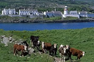
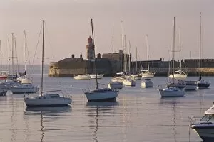
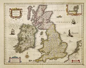
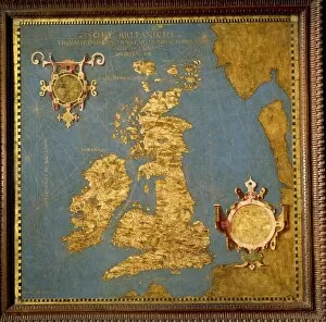
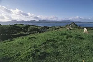
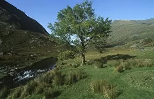
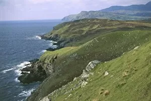
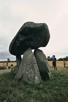
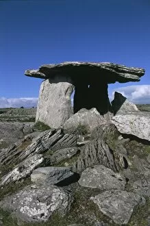
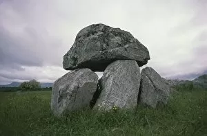
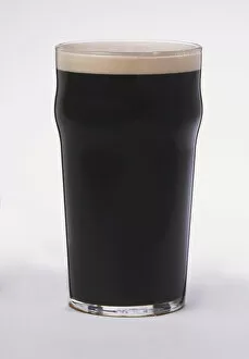
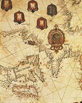
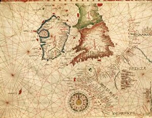
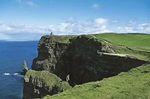
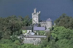
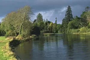
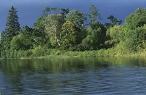
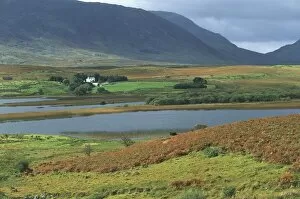
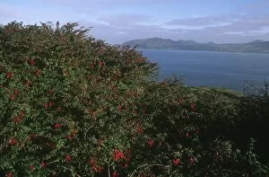
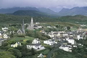
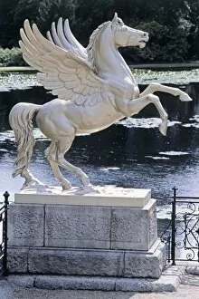
Discover the enchanting beauty of Ireland, a land steeped in history and natural wonders. 🍀 From the majestic Hook Head Lighthouse in County Wexford, Leinster, to the electrifying atmosphere at Ravenhill Stadium Fine Art - Ulster Rugby Union, this country will captivate your senses. Immerse yourself in the breathtaking landscapes of Mourne Mountains and Mt. Slieve Bearnagh in County Down, Northern Ireland. As you explore these stunning peaks that straddle both Ireland and Great Britain, you'll feel a sense of awe wash over you. Remembering the late Michael Collins on that fateful day of 7 November 1922 when his legacy forever shaped Irish history. The Book of Kells illustration depicting St. Matthew is a testament to Ireland's rich artistic heritage. Transport yourself back to the early 1900s with ballerina Anna Pavlova gracefully dancing across stages under Sir John Lavery's brush strokes. And don't miss Molly Malone statue proudly standing on Grafton Street in Dublin, symbolizing the vibrant spirit of Republic of Ireland. Take a glimpse into history with an old map showcasing Great Britain and Ireland from 1867 or delve even further back into time with an Ireland map from the 1870s. These artifacts remind us of how far we've come while honoring our roots. Experience true Irish hospitality as you stroll through Fisher Street in Doolin, County Clare – where traditional music fills every corner. And no visit would be complete without savoring a pint at Brazen Head pub established way back in 1198 AD. As dusk settles over downtown Galway, witness its vibrant streets come alive with energy and charm – a perfect reflection of modern-day Europe intertwined with ancient traditions. Ireland beckons adventurers seeking untamed beauty and warm-hearted locals ready to share their stories. Come lose yourself amidst its emerald landscapes and embrace all that this remarkable country has to offer.