
Hydrographic Collection
"Exploring the Beauty of Hydrographic Art: From Mountain Maps to Coastal Views" Immerse yourself in the captivating world art


All Professionally Made to Order for Quick Shipping
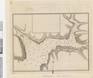
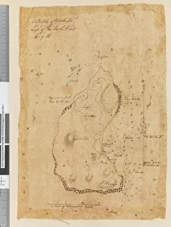
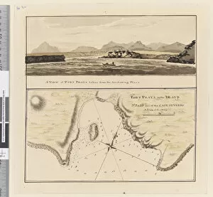
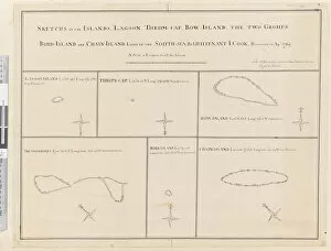
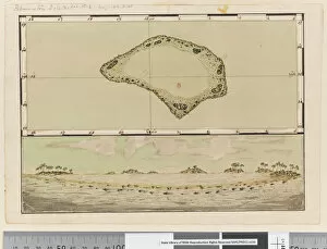
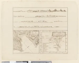
"Exploring the Beauty of Hydrographic Art: From Mountain Maps to Coastal Views" Immerse yourself in the captivating world art, where intricate details and stunning landscapes come alive on canvas. Journey through Africa with a mesmerizing Hydrographic Map, revealing the majestic peaks and valleys of its mountainous terrain. Step into the park at Mereville, circa 1790, as an artist skillfully captures the essence of tranquility by delicately drawing a wooden bridge amidst nature's embrace. The oil on canvas painting transports you to a serene oasis where time stands still. Travel across oceans to Newfoundland in 1763, as pen & ink and wash bring forth A Plan of the Harbour of Croque. Every contour meticulously depicted, guiding sailors through treacherous waters with precision and accuracy. Venture further into maritime exploration with Page 37a's Sketch of Block Island, unveiling its latitude at South Head 41:9 N. Let your imagination sail away as you envision ships navigating these uncharted territories. Discover Middleburg Island on Page 19 (a), bearing witness to its grandeur from afar - distant yet alluringly close. Charting Port Praya in Cape Verde Islands on Page 3a reveals hidden gems like Lagoon, Thrum-Cap, Bow-Island - islands waiting to be explored. Return to Mereville once more with View of the Park c. 1790; this oil-on-canvas masterpiece invites you into a picturesque landscape filled with vibrant colors that breathe life onto every stroke. Unveil Palmerston Island's secrets through Page 25b/a's Map and profile created between 1768-75 using pen & ink and watercolor techniques - an artistic marvel capturing both land and sea in perfect harmony. Page 8 (a) takes us back to Porto Santo's shores extending from NNW to WBN for five miles – a breathtaking view that leaves one in awe.