
Hebron Road Collection
"Hebron Road: A Journey Through History and Landscapes" Embark on a captivating journey along the iconic Hebron Road


All Professionally Made to Order for Quick Shipping
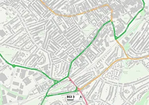
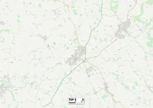
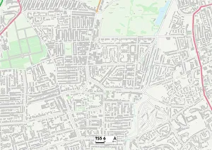
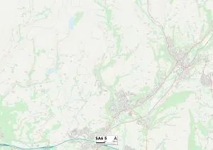
"Hebron Road: A Journey Through History and Landscapes" Embark on a captivating journey along the iconic Hebron Road, as we explore its diverse locations and significant events that have shaped its rich history. From Bristol's vibrant BS3 3 Map to Hambleton's tranquil TS9 5 Map, this road stretches across various landscapes, offering a glimpse into different communities. Venturing further north, we arrive at Middlesbrough's TS5 6 Map, where the road connects neighborhoods and serves as a lifeline for residents. Continuing our expedition westward, Swansea's SA6 5 Map welcomes us with its picturesque surroundings. We take a step back in time to Clydach (Swansea) circa 1910 on High Street—a snapshot of an era long gone but forever etched in memory. Moving forward through time, we encounter Ein el-Dirweh Philips fountain on Hebron Road in 1934—an oasis amidst bustling streets. However, not all moments along this path were serene; tragedy struck on August 19th, 1938 when an attack ravaged the area due to a devastating land-mine explosion. As we approach Halhul village at kilometer 30 of Hebron Road—its significance becomes apparent. The village stands as both witness and participant in the region's narrative. Outside its boundaries lies evidence of resilience and determination displayed by those who call it home. The villagers' stories intertwine with Neby—a testament to their unwavering spirit despite adversity faced throughout history. Each mile traversed reveals tales of triumphs over hardships endured by generations past. Hebron Road is more than just asphalt connecting places—it symbolizes unity among diverse communities sharing common ground. It represents resilience against challenges faced head-on while preserving cultural heritage along every turn. Join us on this remarkable odyssey down Hebron Road—a route steeped in memories from Bristol to Hammersmith and Fulham's W6 0 Map.