Fraud Blocker Skip to main content

Graph Collection (page 3)

"Unveiling the Intricacies: A Journey through Graphs" Step into a world where art and science intertwine, as we explore the captivating realm of graphs

Background imageGraph Collection: Bertha Krupp / Graph 1916

Bertha Krupp / Graph 1916
BERTHA KRUPP Daughter of Friedrich Alfred, who in 1902 inherited control of the Krupp industrial empire 1886-1957

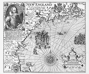
Background imageGraph Collection: Map of New England by Explorer John Smith, Circa 1624

Map of New England by Explorer John Smith, Circa 1624
Beautifully Illustrated Antique Engraved Victorian Illustration of Historical Map of New England from Explorer Captain John Smith, Circa 1624. Source: Original edition from my own archives

Background imageGraph Collection: Map of the Isle of Skye, Scotland Victorian Engraving, 1840

Map of the Isle of Skye, Scotland Victorian Engraving, 1840
Very Rare, Beautifully Illustrated Antique Engraving of Map of the Isle of Skye, Scotland Victorian Engraving, 1840. Source: Original edition from my own archives

Background imageGraph Collection: Economics research, conceptual artwork

Economics research, conceptual artwork
Economics research. Conceptual artwork representing research carried out on the economics and sharing strategies of humans and chimpanzees

Background imageGraph Collection: ANLAB colour space C016 / 2057

ANLAB colour space C016 / 2057
ANLAB colour space. This graphic represents a section through ANLAB colour space. This is the abbreviation for the Adams-Nickerson uniform colour space proposed by Elliot Quincy Adams

Background imageGraph Collection: Mathematical diagrams, 17th century

Mathematical diagrams, 17th century
Mathematical diagrams. 18th-century journal page with 17th-century diagrams illustrating geometric curves and logarithms. This page is from volume 1 of the 1749 edition of The Philosophical

Background imageGraph Collection: Munitions output during 1915 and 1916, WW1

Munitions output during 1915 and 1916, WW1
Graph demonstrating the rise in munitions output in the UK from September 1915 to July 1916 with dips in production visible due to public holidays. Date: 1916

Background imageGraph Collection: Map of the Menai Straits, Carnarvon, Wales Victorian Engraving, 1840

Map of the Menai Straits, Carnarvon, Wales Victorian Engraving, 1840
Very Rare, Beautifully Illustrated Antique Engraving of Map of the Menai Straits, Carnarvon, Wales Victorian Engraving, 1840. Source: Original edition from my own archives

Background imageGraph Collection: Map, Rivers Wye and Derwen, Derbyshire, England Victorian Engraving, 1840

Map, Rivers Wye and Derwen, Derbyshire, England Victorian Engraving, 1840
Very Rare, Beautifully Illustrated Antique Engraving of Map of the Rivers Wye and Derwen in Derbyshire, England Victorian Engraving, 1840. Source: Original edition from my own archives

Background imageGraph Collection: Map of the City of St. Andrewas, Scotland Victorian Engraving, 1840

Map of the City of St. Andrewas, Scotland Victorian Engraving, 1840
Very Rare, Beautifully Illustrated Antique Engraving of Map of the City of St. Andrewas, Scotland Victorian Engraving, 1840. Source: Original edition from my own archives

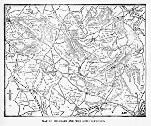
Background imageGraph Collection: Map of the City of Bradgate, England Victorian Engraving, 1840

Map of the City of Bradgate, England Victorian Engraving, 1840
Very Rare, Beautifully Illustrated Antique Engraving of Map of the Map of the City of Bradgate, England Victorian Engraving, 1840. Source: Original edition from my own archives

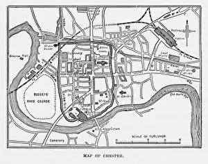
Background imageGraph Collection: Map of the City of Chester, England Victorian Engraving, 1840

Map of the City of Chester, England Victorian Engraving, 1840
Very Rare, Beautifully Illustrated Antique Engraving of Map of the City of Chester, England Victorian Engraving, 1840. Source: Original edition from my own archives

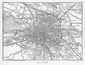
Background imageGraph Collection: Map of the City of Dublin, Ireland Victorian Engraving, 1840

Map of the City of Dublin, Ireland Victorian Engraving, 1840
Very Rare, Beautifully Illustrated Antique Engraving of Map of the City of Map of the City of Dublin, Ireland Victorian Engraving, 1840. Source: Original edition from my own archives

Background imageGraph Collection: Map of Derwentwater, Keswick, England Victorian Engraving, 1840

Map of Derwentwater, Keswick, England Victorian Engraving, 1840
Very Rare, Beautifully Illustrated Antique Engraving of Map of Derwentwater, Keswick, England Victorian Engraving, 1840 from Our Own Country, Great Britain, Descriptive, Historical, Pictorial

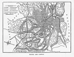
Background imageGraph Collection: Map of Bristol and Clifton, Yorkshire, England Victorian Engraving, 1840

Map of Bristol and Clifton, Yorkshire, England Victorian Engraving, 1840
Very Rare, Beautifully Illustrated Antique Engraving of Map of Bristol and Clifton in Yorkshire, England Victorian Engraving, Circa 1840 from Our Own Country, Great Britain, Descriptive, Historical

Background imageGraph Collection: Map of Bristol in Yorkshire, England Victorian Engraving, Circa 1247

Map of Bristol in Yorkshire, England Victorian Engraving, Circa 1247
Very Rare, Beautifully Illustrated Antique Engraving of Map of Bristol in Yorkshire, England Victorian Engraving, Circa 1247 from Our Own Country, Great Britain, Descriptive, Historical, Pictorial

Background imageGraph Collection: Map of Woburn and Neighborhoods, England Victorian Engraving, Circa 1840

Map of Woburn and Neighborhoods, England Victorian Engraving, Circa 1840
Very Rare, Beautifully Illustrated Antique Engraving of Map of Woburn and Neighborhoods, England Victorian Engraving, Circa 1840 from Our Own Country, Great Britain, Descriptive, Historical

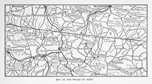
Background imageGraph Collection: Map of Kent and Neighborhoods, England Victorian Engraving, 1840

Map of Kent and Neighborhoods, England Victorian Engraving, 1840
Very Rare, Beautifully Illustrated Antique Engraving of Map of Kent and Neighborhoods, England Victorian Engraving, 1840 from Our Own Country, Great Britain, Descriptive, Historical, Pictorial

Background imageGraph Collection: Map of Burghley and Neighborhoods, England Victorian Engraving, 1840

Map of Burghley and Neighborhoods, England Victorian Engraving, 1840
Very Rare, Beautifully Illustrated Antique Engraving of Map of Burghley and Neighborhoods, England Victorian Engraving, 1840 from Our Own Country, Great Britain, Descriptive, Historical, Pictorial

Background imageGraph Collection: Map of the Course of the River Clyde, England Victorian Engraving, 1840

Map of the Course of the River Clyde, England Victorian Engraving, 1840
Very Rare, Beautifully Illustrated Antique Engraving of Map of the Course of the River Clyde, England Victorian Engraving, 1840 from Our Own Country, Great Britain, Descriptive, Historical

Background imageGraph Collection: Map of Edgehill and Naseby, England Victorian Engraving, 1840

Map of Edgehill and Naseby, England Victorian Engraving, 1840
Very Rare, Beautifully Illustrated Antique Engraving of Map of Edgehill and Naseby, England Victorian Engraving, 1840 from Our Own Country, Great Britain, Descriptive, Historical, Pictorial

Background imageGraph Collection: Map of Ludlow, England Victorian Engraving, Circa 1840

Map of Ludlow, England Victorian Engraving, Circa 1840
Very Rare, Beautifully Illustrated Antique Engraving of Map of Ludlow, England Victorian Engraving, Circa 1840 from Our Own Country, Great Britain, Descriptive, Historical, Pictorial

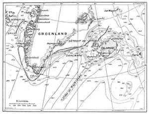
Background imageGraph Collection: Antique illustration of Greenland and Iceland bathymetry map

Antique illustration of Greenland and Iceland bathymetry map

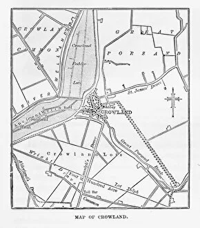
Background imageGraph Collection: Map of Crowland, England Victorian Engraving, Circa 1840

Map of Crowland, England Victorian Engraving, Circa 1840
Very Rare, Beautifully Illustrated Antique Engraving of Crowland, The Cut at Peakirk Victorian Engraving from Our Own Country, Great Britain, Descriptive, Historical, Pictorial. Published in 1880

Background imageGraph Collection: Engraved Chart of United States Time Zones, Circa 1883

Engraved Chart of United States Time Zones, Circa 1883
Beautifully Illustrated Antique Engraved Victorian Illustration of an Engraved Chart of United States Time Zones and Standard Railway Time, Circa 1883. Original edition from my own archives

Background imageGraph Collection: St. Brandans Celebration of the Holy Mass Engraving, Circa 1550

St. Brandans Celebration of the Holy Mass Engraving, Circa 1550
Beautifully Illustrated Antique Engraved Victorian Illustration of St. Brandans Celebration of the Holy Mass on the Back of a Whale Engraving, Circa 1550

Background imageGraph Collection: Map of Global Distribution of Plants, Victorian Botanical Illustration

Map of Global Distribution of Plants, Victorian Botanical Illustration
Very Rare, Beautifully Illustrated Antique Engraved Victorian Botanical Illustration of Map of Global Distribution of Plants: Plate 60

Background imageGraph Collection: Volcanic and Hurricane Charts; Craters; and Antarctica Engraving

Volcanic and Hurricane Charts; Craters; and Antarctica Engraving
Engraved Illustrations of Volcanic and Hurricane Charts; Craters; and Antarctica from Iconographic Encyclopedia of Science, Literature and Art, Published in 1851

Background imageGraph Collection: POSTER, c1940. Yes, of course, ring up the capacity office about it. Poster by Fougasse

POSTER, c1940. Yes, of course, ring up the capacity office about it. Poster by Fougasse, c1940

Background imageGraph Collection: Old Plan of Exeter in Devon, England Victorian Engraving, 1840

Old Plan of Exeter in Devon, England Victorian Engraving, 1840
Very Rare, Beautifully Illustrated Antique Engraving of Old Plan of Exeter in Devon, England Victorian Engraving, 1840. Source: Original edition from my own archives

Background imageGraph Collection: Map of Coventry in Warwickshire, England Victorian Engraving, 1840

Map of Coventry in Warwickshire, England Victorian Engraving, 1840
Very Rare, Beautifully Illustrated Antique Engraving of Map of Coventry in Warwickshire, England Victorian Engraving, 1840. Source: Original edition from my own archives

Background imageGraph Collection: Roman Empire in the Apostolic Age Map, Engraving, 1892

Roman Empire in the Apostolic Age Map, Engraving, 1892
Very rare, beautifully detailed engraving of Roman Empire in the Apostolic Age Map, Engraving, Published in 1892. Original edition from my own archives. Copyright has expired on this artwork

Background imageGraph Collection: South America Physical Map, Engraving, 1892

South America Physical Map, Engraving, 1892
Very rare, beautifully detailed engraving of South America Physical Map, Engraving, Published in 1892. Original edition from my own archives. Copyright has expired on this artwork. Digitally restored

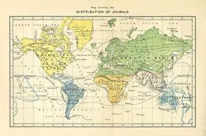
Background imageGraph Collection: Distribution of Animals Map, Engraving, 1892

Distribution of Animals Map, Engraving, 1892
Very rare, beautifully detailed engraving of North America Physical Map, Engraving, Published in 1892. Original edition from my own archives. Copyright has expired on this artwork. Digitally restored

Background imageGraph Collection: Abstract colorful background

Abstract colorful background
Abstract rainbow wave background with bokeh from middle

Background imageGraph Collection: Electricity supply

Electricity supply

Background imageGraph Collection: Concert hall, cross-section illustrating reflection and absorption of sound

Concert hall, cross-section illustrating reflection and absorption of sound

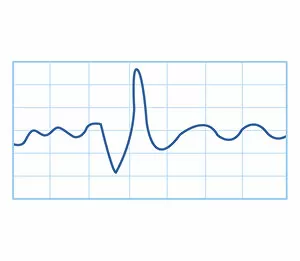
Background imageGraph Collection: Digital illustration of fetal monitoring graph

Digital illustration of fetal monitoring graph

Background imageGraph Collection: Graph showing doctors per population, Rwanda 72, 990: 1, Nepal 20, 000: 1, Laos 4, 380: 1

Graph showing doctors per population, Rwanda 72, 990: 1, Nepal 20, 000: 1, Laos 4, 380: 1, United Arab Emirates 1
Graph showing doctors per population, Rwanda 72, 990:1, Nepal 20, 000:1, Laos 4, 380:1, United Arab Emirates 1, 000:1, Latvia 200:1

Background imageGraph Collection: Illustration of lie detector read out

Illustration of lie detector read out

Background imageGraph Collection: Biomedical illustration of nerve conduction trace

Biomedical illustration of nerve conduction trace

Background imageGraph Collection: Biomedical illustration of electromyography (EMG) result

Biomedical illustration of electromyography (EMG) result

Background imageGraph Collection: Fanad Lighthouse Donegal

Fanad Lighthouse Donegal
Fanad Head Lighthouse, County Donegal, Ireland

Background imageGraph Collection: HEMLINES, 1913-1932. Womens hemlines from 1913 through 1932

HEMLINES, 1913-1932. Womens hemlines from 1913 through 1932. The stippled line indicates the total yearly industrial production of the United States

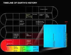
Background imageGraph Collection: A timeline of Earths history

A timeline of Earths history

Background imageGraph Collection: Exoplanet Discovery Technique Diagram

Exoplanet Discovery Technique Diagram
Diagram illustrating how extrasolar planets can be discovered by the dimming of a stars light as the planet passes in front of it

Background imageGraph Collection: Eclipsing Binary Diagram

Eclipsing Binary Diagram. Otherwise invisible planets can be discovered by observing the drop in illumination from their star as they pass in front of it

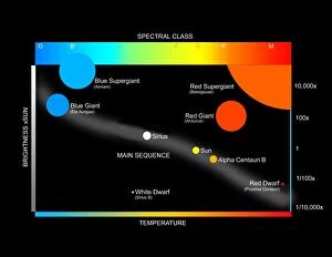
Background imageGraph Collection: A simplified Herzprung-Russell Diagram showing how stars are classified

A simplified Herzprung-Russell Diagram showing how stars are classified


All Professionally Made to Order for Quick Shipping

"Unveiling the Intricacies: A Journey through Graphs" Step into a world where art and science intertwine, as we explore the captivating realm of graphs. From the enchanting Map of Malvern Hills in Worcestershire, England Victorian Engraving, 1840 to the vibrant Colours derived from coal tar (colour litho), each graph tells a unique story. Travel back in time with us as we unravel history's secrets through the Map of the City of Durham, England Victorian Engraving, 1840. Witness how this intricate illustration captures an era long gone yet preserved within its lines. Delve into celestial wonders as you gaze upon the Diagram showing the spectral class and luminosity of stars. Marvel at their brilliance and understand how these cosmic entities are classified based on their radiant characteristics. Under The Arch lies a hidden world waiting to be discovered. Explore H-He-Hg emission spectra C017 / 7260 and uncover its mysteries alongside Kapitsa and Androv, Russian physicists who paved new paths in scientific exploration. Let us not forget those brilliant minds that shaped our understanding of graphs. Leonhard Euler, Swiss mathematician extraordinaire whose contributions revolutionized mathematics forever. His legacy lives on within every line etched onto paper or screen. Witness modern marvels unfold before your eyes with Air traffic visualization - a testament to human ingenuity ensuring safe skies for all travelers. Immerse yourself in Internet blog map showcasing interconnectedness like never before – bridging gaps between people across continents. Journey further through time with maps depicting Coventry in Warwickshire, England Victorian Engraving, 1840 and Exeter in Devon, England Victorian Engraving, 1840 – glimpses into bygone eras frozen within ink strokes. In this vast universe of knowledge encapsulated within graphs' allure lies endless possibilities waiting to be explored. So join us on this extraordinary expedition, where art meets science and history intertwines with innovation.