Fraud Blocker Skip to main content

Geographical Map Collection (page 7)

"Journey through Time: Exploring the Intricate World of Geographical Maps" Step into a world where maps were not just tools, but works of art

Background imageGeographical Map Collection: Geography map: world map representing the southern hemisphere and the boreal hemisphere

Geography map: world map representing the southern hemisphere and the boreal hemisphere. 17th or 18th century
VEN5030300 Geography map: world map representing the southern hemisphere and the boreal hemisphere. 17th or 18th century. Biblioteca Angelica

Background imageGeographical Map Collection: Geography map: representation of the main British islands of the Caribbean Sea (Antigua, Barbados)

Geography map: representation of the main British islands of the Caribbean Sea (Antigua, Barbados, Jamaican, Bermuda)
VEN5030269 Geography map: representation of the main British islands of the Caribbean Sea (Antigua, Barbados, Jamaican, Bermuda, St. Christopher Island or St)

Background imageGeographical Map Collection: Geography map: representation of Brazil, made by Dutch cartographer Johannes Blaeu (1598-1673)

Geography map: representation of Brazil, made by Dutch cartographer Johannes Blaeu (1598-1673), 17th century
VEN5030254 Geography map: representation of Brazil, made by Dutch cartographer Johannes Blaeu (1598-1673), 17th century. Biblioteca Angelica

Background imageGeographical Map Collection: Geography map: representation of the northern part of South America (Brazil, Venezuela)

Geography map: representation of the northern part of South America (Brazil, Venezuela)
VEN5030250 Geography map: representation of the northern part of South America (Brazil, Venezuela, Peru) from the Atlas " Amerique meridionale" by French cartographer Jean-Baptiste

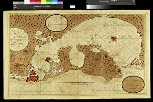
Background imageGeographical Map Collection: Geography map: representation of Cartagena Bay (Cartagena) in Colombia

Geography map: representation of Cartagena Bay (Cartagena) in Colombia, made by Dutch cartographer Gerard van Keulen
VEN5030220 Geography map: representation of Cartagena Bay (Cartagena) in Colombia, made by Dutch cartographer Gerard van Keulen (1678-1726) 1709-1713

Background imageGeographical Map Collection: Geography map: representation of the island of Martinique in the small Antilles

Geography map: representation of the island of Martinique in the small Antilles
VEN5030213 Geography map: representation of the island of Martinique in the small Antilles, made by Dutch cartographer Gerard van Keulen (1678-1726) 1709-1713

Background imageGeographical Map Collection: Geography map: representation of part of the archipelago of the small Antilles

Geography map: representation of part of the archipelago of the small Antilles (island of Saint Lucia, Martinique)
VEN5030211 Geography map: representation of part of the archipelago of the small Antilles (island of Saint Lucia, Martinique, Dominica, Ile des Saintes, Guadeloupe, Montserrat, Antigua, Barbuda)

Background imageGeographical Map Collection: Geography map: representation of the coasts of Surinam (Suriname) in South America

Geography map: representation of the coasts of Surinam (Suriname) in South America
VEN5030152 Geography map: representation of the coasts of Surinam (Suriname) in South America, made by Dutch cartographer Gerard van Keulen (1678-1726) 1709-1713

Background imageGeographical Map Collection: Portrait of Luigi Ferdinando Marsili (1658-1730) Italian oceanographer

Portrait of Luigi Ferdinando Marsili (1658-1730) Italian oceanographer. Anonymous painting of the 18th century
VEN5027933 Portrait of Luigi Ferdinando Marsili (1658-1730) Italian oceanographer. Anonymous painting of the 18th century

Background imageGeographical Map Collection: Geography map: representation of the Orenoque River in Venezuela, the Gulf of Paria

Geography map: representation of the Orenoque River in Venezuela, the Gulf of Paria, the islands of Tobago
VEN5030093 Geography map: representation of the Orenoque River in Venezuela, the Gulf of Paria, the islands of Tobago, Trinidad (Trinidad)

Background imageGeographical Map Collection: Geography Atlas: representation of North America and the Caribbean Sea region, Caribbean (Cuba)

Geography Atlas: representation of North America and the Caribbean Sea region, Caribbean (Cuba, Jamaica, Hispaniola)
VEN5030056 Geography Atlas: representation of North America and the Caribbean Sea region, Caribbean (Cuba, Jamaica, Hispaniola, Jamaica). Map from an Atlas of 1785

Background imageGeographical Map Collection: Geography Atlas: representation of South America and the Caribbean Sea region, Caribbean (Cuba)

Geography Atlas: representation of South America and the Caribbean Sea region, Caribbean (Cuba, Jamaica, Hispaniola)
VEN5030051 Geography Atlas: representation of South America and the Caribbean Sea region, Caribbean (Cuba, Jamaica, Hispaniola)

Background imageGeographical Map Collection: Geography Atlas: representation of the island of Jamaica in the Caribbean archipelago

Geography Atlas: representation of the island of Jamaica in the Caribbean archipelago
VEN5029993 Geography Atlas: representation of the island of Jamaica in the Caribbean archipelago. Map taken from "The west indian atlas or general description of west indies" by Thomas

Background imageGeographical Map Collection: Geography Atlas: representation of the Bahamas islands, northern Hispaniola (Santo Domingo)

Geography Atlas: representation of the Bahamas islands, northern Hispaniola (Santo Domingo)
VEN5029631 Geography Atlas: representation of the Bahamas islands, northern Hispaniola (Santo Domingo) and the Leewind Passage between Cuba and Hispaniola in the West Indies

Background imageGeographical Map Collection: Geography Atlas: representation of the Bequia or Becouya Islands in the North of the Grenadines in

Geography Atlas: representation of the Bequia or Becouya Islands in the North of the Grenadines in the Caribbean Sea
VEN5029628 Geography Atlas: representation of the Bequia or Becouya Islands in the North of the Grenadines in the Caribbean Sea

Background imageGeographical Map Collection: Geography Atlas: representation of the island of Martinique in the West Indies

Geography Atlas: representation of the island of Martinique in the West Indies
VEN5029597 Geography Atlas: representation of the island of Martinique in the West Indies. Map taken from "The west indian atlas or general description of west indies" by Thomas Jefferys

Background imageGeographical Map Collection: Map of New France and Canada, 1597. 19th century coloring engraving

Map of New France and Canada, 1597. 19th century coloring engraving
NWI4851909 Map of New France and Canada, 1597. 19th century coloring engraving.; (add.info.: Map of New France and Canada, 1597. 19th century coloring engraving.); Photo © North Wind Pictures.

Background imageGeographical Map Collection: The western itinerary of the expedition to Louisiana (United States)

The western itinerary of the expedition to Louisiana (United States) of 1539 by Hernando De Soto (1500-1542)
NWI4852599 The western itinerary of the expedition to Louisiana (United States) of 1539 by Hernando De Soto (1500-1542, Spanish conquistador), based on the map of Guillaume Delisle (1675-1726)

Background imageGeographical Map Collection: Map of the western territories of North America, showing the borders between Mexico

Map of the western territories of North America, showing the borders between Mexico and the United States
NWI4853139 Map of the western territories of North America, showing the borders between Mexico and the United States, in the 1840s

Background imageGeographical Map Collection: First map of Cape Bonne Esperance (South Africa), mapped at its correct latitude in 1508 by Johann

First map of Cape Bonne Esperance (South Africa), mapped at its correct latitude in 1508 by Johann (or Johannes)
NWI4852318 First map of Cape Bonne Esperance (South Africa), mapped at its correct latitude in 1508 by Johann (or Johannes) Ruysch (d. 1533)

Background imageGeographical Map Collection: War of Independence of the United States of America (1775-1783)

War of Independence of the United States of America (1775-1783): English colony of North America in 1776
NWI4842561 War of Independence of the United States of America (1775-1783): English colony of North America in 1776. Color lithography.; (add.info)

Background imageGeographical Map Collection: United States of America Independence War (1775-1783): Route of American ships 'Ranger'

United States of America Independence War (1775-1783): Route of American ships "Ranger"
NWI4842352 United States of America Independence War (1775-1783): Route of American ships "Ranger" and "Bonhomme Richard" near the British islands during the war

Background imageGeographical Map Collection: Map of the Isthmus of Panama (Republic of Panama), from the general history of voyages, 1754

Map of the Isthmus of Panama (Republic of Panama), from the general history of voyages, 1754
NWI4846857 Map of the Isthmus of Panama (Republic of Panama), from the general history of voyages, 1754, by Antoine Francois Prevost

Background imageGeographical Map Collection: Map showing the growth of the United States territories from 1783-1867

Map showing the growth of the United States territories from 1783-1867. Colouring engraving of the 19th century
NWI4846482 Map showing the growth of the United States territories from 1783-1867. Colouring engraving of the 19th century.; (add.info)

Background imageGeographical Map Collection: Christopher Columbus studies a map in his office in Spain, 15th century

Christopher Columbus studies a map in his office in Spain, 15th century. Colouring engraving of the 19th century
NWI4846345 Christopher Columbus studies a map in his office in Spain, 15th century. Colouring engraving of the 19th century.; (add.info.: Christopher Columbus (Cristoforo Colombo)

Background imageGeographical Map Collection: Map of the United States of America in 1860: description of territories at the beginning of

Map of the United States of America in 1860: description of territories at the beginning of the Civil War or Secession
NWI4846231 Map of the United States of America in 1860: description of territories at the beginning of the Civil War or Secession War (1861-1865)

Background imageGeographical Map Collection: Union of the Proxy of Provence at the Consulate of Aix. Painting by Michel Francois Dandre Bardon

Union of the Proxy of Provence at the Consulate of Aix. Painting by Michel Francois Dandre Bardon (1700-1783)
JEB4846094 Union of the Proxy of Provence at the Consulate of Aix. Painting by Michel Francois Dandre Bardon (1700-1783). 18th century. Oil on canvas, 66 x 43 cm

Background imageGeographical Map Collection: Description of the eastern part of the itinerary of Hernando De Soto (1500-1542)

Description of the eastern part of the itinerary of Hernando De Soto (1500-1542)
NWI4850452 Description of the eastern part of the itinerary of Hernando De Soto (1500-1542, Spanish conquistador and explorer) through the south east of North America, illustration 1593

Background imageGeographical Map Collection: The still Indian village of Hochelaga, site of Montreal, Canada

The still Indian village of Hochelaga, site of Montreal, Canada. Map of Marc Lescarbot (1570-1641), 1609
NWI4850311 The still Indian village of Hochelaga, site of Montreal, Canada. Map of Marc Lescarbot (1570-1641), 1609. Colouring engraving of the 19th century.; (add.info)

Background imageGeographical Map Collection: Map of Arctic trips by Henry Hudson, English explorer (1570-1611) published in 1612 in ' Voyages'

Map of Arctic trips by Henry Hudson, English explorer (1570-1611) published in 1612 in " Voyages"
NWI4849415 Map of Arctic trips by Henry Hudson, English explorer (1570-1611) published in 1612 in " Voyages". Colouring engraving of the 19th century.; (add.info)

Background imageGeographical Map Collection: Back, Satirical in N & B, War of 14 -18, Press/Media, Germany Prussia

Back, Satirical in N & B, War of 14 -18, Press/Media, Germany Prussia
ICA4849062 Back, Satirical in N & B, War of 14 -18, Press/Media, Germany Prussia; (add.info.: Back, Satirical in N & B, War of 14 -18, Press/Media, Germany Prussia); Photo © Caricadoc.

Background imageGeographical Map Collection: Geographic map: Route of Zebulon Montgomery Pike, American explorer (1779-1813)

Geographic map: Route of Zebulon Montgomery Pike, American explorer (1779-1813)
NWI4848376 Geographic map: Route of Zebulon Montgomery Pike, American explorer (1779-1813) through the western territories to explore the region of Colorado (1805-1806)

Background imageGeographical Map Collection: Geographic map of the new world made by a geographer in 1540

Geographic map of the new world made by a geographer in 1540. Colouring engraving of the 19th century
NWI4848357 Geographic map of the new world made by a geographer in 1540. Colouring engraving of the 19th century.; (add.info.: Geographic map of the new world made by a geographer in 1540)

Background imageGeographical Map Collection: World map depicting the flat earth by Greek historian Herodote (484 or 482-425 BC)

World map depicting the flat earth by Greek historian Herodote (484 or 482-425 BC)
NWI4848152 World map depicting the flat earth by Greek historian Herodote (484 or 482-425 BC). Colourful engraving of the 19th century.; (add.info)

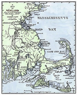
Background imageGeographical Map Collection: Geographic map showing the sites of occupation (Vinland) of Viking explorers in the Cape Code

Geographic map showing the sites of occupation (Vinland) of Viking explorers in the Cape Code (Massachusetts)
NWI4847828 Geographic map showing the sites of occupation (Vinland) of Viking explorers in the Cape Code (Massachusetts, U.S.A.) in the 10th-11th century, as described by Charles Rafn in 1829

Background imageGeographical Map Collection: First World War: France, Patriotic Map showing a French soldier teacher of a school in Alsace with

First World War: France, Patriotic Map showing a French soldier teacher of a school in Alsace with an inscription
LUX4740811 First World War: France, Patriotic Map showing a French soldier teacher of a school in Alsace with an inscription on the painting: we love France

Background imageGeographical Map Collection: First World War: France, Patriotic Map showing a drawing representing a map of France with Alsace

First World War: France, Patriotic Map showing a drawing representing a map of France with Alsace and Lorraine
LUX4739568 First World War: France, Patriotic Map showing a drawing representing a map of France with Alsace and Lorraine and a symbol of France thanking soldiers

Background imageGeographical Map Collection: Map of Asia circa 1810. Handcoloured copperplate engraving by Andrea Bernieri from Giulio

Map of Asia circa 1810. Handcoloured copperplate engraving by Andrea Bernieri from Giulio Ferrario's Ancient
FLO4622502 Map of Asia circa 1810. Handcoloured copperplate engraving by Andrea Bernieri from Giulio Ferrario's Ancient and Modern Costumes of all the Peoples of the World

Background imageGeographical Map Collection: American Civil War, 1861-1865: Map showing the territories occupied by the State of Confederates

American Civil War, 1861-1865: Map showing the territories occupied by the State of Confederates in the late 1861
NWI4830140 American Civil War, 1861-1865: Map showing the territories occupied by the State of Confederates in the late 1861 years

Background imageGeographical Map Collection: US Civil War, 1861-1865: geographic map showing the blockade of the coastal coasts of

US Civil War, 1861-1865: geographic map showing the blockade of the coastal coasts of the Confederate states
NWI4829891 US Civil War, 1861-1865: geographic map showing the blockade of the coastal coasts of the Confederate states. Colour engraving of the 19th century.; (add.info.: US Civil War)

Background imageGeographical Map Collection: American Civil War, 1861-1865: Map of the vicinity of Washington DC at the end of the war

American Civil War, 1861-1865: Map of the vicinity of Washington DC at the end of the war
NWI4830156 American Civil War, 1861-1865: Map of the vicinity of Washington DC at the end of the war. Colour engraving of the 19th century.; (add.info.: American Civil War)

Background imageGeographical Map Collection: United States of America Independence War (1775-1783): Map of Benedict Arnold's road (1741-1801)

United States of America Independence War (1775-1783): Map of Benedict Arnold's road (1741-1801)
NWI4840149 United States of America Independence War (1775-1783): Map of Benedict Arnold's road (1741-1801) to invade Quebec in 1775

Background imageGeographical Map Collection: Geographic map of Great Britain, Scotland and Ireland, the Atlantic Ocean and the North Sea

Geographic map of Great Britain, Scotland and Ireland, the Atlantic Ocean and the North Sea
NWI4832911 Geographic map of Great Britain, Scotland and Ireland, the Atlantic Ocean and the North Sea, showing the route of the Spanish Great Armada (Invincible Armada) in 1588

Background imageGeographical Map Collection: Map of France at the times of king Charles VI, 1851 Private collection

Map of France at the times of king Charles VI, 1851 Private collection
ELD4930293 Map of France at the times of king Charles VI, 1851 Private collection; Private Collection; (add.info.: Map of France at the times of king Charles VI)

Background imageGeographical Map Collection: Map of France at the times of king Charles VII and after the expulsion of the English between 1422

Map of France at the times of king Charles VII and after the expulsion of the English between 1422 and 1461
ELD4930280 Map of France at the times of king Charles VII and after the expulsion of the English between 1422 and 1461 (Map of France at the times of king Charles VII)

Background imageGeographical Map Collection: Map of France under the Reign of King Louis XVI from 1774 to 1793

Map of France under the Reign of King Louis XVI from 1774 to 1793 (Map of France at the times of king Louis XVI)
ELD4930093 Map of France under the Reign of King Louis XVI from 1774 to 1793 (Map of France at the times of king Louis XVI) Plate from "Atlas Universel" by Houze

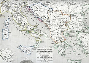
Background imageGeographical Map Collection: Map of the Byzantine Empire during the occupation of Bulgarians and Italy during the reign of Otto I

Map of the Byzantine Empire during the occupation of Bulgarians and Italy during the reign of Otto I
ELD4928012 Map of the Byzantine Empire during the occupation of Bulgarians and Italy during the reign of Otto I, Otto II and Otto III Holy roman emperor

Background imageGeographical Map Collection: Map of Spain at the times of Germanic Hispania, 409-585 (Map of Spain at the times of Germanic)

Map of Spain at the times of Germanic Hispania, 409-585 (Map of Spain at the times of Germanic Hispania)
ELD4927919 Map of Spain at the times of Germanic Hispania, 409-585 (Map of Spain at the times of Germanic Hispania) Engraving from " Atlas Universel" by Houze


All Professionally Made to Order for Quick Shipping

"Journey through Time: Exploring the Intricate World of Geographical Maps" Step into a world where maps were not just tools, but works of art. The Plum Pudding in Danger or State Epicures taking un Petit Souper, 1805 engraving captures the essence of an era when cartography was both informative and visually captivating. Travel back to 1570 with the Map of the Tartar territory engraving, revealing a glimpse into ancient lands and distant cultures. Meanwhile, the Map of Tuscany in Italy from the same year showcases intricate details that transport us to Renaissance Europe. Gerardus Mercator's Atlas 1587 takes us on a comprehensive journey across continents, as his Orbis Terrae Compendiosa Descriptio reveals his mastery in capturing our vast planet's beauty. Delve deeper into specific regions like Algeria with its Geographic map highlighting Algiers, Oran, and Constantine provinces. Witness history unfold as Emperor Albert I studies France's map during Pope Boniface VIII and King Philip IV's conflict – a testament to how geography played a pivotal role even in medieval times. Jean Guerard's Universal hydrographic map manuscript from 1734 offers insights into maritime exploration while showcasing French expertise in cartography. And let us not forget the Representation of a geographic map depicting diseases prevalent at the end of the 19th century – reminding us that maps can also shed light on societal challenges. Finally, immerse yourself in Europe's past with an enchanting Map from 1743; it unveils borders long gone but still etched within historical memory. These they are more than mere navigational aids; they are gateways to different eras and windows into diverse worlds. Join us on this extraordinary expedition through time as we unravel their secrets and marvel at their enduring allure.