Fraud Blocker Skip to main content

From Space Collection (page 5)

"Exploring the vastness of space, we catch a glimpse of our humble abode - the Pale Blue Dot

Background imageFrom Space Collection: Qatar at night, ISS image C018 / 9225

Qatar at night, ISS image C018 / 9225
Qatar at night. Photographed by astronauts aboard the International Space Station 13th October 2012. The picture was taken using a camera aid called NightPod

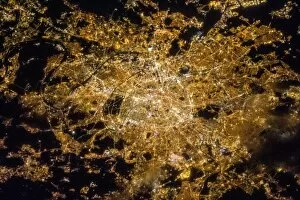
Background imageFrom Space Collection: Paris C018 / 9219

Paris C018 / 9219
Paris at night. Photographed by astronauts aboard the International Space Station 7th April 2013. The picture was taken using a camera aid called NightPod

Background imageFrom Space Collection: Dubai at night, ISS image C018 / 9216

Dubai at night, ISS image C018 / 9216
Dubai at night. Photographed by astronauts aboard the International Space Station 16th June 2012. The picture was taken using a camera aid called NightPod

Background imageFrom Space Collection: Plosky Tolbachik volcano erupting, 2013 C016 / 9732

Plosky Tolbachik volcano erupting, 2013 C016 / 9732
Plosky Tolbachik volcano erupting, satellite image. North is at top. This volcano (3682 metres) is located in Russias far eastern Kamchatka Peninsula

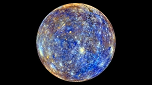
Background imageFrom Space Collection: Mercury hemisphere, MESSENGER image C016 / 9721

Mercury hemisphere, MESSENGER image C016 / 9721
Mercury hemisphere, MESSENGER image. North is at top. This image is centred at longitude 40 degrees West. The colours show chemical and mineralogical differences between the rocks

Background imageFrom Space Collection: Atget crater, Mercury, MESSENGER image C016 / 9719

Atget crater, Mercury, MESSENGER image C016 / 9719
Atget crater on Mercury, MESSENGER image. North is at top. This crater, 100 kilometres across, is located in the Caloris Basin on Mercury, the planet closest to the Sun

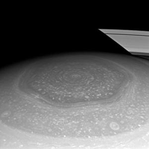
Background imageFrom Space Collection: Saturns north pole region, Cassini image

Saturns north pole region, Cassini image. This north polar hexagon region of the gas giant planet Saturn is in sunlight as spring comes to the planets northern hemisphere

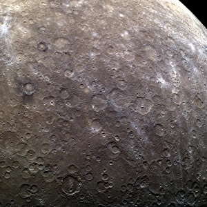
Background imageFrom Space Collection: Craters on Mercury, MESSENGER image C016 / 9720

Craters on Mercury, MESSENGER image C016 / 9720
Craters on Mercury, MESSENGER image. North is towards top left. This area, over 1900 kilometres across, consists mostly of as-yet unnamed craters in the eastern part of the Solitudo Persephones

Background imageFrom Space Collection: Jebel Uweinat mountains, satellite image C016 / 9731

Jebel Uweinat mountains, satellite image C016 / 9731
Jebel Uweinat mountains, satellite image. North is at top. This mountain range (peak elevation: 1934 metres) is located on the Egyptian-Sudanese-Libyan border

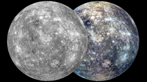
Background imageFrom Space Collection: Mercury hemispheres, MESSENGER images C016 / 9723

Mercury hemispheres, MESSENGER images C016 / 9723
Mercury hemispheres, MESSENGER images. Monochrome (left) and colour-filtered (right) images of a hemisphere of Mercury. North is at top and the hemispheres are centred at longitude 285 degrees West

Background imageFrom Space Collection: Cloud vortex street, satellite image

Cloud vortex street, satellite image. North is at top. The island of Jan Mayen (white, upper left) is located in the Arctic Ocean

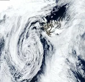
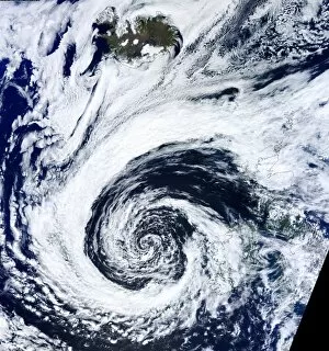
Background imageFrom Space Collection: Low pressure, Iceland, satellite image

Low pressure, Iceland, satellite image. North is at top. The swirl of clouds (lower left) marks an area of low pressure that is centred south-west of Iceland (upper right)

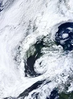
Background imageFrom Space Collection: Low pressure, UK, satellite image

Low pressure, UK, satellite image. North is at top, with land areas outlined in black. The swirl of clouds at lower centre is a lower pressure system centred over South-West England

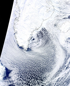
Background imageFrom Space Collection: Cloud streets, Greenland, satellite image

Cloud streets, Greenland, satellite image. North is at top, with Greenland and Iceland outlined in black. Cloud streets are parallel lines of clouds aligned with the wind

Background imageFrom Space Collection: Bassas da India, ISS image C015 / 1897

Bassas da India, ISS image C015 / 1897
Bassas da India photographed by astronauts on the International Space Station (ISS) on 2nd April 2011. Bassas da India is an uninhabited atoll in the Indian Ocean

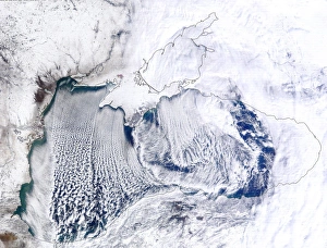
Background imageFrom Space Collection: Cloud streets, Black Sea, satellite image

Cloud streets, Black Sea, satellite image. North is at top, with the Black Sea outlined in black. Cloud streets are parallel lines of clouds aligned with the wind

Background imageFrom Space Collection: Atlantic low pressure, satellite image

Atlantic low pressure, satellite image. North is at top, and land areas are outlined in black. The swirl of cloud at lower centre is a low pressure system centred west of Ireland and the UK

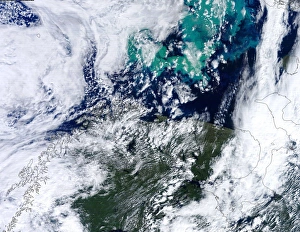
Background imageFrom Space Collection: Barents Sea algal bloom, satellite image

Barents Sea algal bloom, satellite image. North is at top, with land areas outlined in black. Algal blooms (green, top) have formed in the Barents Sea off northern Scandinavia (lower left)

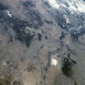
Background imageFrom Space Collection: US-Mexico border, Sonoran Desert C016 / 6318

US-Mexico border, Sonoran Desert C016 / 6318
US-Mexico border, north-western Sonoran Desert. North is towards upper right. Farm fields (green) lie between the Salton Sea in California (top) and the Colorado River Delta in Mexico (bottom)

Background imageFrom Space Collection: New York at night, ISS image C016 / 6382

New York at night, ISS image C016 / 6382
New York at night. Photographed by astronauts aboard the International Space Station 23rd March 2013. The picture was taken using a camera aid called NightPod

Background imageFrom Space Collection: Moonrise C016 / 6312

Moonrise C016 / 6312
Moonrise. View through the Earths atmosphere of the Moon rising in the distance. The blue haze is Earths atmosphere, which fades out into space around 100 kilometres above the surface

Background imageFrom Space Collection: Boston at night, ISS image C016 / 6376

Boston at night, ISS image C016 / 6376
Boston at night. Photographed by astronaut Chris Hadfield aboard the International Space Station 6th April 2012. The picture was taken using a camera aid called NightPod

Background imageFrom Space Collection: New Mexico, USA C016 / 6357

New Mexico, USA C016 / 6357
New Mexico, USA, from Earth orbit. North is towards upper right. At lower right is White Sands National Monument (white), with the Carrizozo Malpais lava flow (dark)

Background imageFrom Space Collection: Venus and Earth, artwork C017 / 7376

Venus and Earth, artwork C017 / 7376
Venus and Earth. Computer artwork comparing the size of the planet Venus (small) with the Earth (large). Venus is the second planet from the Sun

Background imageFrom Space Collection: The Moon from space, artwork C017 / 7341

The Moon from space, artwork C017 / 7341
The Moon from space. Computer artwork of the Moon. The Moon has a diameter of 3475 kilometres, and orbits the Earth at a distance of around 385, 000 kilometres

Background imageFrom Space Collection: Uranus from space, artwork C017 / 7371

Uranus from space, artwork C017 / 7371
Uranus from space. Computer artwork of the planet Uranus. Uranus is the seventh planet from the Sun and the least massive of the gas giants. Its mass is roughly 14.5 times that of the Earth

Background imageFrom Space Collection: Uranus from space, artwork C017 / 7372

Uranus from space, artwork C017 / 7372
Uranus from space. Computer artwork of the planet Uranus. Uranus is the seventh planet from the Sun and the least massive of the gas giants. Its mass is roughly 14.5 times that of the Earth

Background imageFrom Space Collection: Jupiter and Earth, artwork C017 / 7245

Jupiter and Earth, artwork C017 / 7245
Jupiter and Earth. Computer artwork comparing the size of the planet Jupiter (large) with the Earth (small). Jupiter is the largest planet in the solar system

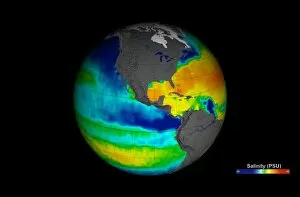
Background imageFrom Space Collection: Sea surface salinity, Aquarius image C017 / 6817

Sea surface salinity, Aquarius image C017 / 6817
Sea surface salinity, Aquarius image. Computer model showing the salinity (dissolved salt-content) of the Atlantic and Pacific oceans

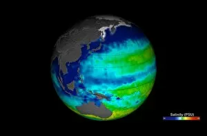
Background imageFrom Space Collection: Sea surface salinity, Aquarius image C017 / 6819

Sea surface salinity, Aquarius image C017 / 6819
Sea surface salinity, Aquarius image. Computer model showing the salinity (dissolved salt-content) of the Western Pacific Ocean

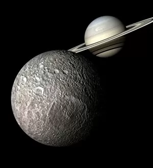
Background imageFrom Space Collection: Saturn and Mimas from space, artwork C017 / 7354

Saturn and Mimas from space, artwork C017 / 7354
Saturn and Mimas from space. Computer artwork showing the planet Saturn (upper right) with Mimas (lower left), one of its moons

Background imageFrom Space Collection: Mars topography, artwork C017 / 7332

Mars topography, artwork C017 / 7332
Mars topography. Computer artwork based on satellite data, showing the topography of the planet Mars. The topography of Mars is clearly divided in two regions

Background imageFrom Space Collection: Wales, United Kingdom, satellite image C014 / 0084

Wales, United Kingdom, satellite image C014 / 0084
Wales, satellite image. North is at top. Natural colour satellite image showing Wales in the United Kingdom, with the surrounding territories shaded out

Background imageFrom Space Collection: Giant solar flare, satellite image

Giant solar flare, satellite image
Giant solar flare. Satellite image showing the development of a giant solar flare (bright) erupting from the surface of the Sun (centre)

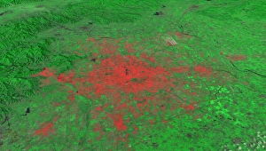
Background imageFrom Space Collection: Beijing, China, 2010, satellite image

Beijing, China, 2010, satellite image
Beijing 2010. Satellite image showing the extent of the city of Beijing, China, in 2010. Beijing is one of the oldest cities in the world

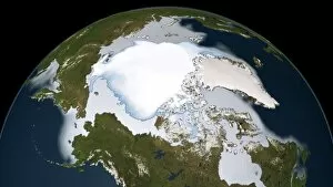
Background imageFrom Space Collection: Artic sea ice coverage, 1980 C014 / 4710

Artic sea ice coverage, 1980 C014 / 4710
Artic sea ice coverage, 1980. Map showing the changes in Arctic sea ice coverage from 1st November 1979 to 31st January 1980

Background imageFrom Space Collection: Greenland ice melt, 2012, satellite image

Greenland ice melt, 2012, satellite image
Greenland ice melt, 2012. Composite image based on data from three NASA satellites, showing the extent of surface melt over Greenlands ice sheet on 12th July 2012. North is at top

Background imageFrom Space Collection: Hurricane Sandy, 28th October 2012 C014 / 5781

Hurricane Sandy, 28th October 2012 C014 / 5781
Hurricane Sandy. Satellite image of hurricane Sandy off the east coast of the USA (top centre) on 28th October 2012 at 17.45 UTC

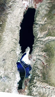
Background imageFrom Space Collection: Dead Sea, 2011 satellite image C014 / 4705

Dead Sea, 2011 satellite image C014 / 4705
Dead Sea. False-colour satellite image of the Dead Sea. North is at top. Deep waters are blue or dark blue, while brighter blues indicate shallow waters or salt ponds (in the south)

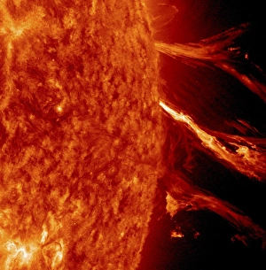
Background imageFrom Space Collection: Solar flare, SDO ultraviolet image

Solar flare, SDO ultraviolet image
Solar activity. Extreme ultraviolet (UV) satellite image showing a solar flare and coronal mass ejection (CME) erupting from the surface of the Sun on 2nd January 2012
Background imageFrom Space Collection: Columbia Glacier, Alaska, 1986

Columbia Glacier, Alaska, 1986
Columbia Glacier, Alaska. False-colour satellite image of the Columbia Glacier, Alaska, USA, taken in 1986. Columbia Glacier descends from an ice field (top) 3, 050 metres above sea level

Background imageFrom Space Collection: Giant solar flare, UV telescope image

Giant solar flare, UV telescope image
Giant solar flare. Ultraviolet (UV) image at 195nm wavelength, of a giant solar flare (bright, lower right) erupting from the surface of the Sun

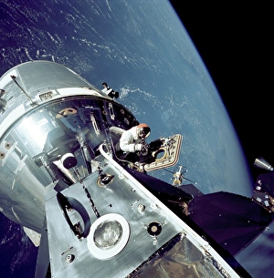
Background imageFrom Space Collection: Apollo 9 docked command module in orbit C014 / 4702

Apollo 9 docked command module in orbit C014 / 4702
Apollo 9 docked command module in orbit. Photograph taken by lunar module pilot Rusty Schweickart of Apollo 9 astronaut Dave Scott standing in the open hatch of the Command Module docked to the Lunar

Background imageFrom Space Collection: Icebergs off Greenland, satellite image

Icebergs off Greenland, satellite image
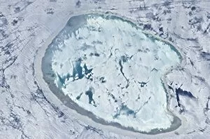
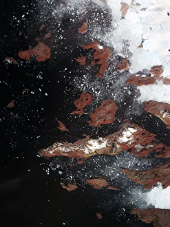
Icebergs off Greenland. Satellite image centred over the west coast of Greenland, showing an ice sheet (white, upper right) on the mainland

Background imageFrom Space Collection: Dead Sea, 1972 satellite image C014 / 4706

Dead Sea, 1972 satellite image C014 / 4706
Dead Sea. False-colour satellite image of the Dead Sea. North is at top. Deep waters are blue or dark blue, while brighter blues indicate shallow waters or salt ponds (in the south)

Background imageFrom Space Collection: Curiosity rover on Mars, satellite image C014 / 4940

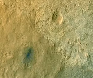
Curiosity rover on Mars, satellite image C014 / 4940
Curiosity rover on Mars. Colour-enhanced satellite image of NASAs Curiosity rover on the surface of Mars. This rover, part of the Mars Science Laboratory (MSL) mission

Background imageFrom Space Collection: Curiosity rover in Gale Crater, Mars C014 / 4944

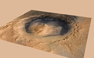
Curiosity rover in Gale Crater, Mars C014 / 4944
Curiosity rover in Gale Crater, Mars. The ellipse (blue) shows the target landing area, and the green dot shows where NASAs Curiosity rover landed on 6 August 2012

Background imageFrom Space Collection: Hurricane Sandy, 29th October 2012 C014 / 5782

Hurricane Sandy, 29th October 2012 C014 / 5782
Hurricane Sandy, 29th October 2012


All Professionally Made to Order for Quick Shipping

"Exploring the vastness of space, we catch a glimpse of our humble abode - the Pale Blue Dot. Voyager 1's iconic image reminds us of Earth's insignificance in the grand scheme of things. " "The breathtaking Earthrise over Moon captured by Apollo 8 serves as a reminder that even from space, our home planet remains an awe-inspiring sight to behold. " "A mesmerizing view of the Whole Earth, also known as Blue Marble 2000, showcases the stunning beauty and fragility of our precious planet. " "From high above, a satellite image reveals the intricate details and natural splendor of the British Isles, offering a unique perspective on this enchanting region. " "As night falls upon the UK, its illuminated cities create a dazzling spectacle when viewed from space. The vibrant lights paint a picture of human activity against the dark canvas of night. " "Gazing down at Europe at night through satellite imagery unveils an interconnected web of bustling metropolises and tranquil landscapes intertwined under twinkling stars. " "Inspired by darkness, Europe at night captivates with its ethereal glow emanating from countless cities scattered across its diverse lands. A testament to humanity's constant motion even after sunset. " "Astonishingly beautiful yet hauntingly mysterious, witnessing Whole Earth at night through satellite imagery evokes contemplation about our place in this vast universe and how we illuminate it with life. " "Jupiter and Io dance gracefully in their celestial ballet as captured by New Horizons' lens. This captivating image transports us beyond our own world into realms where giants roam amidst swirling storms. " "Awe-inspiring from any angle; an exquisite satellite image captures Earth's majestic presence against infinite blackness. A reminder that every corner holds hidden wonders waiting to be discovered. "With remarkable clarity seen from above Scotland within UK is unveiled like never before through detailed satellite imaging—a land steeped in history and adorned with rugged beauty.