Fraud Blocker Skip to main content

Exploration Collection (page 8)

"Unveiling the Unknown: A Journey through Time and Terrain" Embarking on a voyage of discovery, the HMS Erebus and HMS Terror set sail in 1845

Background imageExploration Collection: 1890, Bacon Travelers Pocket Map of London, England, topography, cartography

1890, Bacon Travelers Pocket Map of London, England, topography, cartography
1890, Bacon Travelers Pocket Map of London, England

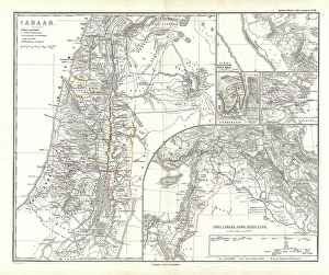
Background imageExploration Collection: 1865, Spruner Map of Israel, Canaan, or Palestine in Ancient Times, topography, cartography

1865, Spruner Map of Israel, Canaan, or Palestine in Ancient Times, topography, cartography
1865, Spruner Map of Israel, Canaan, or Palestine in Ancient Times

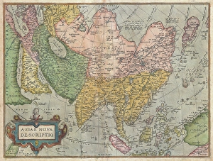
Background imageExploration Collection: 1570, Ortelius Map of Asia, first edition, Abraham Ortelius, also Orthellius, 1527 - 1598

1570, Ortelius Map of Asia, first edition, Abraham Ortelius, also Orthellius, 1527 - 1598, Flemish, Netherlandish cartographer and geographer

Background imageExploration Collection: Panoramic view of the plains of Meridiani on the planet Mars

Panoramic view of the plains of Meridiani on the planet Mars
Panoramic image of an area on Mars dubbed Rub al Khali, acquired by the Mars Exploration Rover Opportunity on the plains of Meridiani

Background imageExploration Collection: View of Burns Cliff on Mars

View of Burns Cliff on Mars
The Mars Exploration Rover Opportunity captured this view of Burns Cliff after driving right to the base of this southeastern portion of the inner wall of Endurance Crater

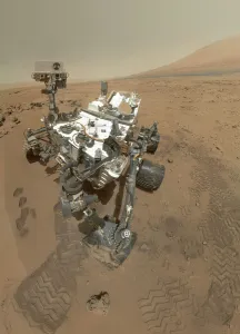
Background imageExploration Collection: Self-portrait of Curiosity rover in Gale Crater on the surface of Mars

Self-portrait of Curiosity rover in Gale Crater on the surface of Mars
On Sol 84 (Oct. 31, 2012), the Curiosity rover used the Mars Hand Lens Imager (MAHLI) to capture the set of thumbnail images stitched together to create this full-color self-portrait

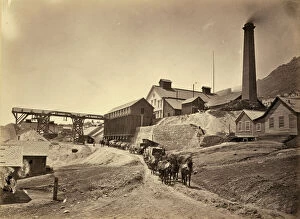
Background imageExploration Collection: NEVADA: VIRGINIA CITY. Savage Works in Virginia City, Nevada. Photograph by Timothy O Sullivan

NEVADA: VIRGINIA CITY. Savage Works in Virginia City, Nevada. Photograph by Timothy O Sullivan, 1868

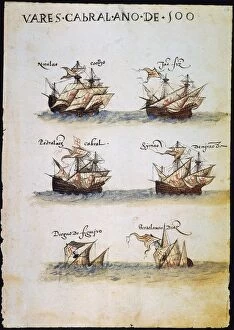
Background imageExploration Collection: CABRAL: FLEET, 1500. Six of the 13 Portuguese ships in Pedro Alvares Cabrals expedition

CABRAL: FLEET, 1500. Six of the 13 Portuguese ships in Pedro Alvares Cabrals expedition to India in 1500, which resulted in the discoveries of Brazil and Madagascar

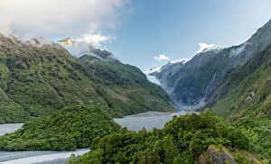
Background imageExploration Collection: Franz Josef Glacier - Panorama View at Sunset

Franz Josef Glacier - Panorama View at Sunset

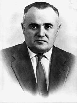
Background imageExploration Collection: Sergei korolyov, soviet scientist and designer in the sphere of rocket building and cosmonautics

Sergei korolyov, soviet scientist and designer in the sphere of rocket building and cosmonautics, ballistic and geophysical rockets, the first satellites

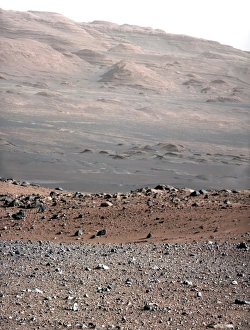
Background imageExploration Collection: Gale Crater landscape, Mars C014 / 4935

Gale Crater landscape, Mars C014 / 4935
Gale Crater landscape, as imaged by NASAs Curiosity rover on Mars. This rover, part of the Mars Science Laboratory (MSL) mission, landed here on 6 August 2012. The view looks south-south-west

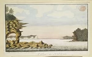
Background imageExploration Collection: View of Grotto Point, looking north-east towards the harbour

View of Grotto Point, looking north-east towards the harbour
Drawing 7 from the Watling Collection titled A View in N.S. Wales. Grotto Point in the entrance of Port Jackson by a Port Jackson Painter, 1788-1797

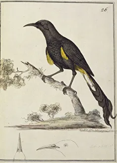
Background imageExploration Collection: Moho nobilis, Hawaii o-o

Moho nobilis, Hawaii o-o
Moho nobilis. Ff. 26, watercolour by William Ellis from a collection of sketches of Mammals, Birds and Fish made on Captian James Cooks third voyage (1776-1780)

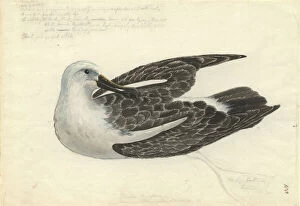
Background imageExploration Collection: Thalassarche chlororhynchos, yellow-nosed albatross

Thalassarche chlororhynchos, yellow-nosed albatross

Background imageExploration Collection: Anas undulata, yellow-billed duck

Anas undulata, yellow-billed duck
Ff. 72. Watercolour painting by George Forster annotated Anas xanthorynchus and made during Captain James Cooks second voyage to explore the southern continent (1772-75)

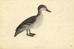
Background imageExploration Collection: Anas erythrorhyncha, red-billed duck

Anas erythrorhyncha, red-billed duck
Ff. 73. Watercolour painting by George Forster annotated Anas pyrrhoryncha and made during Captain James Cooks second voyage to explore the southern continent (1772-75)

Background imageExploration Collection: Monument to the Discoveries beside the Tagus River, Belem, Lisbon, Portugal, Europe

Monument to the Discoveries beside the Tagus River, Belem, Lisbon, Portugal, Europe

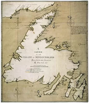
Background imageExploration Collection: COOK: NEWFOUNDLAND, 1763. A Sketch of the Island of Newfoundland drawn in 1763 by James Cook when

COOK: NEWFOUNDLAND, 1763. A Sketch of the Island of Newfoundland drawn in 1763 by James Cook when he was a sailing-master in the Royal Navy

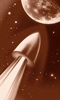
Background imageExploration Collection: Flight to the Moon by Jules Verne

Flight to the Moon by Jules Verne
Flight to the Moon. Artwork depicting a scene from the science fiction novel From the Earth to the Moon (French: De la Terre a la Lune, 1865) by the French author Jules Verne (1828-1905)

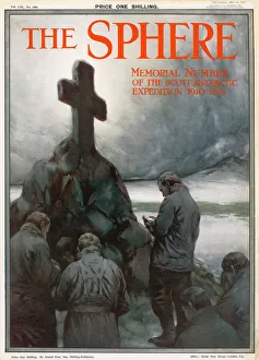
Background imageExploration Collection: Front cover of the Sphere Scott Memorial Number

Front cover of the Sphere Scott Memorial Number
Front cover of The Sphere, Memorial Number of the Scott Antarctic Expedition showing a sombre scene of a group of men praying by a cairn topped with a cross in memory of Captain Scott, who died

Background imageExploration Collection: Frisian Voyagers

Frisian Voyagers
Already an intrepid seafaring people, voyagers from Frisia conduct voyages of exploration into northern latitudes

Background imageExploration Collection: D urville / Astrolabe

D urville / Astrolabe
The corvette Astrolabe caught among icebergs in the Antarctic. Dumont D Urville and his crew attempt to release her - which they do

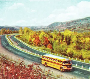
Background imageExploration Collection: Scenic school bus trip

Scenic school bus trip
http://csaimages.com/images/istockprofile/csa_vector_dsp.jpg

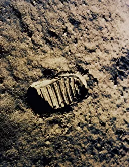
Background imageExploration Collection: Aerospace Industry, Brown, Close-Up, Discovery, Exploration, Final Frontier, Footprint

Aerospace Industry, Brown, Close-Up, Discovery, Exploration, Final Frontier, Footprint
Aerospace Industry, Brown, Close-Up, Discovery, Exploration, Final Fr, 78403186

Background imageExploration Collection: Ernest Shackleton, British explorer, c1909

Ernest Shackleton, British explorer, c1909. Portrait of Shackleton (1874-1922) from his book The Heart of the Antarctic, an account of his expedition of 1908-1909 on board the Nimrod

Background imageExploration Collection: Sketch by Fish showing a couple on a Nights Out, 1926 at Cla

Sketch by Fish showing a couple on a Nights Out, 1926 at Cla
Sketch by Fish for the series Nights Out, 1926 - an exploration of nocturnal acitivities in London and abroad Date: 1926

Background imageExploration Collection: 1818, Pinkerton Map of Chile, John Pinkerton, 1758 - 1826, Scottish antiquarian, cartographer

1818, Pinkerton Map of Chile, John Pinkerton, 1758 - 1826, Scottish antiquarian, cartographer, UK

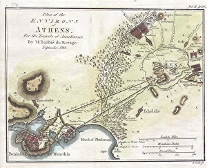
Background imageExploration Collection: 1784, Bocage Map of the City of Athens in Ancient Greece, topography, cartography

1784, Bocage Map of the City of Athens in Ancient Greece, topography, cartography
1784, Bocage Map of the City of Athens in Ancient Greece

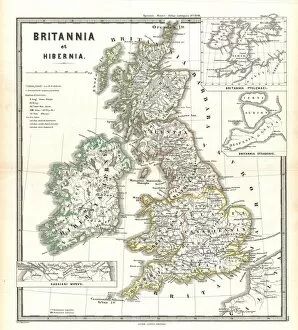
Background imageExploration Collection: 1865, Spruner Map of the British Isles, England, Scotland, Ireland, topography, cartography

1865, Spruner Map of the British Isles, England, Scotland, Ireland, topography, cartography
1865, Spruner Map of the British Isles, England, Scotland, Ireland

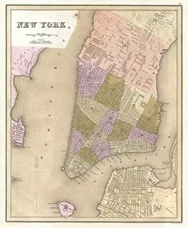
Background imageExploration Collection: 1839, Bradford Map of New York City, New York, topography, cartography, geography

1839, Bradford Map of New York City, New York, topography, cartography, geography
1839, Bradford Map of New York City, New York

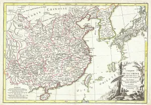
Background imageExploration Collection: 1770, Bonne Map of China, Korea, Japan and Formosa, Rigobert Bonne 1727 - 1794, one

1770, Bonne Map of China, Korea, Japan and Formosa, Rigobert Bonne 1727 - 1794, one of the most important cartographers of the late 18th century

Background imageExploration Collection: 1683, Mortier Map of North America, the West Indies, and the Atlantic Ocean, topography

1683, Mortier Map of North America, the West Indies, and the Atlantic Ocean, topography
1683, Mortier Map of North America, the West Indies, and the Atlantic Ocean

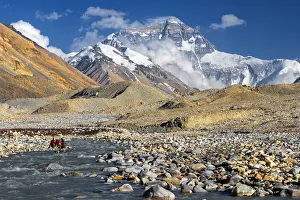
Background imageExploration Collection: mt. Everest from Everest Base Camp, Tibet

mt. Everest from Everest Base Camp, Tibet

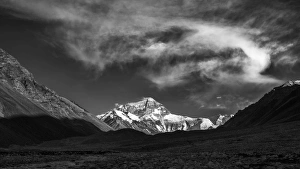
Background imageExploration Collection: mt. Everest from Everest Base Camp, Tibet, China

mt. Everest from Everest Base Camp, Tibet, China

Background imageExploration Collection: Map of India and Indian Ocean, from Miller Atlas by Pedro and Jorge Reinel, Lopo Homen

Map of India and Indian Ocean, from Miller Atlas by Pedro and Jorge Reinel, Lopo Homen
Cartography, 16th century. Map of India and Indian Ocean, from Miller Atlas, by Pedro and Jorge Reinel, Lopo Homen (cartographers) and Antonio de Holanda (miniaturist), 1519

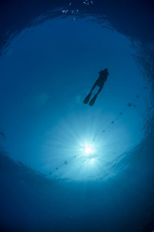
Background imageExploration Collection: Silhouette of one scuba diver and sunball underwater, fish eye view, Egypt, North Africa, Africa

Silhouette of one scuba diver and sunball underwater, fish eye view, Egypt, North Africa, Africa

Background imageExploration Collection: View of Sydney Harbour, Sydney, Australia

View of Sydney Harbour, Sydney, Australia
A photograph taken during the voyage of H.M.S. Challenger (1872-1876) funded by the British Government for scientific purposes

Background imageExploration Collection: Chart of oceanic section, Madeira, Portugal to St. Vincent

Chart of oceanic section, Madeira, Portugal to St. Vincent
A photograph taken during the voyage of H.M.S. Challenger (1872-1876) funded by the British Government for scientific purposes

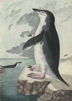
Background imageExploration Collection: Pygoscelis antarcticus, chinstrap penguin

Pygoscelis antarcticus, chinstrap penguin
Ff. 82. Watercolour painting by George Forster annotated Aptenodytes antartica and made during Captain James Cooks second voyage to explore the southern continent (1772-75)

Background imageExploration Collection: NORSEMEN AND NATIVE AMERICANS. Norsemen trading with Native Americans on the east cost of North

NORSEMEN AND NATIVE AMERICANS. Norsemen trading with Native Americans on the east cost of North America, early 11th century A.D. Wood engraving, American, 1846

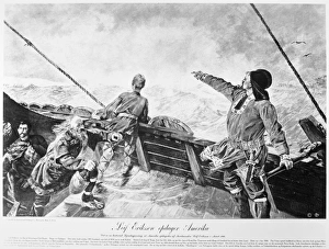
Background imageExploration Collection: LEIF ERICSSON (c970-1020) Discovering America. Line engraving, late 19th century

LEIF ERICSSON (c970-1020) Discovering America. Line engraving, late 19th century, after a painting by Christian Krohg

Background imageExploration Collection: Authority from Henry VII

Authority from Henry VII
Authority for Henry VII to grant letters patent to John Cabot for a voyage to discover new lands 5 March 1496 Date: 5th March 1496

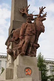
Background imageExploration Collection: Monument to Arctic exploration - Archangel

Monument to Arctic exploration - Archangel
Russia, Arkhangelsk (Archangel) - Monument to Arctic exploration and explorers. 2010

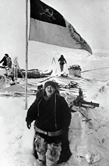
Background imageExploration Collection: Soviet Arctic explorer Papanin, 1937

Soviet Arctic explorer Papanin, 1937
Soviet Arctic explorer Ivan Papanin (1894-1986) in 1937 while commanding the first Soviet drifting station " North Pole-1". Expedition members and equipment are in the background

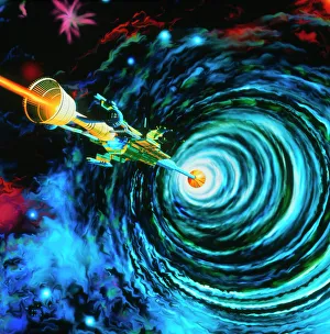
Background imageExploration Collection: Artwork of Bussard RamScoop starship

Artwork of Bussard RamScoop starship

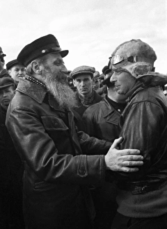
Background imageExploration Collection: Otto Schmidt, Soviet Arctic explorer

Otto Schmidt, Soviet Arctic explorer
Otto Yulievich Schmidt (left, 1891-1956), Soviet Arctic explorer and geophysicist, greeting one of the rescue pilots (right) during the Chelyuskin expedition to the Arctic

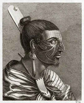
Background imageExploration Collection: Maori man, profile, 18th century

Maori man, profile, 18th century
Maori man. Engraved plate showing a profile of a Maori man. Clearly seen are the facial tattoos, hair comb and other jewellery worn

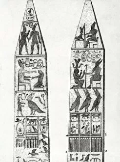
Background imageExploration Collection: Egyptian obelisks, 18th century artwork

Egyptian obelisks, 18th century artwork. Egyptian hieroglyphics can be seen carved on the sides. This artwork is from the Italian edition of De l origine des lois, des arts et des sciences


All Professionally Made to Order for Quick Shipping

"Unveiling the Unknown: A Journey through Time and Terrain" Embarking on a voyage of discovery, the HMS Erebus and HMS Terror set sail in 1845, their mission shrouded in mystery. As they ventured into uncharted waters, these vessels became symbols of exploration's relentless pursuit. Across distant lands, explorers like Sir Edmund Hillary left indelible marks on history. Scaling the majestic Mount Everest alongside Tenzing Norgay in 1953, they reached new heights both literally and metaphorically. Their triumph echoed throughout time as a testament to human resilience. Yet not all expeditions ended with glory. The ill-fated journey of Erebus and Terror marked Franklin's last endeavor, forever etched in maritime lore. These ships vanished into icy depths, leaving behind tales of bravery amidst treacherous conditions. In a single snapshot captured from space, the Earthrise photograph revealed our planet's fragility against the vastness of space—a reminder that exploration extends beyond earthly boundaries. Heroes emerged from adversity; Shackleton, Wild, and Adams defied nature's wrath during their Antarctic expedition—an epic tale of survival against all odds. The HMS Beagle Ship laid up after Darwin's transformative voyage—its significance imprinted upon scientific progress forevermore. This vessel carried ideas that challenged conventions and reshaped our understanding of life itself. Maps unfolded before us like portals to unknown territories—the British Empire world map depicted an era when exploration expanded horizons far beyond imagination. From ancient Viking ships sailing turbulent seas to Captain Francis Crozier leading his crew aboard HMS Terror—exploration coursed through veins filled with courage and determination. Even within city limits lay untrodden paths waiting to be discovered—the James Craig Map showcased Edinburgh's New Town emerging from topographical dreams into reality—an urban landscape born out of innovation and vision.