Fraud Blocker Skip to main content

Earth Observation Collection (page 10)

"Earth Observation: Glimpses of Our Pale Blue Dot and Beyond" In the vast expanse of space

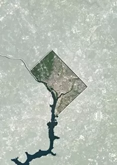
Background imageEarth Observation Collection: Washington DC, USA, satellite image

Washington DC, USA, satellite image
Washington DC, USA. North is at top. Natural colour satellite showing Washington, D.C. in the Mid Atlantic region of the USA, with the surrounding states shaded out

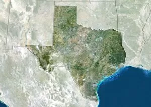
Background imageEarth Observation Collection: Texas, USA, satellite image

Texas, USA, satellite image
Texas, USA. North is at top. Natural colour satellite image of the USA, showing the state of Texas, with the surrounding states shaded out. The USA consists of 50 states

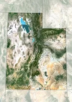
Background imageEarth Observation Collection: Utah, USA, satellite image

Utah, USA, satellite image
Utah, USA. North is at top. Natural colour satellite image of the USA, showing the state of Utah, with the surrounding states shaded out. The USA consists of 50 states

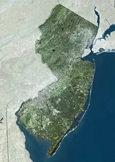
Background imageEarth Observation Collection: New Jersey, USA, satellite image

New Jersey, USA, satellite image
New Jersey, USA. North is at top. Natural colour satellite image of the USA, showing the state of New Jersey, with the surrounding states shaded out. The Atlantic Ocean (blue) is also shown

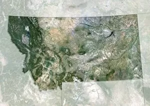
Background imageEarth Observation Collection: Montana, USA, satellite image

Montana, USA, satellite image
Montana, USA. North is at top. Natural colour satellite image of the USA, showing the state of Montana, with the surrounding states shaded out. The USA consists of 50 states

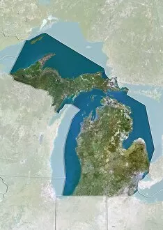
Background imageEarth Observation Collection: Michigan, USA, satellite image

Michigan, USA, satellite image
Michigan, USA. North is at top. Natural colour satellite image of the USA, showing the state of Michigan with the surrounding states shaded out. The USA consists of 50 states

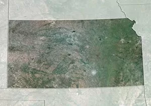
Background imageEarth Observation Collection: Kansas, USA, satellite image

Kansas, USA, satellite image
Kansas, USA. North is at top. Natural colour satellite image of the USA, showing the state of Kansas with the surrounding states shaded out. The USA consists of 50 states

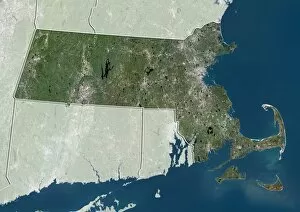
Background imageEarth Observation Collection: Massachusetts, USA, satellite image

Massachusetts, USA, satellite image
Massachusetts, USA. North is at top. Natural colour satellite image of the USA, showing the state of Massachusetts with the surrounding states shaded out. The USA consists of 50 states

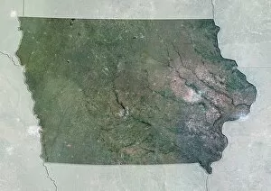
Background imageEarth Observation Collection: Iowa, USA, satellite image

Iowa, USA, satellite image
Iowa, USA. North is at top. Natural colour satellite image of the USA, showing the state of Iowa with the surrounding states shaded out. The USA consists of 50 states

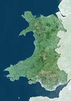
Background imageEarth Observation Collection: Wales, UK, satellite image

Wales, UK, satellite image
Wales, UK. North is at top. Natural colour satellite image showing Wales in the United Kingdom, with the surrounding territories shaded out

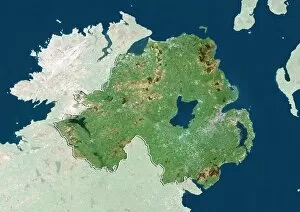
Background imageEarth Observation Collection: Northern Ireland, UK, satellite image

Northern Ireland, UK, satellite image
Northern Ireland, UK. North is at top. Natural colour satellite image showing Northern Ireland in the United Kingdom, with the surrounding territories shaded out

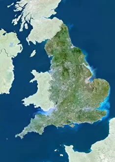
Background imageEarth Observation Collection: England, UK, satellite image

England, UK, satellite image
England, UK. North is at top. Natural colour satellite image showing England in the United Kingdom, with the surrounding territories shaded out

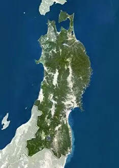
Background imageEarth Observation Collection: Tohoku, Japan, satellite image

Tohoku, Japan, satellite image
Tohoku, Japan. North is at top. Natural colour satellite image showing the Tohoku region of Japan, with the surrounding regions shaded out. Japan is an island nation in East Asia

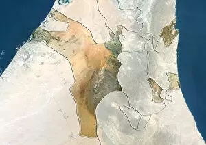
Background imageEarth Observation Collection: Sharjah, UAE, satellite image

Sharjah, UAE, satellite image
Sharjah, United Arab Emirates. North is at top. Natural colour satellite image showing the emirate of Sharjah, United Arab Emirates (UAE), with the surrounding emirates shaded out

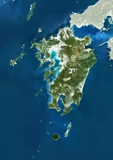
Background imageEarth Observation Collection: Kyushu, Japan, satellite image

Kyushu, Japan, satellite image
Kyushu, Japan. North is at top. Natural colour satellite image showing the island of Kyushu, Japan, with the surrounding regions shaded out. Japan is an island nation in East Asia

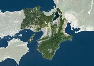
Background imageEarth Observation Collection: Kansai, Japan, satellite image

Kansai, Japan, satellite image
Kansai, Japan. North is at top. Natural colour satellite image showing the Kansai region of Japan, with the surrounding regions shaded out. Japan is an island nation in East Asia

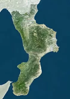
Background imageEarth Observation Collection: Calabria, Italy, satellite image

Calabria, Italy, satellite image
Calabria, Italy. North is at top. Natural colour satellite image showing the region of Calabria, in Italy, with the surrounding Italian regions shaded out

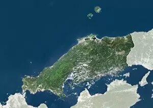
Background imageEarth Observation Collection: Chugoku, Japan, satellite image

Chugoku, Japan, satellite image
Chugoku, Japan. North is at top. Natural colour satellite image showing the Chugoku region of Japan, with the surrounding regions shaded out. Japan is an island nation in East Asia

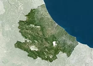
Background imageEarth Observation Collection: Abruzzo, Italy, satellite image

Abruzzo, Italy, satellite image
Abruzzo, Italy. North is at top. Natural colour satellite image showing the region of Abruzzo, in Italy, with the surrounding Italian regions shaded out

Background imageEarth Observation Collection: Uttarakhand, India, satellite image

Uttarakhand, India, satellite image
Uttarakhand, India. North is at top. Natural colour satellite image showing the state of Uttarakhand, India, with the surrounding states shaded out. India is located in South Asia

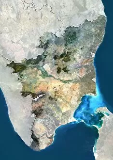
Background imageEarth Observation Collection: Tamil Nadu, India, satellite image

Tamil Nadu, India, satellite image
Tamil Nadu, India. North is at top. Natural colour satellite image showing the state of Tamil Nadu, India, with the surrounding states shaded out. India is located in South Asia

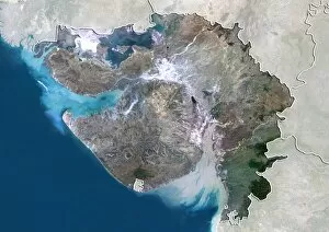
Background imageEarth Observation Collection: Gujarat, India, satellite image

Gujarat, India, satellite image
Gujarat, India. North is at top. Natural colour satellite image showing the state of Gujarat, India, with the surrounding states shaded out. India is located in South Asia

Background imageEarth Observation Collection: Delhi, India, satellite image

Delhi, India, satellite image
Delhi, India. North is at top. Natural colour satellite image showing the National Capital Territory of Delhi, India, with the surrounding states shaded out. India is located in South Asia

Background imageEarth Observation Collection: Xinjiang, China, satellite image

Xinjiang, China, satellite image
Xinjiang, China. North is at top. Natural colour satellite image showing the Xinjiang region of China, with the surrounding Chinese provinces and regions shaded out

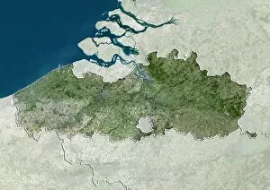
Background imageEarth Observation Collection: Flanders, Belgium, satellite image

Flanders, Belgium, satellite image
Flanders, Belgium. North is at top. Natural colour satellite image showing the Flemish region of Belgium, with the surrounding regions shaded out

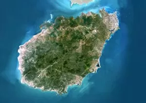
Background imageEarth Observation Collection: Hainan, China, satellite image

Hainan, China, satellite image
Hainan, China. North is at top. Natural colour satellite image showing Hainan Island off the coast of China (top). Hainan is located in the South China Sea (blue)

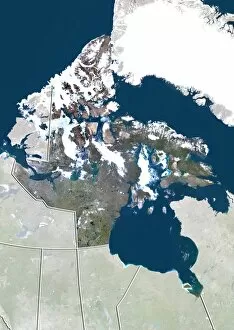
Background imageEarth Observation Collection: Nunavut, Canada, satellite image

Nunavut, Canada, satellite image. North is at top. Natural colour satellite image showing the Canadian province of Nunavut

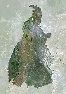
Background imageEarth Observation Collection: Tocantins, Brazil, satellite image

Tocantins, Brazil, satellite image
Amazonas, Brazil. North is at top. Natural colour satellite image showing the state of Tocantins in Brazil, with the surrounding states shaded out

Background imageEarth Observation Collection: Alberta, Canada, satellite image

Alberta, Canada, satellite image
Alberta, Canada. North is at top. Natural colour satellite image showing the Canadian province of Alberta with the surrounding provinces and territories shaded out

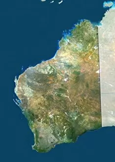
Background imageEarth Observation Collection: Western Australia

Western Australia. True colour satellite image showing the state of Western Australia, with the surrounding states and territories shaded out, the Great Australian Bight (blue, bottom right)

Background imageEarth Observation Collection: Victoria, Australia

Victoria, Australia. True colour satellite image showing the state of Victoria, Australia, with the surrounding states and territories shaded out, and the Great Australian Bight (blue) at bottom

Background imageEarth Observation Collection: South Australia

South Australia. True colour satellite image showing the state of South Australia, with the surrounding states and territories shaded out, and the Great Australian Bight (blue) at bottom

Background imageEarth Observation Collection: Northern Territory, Australia

Northern Territory, Australia. Natural colour satellite image showing Australias Northern Territory, with the surrounding states and territories shaded out

Background imageEarth Observation Collection: Queensland, Australia

Queensland, Australia. True colour satellite image showing the state of Queensland, Australia, with the surrounding states and territories shaded out, and the island of New Guinea at top

Background imageEarth Observation Collection: New South Wales, Australia

New South Wales, Australia. True colour satellite image showing the state of New South Wales, Australia, with the surrounding states and territories shaded out

Background imageEarth Observation Collection: Earth from space, astronaut photo C014 / 0570

Earth from space, astronaut photo C014 / 0570
Earth from space, astronaut photo. Image taken by the STS-109 crew members onboard Space Shuttle Columbia. This image shows the Red Sea (blue, lower left), Sinai Peninsula (triangular)

Background imageEarth Observation Collection: Global tectonics, Pacific Plate C016 / 0582

Global tectonics, Pacific Plate C016 / 0582
Global tectonics. Satellite-based artwork of an Earth globe centred on the Pacific Plate. This is one of the seven primary tectonic plates that make up the Earths crust

Background imageEarth Observation Collection: Global tectonics, Eurasian Plate C016 / 0580

Global tectonics, Eurasian Plate C016 / 0580
Global tectonics. Satellite-based artwork of an Earth globe centred on the Eurasian Plate. This is one of the seven primary tectonic plates that make up the Earths crust

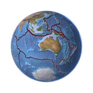
Background imageEarth Observation Collection: Global tectonics, Australian Plate C016 / 0579

Global tectonics, Australian Plate C016 / 0579
Global tectonics. Satellite-based artwork of an Earth globe centred on the Australian Plate. This is one of the seven primary tectonic plates that make up the Earths crust

Background imageEarth Observation Collection: Global tectonics, Antarctic Plate C016 / 0578

Global tectonics, Antarctic Plate C016 / 0578
Global tectonics. Satellite-based artwork of an Earth globe centred on the Antarctic Plate. This is one of the seven primary tectonic plates that make up the Earths crust

Background imageEarth Observation Collection: Global tectonics, African Plate C016 / 0577

Global tectonics, African Plate C016 / 0577
Global tectonics. Satellite-based artwork of an Earth globe centred on the African Plate. This is one of the seven primary tectonic plates that make up the Earths crust

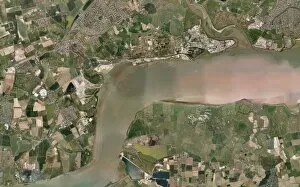
Background imageEarth Observation Collection: Thames Estuary, UK, aerial view C014 / 6206

Thames Estuary, UK, aerial view C014 / 6206
Thames Estuary. Aerial photograph of the Thames Estuary, UK. Essex is north of the estuary, Kent to the south

Background imageEarth Observation Collection: Sittingbourne, UK, aerial view C014 / 6205

Sittingbourne, UK, aerial view C014 / 6205
Sittingbourne. Aerial photograph of Sittingbourne, Kent, UK, and the surrounding area

Background imageEarth Observation Collection: South East England, satellite image

South East England, satellite image
South East England. 15 metre resolution satellite image of South East England. London, the capital city of the UK, is at left centre. The River Thames flows through London to the North Sea (right)

Background imageEarth Observation Collection: West Africa, satellite image

West Africa, satellite image
West Africa. Satellite image centre over West Africa, with Spain and Portugal on the Iberian Peninsula at upper right

Background imageEarth Observation Collection: Saudi Arabia agriculture, 2000

Saudi Arabia agriculture, 2000
Saudi Arabia agriculture. False-colour satellite image showing the extent of agricultural operations in the Wadi As-Sirhan Basin of Saudi Arabia in 2000

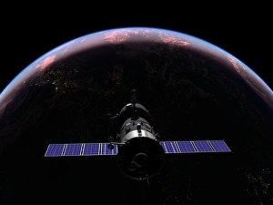
Background imageEarth Observation Collection: Soyuz spacecraft in Earth orbit, artwork

Soyuz spacecraft in Earth orbit, artwork
Soyuz spacecraft in Earth orbit. Artwork of a Soyuz TMA-M spacecraft at sunset over the Atlantic Ocean at an orbital altitude of 320 kilometres

Background imageEarth Observation Collection: Saudi Arabia agriculture, 1987

Saudi Arabia agriculture, 1987
Saudi Arabia agriculture. False-colour satellite image showing the extent of agricultural operations in the Wadi As-Sirhan Basin of Saudi Arabia in 1987


All Professionally Made to Order for Quick Shipping

"Earth Observation: Glimpses of Our Pale Blue Dot and Beyond" In the vast expanse of space, Voyager 1 captured an awe-inspiring image that forever changed our perspective. The iconic "Pale Blue Dot" photograph revealed Earth as a tiny speck in the cosmic ocean, reminding us of our interconnectedness on this magnificent planet. Zooming in closer, we witness the intricate details of human achievements. The Wimbledon tennis complex stands out amidst the bustling cityscape of London, UK. From high above, a satellite image showcases the British Isles with its lush green landscapes and rugged coastlines – a testament to nature's beauty. As night falls, lights illuminate cities across Europe like constellations on Earth's canvas. A mesmerizing satellite image captures the brilliance of UK at night from space – a tapestry woven by millions living their lives under starry skies. Expanding further into darkness reveals Europe at night; clusters of light representing vibrant metropolises and quiet towns alike. And then there it is - an astonishing view showcasing our entire planet bathed in nocturnal glow - Whole Earth at night seen from space. Venturing beyond terrestrial boundaries, Tenerife emerges through a satellite lens – its volcanic terrain contrasting against azure waters surrounding this Spanish island paradise. The International Space Station floats gracefully in orbit around Earth during 2008 – humanity's outpost where astronauts conduct research while gazing back upon their home planet with wonderment. From afar, another satellite image depicts Earth from space - swirling clouds dance over continents and oceans; an ever-changing masterpiece painted by atmospheric currents and weather patterns. Closer to home once more, Scotland's stunning landscape unfolds beneath us through yet another captivating satellite image. Majestic mountains blend seamlessly with lochs and glens creating breathtaking scenery that captivates all who behold it.