
De Wit Collection
Discover the captivating world of Frederik de Wit (1600-1672), a Dutch cartographer and engraver of the 17th century


All Professionally Made to Order for Quick Shipping
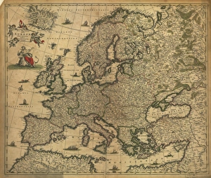
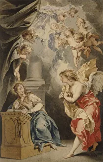
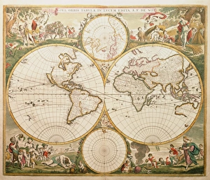
Discover the captivating world of Frederik de Wit (1600-1672), a Dutch cartographer and engraver of the 17th century. His intricately detailed maps, including the "Nova Europas Descriptio Aucta F. De Wit" and "Nova orbis tabvla lvcem edita A. F. De Wit, " showcased Europe and the world with unprecedented accuracy. De Wit's artistic talents extended beyond cartography, as seen in his masterful interpretation of religious themes, such as "The Annunciation" and "Archangel Michael, " created in black chalk, pen, grey ink, watercolor, and heightened with white. His maps and illustrations were highly sought after, with the "Map of Europe" and "Map showing Portugal" being prime examples. De Wit's impact on history is further highlighted by his role in the "Escape of Steyn and De Wit, " an event documented in an illustration from "After Pretoria: The Guerilla War. " With a career spanning over six decades and a production number of approximately 986, 455 maps, De Wit's legacy continues to inspire and inform our understanding of the world.