Fraud Blocker Skip to main content

Church View Collection

"Exploring the Church View: A Spiritual Journey through Yorkshire, Sunderland

Background imageChurch View Collection: East Riding of Yorkshire YO43 4 Map

East Riding of Yorkshire YO43 4 Map
Postcode Sector Map of East Riding of Yorkshire YO43 4

Background imageChurch View Collection: Melton LE14 2 Map

Melton LE14 2 Map
Postcode Sector Map of Melton LE14 2

Background imageChurch View Collection: Piana Village, Les Calanches, Corsica Island, France, UNESCO

Piana Village, Les Calanches, Corsica Island, France, UNESCO

Background imageChurch View Collection: Wakefield WF1 5 Map

Wakefield WF1 5 Map
Postcode Sector Map of Wakefield WF1 5

Background imageChurch View Collection: Sunderland SR3 1 Map

Sunderland SR3 1 Map
Postcode Sector Map of Sunderland SR3 1

Background imageChurch View Collection: Barnsley S74 0 Map

Barnsley S74 0 Map
Postcode Sector Map of Barnsley S74 0

Background imageChurch View Collection: Barnsley S73 9 Map

Barnsley S73 9 Map
Postcode Sector Map of Barnsley S73 9

Background imageChurch View Collection: Barnsley S70 4 Map

Barnsley S70 4 Map
Postcode Sector Map of Barnsley S70 4

Background imageChurch View Collection: Hampshire RG29 1 Map

Hampshire RG29 1 Map
Postcode Sector Map of Hampshire RG29 1

Background imageChurch View Collection: Telford and Wrekin TF4 2 Map

Telford and Wrekin TF4 2 Map
Postcode Sector Map of Telford and Wrekin TF4 2

Background imageChurch View Collection: West Norfolk PE33 9 Map

West Norfolk PE33 9 Map
Postcode Sector Map of West Norfolk PE33 9

Background imageChurch View Collection: Norfolk NR14 8 Map

Norfolk NR14 8 Map
Postcode Sector Map of Norfolk NR14 8

Background imageChurch View Collection: Rochdale OL11 5 Map

Rochdale OL11 5 Map
Postcode Sector Map of Rochdale OL11 5

Background imageChurch View Collection: Bedford MK45 2 Map

Bedford MK45 2 Map
Postcode Sector Map of Bedford MK45 2

Background imageChurch View Collection: Leeds LS14 3 Map

Leeds LS14 3 Map
Postcode Sector Map of Leeds LS14 3

Background imageChurch View Collection: Salford M44 6 Map

Salford M44 6 Map
Postcode Sector Map of Salford M44 6

Background imageChurch View Collection: Leeds LS25 6 Map

Leeds LS25 6 Map
Postcode Sector Map of Leeds LS25 6

Background imageChurch View Collection: Leeds LS25 5 Map

Leeds LS25 5 Map
Postcode Sector Map of Leeds LS25 5

Background imageChurch View Collection: Aylesbury Vale HP22 5 Map

Aylesbury Vale HP22 5 Map
Postcode Sector Map of Aylesbury Vale HP22 5

Background imageChurch View Collection: Gloucester GL13 9 Map

Gloucester GL13 9 Map
Postcode Sector Map of Gloucester GL13 9

Background imageChurch View Collection: North Lincolnshire DN18 5 Map

North Lincolnshire DN18 5 Map
Postcode Sector Map of North Lincolnshire DN18 5

Background imageChurch View Collection: North Dorset DT11 8 Map

North Dorset DT11 8 Map
Postcode Sector Map of North Dorset DT11 8

Background imageChurch View Collection: Colchester CO7 7 Map

Colchester CO7 7 Map
Postcode Sector Map of Colchester CO7 7

Background imageChurch View Collection: Bristol BS16 5 Map

Bristol BS16 5 Map
Postcode Sector Map of Bristol BS16 5

Background imageChurch View Collection: Wakefield WF4 3 Map

Wakefield WF4 3 Map
Postcode Sector Map of Wakefield WF4 3

Background imageChurch View Collection: North Yorkshire YO17 6 Map

North Yorkshire YO17 6 Map
Postcode Sector Map of North Yorkshire YO17 6

Background imageChurch View Collection: North Yorkshire YO51 9 Map

North Yorkshire YO51 9 Map
Postcode Sector Map of North Yorkshire YO51 9

Background imageChurch View Collection: York YO8 5 Map

York YO8 5 Map
Postcode Sector Map of York YO8 5

Background imageChurch View Collection: North Yorkshire YO7 1 Map

North Yorkshire YO7 1 Map
Postcode Sector Map of North Yorkshire YO7 1

Background imageChurch View Collection: North Yorkshire YO17 8 Map

North Yorkshire YO17 8 Map
Postcode Sector Map of North Yorkshire YO17 8

Background imageChurch View Collection: York YO8 6 Map

York YO8 6 Map
Postcode Sector Map of York YO8 6

Background imageChurch View Collection: Redcar & Cleveland TS12 1 Map

Redcar & Cleveland TS12 1 Map
Postcode Sector Map of Redcar & Cleveland TS12 1

Background imageChurch View Collection: Cheshire East WA16 6 Map

Cheshire East WA16 6 Map
Postcode Sector Map of Cheshire East WA16 6

Background imageChurch View Collection: Cheshire West and Chester WA6 8 Map

Cheshire West and Chester WA6 8 Map
Postcode Sector Map of Cheshire West and Chester WA6 8

Background imageChurch View Collection: Shepway TN29 0 Map

Shepway TN29 0 Map
Postcode Sector Map of Shepway TN29 0

Background imageChurch View Collection: Ashford TN27 8 Map

Ashford TN27 8 Map
Postcode Sector Map of Ashford TN27 8

Background imageChurch View Collection: Eastleigh SO32 2 Map

Eastleigh SO32 2 Map
Postcode Sector Map of Eastleigh SO32 2

Background imageChurch View Collection: Staffordshire ST21 6 Map

Staffordshire ST21 6 Map
Postcode Sector Map of Staffordshire ST21 6

Background imageChurch View Collection: Shropshire SY4 2 Map

Shropshire SY4 2 Map
Postcode Sector Map of Shropshire SY4 2

Background imageChurch View Collection: Sunderland SR5 2 Map

Sunderland SR5 2 Map
Postcode Sector Map of Sunderland SR5 2

Background imageChurch View Collection: Tameside SK14 1 Map

Tameside SK14 1 Map
Postcode Sector Map of Tameside SK14 1

Background imageChurch View Collection: Wiltshire SN11 0 Map

Wiltshire SN11 0 Map
Postcode Sector Map of Wiltshire SN11 0

Background imageChurch View Collection: Wiltshire SN15 4 Map

Wiltshire SN15 4 Map
Postcode Sector Map of Wiltshire SN15 4

Background imageChurch View Collection: Wiltshire SN15 1 Map

Wiltshire SN15 1 Map
Postcode Sector Map of Wiltshire SN15 1

Background imageChurch View Collection: South Oxfordshire RG9 5 Map

South Oxfordshire RG9 5 Map
Postcode Sector Map of South Oxfordshire RG9 5

Background imageChurch View Collection: Kennet SN10 4 Map

Kennet SN10 4 Map
Postcode Sector Map of Kennet SN10 4

Background imageChurch View Collection: Wiltshire SN6 6 Map

Wiltshire SN6 6 Map
Postcode Sector Map of Wiltshire SN6 6

Background imageChurch View Collection: Wakefield WF9 3 Map

Wakefield WF9 3 Map
Postcode Sector Map of Wakefield WF9 3


All Professionally Made to Order for Quick Shipping

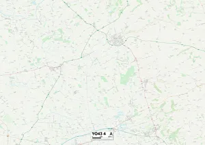
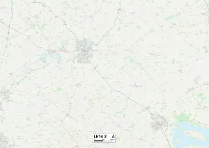
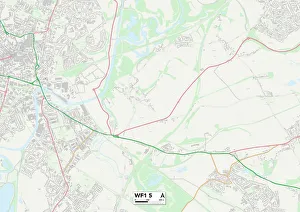
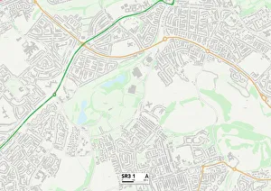
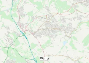
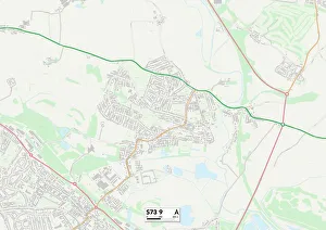
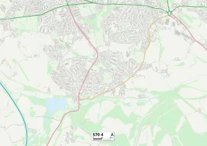
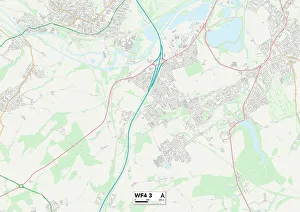
"Exploring the Church View: A Spiritual Journey through Yorkshire, Sunderland, and Beyond" Embark on a captivating spiritual journey as we delve into the enchanting landscapes of Church View. Nestled in the heart of East Riding of Yorkshire (YO43 4 Map), this picturesque location offers breathtaking views that will leave you in awe. As we venture further, our next stop takes us to Melton (LE14 2 Map), where tranquility meets divinity. The church view here is a sight to behold, with its timeless architecture and serene surroundings. Moving on to Wakefield (WF1 5 Map), prepare to be mesmerized by an ethereal panorama that showcases both history and faith. The church view in this vibrant city is a testament to the rich cultural heritage it holds dear. Continuing our expedition, Sunderland (SR3 1 Map) welcomes us with open arms. Here, amidst its bustling streets, lies a hidden gem – a church view that exudes serenity amidst urban life. Take a moment to pause and reflect in this oasis of calm. Our journey then leads us southward towards Barnsley (S74 0 Map). With not just one but three remarkable church views - S74 0, S73 9, and S70 4 Maps - this town offers an immersive experience for those seeking solace within sacred spaces. Leaving behind South Yorkshire's charm, Telford and Wrekin (TF4 2 Map) beckons with its own unique allure. Discover peace amid nature's embrace as you witness the harmonious blend of spirituality and natural beauty at their finest. Heading eastwards now brings us to West Norfolk (PE33 9 Map). Prepare yourself for an enchanting encounter with centuries-old churches nestled among idyllic countryside vistas – truly a sight worth cherishing forever. Norfolk's NR14 8 map unveils yet another treasure trove of church views.