Fraud Blocker Skip to main content

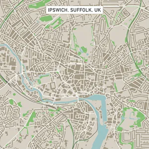
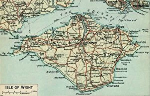
Cartography Collection (page 3)

Cartography, the art of mapmaking, has a rich history that spans centuries and continents

Background imageCartography Collection: General Map of British South Africa, 1900. Creator: Unknown

General Map of British South Africa, 1900. Creator: Unknown
General Map of British South Africa, 1900. From " South Africa and the Transvaal War, Vol. I", by Louis Creswicke. [T. C. & E. C. Jack, Edinburgh, 1900]

Background imageCartography Collection: Map of Scarborough

Map of Scarborough
" Vintage map from 1880 of Scarborough, a town on the North Sea coast of North Yorkshire, England.++Inspector: Info about source material uploaded as property release++"

Background imageCartography Collection: Map of the Ancient World according to Herodotus

Map of the Ancient World according to Herodotus
Vintage engraving of a Map of the Ancient World according to Herodotus. Herodotus was a Greek historian who was born in Halicarnassus, Caria and lived in the fifth century BC

Background imageCartography Collection: Antique map, North and East Yorkshire 19th Century

Antique map, North and East Yorkshire 19th Century
Vintage engraving of a Antique map, North and East Yorkshire 19th Century

Background imageCartography Collection: World map from 1520

World map from 1520
Western hemisphere of the Johannes SchAoner globe from 1520. expedition

Background imageCartography Collection: Antique map of Bombay, India, 19th Century

Antique map of Bombay, India, 19th Century
Antique map of Bombay, Berar, and part of central India from 1891

Background imageCartography Collection: The Selden Map of China. Artist: Chinese Master

The Selden Map of China. Artist: Chinese Master
The Selden Map of China. Found in the collection of the Bodleian Library, Oxford

Background imageCartography Collection: Map of Essex, 1678. Artists: John Ogilby, William Morgan

Map of Essex, 1678. Artists: John Ogilby, William Morgan
Map of Essex, 1678. From Essex, actually surveyed, with the several Roads from London &c. by Francis Lamb. [Philip Lea, Essex, 1678]

Background imageCartography Collection: Map of the Caribbean island of Martinique, c1783

Map of the Caribbean island of Martinique, c1783

Background imageCartography Collection: Ancient History - Map of Alexander the Great Campaigns

Ancient History - Map of Alexander the Great Campaigns
Vintage engraving of a map of the campaigns and marches of Alexander the Great

Background imageCartography Collection: Peru map 1897

Peru map 1897
The World-Wide Atlas of Modern Geography, Political and Physical W. & A.K. Johnston - London 1897

Background imageCartography Collection: Costa Rica Vector Map

Costa Rica Vector Map
+++

Background imageCartography Collection: Country map of Canada

Country map of Canada
Reference Maps, 102270216

Background imageCartography Collection: Map of Greek island of Corfu. Ionian Sea. Italian map. 1537

Map of Greek island of Corfu. Ionian Sea. Italian map. 1537

Background imageCartography Collection: Septentrionalium Terrarum descriptio, 1595, by Gerardus Merc

Septentrionalium Terrarum descriptio, 1595, by Gerardus Merc
Gerardus Mercator (1512-1594). Flemish cartographer. Septentrionalium Terrarum descriptio. Map of the Arctic with the North Pole and surrounding lands within and outside the Arctic Circle, 1595

Background imageCartography Collection: Map of Texas 1867

Map of Texas 1867
Mitchells Modern Atlas - Published by E.H. Buttler & Co - Philadelphia 1867

Background imageCartography Collection: Map of the world 1869

Map of the world 1869
Cornells Grammars-School Geography - S.S. Cornell - New York D. Appleton and Company 1869

Background imageCartography Collection: Map of Australia and New Zealand 1856

Map of Australia and New Zealand 1856
Colton and Fitchs Modern School Geography by George W. Fitch - New York 1856

Background imageCartography Collection: Map of the Cinque Ports (Victorian engraving)

Map of the Cinque Ports (Victorian engraving)
An old map of the Cinque Ports, which are five historic ports on the south-eastern corner of Kent, England. The Confederation of Cinque Ports (Cinque is pronounced asinka)

Background imageCartography Collection: Map of the Netherlands, lithograph, published in 1877

Map of the Netherlands, lithograph, published in 1877
Map of the Netherlands. Lithograph, published in 1877

Background imageCartography Collection: City map of Paris, lithograph, published in 1877

City map of Paris, lithograph, published in 1877
City map of Paris, France. Lithograph, published in 1877

Background imageCartography Collection: Travels of The Apostle Paul Map Engraving

Travels of The Apostle Paul Map Engraving
Engraved illustration of the Travels of The Apostle Paul Map Engraving from The Popular Pictorial Bible, Containing the Old and New Testaments, Published in 1862

Background imageCartography Collection: Map of Panama 1864

Map of Panama 1864
Map of Panama - combined with 2 different texture overlays

Background imageCartography Collection: Prague map 1896

Prague map 1896
Meyers Konversations-Lexikon

Background imageCartography Collection: England and Wales map 1875

England and Wales map 1875
The Independent Course Comprehensive Geography by James Monteith, A.S. Barnes & Co, New York & Chicago 1875

Background imageCartography Collection: Italy map 1875

Italy map 1875
The Independent Course Comprehensive Geography by James Monteith, A.S. Barnes & Co, New York & Chicago 1875

Background imageCartography Collection: Palestine map 1875

Palestine map 1875
The Independent Course Comprehensive Geography by James Monteith, A.S. Barnes & Co, New York & Chicago 1875

Background imageCartography Collection: Budapest city map 1895

Budapest city map 1895
Meyers Konversations-Lexikon. Ein Nachschlagewerk des allgemeinen Wissens, 5th edition 17 volumes Bibliographisches Institut - Leipzig 1895-1897

Background imageCartography Collection: Antique map of Africa in the 19th Century, 1873

Antique map of Africa in the 19th Century, 1873
Vintage engraving of a Victorian Antique map of Africa in the 19th Century, 1873

Background imageCartography Collection: Antique damaged map of Scotland in the 19th Century

Antique damaged map of Scotland in the 19th Century
Vintage engraving of a Antique damaged map of Scotland in the 19th Century, 1873

Background imageCartography Collection: Map of the world according to Strabo

Map of the world according to Strabo 63 B.C

Background imageCartography Collection: Map of the world, 1720

Map of the world, 1720
(Original Caption) 18th century map of the world. Published in Paris in 1720, this French map shows the known world, including the new lands that had been discovered in the preceding centuries by

Background imageCartography Collection: Map of Bermuda (colour engraving)

Map of Bermuda (colour engraving)
XCF285171 Map of Bermuda (colour engraving) by English School; Private Collection; English, out of copyright

Background imageCartography Collection: Copy made in Cairo in 1456 of the world map prepared by the Arab geographer Muhammad al-Idrisi

Copy made in Cairo in 1456 of the world map prepared by the Arab geographer Muhammad al-Idrisi (1100-1165) for Roger II (1095-1154) King of Sicily from 1130. In this map, North is at the bottom

Background imageCartography Collection: Mappa Mundi by Sawley or Enrico di Magonza, ink and colors on parchment, 12th Century

Mappa Mundi by Sawley or Enrico di Magonza, ink and colors on parchment, 12th Century
Cartography, 12th century. Mappa Mundi, Medieval world map by Sawley or Enrico di Magonza, from the end of the 12th century. Ink and colors on parchment, 29.5 x 20.5 cm

Background imageCartography Collection: Map of Scandinavia, from Carta Marina, Sea Map by Olaus Magnus, 1539

Map of Scandinavia, from Carta Marina, Sea Map by Olaus Magnus, 1539
Cartography, 16th century. Map of Scandinavia. From Carta Marina (Sea Map) by Olaus Magnus, 1539

Background imageCartography Collection: Vinland Map, oldest map of Greenland and Northern America areas discovered by Norse

Vinland Map, oldest map of Greenland and Northern America areas discovered by Norse, Vikings during their explorations
Cartography, 15th century. Vinland Map (circa 1440). Oldest map of Greenland and Northern America areas discovered by Norse (Vikings) during their explorations

Background imageCartography Collection: Scotland, UK, satellite image

Scotland, UK, satellite image
Scotland, UK. North is at top. Natural colour satellite image showing Scotland in the United Kingdom, with the surrounding territories shaded out

Background imageCartography Collection: 17th century map of Europe

17th century map of Europe

Background imageCartography Collection: Antique map, Isle of Man 19th Century

Antique map, Isle of Man 19th Century
Vintage engraving of a Isle of Man 19th Century with detail of Douglas

Background imageCartography Collection: Antique map, West Yorkshire, Derby, Nottingham, Lincoln, 19th Century

Antique map, West Yorkshire, Derby, Nottingham, Lincoln, 19th Century
Vintage engraving of a Antique map, West Yorkshire, Derby, Nottingham, Lincoln, Stafford, Leicester, Rutland, England. 19th Century

Background imageCartography Collection: Antique map, Southampton, England, 19th Century

Antique map, Southampton, England, 19th Century
Vintage engraving of a Antique map Southampton, , England, 19th Century

Background imageCartography Collection: Milwaukee, Wisconsin Area Street Map

Milwaukee, Wisconsin Area Street Map

Background imageCartography Collection: Ipswich Suffolk UK City Street Map

Ipswich Suffolk UK City Street Map
Vector Illustration of a City Street Map of Ipswich, Suffolk, UK. Included files are EPS (v10) and Hi-Res JPG. Data courtesy from Ordnance Survey: VectorMap District https

Background imageCartography Collection: Isle of Wight. c20th Century. Artist: John Bartholomew

Isle of Wight. c20th Century. Artist: John Bartholomew
Isle of Wight. c20th Century. [John Bartholomew & Son, Edinburgh]

Background imageCartography Collection: Ptolemys Map of the World cA. D 150. (1912) Artist: Claudius Ptolemy

Ptolemys Map of the World cA. D 150. (1912) Artist: Claudius Ptolemy
Ptolemys Map of the World cA.D 150. The Ptolemy world map is a map of the known world to Hellenistic society in the 2nd century AD

Background imageCartography Collection: Antique map of Ancient Greece

Antique map of Ancient Greece

Background imageCartography Collection: United States South West Central map 1897

United States South West Central map 1897
The World-Wide Atlas of Modern Geography, Political and Physical W. & A.K. Johnston - London 1897


All Professionally Made to Order for Quick Shipping

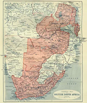
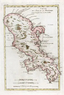
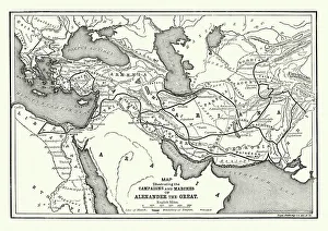
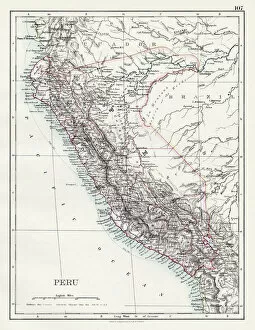
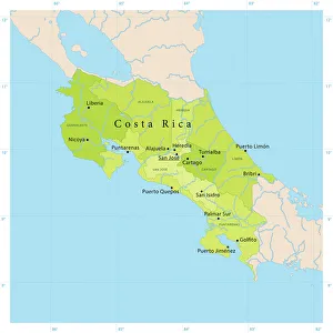
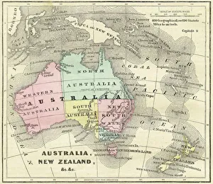
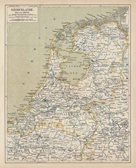
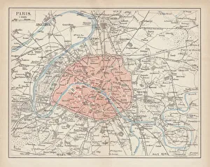
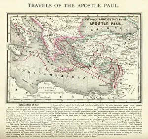
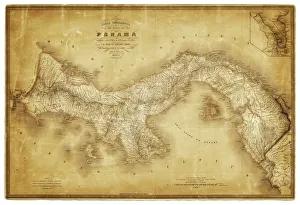
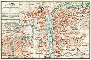
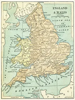
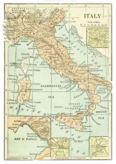
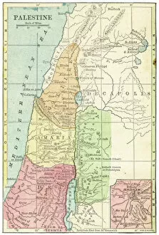
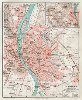
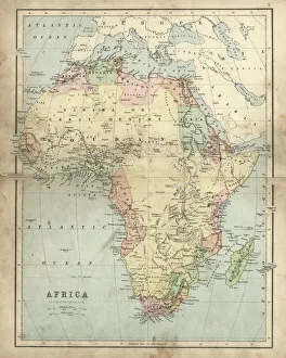
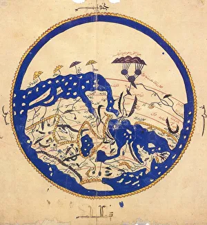
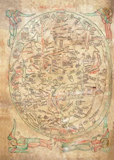
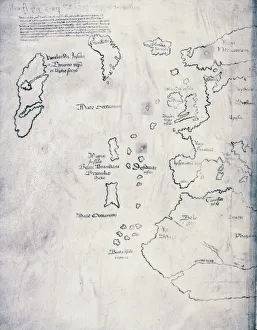
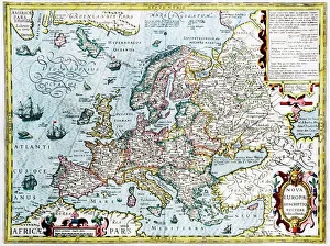
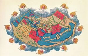
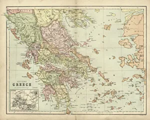
Cartography, the art of mapmaking, has a rich history that spans centuries and continents. From ancient civilizations to modern times, maps have been used as powerful tools for navigation, exploration, and understanding the world around us. One notable example of early the Hereford Mappa Mundi, created in 1285 by Richard de Bello. This intricate map depicts a combination of geographical features and religious symbolism, offering a unique perspective on medieval Europe. Another remarkable piece is Al-Idrisi's world map from 1154. Crafted during the Islamic Golden Age, this map showcases an impressive level of detail and accuracy for its time. It highlights trade routes and important cities across Africa, Asia, and Europe. For those interested in British history, antique maps provide fascinating insights into different eras. An antique map depicting Britain under the Anglo Saxons offers a glimpse into the island's past before Norman conquests reshaped its landscape. Similarly captivating is an antique map showcasing the vast Roman Empire at its height. This visual representation allows us to trace their expansive territories across Europe, North Africa, and parts of Asia. Moving forward in time brings us to more recent cartographic works like the Map of Cyprus published in 1880. This detailed depiction captures not only geographical features but also cultural landmarks that define this Mediterranean island nation. Maps are not limited to landmasses alone; they can also illustrate political boundaries on larger scales. A Political Map of Africa provides valuable information about countries' borders and capital cities within this diverse continent. On a smaller scale but equally significant is California Highway Map—a practical tool for travelers navigating through one of America's most populous states with ease. Exploring historical empires leads us to delve into Byzantine history with a Map of the Byzantine Empire from the 9th century—showcasing Constantinople as its vibrant heart while encompassing regions stretching from Greece to Egypt.