
Birmingham Map Collection
Step back in time with these captivating glimpses into the history of Birmingham through a collection of old maps


All Professionally Made to Order for Quick Shipping
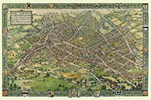
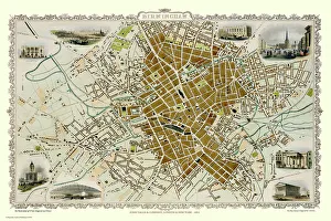
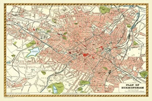
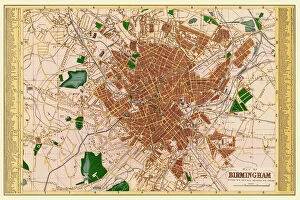
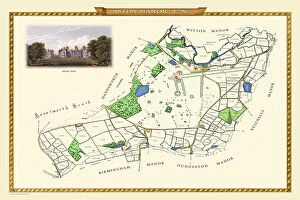
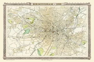
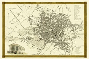
Step back in time with these captivating glimpses into the history of Birmingham through a collection of old maps. The "Old Map of Birmingham 1851 by John Tallis" takes us on a journey to the bustling streets and landmarks that once defined this vibrant city. Meanwhile, the "Conjectural Picture Map of Birmingham In 1730" allows us to envision what life was like during an era long gone. Intriguingly, the "Birds Eye View of Birmingham In 1886" offers a unique perspective from above, showcasing the industrial revolution's impact on this growing metropolis. Delve further into history with the "Old Map of Birmingham 1795 by C. Pye, " which reveals how much has changed over time. The meticulous details found in the "Old Map of Birmingham Surveyed in 1750 by Thomas Hanson" provide valuable insights into early urban planning and development. Similarly, Aston Manor near Birmingham is brought to life through an "Old Map from 1796. " These maps serve as windows into forgotten landscapes and forgotten lives. For those seeking comprehensive historical references, both the "Royal Atlas by Bartholomew (1898)" and the "Comprehensive Gazetteer Atlas of England and Wales (1893)" offer rich sources for exploration. Traveling further back in time brings us to Fullarton & Co's detailed depiction in their "Old Map of Birmingham 1866. " Finally, we have James Drake's map from 1832 and John Dower and William Orr's rendition from 1834 – both capturing moments before significant transformations swept across this remarkable city. These maps not only showcase how far we've come but also remind us to appreciate our heritage while embracing progress. So take a moment to immerse yourself in these historical treasures; let them transport you through time as you rediscover one of Britain's most iconic cities - Birmingham.