Fraud Blocker Skip to main content

Bas Rhin Collection (page 3)

Discover the enchanting beauty of Bas-Rhin in France's picturesque region of Alsace

Background imageBas Rhin Collection: Detail of the tympanum on Notre Dame de Strasbourg Cathedral, UNESCO World Heritage Site

Detail of the tympanum on Notre Dame de Strasbourg Cathedral, UNESCO World Heritage Site, Strasbourg, Bas-Rhin, Alsace, France, Europe

Background imageBas Rhin Collection: Statue of Benedictine monk and Roman Catholic church in snow, St. Peter and St

Statue of Benedictine monk and Roman Catholic church in snow, St. Peter and St. Pauls Church, Wissembourg, Bas-Rhin, Alsace, France, December

Background imageBas Rhin Collection: A STRASBOURG BEGGAR, FRANCE. STRASBOURG is the capital and principal city of the

A STRASBOURG BEGGAR, FRANCE. STRASBOURG is the capital and principal city of the Alsace region in eastern France and is the official seat of the European Parliament

Background imageBas Rhin Collection: HENRI VALENTIN 10 January 1820 in Allarmont (Vosges) and died the 11 August 1855 in Strasbourg

HENRI VALENTIN 10 January 1820 in Allarmont (Vosges) and died the 11 August 1855 in Strasbourg (Bas-Rhin), French engraver. engraving 1855

Background imageBas Rhin Collection: Region of Provence-Alpes-Cote d Azur, France, Relief Map

Region of Provence-Alpes-Cote d Azur, France, Relief Map
Relief map of the departement of Alpes-Maritimes in Provence-Alpes-Cote d Azur, France. It includes the French Riviera coastline on the Mediterranean sea and the Southern area of the Alps

Background imageBas Rhin Collection: Mali, Satellite Image

Mali, Satellite Image
Satellite view of Mali. This image was compiled from data acquired by LANDSAT satellite

Background imageBas Rhin Collection: Nigeria, Relief Map

Nigeria, Relief Map
Relief map of Nigeria. This map was processed from elevation data

Background imageBas Rhin Collection: Departement of Haute-Vienne, France, True Colour Satellite Image

Departement of Haute-Vienne, France, True Colour Satellite Image
Satellite view of the departement of Haute-Vienne in Limousin, France. This image was compiled from data acquired by LANDSAT 5 & 7 satellites

Background imageBas Rhin Collection: Malawi, Relief Map

Malawi, Relief Map
Relief map of Malawi. This map was processed from elevation data

Background imageBas Rhin Collection: Mozambique, Satellite Image

Mozambique, Satellite Image
Satellite view of Mozambique. This image was compiled from data acquired by LANDSAT satellite

Background imageBas Rhin Collection: Departement of Puy-de-Dome, France, Relief Map

Departement of Puy-de-Dome, France, Relief Map
Relief map of the departement of Puy-de-Dome in Auvergne, France. It is well-known for the Chaine-des-Puys, a north-south oriented chain of over 60 volcanoes

Background imageBas Rhin Collection: Libya, Satellite Image

Libya, Satellite Image
Satellite view of Libya. This image was compiled from data acquired by LANDSAT satellite

Background imageBas Rhin Collection: Ivory Coast, Relief Map

Ivory Coast, Relief Map
Relief map of Ivory Coast. This map was processed from elevation data

Background imageBas Rhin Collection: Liberia, Relief Map

Liberia, Relief Map
Relief map of Liberia. This map was processed from elevation data

Background imageBas Rhin Collection: Departement of Calvados, France, Relief Map

Departement of Calvados, France, Relief Map
Relief map of the departement of Calvados in Lower Normandy, France. Bordered by the English Channel to the north, it includes the famous seaside resort of Deauville

Background imageBas Rhin Collection: Departement of Seine-Saint-Denis, France, True Colour Satellite Image

Departement of Seine-Saint-Denis, France, True Colour Satellite Image
Satellite view of the departement of Seine-Saint-Denis in Ile-de-France, France. This image was compiled from data acquired by LANDSAT 5 & 7 satellites

Background imageBas Rhin Collection: Departement of Aisne, France, Relief Map

Departement of Aisne, France, Relief Map
Relief map of the departement of Aisne in Picardy, France. This image was compiled from data acquired by LANDSAT 5 & 7 satellites combined with elevation data

Background imageBas Rhin Collection: Departement of Nievre, France, True Colour Satellite Image

Departement of Nievre, France, True Colour Satellite Image
Satellite view of the departement of Nievre in Burgundy, France. This image was compiled from data acquired by LANDSAT 5 & 7 satellites

Background imageBas Rhin Collection: Departement of Hautes-Pyrenees, France, Relief Map

Departement of Hautes-Pyrenees, France, Relief Map
Relief map of the departement of Hautes-Pyrenees in Midi-Pyrenees, France. The southern part, along the border with Spain, is located in the Pyrenees mountain range

Background imageBas Rhin Collection: Tunisia, Relief Map

Tunisia, Relief Map
Relief map of Tunisia. This map was processed from elevation data

Background imageBas Rhin Collection: Tunisia, Satellite Image

Tunisia, Satellite Image
Satellite view of Tunisia. This image was compiled from data acquired by LANDSAT satellite

Background imageBas Rhin Collection: Papua New Guinea, Relief Map

Papua New Guinea, Relief Map
Relief map of Papua New Guinea in Oceania with country borders. This map was processed from elevation data

Background imageBas Rhin Collection: Bhutan, Relief Map

Bhutan, Relief Map
Relief map of Bhutan. This map was processed from elevation data

Background imageBas Rhin Collection: Asia, Relief Map

Asia, Relief Map
Relief map of Asia. This map was processed from elevation data

Background imageBas Rhin Collection: Cambodia, Relief Map

Cambodia, Relief Map
Relief map of Cambodia. This map was processed from elevation data

Background imageBas Rhin Collection: Saudi Arabia, Satellite Image

Saudi Arabia, Satellite Image
Satellite view of Saudi Arabia in the Middle East with country borders. This image was compiled from data acquired by LANDSAT satellite

Background imageBas Rhin Collection: Niger, Relief Map

Niger, Relief Map
Relief map of Niger. This map was processed from elevation data

Background imageBas Rhin Collection: Rwanda, Relief Map

Rwanda, Relief Map
Relief map of Rwanda. This map was processed from elevation data

Background imageBas Rhin Collection: French Guiana, Satellite Image

French Guiana, Satellite Image
Satellite view of French Guiana in South America with country borders. This image was compiled from data acquired by LANDSAT satellite

Background imageBas Rhin Collection: South Africa, Satellite Image

South Africa, Satellite Image
Satellite view of South Africa. This image was compiled from data acquired by LANDSAT satellite

Background imageBas Rhin Collection: Swaziland, Relief Map

Swaziland, Relief Map
Relief map of Swaziland. This map was processed from elevation data

Background imageBas Rhin Collection: Departement of Pyrenees-Orientales, France, Relief Map

Departement of Pyrenees-Orientales, France, Relief Map
Relief map of the departement of Pyrenees-Orientales in Languedoc-Roussillon, France. The southern part, along the border with Spain, is located in the Pyrenees mountain range

Background imageBas Rhin Collection: Departement of Pas-de-Calais, France, Relief Map

Departement of Pas-de-Calais, France, Relief Map
Relief map of the departement of Pas-de-Calais in Nord-Pas-de-Calais, France. Relief map It borders the Strait of Dover in northern France. This image was processed from elevation data

Background imageBas Rhin Collection: Mauritania, Satellite Image

Mauritania, Satellite Image
Satellite view of Mauritania. This image was compiled from data acquired by LANDSAT satellite

Background imageBas Rhin Collection: Libya, Relief Map

Libya, Relief Map
Relief map of Libya. This map was processed from elevation data

Background imageBas Rhin Collection: Zambia, Relief Map

Zambia, Relief Map
Relief map of Zambia. This map was processed from elevation data

Background imageBas Rhin Collection: Western Sahara, Relief Map

Western Sahara, Relief Map
Relief map of Western Sahara. This map was processed from elevation data

Background imageBas Rhin Collection: Chad, Relief Map

Chad, Relief Map
Relief map of Chad. This map was processed from elevation data

Background imageBas Rhin Collection: Africa, True Colour Satellite Image With Country Borders

Africa, True Colour Satellite Image With Country Borders
Satellite view of Africa with country borders. This image was compiled from data acquired by LANDSAT satellite

Background imageBas Rhin Collection: Departement of Seine-et-Marne, France, Relief Map

Departement of Seine-et-Marne, France, Relief Map
Relief map of the departement of Seine-et-Marne in Ile-de-France, France. This image was compiled from data acquired by LANDSAT 5 & 7 satellites combined with elevation data

Background imageBas Rhin Collection: Republic of Congo, Relief Map

Republic of Congo, Relief Map
Relief map of Republic of Congo. This map was processed from elevation data

Background imageBas Rhin Collection: Malawi, Satellite Image

Malawi, Satellite Image
Satellite view of Malawi. This image was compiled from data acquired by LANDSAT satellite

Background imageBas Rhin Collection: Region of Burgundy, France, True Colour Satellite Image

Region of Burgundy, France, True Colour Satellite Image
Satellite view of Burgundy, France, with regional boundaries. This image was compiled from data acquired by LANDSAT 5 & 7 satellites

Background imageBas Rhin Collection: Eritrea, Satellite Image

Eritrea, Satellite Image
Satellite view of Eritrea. This image was compiled from data acquired by LANDSAT satellite

Background imageBas Rhin Collection: Region of Nord-Pas de Calais, France, True Colour Satellite Image

Region of Nord-Pas de Calais, France, True Colour Satellite Image
Satellite view of the departement of Pas-de-Calais in Nord-Pas-de-Calais, France. Relief map It borders the Strait of Dover in northern France

Background imageBas Rhin Collection: Sierra Leone, Relief Map

Sierra Leone, Relief Map
Relief map of Sierra Leone. This map was processed from elevation data

Background imageBas Rhin Collection: Burundi, Relief Map

Burundi, Relief Map
Relief map of Burundi. This map was processed from elevation data

Background imageBas Rhin Collection: North America, Relief Map With Country Borders

North America, Relief Map With Country Borders
Relief map of North America with country borders. This map was processed from elevation data


All Professionally Made to Order for Quick Shipping

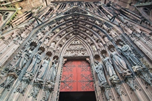
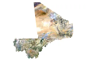
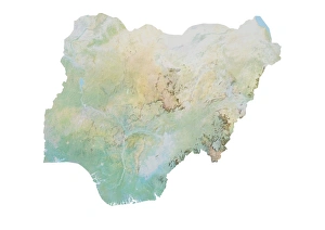
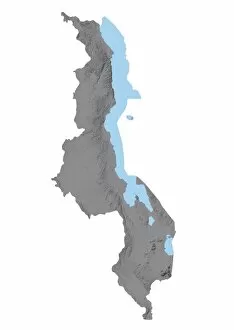
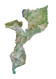
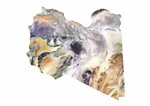
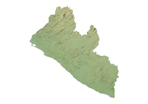
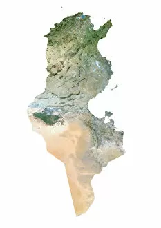
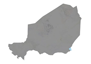
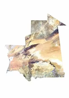
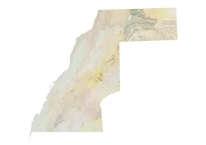
Discover the enchanting beauty of Bas-Rhin in France's picturesque region of Alsace. Nestled in the heart of Strasbourg, you'll find the magnificent Notre Dame Cathedral, a true masterpiece of Gothic architecture. Immerse yourself in the vibrant cafe scene nearby, savoring delicious French cuisine while soaking up the charming atmosphere. As you explore further, be captivated by the stunning sights that await you. From an aerial view at Chateau de Haut-Andlau to the mystical Witches Tower at Chatenois, Bas-Rhin offers a diverse range of attractions. Marvel at Christian art showcased through intricate stained glass windows and admire half-timbered houses that exude historic charm in Obernai. Step back in time as you pass through city gates like those found in Rosheim and uncover hidden gems such as Chapel Tower at Obernai or Chateau Haut-Barr near Saverne. Each location tells its own unique story and adds to the rich tapestry of history within this region. Bas-Rhin is not only known for its architectural wonders but also for its breathtaking natural landscapes. Take a moment to appreciate satellite images showcasing Niger's vast beauty or Turkey's mesmerizing terrain – reminders that nature's splendor knows no bounds. Whether you're drawn to cultural landmarks or awe-inspiring scenery, Bas-Rhin promises an unforgettable journey through history and natural wonderment. Come experience this captivating destination nestled within Alsace-Champagne-Ardenne-Lorraine region – where past meets present amidst Europe's timeless allure.