
Aral Sea Collection
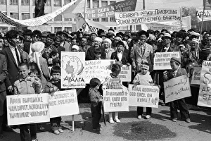
In the heart of Kazakhstan, a public protest unfolded in 1990, echoing the cries for justice and preservation of the Aral Sea


All Professionally Made to Order for Quick Shipping
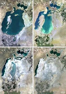
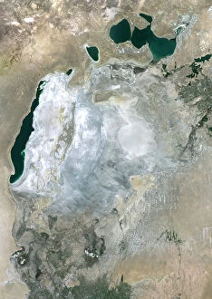
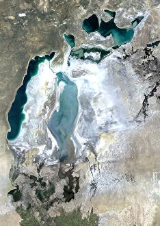
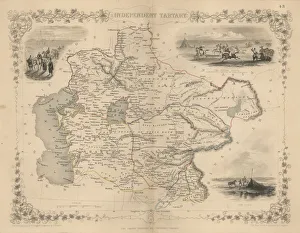
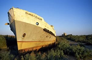
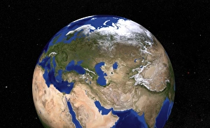
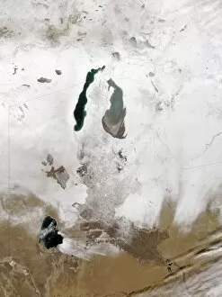
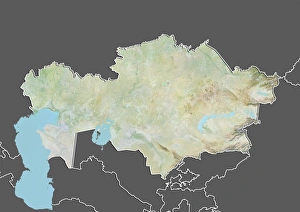
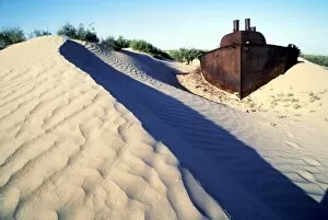
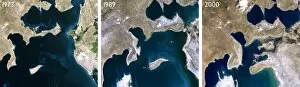
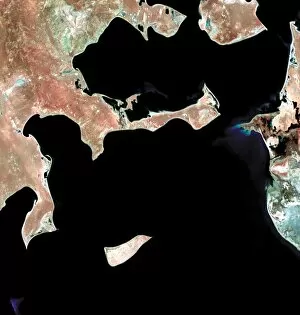
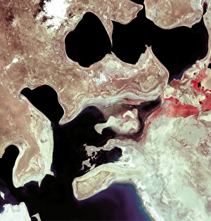
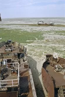
In the heart of Kazakhstan, a public protest unfolded in 1990, echoing the cries for justice and preservation of the Aral Sea. The once thriving body of water had fallen victim to human greed and negligence, leaving behind a haunting legacy. As if torn from an ancient tale, an engraving depicted Russian stage-coaches being pillaged by steppe robbers near the shores of the Aral Sea. This image served as a reminder that even centuries ago, this region was not immune to turmoil and conflict. Maps drawn by Augustus Petermann showcased the vastness of the Aral Sea in all its glory. Its turquoise waters stretched across independent Tartary like a precious gem embedded within Central Asia's tapestry. But time took its toll on this natural wonder. The rusting hulls of old Russian ships now lay abandoned on dry land where waves once danced. A stark contrast between past grandeur and present desolation. From space, satellite images revealed distinctive lines of clouds stretching out from the shorelines like desperate pleas for rain to revive what was lost. The Blue Marble Next Generation Earth captured these ethereal patterns against a backdrop showcasing both Europe and North Africa – reminding us that environmental devastation knows no borders. Snow-covered landscapes around the Aral Sea painted a picture of resilience amidst adversity; nature's attempt at reclaiming what was stolen from it. Yet, it stood as a chilling testament to how irreversible damage can be inflicted upon our planet when we fail to act responsibly. The Mediterranean Sea appeared alongside these images – another reminder that bodies of water are interconnected ecosystems deserving our utmost care and protection. Amidst all this despair emerged hope - public protests demanding change echoed through Kazakhstan's streets in 1990 C017 / 9394. People united under one cause: restoring life to their beloved Aral Sea before it vanished completely into history books. The story of the Aral Sea serves as both warning and call to action.