Fraud Blocker Skip to main content

Amerique Du Nord Collection

"Discover the Rich History and Cultural Tapestry of Amerique du Nord" Step into the past with a vibrant poster advertising the Hamburg-Amerika Linie

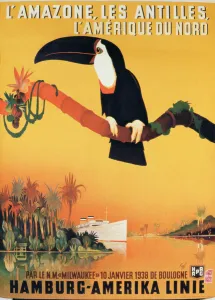
Background imageAmerique Du Nord Collection: Poster advertising the Hamburg-Amerika Linie (colour litho)

Poster advertising the Hamburg-Amerika Linie (colour litho)
LEE249087 Poster advertising the Hamburg-Amerika Linie (colour litho) by German School, (20th century); Private Collection; (add.info.: to the Amazon, the Antillies)

Background imageAmerique Du Nord Collection: Portrait of Jerzy Kosinski, May 7, 1976

Portrait of Jerzy Kosinski, May 7, 1976
SOB4825463 Portrait of Jerzy Kosinski, May 7, 1976 by Rousseau, Henri J.F. (Le Douanier) (1844-1910); (add.info.: Portrait of Jerzy Kosinski, May 7, 1976 ); © Sophie Bassouls

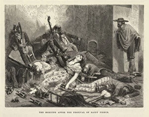
Background imageAmerique Du Nord Collection: The morning after the Saint Firmin Festival, New York 1875 (engraving)

The morning after the Saint Firmin Festival, New York 1875 (engraving)
8679737 The morning after the Saint Firmin Festival, New York 1875 (engraving) by Riou, Edouard (1833-1900); 15,6x11,6 cm; Private Collection; (add.info.: The morning after the Saint Firmin Festival)

Background imageAmerique Du Nord Collection: Geography: map showing the Gulf of Mexico, the Caribbean Islands, Central America (Honduras)

Geography: map showing the Gulf of Mexico, the Caribbean Islands, Central America (Honduras, Costarica)
VEN5031255 Geography: map showing the Gulf of Mexico, the Caribbean Islands, Central America (Honduras, Costarica), northern South America (Venezuela) and southern United States

Background imageAmerique Du Nord Collection: Geography: representation of the Gulf of Mexico with the coasts of Mexico, Yucatan

Geography: representation of the Gulf of Mexico with the coasts of Mexico, Yucatan, Florida and Cuba (Antilles)
VEN5031179 Geography: representation of the Gulf of Mexico with the coasts of Mexico, Yucatan, Florida and Cuba (Antilles)

Background imageAmerique Du Nord Collection: Frontispice of the Treaty 'Natural and moral history of the Caribbean Islands of America'

Frontispice of the Treaty "Natural and moral history of the Caribbean Islands of America" attributed to Cesar
VEN5031148 Frontispice of the Treaty "Natural and moral history of the Caribbean Islands of America" attributed to Cesar de Rochefort (1638-1691)

Geography map: representation of the island of Hispaniola (Santo Domingo and Haiti) (Greater Antilles)
VEN5030472 Geography map: representation of the island of Hispaniola (Santo Domingo and Haiti) (Greater Antilles), of the Virgin Islands (Lesser Antilles)

Background imageAmerique Du Nord Collection: Geography map: representation of Peru's South American coast from an Atlas made by Italian

Geography map: representation of Peru's South American coast from an Atlas made by Italian cartographer Antonio
VEN5030459 Geography map: representation of Peru's South American coast from an Atlas made by Italian cartographer Antonio Francesco Lucini (born 1605), 1661 approximately Biblioteca Angelica

Background imageAmerique Du Nord Collection: Geography: Earth globe realized by cartographer Willem Janszoon Blaeu (1571-1638)

Geography: Earth globe realized by cartographer Willem Janszoon Blaeu (1571-1638)
VEN5030392 Geography: Earth globe realized by cartographer Willem Janszoon Blaeu (1571-1638). Debut of the 17th century Biblioteca Angelica

Background imageAmerique Du Nord Collection: Geography map: representation of the Atlantic Ocean (or North Sea) with the coasts of the Americas

Geography map: representation of the Atlantic Ocean (or North Sea) with the coasts of the Americas
VEN5030386 Geography map: representation of the Atlantic Ocean (or North Sea) with the coasts of the Americas (South and United States), the Caribbean Sea and the Caribbean

Geography map: representation of the Paraiba region in northern Brazil where the Rio Grande river of the North in South
VEN5030364 Geography map: representation of the Paraiba region in northern Brazil where the Rio Grande river of the North in South America is located from an Atlas made by the cartographer Willem

Background imageAmerique Du Nord Collection: Geography map: representation of Chile from an Atlas by Willem Janszoon Blaeu (1571-1638)

Geography map: representation of Chile from an Atlas by Willem Janszoon Blaeu (1571-1638), approximately 1630
VEN5030319 Geography map: representation of Chile from an Atlas by Willem Janszoon Blaeu (1571-1638), approximately 1630. Biblioteca Angelica

Background imageAmerique Du Nord Collection: Geography map: representation of Magellan Detroit and Tierra del Fuego in the extreme south of

Geography map: representation of Magellan Detroit and Tierra del Fuego in the extreme south of South America from an
VEN5030314 Geography map: representation of Magellan Detroit and Tierra del Fuego in the extreme south of South America from an Atlas by Willem Janszoon Blaeu (1571-1638), approximately 1630

Background imageAmerique Du Nord Collection: Geography map: representation of Barbados Island (Barbados) from an Atlas by Charles Price

Geography map: representation of Barbados Island (Barbados) from an Atlas by Charles Price
VEN5030270 Geography map: representation of Barbados Island (Barbados) from an Atlas by Charles Price, beginning of the 18th century

Background imageAmerique Du Nord Collection: Geography map: representation of South America from an Atlas by Charles Price

Geography map: representation of South America from an Atlas by Charles Price, beginning of the 18th century
VEN5030268 Geography map: representation of South America from an Atlas by Charles Price, beginning of the 18th century. Biblioteca Angelica

Background imageAmerique Du Nord Collection: Geography map: representation of South America from an Atlas of Guillaume de l'Isle (1675-1726)

Geography map: representation of South America from an Atlas of Guillaume de l'Isle (1675-1726), 1700
VEN5030263 Geography map: representation of South America from an Atlas of Guillaume de l'Isle (1675-1726), 1700. Biblioteca Angelica

Background imageAmerique Du Nord Collection: Geography map: representation of the meridional part of South America (Argentina, Chile)

Geography map: representation of the meridional part of South America (Argentina, Chile)
VEN5030237 Geography map: representation of the meridional part of South America (Argentina, Chile, Falkland Islands) from the Atlas " Amerique meridionale" by French cartographer

Background imageAmerique Du Nord Collection: Geography map: representation of the coasts of Colombia, made by Dutch cartographer Gerard van

Geography map: representation of the coasts of Colombia, made by Dutch cartographer Gerard van Keulen (1678-1726)
VEN5030222 Geography map: representation of the coasts of Colombia, made by Dutch cartographer Gerard van Keulen (1678-1726) 1709-1713

Background imageAmerique Du Nord Collection: Geography map: representation of the coasts of Cuba and Havana Bay in the West Indies

Geography map: representation of the coasts of Cuba and Havana Bay in the West Indies
VEN5030185 Geography map: representation of the coasts of Cuba and Havana Bay in the West Indies, made by Dutch cartographer Gerard van Keulen (1678-1726) 1709-1713

Background imageAmerique Du Nord Collection: Geography map: representation of Turtle Island off Hispaniola near the Passage of the Winds

Geography map: representation of Turtle Island off Hispaniola near the Passage of the Winds between Cuba
VEN5030175 Geography map: representation of Turtle Island off Hispaniola near the Passage of the Winds between Cuba and Hispaniola, made by Dutch cartographer Gerard van Keulen (1678-1726) 1709-1713

Background imageAmerique Du Nord Collection: Geography map: representation of the coasts of New Spain (which included part of present-day Mexico)

Geography map: representation of the coasts of New Spain (which included part of present-day Mexico)
VEN5030163 Geography map: representation of the coasts of New Spain (which included part of present-day Mexico, California and some southern states of the United States)

Background imageAmerique Du Nord Collection: Geography Atlas: representation of the Bahamas islands, northern Hispaniola (Santo Domingo)

Geography Atlas: representation of the Bahamas islands, northern Hispaniola (Santo Domingo)
VEN5031335 Geography Atlas: representation of the Bahamas islands, northern Hispaniola (Santo Domingo) and the Leewind Passage between Cuba and Hispaniola in the West Indies

Background imageAmerique Du Nord Collection: Geography: Map of Puerto Rico Island, Beata Island, Hispaniola coasts in the West Indies

Geography: Map of Puerto Rico Island, Beata Island, Hispaniola coasts in the West Indies
VEN5031327 Geography: Map of Puerto Rico Island, Beata Island, Hispaniola coasts in the West Indies. Map from an Atlas of Maritime Geography of 1767

Background imageAmerique Du Nord Collection: Portrait of Marie Van Zandt (1858-1919), American soprano

Portrait of Marie Van Zandt (1858-1919), American soprano
JEB4839145 Portrait of Marie Van Zandt (1858-1919), American soprano.; (add.info.: Portrait of Marie Van Zandt (1858-1919), American soprano.); © Jean Bernard. All rights reserved 2023.

Background imageAmerique Du Nord Collection: Geography Atlas: representation of the Caribbean Sea region, the Caribbean (Cuba, Jamaica)

Geography Atlas: representation of the Caribbean Sea region, the Caribbean (Cuba, Jamaica, Hispaniola, Jamaica)
VEN5030043 Geography Atlas: representation of the Caribbean Sea region, the Caribbean (Cuba, Jamaica, Hispaniola, Jamaica), the Bahamas Islands, the Lesser Antilles

Background imageAmerique Du Nord Collection: Geography Atlas: description of the Caribbean Sea, Caribbean Sea (Cuba, Jamaica, Hispaniola)

Geography Atlas: description of the Caribbean Sea, Caribbean Sea (Cuba, Jamaica, Hispaniola, Jamaica)
VEN5030036 Geography Atlas: description of the Caribbean Sea, Caribbean Sea (Cuba, Jamaica, Hispaniola, Jamaica), the Bahamas Islands and the Lesser Antilles with map

Background imageAmerique Du Nord Collection: Geography Atlas: frontispiece of 'Atlantis contracti' (Atlas)

Geography Atlas: frontispiece of "Atlantis contracti" (Atlas) by geographer Johann Janssonius (or Jan Jansson)
VEN5030023 Geography Atlas: frontispiece of "Atlantis contracti" (Atlas) by geographer Johann Janssonius (or Jan Jansson) (1588-1664), 1666

Background imageAmerique Du Nord Collection: Geography Atlas: representation of the island of Antigua in the Caribbean

Geography Atlas: representation of the island of Antigua in the Caribbean
VEN5030006 Geography Atlas: representation of the island of Antigua in the Caribbean. Map taken from "The west indian atlas or general description of west indies" by Thomas Jefferys

Background imageAmerique Du Nord Collection: Geography Atlas: representation of Tobago Island in the Lesser Antilles

Geography Atlas: representation of Tobago Island in the Lesser Antilles. Map taken from "The west indian atlas or
VEN5029619 Geography Atlas: representation of Tobago Island in the Lesser Antilles. Map taken from "The west indian atlas or general description of west indies" by Thomas Jefferys

Background imageAmerique Du Nord Collection: Scene in an American farmhouse on a November night, mid 19th century

Scene in an American farmhouse on a November night, mid 19th century. Family members playing cards at a table
FLO4646497 Scene in an American farmhouse on a November night, mid 19th century. Family members playing cards at a table, men smoking pipes, etc

Background imageAmerique Du Nord Collection: Native American hunter with rifle watching beavers, Castor canadensis, build a dam

Native American hunter with rifle watching beavers, Castor canadensis, build a dam
FLO4646423 Native American hunter with rifle watching beavers, Castor canadensis, build a dam. Handcoloured lithograph from Carl Hoffmann's Book of the World, Stuttgart

Background imageAmerique Du Nord Collection: Cranium from an eskimo (Inuit), and one from an ancient tomb near Niagara. Lithograph by J

Cranium from an eskimo (Inuit), and one from an ancient tomb near Niagara. Lithograph by J
FLO4688402 Cranium from an eskimo (Inuit), and one from an ancient tomb near Niagara. Lithograph by J. Bull from James Cowles Prichard's Natural History of Man (Balliere, London)

Background imageAmerique Du Nord Collection: Aleut woman of the Aleutian islands, northern Pacific Ocean. She wears a cross on a necklace

Aleut woman of the Aleutian islands, northern Pacific Ocean. She wears a cross on a necklace, earrings
FLO4688613 Aleut woman of the Aleutian islands, northern Pacific Ocean. She wears a cross on a necklace, earrings, and her hair in plaits

Background imageAmerique Du Nord Collection: Not-een-a-akm, the Strong Wind, Ojibwe nation. Alexander Cadotte was interpreter to

Not-een-a-akm, the Strong Wind, Ojibwe nation. Alexander Cadotte was interpreter to the nine-strong troupe of Ojibwe
FLO4688536 Not-een-a-akm, the Strong Wind, Ojibwe nation. Alexander Cadotte was interpreter to the nine-strong troupe of Ojibwe dancers who visited England in 1844. Handcoloured lithograph by J

Background imageAmerique Du Nord Collection: History. USA. The french general Henri Gouraud arrives in New York

History. USA. The french general Henri Gouraud arrives in New York. View of New York harbour and the Statue of Liberty
3434857 History. USA. The french general Henri Gouraud arrives in New York. View of New York harbour and the Statue of Liberty

Pampas fox or aguarachay, (Aszara Fox) Lycalopex gymnocercus, and spiny rat or casiragua
FLO4721717 Pampas fox or aguarachay, (Aszara Fox) Lycalopex gymnocercus, and spiny rat or casiragua, (spiny rat) Proechimys guairae. After Felix de Azara's Voyages in America Meridionale

Background imageAmerique Du Nord Collection: Silky anteater or pygmy anteater (Fourmilier) (Azara's cagouare), Cyclopes didactylus

Silky anteater or pygmy anteater (Fourmilier) (Azara's cagouare), Cyclopes didactylus, and black tamandua
FLO4721690 Silky anteater or pygmy anteater (Fourmilier) (Azara's cagouare), Cyclopes didactylus, and black tamandua, (Tamandou) Tamandua tetradactyla

Background imageAmerique Du Nord Collection: Niagara Falls and the Rhine waterfall at Lauffen. Handcoloured copperplate engraving

Niagara Falls and the Rhine waterfall at Lauffen. Handcoloured copperplate engraving from Bertuch's "
FLO4575852 Niagara Falls and the Rhine waterfall at Lauffen. Handcoloured copperplate engraving from Bertuch's " Bilderbuch fur Kinder" (Picture Book for Children), Weimar, 1805

Background imageAmerique Du Nord Collection: Howler monkey, Alouatta species, Ouarine or preacher monkey - Handcoloured copperplate engraving

Howler monkey, Alouatta species, Ouarine or preacher monkey - Handcoloured copperplate engraving by J
FLO4714801 Howler monkey, Alouatta species, Ouarine or preacher monkey - Handcoloured copperplate engraving by J. Pass after an illustration by Johann Jakob Ihle from Ebenezer Siblly's Universal

Background imageAmerique Du Nord Collection: Woman in fancy dress costume as Native American, Indian, in feather headdress, embroidered dress

Woman in fancy dress costume as Native American, Indian, in feather headdress, embroidered dress
FLO4684556 Woman in fancy dress costume as Native American, Indian, in feather headdress, embroidered dress, holding a bow and arrow

North American ash-coloured heron, Ardea fusca. Illustration copied from George Edwards
FLO4640057 North American ash-coloured heron, Ardea fusca. Illustration copied from George Edwards. Handcoloured copperplate engraving from " The Naturalist's Pocket Magazine,"

Background imageAmerique Du Nord Collection: Brown pelican, Pelecanus occidentalis. Handcoloured copperplate engraving from ' The Naturalist's

Brown pelican, Pelecanus occidentalis. Handcoloured copperplate engraving from " The Naturalist's Pocket
FLO4640054 Brown pelican, Pelecanus occidentalis. Handcoloured copperplate engraving from " The Naturalist's Pocket Magazine," Harrison, London, 1799.; (add.info.: Brown pelican)

A family of Carib Indians from Suriname (Suriname). Lithography for the book
FLO4635752 A family of Carib Indians from Suriname (Suriname). Lithography for the book: " Galerie complete en tableaux fideles des peuples d'Amerique et d'Australie" by Friedrich

Background imageAmerique Du Nord Collection: Four portraits of Indian botocudo (Brazil), with wooden discs with lips and ears

Four portraits of Indian botocudo (Brazil), with wooden discs with lips and ears and a mummifiee head of a botocudo
FLO4635749 Four portraits of Indian botocudo (Brazil), with wooden discs with lips and ears and a mummifiee head of a botocudo

Background imageAmerique Du Nord Collection: The Great Pyramid of Cholula (Mexico). Lithography for the book

The Great Pyramid of Cholula (Mexico). Lithography for the book: " Galerie complete en tableaux fideles des
FLO4635655 The Great Pyramid of Cholula (Mexico). Lithography for the book: " Galerie complete en tableaux fideles des peuples d'America et d'Australia" by Friedrich Wilhelm

A nuu chah nult (formerly nutka) couple from Nootka Island (Canada) and a portrait of a native of North America
FLO4635511 A nuu chah nult (formerly nutka) couple from Nootka Island (Canada) and a portrait of a native of North America

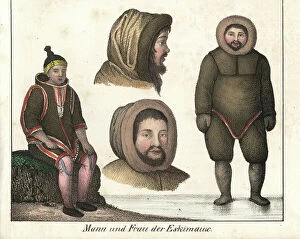
Background imageAmerique Du Nord Collection: Inuit couple in sealskin clothing (Canada and Alaska, USA). Lithography for the book

Inuit couple in sealskin clothing (Canada and Alaska, USA). Lithography for the book
FLO4635499 Inuit couple in sealskin clothing (Canada and Alaska, USA). Lithography for the book: " Galerie complete en tableaux fideles des peuples d'Amerique et d'Australie" by

House of a Brazilian planter, with a garden of palm trees enclosed on the bank of a river
FLO4635899 House of a Brazilian planter, with a garden of palm trees enclosed on the bank of a river. Lithography for the book


All Professionally Made to Order for Quick Shipping

"Discover the Rich History and Cultural Tapestry of Amerique du Nord" Step into the past with a vibrant poster advertising the Hamburg-Amerika Linie, showcasing the allure of transatlantic travel. Immerse yourself in breathtaking landscapes as you gaze upon mesmerizing oil paintings like "Icebergs, 1861, " capturing the raw beauty and power of nature. Experience the enchanting charm of city life through masterpieces such as "Nocturne: Blue and Gold - Old Battersea Bridge, 1863, " where London's nocturnal glow comes to life on canvas. Delve into pivotal moments in history with "The Siege of Yorktown (1781), 1836, " depicting a crucial turning point during the American Revolution. Witness poignant scenes that shed light on societal struggles, like "A Cotton Office in New Orleans, 1873, " which portrays the complex dynamics surrounding slavery. Reflect on humanity's progress as you observe images like "Sale of slaves in Virginia, 1861, " reminding us of our collective journey towards equality. Marvel at medical advancements that shaped modern healthcare; from Horace Wells' pioneering dental extraction demonstration in front of his students to William Morton's groundbreaking surgical operation using sulfuric ether anesthesia at Boston Hospital. Trace Amerique du Nord's maritime heritage through captivating illustrations such as Raoul du Gardier's depiction of Le Normandie arriving at New York Harbor in 1935. Explore literary classics like Harriet Beecher Stowe's influential novel Uncle Tom’s Cabin brought to life by George Cruikshank’s evocative illustrations. Amerique du Nord beckons you to embark on an immersive journey through time – where art intertwines with history and narratives unfold before your eyes. Discover this fascinating continent filled with diverse stories waiting to be explored.