
Aggas Collection
"Exploring London's Rich History: Unveiling the Enigmatic Aggas" Step back in time and immerse yourself in the captivating world of Aggas


All Professionally Made to Order for Quick Shipping
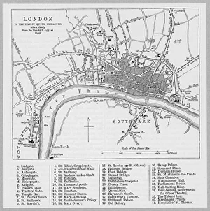
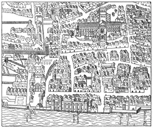
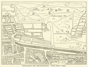
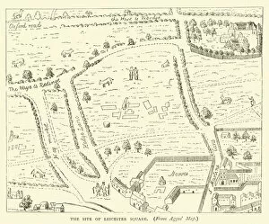
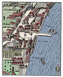
"Exploring London's Rich History: Unveiling the Enigmatic Aggas" Step back in time and immerse yourself in the captivating world of Aggas, a renowned cartographer whose maps have become invaluable treasures for historians. From the intricate details of his 1560 London Map to the enchanting litho of The Charing Cross Region in 1592, Aggas takes us on a journey through centuries. Delve into St Pauls neighborhood as depicted by Aggas, where ancient streets intertwine with modern life. Witness the evolution of Cripplegate and its surroundings through an engraving from Aggass map, offering glimpses into a bygone era. Leicester Square comes alive before your eyes as you gaze upon its origins captured meticulously on another one of Aggass' engravings. Travel further west to Whitehall and Westminster, where power and politics converge. Discover Cromwell's House standing tall amidst history's pages, immortalized by both Herbert's "City Companies" engraving and yet again on Aggass' map from 1897. Marvel at a bird's-eye view of the majestic Palace of Westminster circa 1560; let your imagination soar above this iconic landmark that has witnessed countless events throughout time. Wander along The Strand as it appeared in 1560 according to Ralph Aggas' artistic vision, envisioning bustling streets filled with life. Finally, lose yourself in St Pauls and its neighboring areas once more through an engraving based on Aggass' plan from 1563. Let these images transport you back to an age when London was still finding its identity but already leaving indelible marks on history. Aggas may be shrouded in mystery himself, but his legacy lives on within these remarkable maps that offer us glimpses into forgotten times. Embark on this visual odyssey through centuries past – uncover hidden stories etched onto each line drawn by his skilled hand.