Fraud Blocker Skip to main content

Aerial Photography Collection

Capturing the world from above, aerial photography unveils breathtaking vistas and hidden wonders

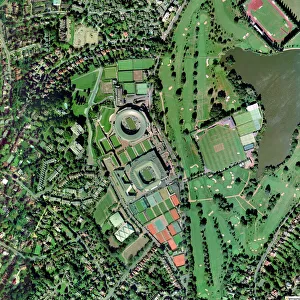
Background imageAerial Photography Collection: Wimbledon tennis complex, UK

Wimbledon tennis complex, UK
Wimbledon tennis complex, aerial photograph. This complex is host to the Wimbledon tennis championships, the oldest tennis tournament in the world

Background imageAerial Photography Collection: RAF Fylingdales H820 / 0072

RAF Fylingdales H820 / 0072
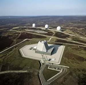
RAF Fylingdales. Aerial photograph RAF Fylingdales Ballistic Missile Early Warning Site (BMEWS). The pyramid shaped structure is a solid-state phased-array radar (SSPAR)

Background imageAerial Photography Collection: Practicing synchronised swimming

Practicing synchronised swimming. Aerial view of swimmers training before a junior-league synchronised swimming competition. Photographed at Trud swimming pool, Moscow, Russia

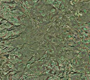
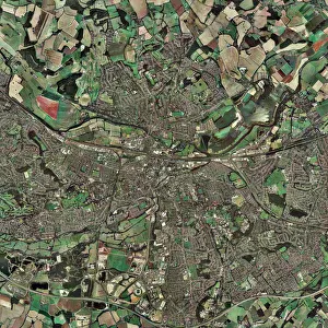
Background imageAerial Photography Collection: Sheffield, UK, aerial image

Sheffield, UK, aerial image
Sheffield, UK, aerial photograph. Sheffield is a city of some 510, 000 people (2003) in South Yorkshire. The M1 motorway (running down right) links Sheffield with London (to the south)

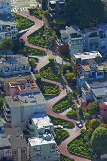
Background imageAerial Photography Collection: USA, California, San Francisco - Lombard Street (claimed to be the worlds crookedest street)

USA, California, San Francisco - Lombard Street (claimed to be the worlds crookedest street)
USA, California, San Francisco - Lombard Street (claimed to be the worldas crookedest street), Russian Hill neighborhood - aerial

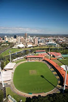
Background imageAerial Photography Collection: Adelaide Oval, River Torrens and Central Business District, Adelaide, South Australia

Adelaide Oval, River Torrens and Central Business District, Adelaide, South Australia, Australia - aerial

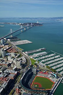
Background imageAerial Photography Collection: USA, California, San Francisco - AT&T Park / Giants Ballpark (home of San Francisco

USA, California, San Francisco - AT&T Park / Giants Ballpark (home of San Francisco Giants baseball team), South Beach Marina, downtown San Francisco, and Bay Bridge - aerial

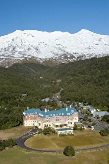
Background imageAerial Photography Collection: Mt Ruapehu and Grand Chateau, Tongariro National Park, Central Plateau, North Island

Mt Ruapehu and Grand Chateau, Tongariro National Park, Central Plateau, North Island, New Zealand - aerial

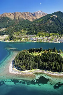
Background imageAerial Photography Collection: Queenstown and Lake Wakatipu, South Island, New Zealand - aerial

Queenstown and Lake Wakatipu, South Island, New Zealand - aerial

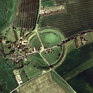
Background imageAerial Photography Collection: Avebury ring

Avebury ring, aerial photograph. The circles of standing stones and the henge (ditch) at Avebury date from about 2500 BC. The entire site encompasses some 28 acres and comprises a perimeter ditch

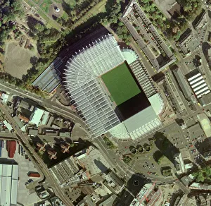
Background imageAerial Photography Collection: Newcastle Uniteds St James Park Stadium

Newcastle Uniteds St James Park Stadium
St James Park Stadium, home of Newcastle United Football Club, aerial photograph. This all-seater stadium, in Newcastle, UK, can hold over 52, 000 people

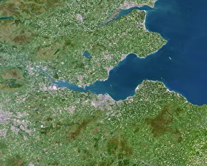
Background imageAerial Photography Collection: Firth of Forth, UK, satellite image

Firth of Forth, UK, satellite image. The Firth of Forth is the major estuary of the River Forth in Scotland. The grey area at centre is the city of Edinburgh

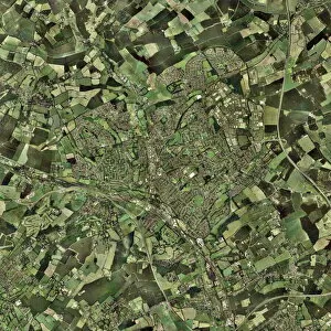
Background imageAerial Photography Collection: Reading, UK

Reading, UK, aerial photograph

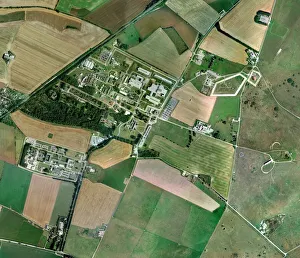
Background imageAerial Photography Collection: Porton Down, aerial photograph

Porton Down, aerial photograph. This site, in Wiltshire, UK, houses the headquarters of the Defence Science and Technology Laboratory, an executive Agency of the Ministry of Defence

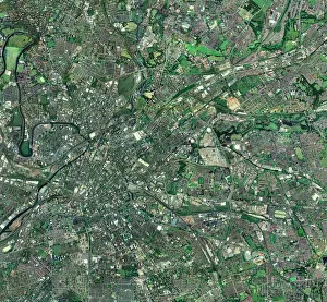
Background imageAerial Photography Collection: Central Manchester, aerial view

Central Manchester, aerial view. North is at top. Manchester is one of the largest cities in the UK. The River Irwell (upper left) flows through the city centre (centre left)

Background imageAerial Photography Collection: Fareham, UK, aerial image

Fareham, UK, aerial image
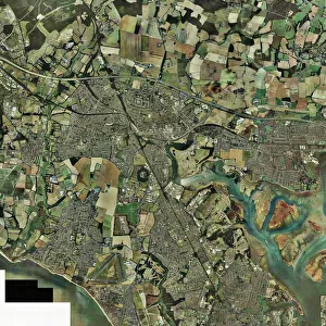
Fareham, UK, aerial photograph. Fareham is a market town in Hampshire, England, between the two cities of Portsmouth and Southampton

Background imageAerial Photography Collection: Southampton, UK, aerial photograph

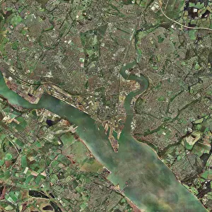
Southampton, UK, aerial photograph. Southampton is a city and major port on the south coast of England. Running from centre left to bottom right is Southampton Water

Background imageAerial Photography Collection: Isle of Sheppey, UK, aerial view C014 / 6171

Isle of Sheppey, UK, aerial view C014 / 6171
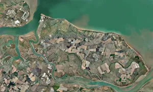
Isle of Sheppey. Aerial photograph of the Isle of Sheppey, Kent, UK

Background imageAerial Photography Collection: Aerial view of Stamford Bridge, stadium of Chelsea Football Club, London, c1922

Aerial view of Stamford Bridge, stadium of Chelsea Football Club, London, c1922. A print from Peoples of all Nations, Volume III, edited by JA Hammerton, The Fleetway House, London, c1922

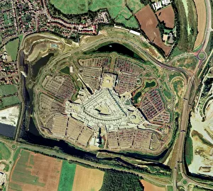
Background imageAerial Photography Collection: Bluewater shopping centre, aerial image

Bluewater shopping centre, aerial image
Bluewater shopping centre, UK, aerial image. This is an out of town shopping centre in Greenhithe in Kent. It opened in March 1999 and has since attracted around 27 million visitors per year

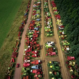
Background imageAerial Photography Collection: Combine harvesters in a scrapyard

Combine harvesters in a scrapyard
Combine harvesters. Aerial photograph of combine harvesters in a scrapyard. Photographed in Northumberland, UK

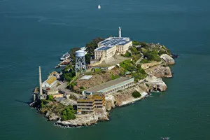
Background imageAerial Photography Collection: USA, California, San Francisco - Alcatraz Island, former maximum high-security federal prison

USA, California, San Francisco - Alcatraz Island, former maximum high-security federal prison, San Francisco Bay - aerial

Background imageAerial Photography Collection: Yellow Point, Broad Bay and Otago Peninsula, Dunedin, South Island, New Zealand

Yellow Point, Broad Bay and Otago Peninsula, Dunedin, South Island, New Zealand - drone aerial

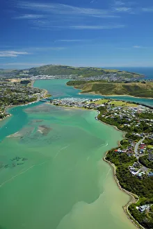
Background imageAerial Photography Collection: Pauatahanui Inlet, Porirua Harbour, Wellington Region, North Island, New Zealand - aerial

Pauatahanui Inlet, Porirua Harbour, Wellington Region, North Island, New Zealand - aerial

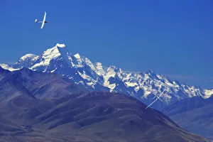
Background imageAerial Photography Collection: Gliders and Aoraki / Mt Cook, Mackenzie Country, South Island, New Zealand

Gliders and Aoraki / Mt Cook, Mackenzie Country, South Island, New Zealand

Background imageAerial Photography Collection: Rear-Gunner Camera-Gun on an Aircraft for Aerial-Photography

Rear-Gunner Camera-Gun on an Aircraft for Aerial-Photography Date: 1934

Background imageAerial Photography Collection: de Havilland Airco DH-9

de Havilland Airco DH-9
Camera-Gun on a de Havilland Airco Dh-9 for Aerial-Photography Date: 1920s

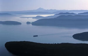
Background imageAerial Photography Collection: A ferry makes its way to Friday Harbor in the San Juan Islands of Washington

A ferry makes its way to Friday Harbor in the San Juan Islands of Washington
A ferry enters Friday Harbor, San Juan Islands, Washington. Mount Baker and islands

Background imageAerial Photography Collection: Summit of Mt Taranaki / Mt Egmont at Dawn, Taranaki, North Island, New Zealand - aerial

Summit of Mt Taranaki / Mt Egmont at Dawn, Taranaki, North Island, New Zealand - aerial

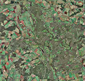
Background imageAerial Photography Collection: Oxford, UK, aerial image

Oxford, UK, aerial image

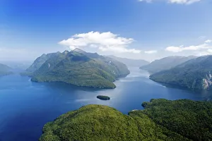
Background imageAerial Photography Collection: Secretary Island (centre), Doubtful Sound (left), Thompson Sound (right), Fiordland National Park

Secretary Island (centre), Doubtful Sound (left), Thompson Sound (right), Fiordland National Park, South Island, New Zealand - aerial

Background imageAerial Photography Collection: Hemel Hempstead, UK, aerial image

Hemel Hempstead, UK, aerial image
Hemel Hempstead, UK, aerial photograph. Hemel Hempstead is a town in Hertfordshire, England. It was developed after World War II as a new town, but has existed since the 8th century

Background imageAerial Photography Collection: A ride through the forest, captured by a drone

A ride through the forest, captured by a drone
Infrared version of a drive through a forest, captured by a drone

Background imageAerial Photography Collection: Magnetic Island

Magnetic Island
Aerial view of Magnetic Island headland

Background imageAerial Photography Collection: The crests of Mount Blanc in aerial photography. Courmayer, Aosta valley, Italy

The crests of Mount Blanc in aerial photography. Courmayer, Aosta valley, Italy

Background imageAerial Photography Collection: Gaston Tissandier taking aerial photographs

Gaston Tissandier taking aerial photographs
5311936 Gaston Tissandier taking aerial photographs; (add.info.: Engraving depicting Gaston Tissandier taking aerial photographs during a balloon trip from Paris to Rheims)

Background imageAerial Photography Collection: Mountain View

Mountain View
Lynann Colligan

Background imageAerial Photography Collection: Aerial view of the Orchard Park Estate, Hull 10th September 1980

Aerial view of the Orchard Park Estate, Hull 10th September 1980

Background imageAerial Photography Collection: Aerial view of the British Oil & Cake Mill, on the banks of the River Hull, Stoneferry

Aerial view of the British Oil & Cake Mill, on the banks of the River Hull, Stoneferry, Hull. 1st September 1954

Background imageAerial Photography Collection: Aerial view of Riverside Quay, Hull. 21st April 1958

Aerial view of Riverside Quay, Hull. 21st April 1958

Background imageAerial Photography Collection: Aerial view of Hull College, The Wiberforce Monument and Hull Police Headquarters

Aerial view of Hull College, The Wiberforce Monument and Hull Police Headquarters. 28th February 1971

Background imageAerial Photography Collection: Aerial View of Hull Marshalling Yards Circa 1950

Aerial View of Hull Marshalling Yards Circa 1950

Background imageAerial Photography Collection: Cathay fertiliser works in Redcliffe, Bristol 1890

Cathay fertiliser works in Redcliffe, Bristol 1890

Background imageAerial Photography Collection: An aerial view showing the St Mary Le Port area of Bristol before the Blitz Circa June

An aerial view showing the St Mary Le Port area of Bristol before the Blitz Circa June 1939

Background imageAerial Photography Collection: Aerial view of Bristol Airport in 1960s

Aerial view of Bristol Airport in 1960s

Background imageAerial Photography Collection: The Pool now know as 'Tropicana'at Weston-super-Mare. Circa June 1946

The Pool now know as "Tropicana"at Weston-super-Mare. Circa June 1946
The Pool now know as " Tropicana" at Weston-super-Mare. Circa June 1946

Background imageAerial Photography Collection: The City of Lincoln Lancaster (which now forms part of the Battle of Britain Memorial

The City of Lincoln Lancaster (which now forms part of the Battle of Britain Memorial Flight), closely followed by XL 317 Vulcan flying over Lincoln, with Lincoln Cathedral clearly visible

Background imageAerial Photography Collection: Re-indexed caption : Spectacular images captured in 1992 as Lincolnshire Echo

Re-indexed caption : Spectacular images captured in 1992 as Lincolnshire Echo photographer at the time Ken James, was given unique access to fly alongside the last flying Vulcan XH558 before she she

Background imageAerial Photography Collection: Great Barrier Reef and Hardy Reef, Australia

Great Barrier Reef and Hardy Reef, Australia
Aerial images from a private charter helicopter over the Great Barrier Reef and Hardy Reef, Australia

Background imageAerial Photography Collection: Salt Flat Aerial

Salt Flat Aerial
Aerial views from directly above of patterns and subjects in a salt flat

Background imageAerial Photography Collection: Williamson Eagle Vertical Aerial Camera System Component?

Williamson Eagle Vertical Aerial Camera System Component?
Williamson Eagle Vertical Aerial Camera System Components Aerial-Photography Date: 19??

Background imageAerial Photography Collection: Vertical Aerial Photograph of Flying-Boats and Hangars a?

Vertical Aerial Photograph of Flying-Boats and Hangars a?
Vertical Aerial Photograph of Flying-Boats and Hangars at RAF Mount Batten, Plymouth Sound, Devon, UK England Aerial-Photography Date: 1942

Background imageAerial Photography Collection: Stereoscopic Oblique Aerial Photography of Ypres and WW1?

Stereoscopic Oblique Aerial Photography of Ypres and WW1?
Stereoscopic Oblique Aerial Photography of Ypres and WW1 Battlefield Aerial-Photography Date: 1917

Background imageAerial Photography Collection: Aerial view of the City of Arts and Sciences, Valencia, Spain

Aerial view of the City of Arts and Sciences, Valencia, Spain

Background imageAerial Photography Collection: Route planning JLP01_08_049267b

Route planning JLP01_08_049267b
FILTON AIRFIELD, SOUTH GLOUCESTERSHIRE. Two men, one holding a camera, conferring over maps beside a helicopter at Filton Airfield

Background imageAerial Photography Collection: Highlining above Harwoods Hole, Golden Bay, New Zealand, Oceania

Highlining above Harwoods Hole, Golden Bay, New Zealand, Oceania

Background imageAerial Photography Collection: Aerial view of Peak Piazzi Valdidentro Sondrio Valtellina Lombardy Italy Europe

Aerial view of Peak Piazzi Valdidentro Sondrio Valtellina Lombardy Italy Europe

Background imageAerial Photography Collection: Aerial view of the Odle at sunset. Dolomites Gardena Valley Trentino Alto Adige Italy

Aerial view of the Odle at sunset. Dolomites Gardena Valley Trentino Alto Adige Italy Europe

Background imageAerial Photography Collection: Aerial view of Forni Glacier and Mount Cevedale Valtellina Lombardy Italy Europe

Aerial view of Forni Glacier and Mount Cevedale Valtellina Lombardy Italy Europe

Background imageAerial Photography Collection: Aerial view of Sassolungo Sassopiatto and Grohmann peak at sunset

Aerial view of Sassolungo Sassopiatto and Grohmann peak at sunset. Dolomites Sella Group Trentino Alto Adige Italy Europe

Background imageAerial Photography Collection: Aerial view of Sassolungo at sunset. Dolomites Sella Group Trentino Alto Adige Italy

Aerial view of Sassolungo at sunset. Dolomites Sella Group Trentino Alto Adige Italy Europe

Background imageAerial Photography Collection: Aerial view of Catinaccio Group at sunset

Aerial view of Catinaccio Group at sunset. Sciliar Natural Park Dolomites Trentino Alto Adige Italy Europe

Background imageAerial Photography Collection: Aerial view of Masino Valley at sunset Valtellina Lombardy Italy Europe

Aerial view of Masino Valley at sunset Valtellina Lombardy Italy Europe

Background imageAerial Photography Collection: Aerial view of peaks Torrone and Cima of Castello at sunset Masino Valley Valtellina

Aerial view of peaks Torrone and Cima of Castello at sunset Masino Valley Valtellina Lombardy Italy Europe

Background imageAerial Photography Collection: Aerial view of peaks Torrone and Bernina Group at sunset Masino Valley Valtellina

Aerial view of peaks Torrone and Bernina Group at sunset Masino Valley Valtellina Lombardy Italy Europe

Background imageAerial Photography Collection: Aerial view of Catinaccio Group and Vajolet Towers at sunset

Aerial view of Catinaccio Group and Vajolet Towers at sunset. Sciliar Natural Park Dolomites Trentino Alto Adige Italy Europe

Background imageAerial Photography Collection: Aerial view of snowy peaks of Grignone with Brioschi Refuge on the summit Lecco Province

Aerial view of snowy peaks of Grignone with Brioschi Refuge on the summit Lecco Province Lombardy Italy Europe

Background imageAerial Photography Collection: Aerial view of the green hill and castle overlooking Varenna surrounded by Lake Como

Aerial view of the green hill and castle overlooking Varenna surrounded by Lake Como Lecco Province Lombardy Italy Europe

Background imageAerial Photography Collection: Aerial view of the village of Varenna frames by the blue water of Lake Como Lecco

Aerial view of the village of Varenna frames by the blue water of Lake Como Lecco Province Lombardy Italy Europe

Background imageAerial Photography Collection: Aerial view of the picturesque village of Varenna overlooking the blue waters of Lake

Aerial view of the picturesque village of Varenna overlooking the blue waters of Lake Como Lecco Province Lombardy Italy Europe

Background imageAerial Photography Collection: Aerial view of Franciacorta fields, Franciacorta, Brescia province, Lombardy district

Aerial view of Franciacorta fields, Franciacorta, Brescia province, Lombardy district, Italy

Background imageAerial Photography Collection: The Anchorage (left) and Torrent Bay (right), Abel Tasman National Park, Nelson Region

The Anchorage (left) and Torrent Bay (right), Abel Tasman National Park, Nelson Region, South Island, New Zealand - aerial

Background imageAerial Photography Collection: Vue generale du Caire; Le Nord-Est Africain, 1914. Creator: Bonfils

Vue generale du Caire; Le Nord-Est Africain, 1914. Creator: Bonfils
Vue generale du Caire; Le Nord-Est Africain, 1914. From "Grande Geographie Bong Illustree", 1914

Background imageAerial Photography Collection: Monastir; du lac d'Ostrovo a Monastir: vue prise en areoplane de la premiere ville serbe... 1916

Monastir; du lac d'Ostrovo a Monastir: vue prise en areoplane de la premiere ville serbe... 1916. Creator: Unknown
Monastir; du lac d'Ostrovo a Monastir : vue prise en areoplane de la premiere ville serbe que vont delivrer les soldats du prince Alexandre, avec l'aide de leurs allies, Francais et Russes

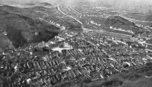
Background imageAerial Photography Collection: L'entrée de l'armee Roumaine en Transylvanie; Vue a vol d'oiseau de Brasso, 1 Creator: Unknown

L'entrée de l'armee Roumaine en Transylvanie; Vue a vol d'oiseau de Brasso, 1 Creator: Unknown
L'entree de l'armee Roumaine en Transylvanie; Vue a vol d'oiseau de Brasso, la premiere ville de Transylvanie que les Roumains ont occupee, 1916. From "Collection de la Guerre IV

Background imageAerial Photography Collection: Thiaumont; Deux aspects du champ de bataille de Thiaumont, 1916. Creator: Unknown

Thiaumont; Deux aspects du champ de bataille de Thiaumont, 1916. Creator: Unknown
Thiaumont; Deux aspects du champ de bataille de Thiaumont photographie de 800 metres d'altitude: Thiaumont, Douaumont et Vaux. Le 1er juillet, 1916. From "Collection de la Guerre IV

Background imageAerial Photography Collection: Thiaumont; Deux aspects du champ de bataille de Thiaumont, 1916. Creator: Unknown

Thiaumont; Deux aspects du champ de bataille de Thiaumont, 1916. Creator: Unknown
Thiaumont; Deux aspects du champ de bataille de Thiaumont photographie de 800 metres d'altitude: la crete de Thiaumont le 1er juillet, 1916. From "Collection de la Guerre IV

Background imageAerial Photography Collection: Thiaumont; L'ouvrage de Thiaumont photographie le 12 aout, 1916. Creator: Unknown

Thiaumont; L'ouvrage de Thiaumont photographie le 12 aout, 1916. Creator: Unknown
Thiaumont; L'ouvrage de Thiaumont photographie le 12 aout, 1916. From "Collection de la Guerre IV. L'Illustration Tome CXLVIII

Background imageAerial Photography Collection: Thiaumont; L'ouvrage de Thiaumont photographie le 31 mars, 1916. Creator: Unknown

Thiaumont; L'ouvrage de Thiaumont photographie le 31 mars, 1916. Creator: Unknown
Thiaumont; L'ouvrage de Thiaumont photographie le 31 mars, 1916. From "Collection de la Guerre IV. L'Illustration Tome CXLVIII

Background imageAerial Photography Collection: L'Aviation Francaise sur le front Macedonien; Vue de monastir, prise d'un avion, 1916

L'Aviation Francaise sur le front Macedonien; Vue de monastir, prise d'un avion, 1916. Creator: Unknown
L'Aviation Francaise sur le front Macedonien; Vue de monastir, prise d'un avion descendutres bas pour mieux viser les objectifs militaires a detruire, 1916

Background imageAerial Photography Collection: L'Aviation Francaise sur le front Macedonien; un des bombardements de la ville de Petritch

L'Aviation Francaise sur le front Macedonien; un des bombardements de la ville de Petritch, 1916 Creator: Unknown
L'Aviation Francaise sur le front Macedonien; un des bombardements de la ville de Petritch: Pendant la periode de preparation sur le front d'Orient

Background imageAerial Photography Collection: L'offensive de la Somme: L'attaque du 1er juillet 1916 observee d'un aeroplane, 1916

L'offensive de la Somme: L'attaque du 1er juillet 1916 observee d'un aeroplane, 1916. Creator: Unknown
L'offensive de la Somme: L'attaque du 1er juillet 1916 observee d'un aeroplane; La tranchee allemande de Stuttgart, au Nord de la route de Foucaucourt a Estrees

Background imageAerial Photography Collection: L'offensive de la Somme: L'attaque du 1er juillet 1916 observee d'un aeroplane, 1916

L'offensive de la Somme: L'attaque du 1er juillet 1916 observee d'un aeroplane, 1916. Creator: Unknown
L'offensive de la Somme: L'attaque du 1er juillet 1916 observee d'un aeroplane; Nos fantassins occupent la tranchee allemande de Landsberg, a 500 metres au Sud de Fay, 1916

Background imageAerial Photography Collection: L'offensive de la Somme; la preparation d'une bataille: L'attaque du 1er juillet 1916, 1916

L'offensive de la Somme; la preparation d'une bataille: L'attaque du 1er juillet 1916, 1916
L'offensive de la Somme; la preparation d'une bataille: L'attaque du 1er juillet 1916 observee d'un aeroplane; Tranchee allemande a un kilometre au Sud-Ouest de Fay


All Professionally Made to Order for Quick Shipping

Capturing the world from above, aerial photography unveils breathtaking vistas and hidden wonders. In the heart of Wimbledon's tennis complex in the UK, a bird's-eye view reveals meticulously maintained courts awaiting fierce battles. Meanwhile, synchronized swimmers gracefully glide through sparkling waters in Sheffield, UK, their movements forming an exquisite dance. Venturing further afield to Tongariro National Park's Central Plateau on New Zealand's North Island, Mt Ruapehu stands tall alongside the majestic Grand Chateau. The snow-capped peaks and lush landscapes create a picture-perfect scene that seems straight out of a fairytale. Across continents to Adelaide in South Australia, we soar over Adelaide Oval with its sprawling River Torrens and bustling Central Business District below. The cityscape unfolds like an intricate tapestry against nature's backdrop. In San Francisco, California, Lombard Street claims fame as the "world's crookedest street. " From above, its winding path resembles an artist's brushstroke on a canvas. Nearby lies AT&T Park or Giants Ballpark - home to San Francisco baseball enthusiasts who gather beneath our lens for thrilling games under sunny skies. Queenstown and Lake Wakatipu grace our vision next as we hover over New Zealand's South Island. This aerial perspective showcases nature at its finest – serene blue waters surrounded by rugged mountains and verdant forests that beckon adventurers from afar. Avebury ring emerges mysteriously before us; this ancient stone circle holds secrets from centuries past within its enigmatic structure. As we continue our journey across England to Newcastle United’s St James Park Stadium – where passionate fans unite to cheer on their beloved team – excitement fills the air both on and off the pitch. The Firth of Forth captivates us next with its captivating beauty captured by satellite imagery. Its vast expanse merges land and sea seamlessly while inviting exploration into unknown depths beyond what meets the eye.

© Copyright Media Storehouse, All Rights Reserved 2003 - 2024
Facebook     Pinterest     Card Payments     Reviews IO