mail_outline sales@mediastorehouse.com
Framed Print
Premium Framed Print
Canvas Print
Metal Print
Photographic Print
Poster Print
Fine Art Print
Jigsaw Puzzle
Photo Mug
Pillow
Mouse Mat
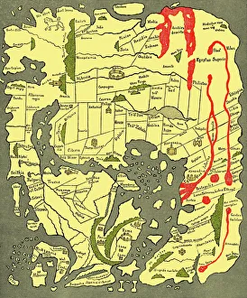
Anglo-Saxon 10th century world mapAnglo-Saxon world map, dating from the 10th century. East is top. This map of the known world was probably produced by an Irish monk
Early picture of New World peopleFirst picture of people of the New World. Taken from a woodcut published in Augsburg, Germany, around the turn of the sixteenth century, this is the first depiction of the indigenous Americans
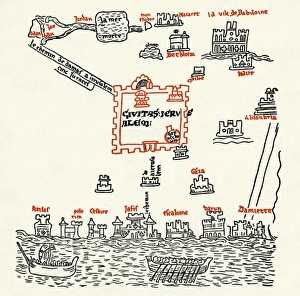
Paris itinerary: Jerusalem and the EastParis itinerary. Map produced by Matthew of Paris (? - 1259) in the 13th century depicting the route of an imagined pilgramage to the Holy Land. This section shows Jerusalem and the East
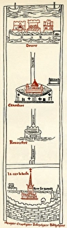
Paris itinerary: London to DoverParis itinerary. Map produced by Matthew of Paris (? - 1259) in the 13th century depicting the route of an imagined pilgramage to the Holy Land. This section shows the portion from London to Dover
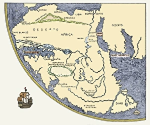
Africa, from Fra Mauros world map, 1457Africa, from Fra Mauros Great Map of the World, 1457. Fra Mauro was a 15th century Italian monk and cartographer. In producing this map, which has been inverted from the original to put north at top