Fraud Blocker Skip to main content

19th Century Style Collection (page 7)

Step back in time with the enchanting 19th century style, where elegance and sophistication reigned supreme

Background image19th Century Style Collection: Canary-creeper

Canary-creeper
Photo of an original Fine Lithograph from the Favourite Flowers of Garden & Greenhouse by Edward Step published in 1897 in London

Background image19th Century Style Collection: Creeping saxifrage

Creeping saxifrage
Photo of an original Fine Lithograph from the Favourite Flowers of Garden & Greenhouse by Edward Step published in 1897 in London

Background image19th Century Style Collection: Arachis hypogaea, the peanut or groundnu

Arachis hypogaea, the peanut or groundnu
Illustration of a Arachis hypogaea, the peanut or groundnu

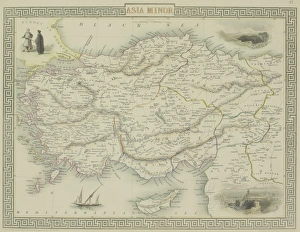
Background image19th Century Style Collection: Antique map of Asia Minor

Antique map of Asia Minor

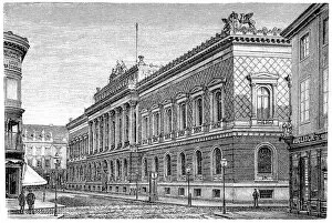
Background image19th Century Style Collection: German Reichsbank in Berlin, Germany

German Reichsbank in Berlin, Germany
Antique illustration of a German Reichsbank in Berlin, Germany

Background image19th Century Style Collection: Chamois (Rupicapra Rupicapra)

Chamois (Rupicapra Rupicapra)
Illustration of a Chamois (Rupicapra Rupicapra)

Background image19th Century Style Collection: Olm or proteus (Proteus anguinus)

Olm or proteus (Proteus anguinus)
Antique illustration of olm or proteus (Proteus anguinus)

Background image19th Century Style Collection: Britannia Bridge, Menai Straits

Britannia Bridge, Menai Straits
Vintage engraving of the Britannia Bridge, Menai Straits. 1884

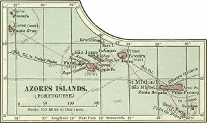
Background image19th Century Style Collection: Map of Azores Islands, c.1900 (engraving)

Map of Azores Islands, c.1900 (engraving)
533297 Map of Azores Islands, c.1900 (engraving); (add.info.: Map of Azores Islands (Portuguese), circa 1900, from the 10th edition of Encyclopaedia Britannica.); Encyclopaedia Britannica/UIG.

Background image19th Century Style Collection: Map of Italy, c.1900 (engraving)

Map of Italy, c.1900 (engraving)
532986 Map of Italy, c.1900 (engraving); (add.info.: Map of northern Italy, circa 1902, from the 10th edition of Encyclopaedia Britannica.); Encyclopaedia Britannica/UIG.

Background image19th Century Style Collection: Map of Switzerland and Liechtenstein, c.1900 (engraving)

Map of Switzerland and Liechtenstein, c.1900 (engraving)
532974 Map of Switzerland and Liechtenstein, c.1900 (engraving); (add.info.: Map showing historical boundaries of Switzerland and Liechtenstein, circa 1902)

Background image19th Century Style Collection: Map of the northern part of the German Empire, c.1900 (engraving)

Map of the northern part of the German Empire, c.1900 (engraving)
532959 Map of the northern part of the German Empire, c.1900 (engraving); (add.info.: Map of the northern part of the German empire, circa 1902)

Background image19th Century Style Collection: Map of England, c.1900 (engraving)

Map of England, c.1900 (engraving)
532917 Map of England, c.1900 (engraving); (add.info.: Map of England, with Oxford, Buckingham, Hertford, Essex, Middlesex, Berkshire, Hampshire, parts of Bedford and Wiltshire, circa 1902)

Background image19th Century Style Collection: Map of the northern part of Missouri, c.1900 (engraving)

Map of the northern part of Missouri, c.1900 (engraving)
533200 Map of the northern part of Missouri, c.1900 (engraving); (add.info.: Map of the northern part of Missouri with inset maps of Kansas City and St)

Background image19th Century Style Collection: Map of Nebraska with inset of Omaha, c.1900 (engraving)

Map of Nebraska with inset of Omaha, c.1900 (engraving)
533197 Map of Nebraska with inset of Omaha, c.1900 (engraving); (add.info.: Map of Nebraska, United States, with an inset map of Omaha, circa 1902)

Background image19th Century Style Collection: Map of Rochester, c.1900 (engraving)

Map of Rochester, c.1900 (engraving)
532845 Map of Rochester, c.1900 (engraving); (add.info.: Map of Rochester, New York, circa 1900, from the 10th edition of Encyclopaedia Britannica.); Encyclopaedia Britannica/UIG.

Background image19th Century Style Collection: Map of Kentucky, c.1900 (engraving)

Map of Kentucky, c.1900 (engraving)
533143 Map of Kentucky, c.1900 (engraving); (add.info.: Map of Kentucky, United States, circa 1902, from the 10th edition of Encyclopaedia Britannica.); Encyclopaedia Britannica/UIG.

Background image19th Century Style Collection: Map of Pennsylvania with inset map of Philadelphia, c.1900 (engraving)

Map of Pennsylvania with inset map of Philadelphia, c.1900 (engraving)
533115 Map of Pennsylvania with inset map of Philadelphia, c.1900 (engraving); (add.info.: Map of eastern Pennsylvania with inset map of Philadelphia, circa 1902)

Background image19th Century Style Collection: Map of New York State, c.1900 (engraving)

Map of New York State, c.1900 (engraving)
533109 Map of New York State, c.1900 (engraving); (add.info.: Map of western New York State, with inset map of Buffalo, Niagara Frontier, and Rochester, circa 1902)

Background image19th Century Style Collection: Map of New York State, c.1900 (engraving)

Map of New York State, c.1900 (engraving)
533104 Map of New York State, c.1900 (engraving); (add.info.: Map of southern New York State, United States, insets map of New York City, the Hudson River, and the Catskill Mountains, circa 1902)

Background image19th Century Style Collection: Map of North America and Central America, c.1900 (engraving)

Map of North America and Central America, c.1900 (engraving)
533069 Map of North America and Central America, c.1900 (engraving); (add.info.: Map of North America and Central America, circa 1902)

Background image19th Century Style Collection: Map of Southern Africa, c.1900 (engraving)

Map of Southern Africa, c.1900 (engraving)
533065 Map of Southern Africa, c.1900 (engraving); (add.info.: Map of colonial southern Africa, with insets of Cape Town, Johannesburg, and Ladysmith, circa 1902)

Background image19th Century Style Collection: Map of Cincinnati, c.1900 (engraving)

Map of Cincinnati, c.1900 (engraving)
532743 Map of Cincinnati, c.1900 (engraving); (add.info.: Map of Cincinnati, Ohio, circa 1900, from the 10th edition of Encyclopaedia Britannica.); Encyclopaedia Britannica/UIG.

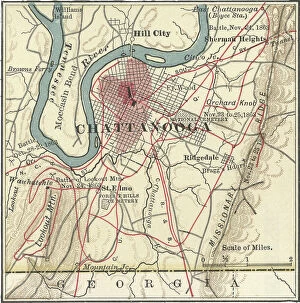
Background image19th Century Style Collection: Map of Chattanooga, c.1900 (engraving)

Map of Chattanooga, c.1900 (engraving)
532737 Map of Chattanooga, c.1900 (engraving); (add.info.: Map of Chattanooga, Tennessee, circa 1900, from the 10th edition of Encyclopaedia Britannica.); Encyclopaedia Britannica/UIG.

Background image19th Century Style Collection: Map of Charleston, c.1900 (engraving)

Map of Charleston, c.1900 (engraving)
532734 Map of Charleston, c.1900 (engraving); (add.info.: Map of Charleston, South Carolina, circa 1900, from the 10th edition of Encyclopaedia Britannica.); Encyclopaedia Britannica/UIG.

Background image19th Century Style Collection: Map of Valparaiso and Santiago, c.1900 (engraving)

Map of Valparaiso and Santiago, c.1900 (engraving)
533503 Map of Valparaiso and Santiago, c.1900 (engraving); (add.info.: Map of Valparaiso and Santiago, Chile, circa 1902, from the 10th edition of Encyclopaedia Britannica)

Background image19th Century Style Collection: Map of Buenos Aires and Montevideo, c.1900 (engraving)

Map of Buenos Aires and Montevideo, c.1900 (engraving)
533500 Map of Buenos Aires and Montevideo, c.1900 (engraving); (add.info.: Inset map of Buenos Aires (Argentina) and Montevideo (Uruguay), circa 1902

Background image19th Century Style Collection: Map of Trinidad and Martin Vas, c.1900 (engraving)

Map of Trinidad and Martin Vas, c.1900 (engraving)
533494 Map of Trinidad and Martin Vas, c.1900 (engraving); (add.info.: Map of Trinidad and Martin Vas, circa 1902, from the 10th edition of Encyclopaedia Britannica.); Encyclopaedia Britannica/UIG.

Background image19th Century Style Collection: Map of Barbados, c.1900 (engraving)

Map of Barbados, c.1900 (engraving)
533469 Map of Barbados, c.1900 (engraving); (add.info.: Map showing the parish boundaries of Barbados, circa 1902, from the 10th edition of Encyclopaedia Britannica.); Encyclopaedia Britannica/UIG.

Background image19th Century Style Collection: Map of the Bermudas, c.1900 (engraving)

Map of the Bermudas, c.1900 (engraving)
533466 Map of the Bermudas, c.1900 (engraving); (add.info.: Map of the Bermudas, circa 1902, from the 10th edition of Encyclopaedia Britannica.); Encyclopaedia Britannica/UIG.

Background image19th Century Style Collection: Map of the Catskill Mountains, New York, c.1900 (engraving)

Map of the Catskill Mountains, New York, c.1900 (engraving)
533423 Map of the Catskill Mountains, New York, c.1900 (engraving); (add.info.: Map of Catskill Mountains, New York, circa 1902)

Background image19th Century Style Collection: Map of Ladysmith, c.1900 (engraving)

Map of Ladysmith, c.1900 (engraving)
533405 Map of Ladysmith, c.1900 (engraving); (add.info.: Map of Ladysmith, South Africa, circa 1902, from the 10th edition of Encyclopaedia Britannica.); Encyclopaedia Britannica/UIG.

Background image19th Century Style Collection: Map of Johannesburg, c.1900 (engraving)

Map of Johannesburg, c.1900 (engraving)
533402 Map of Johannesburg, c.1900 (engraving); (add.info.: Map of Johannesburg, South Africa, circa 1902, from the 10th edition of Encyclopaedia Britannica.); Encyclopaedia Britannica/UIG.

Background image19th Century Style Collection: Map of Saint Helena Island, c.1900 (engraving)

Map of Saint Helena Island, c.1900 (engraving)
533393 Map of Saint Helena Island, c.1900 (engraving); (add.info.: Map of Saint Helena Island, circa 1902, from the 10th edition of Encyclopaedia Britannica.); Encyclopaedia Britannica/UIG.

Background image19th Century Style Collection: Map of Solomon Islands, c.1900 (engraving)

Map of Solomon Islands, c.1900 (engraving)
533372 Map of Solomon Islands, c.1900 (engraving); (add.info.: Map of Solomon Islands, Bougainville, South Pacific, circa 1902)

Background image19th Century Style Collection: Map of islands in the South Pacific, c.1900 (engraving)

Map of islands in the South Pacific, c.1900 (engraving)
533367 Map of islands in the South Pacific, c.1900 (engraving); (add.info.: Map of New Hebrides Islands, Santa Cruz Islands, Loyalty Islands, and New Caledonia, circa 1902)

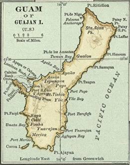
Background image19th Century Style Collection: Map of Guam, c.1900 (engraving)

Map of Guam, c.1900 (engraving)
533357 Map of Guam, c.1900 (engraving); (add.info.: Map of Guam or Guajan Island (U.S.), circa 1902, from the 10th edition of Encyclopaedia Britannica.); Encyclopaedia Britannica/UIG.

Background image19th Century Style Collection: Map of the north extension of Kurile Islands, c.1900 (engraving)

Map of the north extension of Kurile Islands, c.1900 (engraving)
533332 Map of the north extension of Kurile Islands, c.1900 (engraving); (add.info.: Map of the north extension of Kurile Islands (then part of Japan), circa 1902

Background image19th Century Style Collection: Map of Sicily, c.1900 (engraving)

Map of Sicily, c.1900 (engraving)
533317 Map of Sicily, c.1900 (engraving); (add.info.: Map of Sicily, Italy, circa 1902, from the 10th edition of Encyclopaedia Britannica.); Encyclopaedia Britannica/UIG.

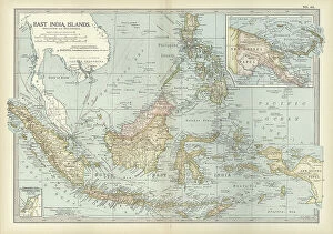
Background image19th Century Style Collection: Map of East India Islands with New Guinea, c.1900 (engraving)

Map of East India Islands with New Guinea, c.1900 (engraving)
533036 Map of East India Islands with New Guinea, c.1900 (engraving); (add.info.: Map of East India Islands, with an inset of New Guinea, circa 1902)

Background image19th Century Style Collection: Map of China, c.1900 (engraving)

Map of China, c.1900 (engraving)
533028 Map of China, c.1900 (engraving); (add.info.: Map of China, circa 1902, from the 10th edition of Encyclopaedia Britannica.); Encyclopaedia Britannica/UIG.

Background image19th Century Style Collection: Map of Arabia with part of Turkey and Oman, c.1900 (engraving)

Map of Arabia with part of Turkey and Oman, c.1900 (engraving)
533009 Map of Arabia with part of Turkey and Oman, c.1900 (engraving); (add.info.: Map of Arabia, Turkey, Oman, Aden, with insets map of Jerusalem and Palestine, circa 1902)

Background image19th Century Style Collection: Map of Turkey, c.1900 (engraving)

Map of Turkey, c.1900 (engraving)
533006 Map of Turkey, c.1900 (engraving); (add.info.: Map showing the historical boundaries of Turkey in Asia, circa 1902)

Background image19th Century Style Collection: Map of Russia with inset of St. Petersburg, c.1900 (engraving)

Map of Russia with inset of St. Petersburg, c.1900 (engraving)
532995 Map of Russia with inset of St. Petersburg, c.1900 (engraving); (add.info.: Map of Russia, with an inset of St. Petersburg, circa 1902)

Background image19th Century Style Collection: Map of Channel Islands, c.1900 (engraving)

Map of Channel Islands, c.1900 (engraving)
533278 Map of Channel Islands, c.1900 (engraving); (add.info.: Map of Channel Islands, United Kingdom, circa 1902, from the 10th edition of Encyclopaedia Britannica.); Encyclopaedia Britannica/UIG.

Background image19th Century Style Collection: Map of the northwestern part of South America, c.1900 (engraving)

Map of the northwestern part of South America, c.1900 (engraving)
533259 Map of the northwestern part of South America, c.1900 (engraving); (add.info.: Map of northwest South America: Colombia, Venezuela, British Guiana, Ecuador, Peru, and Bolivia, circa 1902)

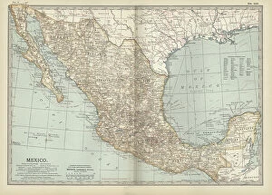
Background image19th Century Style Collection: Map of Mexico, c.1900 (engraving)

Map of Mexico, c.1900 (engraving)
533250 Map of Mexico, c.1900 (engraving); (add.info.: Map of Mexico, circa 1902, from the 10th edition of Encyclopaedia Britannica.); Encyclopaedia Britannica/UIG.

Background image19th Century Style Collection: Map of Nevada and Utah, c.1900 (engraving)

Map of Nevada and Utah, c.1900 (engraving)
533228 Map of Nevada and Utah, c.1900 (engraving); (add.info.: Map of Nevada and Utah, United States, with an inset map of Salt Lake City, circa 1902)


All Professionally Made to Order for Quick Shipping

Step back in time with the enchanting 19th century style, where elegance and sophistication reigned supreme. Transport yourself to a bygone era with the iconic Railway Children original UK one-sheet poster, capturing the essence of this timeless period. Jenny Agutter's captivating performance in The Railway Children (1970) epitomizes the grace and poise that defined this era. Immerse yourself in nature's beauty with the majestic Monkey puzzle tree (araucaria imbricata), a symbol of strength and resilience that graced many Victorian gardens. Discover the elusive Thylacinus cynocephalus, also known as the Tasmanian Tiger or Thylacine, an intriguing creature from this era shrouded in mystery. Indulge in tales of aristocracy and intrigue through Kind Hearts And Coronets, a classic film showcasing opulent costumes and lavish settings reminiscent of high society during this period. Explore Whitby through an exquisite map that transports you to its picturesque streets lined with charming cottages and historic landmarks. Uncover history's secrets through antique maps like Ireland's intricate cartography or Tasmania's rugged coastlines; each telling stories of exploration and discovery. Delve into human anatomy with detailed illustrations depicting our backbone including ribs and pelvis - a testament to scientific advancements during this time. Marvel at antique colored illustrations such as Geological map of England and Wales, which showcase not only geological wonders but also highlight artistic craftsmanship prevalent throughout the 19th century. Let The Railway Children whisk you away on a nostalgic journey filled with innocence, adventure, and heartfelt moments that capture the spirit of this remarkable era. Finally, immerse yourself in Heroes Of The Trojan War - tales passed down through generations embodying bravery amidst epic battles - reminding us that even centuries later these stories continue to captivate our imagination. Embrace all things 19th century style.