
1681 1803 Collection
"Exploring the Seas: A Journey through 1681-1803" Embark on a captivating voyage as we delve into the world of sea charts from 1681 to 1803


All Professionally Made to Order for Quick Shipping
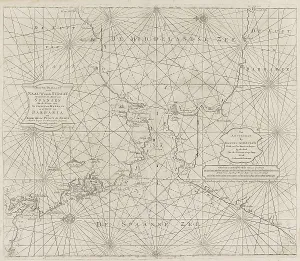
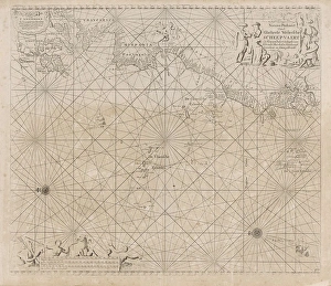
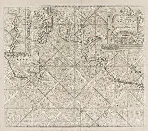
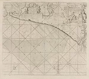
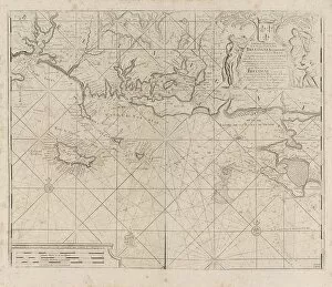
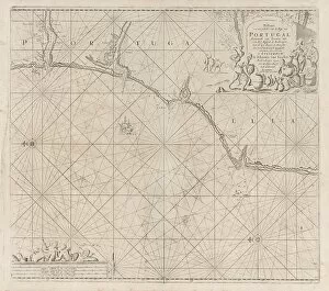
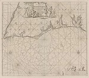
"Exploring the Seas: A Journey through 1681-1803" Embark on a captivating voyage as we delve into the world of sea charts from 1681 to 1803. These intricate navigational maps were essential tools for sailors, guiding them across treacherous waters and uncharted territories. One such chart reveals a mesmerizing view of the Irish Sea, stretching between Ireland and Britain, with St George's Channel prominently featured. Crafted by skilled cartographers Jan Luyken and Anonymous under Johannes van Keulen's guidance, this masterpiece showcases their meticulous attention to detail. Moving along the west coast of Ireland, another chart captures our imagination. Created by Jan Luyken and Anonymous once again, it offers an intimate glimpse into this rugged coastline that has witnessed countless maritime adventures throughout history. Venturing further south, we encounter a remarkable depiction of the Bristol Channel. With its strategic location connecting England and Wales, this map proves invaluable for seafarers seeking safe passage in these challenging waters. Our journey takes us beyond Europe's shores as we explore a sea chart illustrating the Strait of Gibraltar. An anonymous artist working alongside Johannes van Keulen meticulously crafted this piece in 1681 - an era when trade routes thrived amidst political tensions in these Mediterranean waters. As we sail towards Africa's western coast, an awe-inspiring sea chart unfolds before us. This comprehensive map not only guides mariners but also unveils glimpses of distant lands waiting to be discovered by intrepid explorers. Turning our attention northwards once more brings us to the Zeeland Islands and part of the North Sea. The combined efforts of Jan Luyken and Anonymous present a detailed portrayal that aided Dutch sailors navigating these perilous waters during their golden age. Continuing our nautical odyssey along Europe's coastline reveals yet another masterpiece – a stunning sea chart showcasing Ireland, Scotland, England, and France intricately mapped by Jan Luyken and Anonymous.